2017/05/31: Home
Category: General
Posted by: The Agnew Family
We made it home safe and sound on May 26th. It's the first time we've
flown Air Canada Rouge and I would definitely fly with them again. The
seats were reasonably comfortable and leg room was fine ---- Ed's long
legs even fit. Each seat had a pillow and a blanket both for the night
flight and the afternoon flight and we were given a full meal and a
light meal plus beverage service several times.
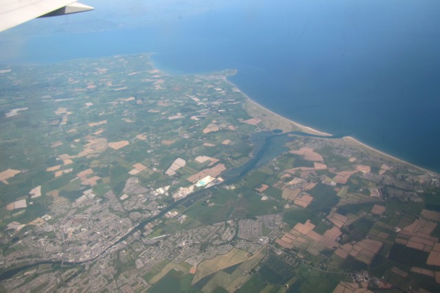
One last look at Ireland. What a beautiful country.
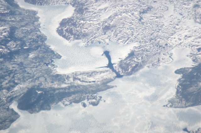
Our flight took us across Labrador ---- it's still winter there!
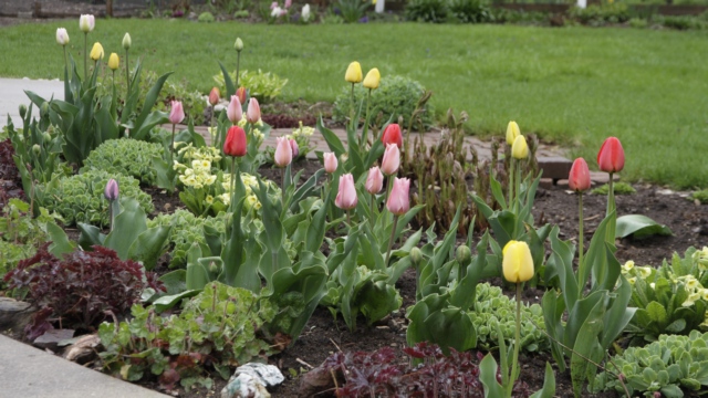
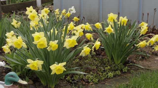
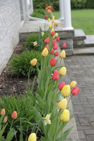
The last few days of May were spent catching up with life --- unpacking, mucho laundry, major gardening and house cleaning. Now it's time for summer to begin.
One last look at Ireland. What a beautiful country.
Our flight took us across Labrador ---- it's still winter there!
The last few days of May were spent catching up with life --- unpacking, mucho laundry, major gardening and house cleaning. Now it's time for summer to begin.
2017/05/26: Leaving on a Jet Plane
Category: General
Posted by: The Agnew Family
We're flying home to today and as Ed is still sleeping I thought I'd write a little about the over all trip.
We stayed in 11 B&B;'s and 1 hotel and all of them were good. One B&B; had the best towels, another the best home baked goodies, a third the best sausages another the best view and largest room. Only one was a little on the small size. The bathroom was a converted closet --- just the toilet and showerr fit. The sink was in the bedroom and that room was a little on the small size as well, but the room was clean and the bed comfortble. All the B&B;'s had sitting rooms you could use so a small room wasn't really a problem.
Food, oh we had some wonderful food on this trip. I've already mention sausages and baked goods, Then there was the bouble and squeek, it's really a British dish and just left over potatoe, turnip, and cabbage but oh so much better than regular hash browns. Then there was a savoury pancake --- a thin pancake (but not a crepe) filled with cheese, ham, cooked onions and peppers. I'm not an egg fan but scramble eggs and smoked salmon for breakfast is really good --- think there was as much smoked salmon as therre was egg. The dinners were really good as well --- we tried most off the standard Irish meals, Guiness Stew, Irish Stew, Bangers and Mash, Pot Pie, Fish and Chips, Fish Pie. We also branched out and had Lamb shanks, lasgnage, seafood pasta, Chicken Fajita salad ---- the list goes on. There was only one meal I didn't like, the chicken in a chicken stir fry was tough and I didn't care ffor the sauce but it was edible.
Once again it's been proven that it's a small world. When we werre in Doolin at a pub eating dinner we ended up at a table beside a woman, her mother and her son that are from BC, I think Kelowna. Then in Donegal Ed and I went into a hotel bar for dinner and sat down. After a few minutes I noticed the people at the table beside us ---- yup the three people from BC. We said hello and had a chuckle. Well, last night Ed and I are walking through the streets of Dublin heading back to the bus stop and who walks up to us and says hello. Yup the three people from BC. Then there was the Germain couple. They were at our B&B; in Donegal. Who pulled into the driveway right behind us when we stopped at our B&B; in Dunfanaghy. Yup the couple from Germany, we had reservations and they were winging it.
Bathrooms --- oh I could go on and on about the bathrooms but there is one that deserves to be mentioned. We stopped at a park so Ed could find a geocache. When he got back to the car he told me I had to go use the bathroom. He said whoever designed the bathroom had spent too much of their childhood watching The Jetsons (I hope you remember the cartoon show with George and his son Leroy). Anyway, the building was square and metal, you pushed and button the door opened, after several seconds the door closed behind you. The room felt like it was totally stainless steel --- to wash it you could bring a hose in a spray. Everything was attivated with push buttons, you wanted toilet paper you pushed a button, you wanted water to washer hands, push a button. There even was an SOS button. Oh and to get out you pushed a button.
Some other bathroom highlights, taps that reminded me of a Kligon battleship, a mirror with a touch sensitive button in it that turned on side lights that were also in the mirror (Ed wants one of these), a rectangular toilet seat, plumbing on the outside of the wall, shut off values turned the water on and off. I've seen shared bathrooms in small establishments but at the Cliffs of Moher they took it to the next level. The washroom was a true unisex washroom --- every body went into the same bathroom and took the next available stall. just waiting in the same room.
There is a lot more interesting things we ran into on our trip but this is all I have time for right now and if you haven't quick reading already you're happy that I'm done.
2017/05/25: Dublin
Category: General
Posted by: The Agnew Family
Four beers today, two Guiness, Porthouse Pilsner and Porthouse Nitro Red.
I learned a few thing today. Don't make assumptions, I assumed that the exact fair was required but didn't think that notes (paper money) would not be accepted. Also know what bus stop you want to get off at before you get on the bus, don't assume it'll be obvious. The first error in judgement neccessitated a trip back to the hotel to get a 10 euro note changed into coins. The second error in judgement caused us to walk an extra kilometer or so. Luckily a gentleman noticed that we were not sure where we were and gave us directions. Turned out we were going in the correct direction, we were just looking in the wrong part of map to determine our location.
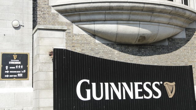
First destination was the Guinness Storehouse for a tour. Guess who chose this stop?
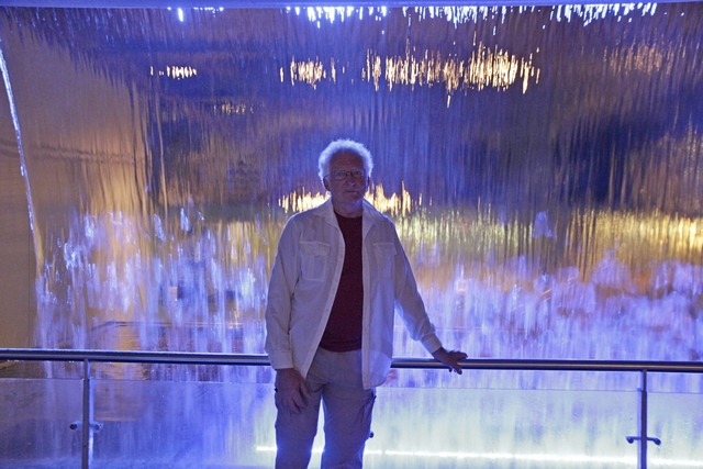
The tour goes through the entire process of making beer. When you get to the part about the spring water from the Wicklow Mountains there is a waterfall. It makes for interesting photos.
_7D_7358.JPG)
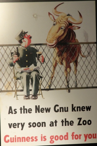
One stop on the tour was the tasting room. Mini beer glasses are used dooring the tasting phase of beer making. Advertising for Guinness has changed over the years. A lot of the old and new advertising was on display. Ed noticed a lot of old Guiness ads on buildings through out Ireland.
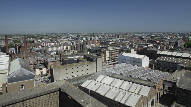
The tour ended with a couple of glasses of Guinness (included in your tour cost) in the Gravity Bar overlooking the city. This has got to be one of the most popular tours in Dublin.
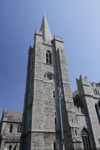
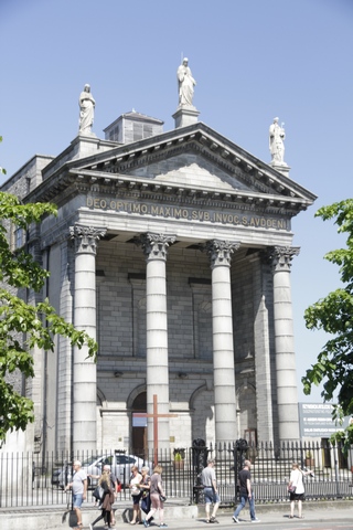
Dublin is full of old buildings, especially churches.
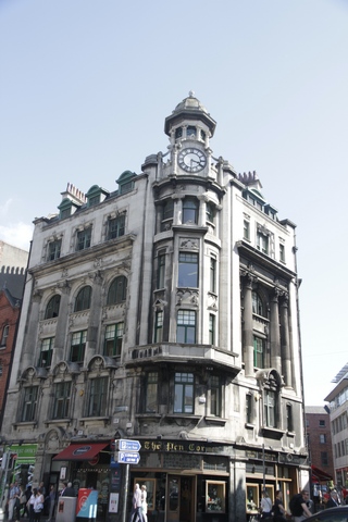
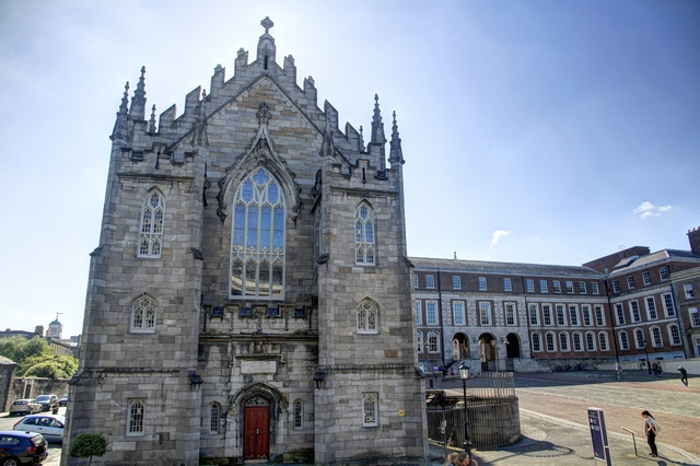
Dublin Castle.
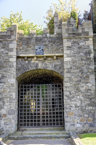
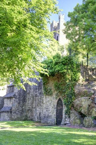
The old city walls.
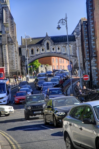
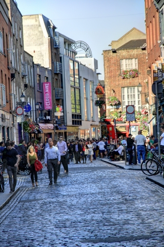
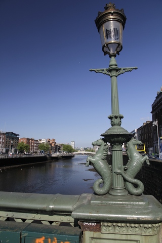
A couple more city shots.
I learned a few thing today. Don't make assumptions, I assumed that the exact fair was required but didn't think that notes (paper money) would not be accepted. Also know what bus stop you want to get off at before you get on the bus, don't assume it'll be obvious. The first error in judgement neccessitated a trip back to the hotel to get a 10 euro note changed into coins. The second error in judgement caused us to walk an extra kilometer or so. Luckily a gentleman noticed that we were not sure where we were and gave us directions. Turned out we were going in the correct direction, we were just looking in the wrong part of map to determine our location.
First destination was the Guinness Storehouse for a tour. Guess who chose this stop?
The tour goes through the entire process of making beer. When you get to the part about the spring water from the Wicklow Mountains there is a waterfall. It makes for interesting photos.
One stop on the tour was the tasting room. Mini beer glasses are used dooring the tasting phase of beer making. Advertising for Guinness has changed over the years. A lot of the old and new advertising was on display. Ed noticed a lot of old Guiness ads on buildings through out Ireland.
The tour ended with a couple of glasses of Guinness (included in your tour cost) in the Gravity Bar overlooking the city. This has got to be one of the most popular tours in Dublin.
Dublin is full of old buildings, especially churches.

Dublin Castle.


The old city walls.


A couple more city shots.
2017/05/24: Starting to Wind Down
Category: General
Posted by: The Agnew Family
Guiness and a glass of Chardoney were tonight's libations.
This morning we drove a few miles to Bru na Boinne. Bru na Boinne, which means the ‘palace’ or the ‘mansion’ of the Boyne, refers to the area within the bend of the River Boyne which contains one of the world’s most important prehistoric landscapes.Within Bru na Boinne are three well-known large passage tombs, Knowth, Newgrange and Dowth, built some 5,000 years ago in the Neolithic or Late Stone Age.
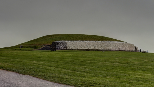
In the 1960's when archeaologists started excavating the site, Newgrange was a small hill. As they dug they found stones not native to the area, then large stones and finally the opening into the tomb. It has since been "rebuilt" to match one archaeologist's view of what Newgrange would have looked liked.
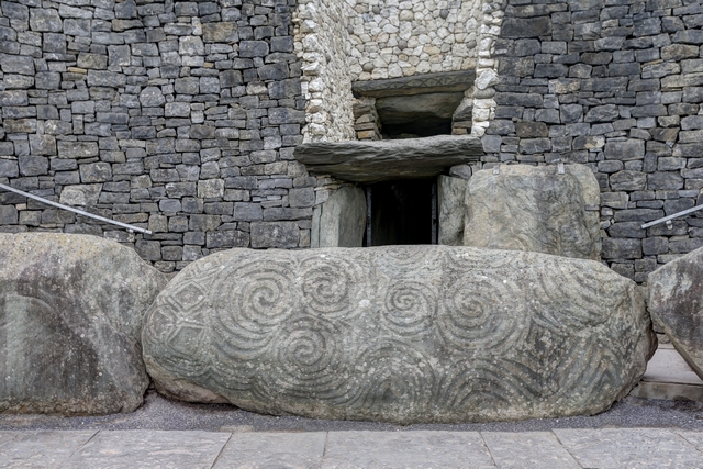
The entrance to the tomb. The outside of the tomb is ringed with carved kerb stones. Above the doorway is a port that allows the sun to enter the tomb and shine to the back of the tomb on December 21st --- winter soltice. When you enter the tomb you walk down a very narrow low passage way and after 19 metres you enter a large chamber with three recesses. Unfortunately photography was not allowed in the passage way or chamber.
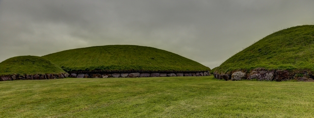
Knowth is a large mound with 2 tombs. There are also a number of smaller mounds in the same grounds.
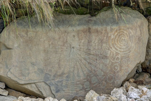
Knowth also has carved kerb stones.
The mounds look boring but the history behind them is very interesting.
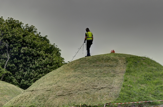
The mounds need maintenance, so you have to figure out how to mow them.
Next stop our hotel a few kilometres away from the Dublin airport. We checked in, dropped our bags off and drove to the car rental car return. The sun was shining and it was about 21 degrees C so we walked the 4 1/2 km back to the hotel. Now it's time for a restful evening before we head into Dublin tomorrow.
This morning we drove a few miles to Bru na Boinne. Bru na Boinne, which means the ‘palace’ or the ‘mansion’ of the Boyne, refers to the area within the bend of the River Boyne which contains one of the world’s most important prehistoric landscapes.Within Bru na Boinne are three well-known large passage tombs, Knowth, Newgrange and Dowth, built some 5,000 years ago in the Neolithic or Late Stone Age.

In the 1960's when archeaologists started excavating the site, Newgrange was a small hill. As they dug they found stones not native to the area, then large stones and finally the opening into the tomb. It has since been "rebuilt" to match one archaeologist's view of what Newgrange would have looked liked.

The entrance to the tomb. The outside of the tomb is ringed with carved kerb stones. Above the doorway is a port that allows the sun to enter the tomb and shine to the back of the tomb on December 21st --- winter soltice. When you enter the tomb you walk down a very narrow low passage way and after 19 metres you enter a large chamber with three recesses. Unfortunately photography was not allowed in the passage way or chamber.

Knowth is a large mound with 2 tombs. There are also a number of smaller mounds in the same grounds.

Knowth also has carved kerb stones.
The mounds look boring but the history behind them is very interesting.

The mounds need maintenance, so you have to figure out how to mow them.
Next stop our hotel a few kilometres away from the Dublin airport. We checked in, dropped our bags off and drove to the car rental car return. The sun was shining and it was about 21 degrees C so we walked the 4 1/2 km back to the hotel. Now it's time for a restful evening before we head into Dublin tomorrow.
2017/05/23: Switched Countries Again
Category: General
Posted by: The Agnew Family
Ed tried a Boyne Ale local to Drogheda and I had a cider this evening.
This morning we drove east along the Causeway Coastal Route. First stop was at a scenic overlook with a castle.
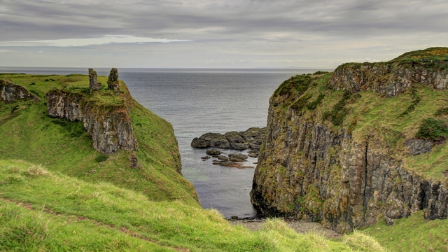
The bit of rock on top of the left hill is all that's left of the Dunseverick Castle.
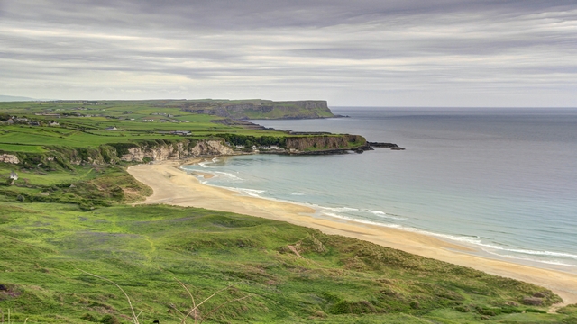
Another beautiful beach.
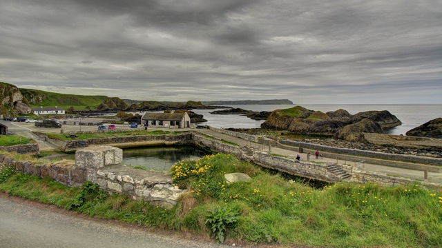
Ballintoy harbour
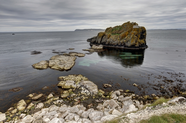
One of several loctions in Ireland where the Game of Thrones is filmed.
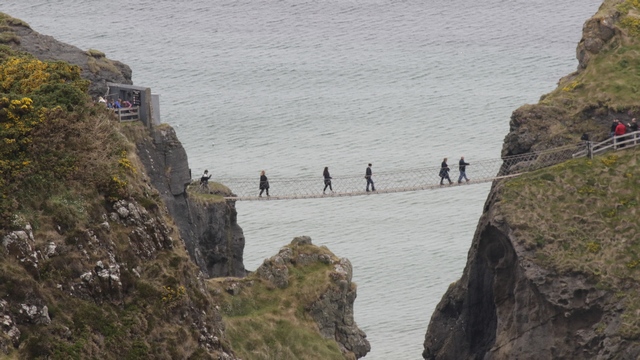
The rope bridge to the island Carrick-A-Rede. We opted to skip this tourist attraction.
_DX_0357_8_9.jpg)
Kilbane Castle isn't in great shape. It was built in 1547 by Colla MacDonnell (Ed's mom was a MacDonnell).
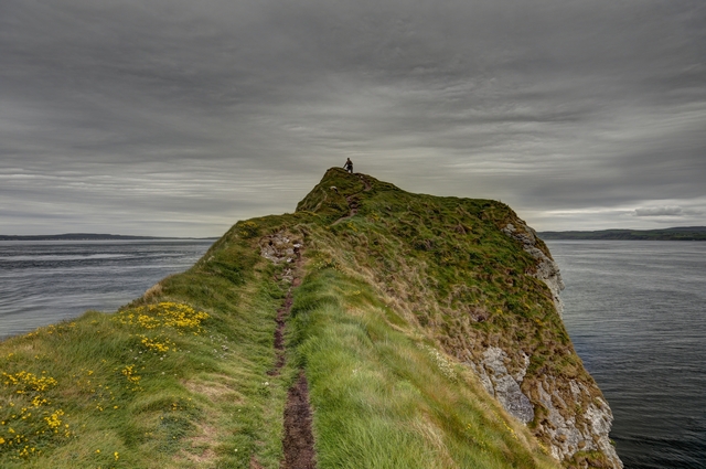
That's me at the end of the pennisula. I got my adrenaline rush by walking out to the end of the pennisula along a narrow path. I was high enough that birds were flying below me.
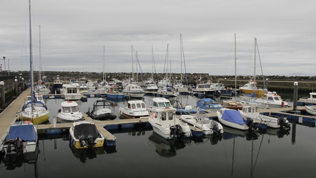
The harbour at Ballycastle.
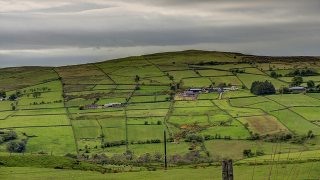
We decided to leave the coastal road and cut cross country, which included going up a hill and seeing beautiful farms.
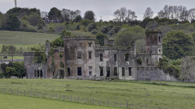
The Agnew clan originated in Scotland but was also found in Northern Ireland near Larne. This is the remains of the Kilwaughter Castle which was once owned by the John Agnew.
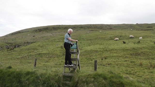
Ed thinking about climbing Agnew Hill --- he didn't. Agnew Hill is one of the highest hills in the area at 474 metres or just over 1500 feet.
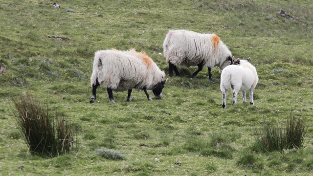
The token sheep photo of the day.
Leaving the Larne area we travelled south. As it was rush hour in Belfast we stuck to back roads till we were past the city. It was long before we were back in the Republic of Ireland and in the town of Drogheda for the night.
This morning we drove east along the Causeway Coastal Route. First stop was at a scenic overlook with a castle.

The bit of rock on top of the left hill is all that's left of the Dunseverick Castle.

Another beautiful beach.

Ballintoy harbour

One of several loctions in Ireland where the Game of Thrones is filmed.
The rope bridge to the island Carrick-A-Rede. We opted to skip this tourist attraction.
_DX_0357_8_9.jpg)
Kilbane Castle isn't in great shape. It was built in 1547 by Colla MacDonnell (Ed's mom was a MacDonnell).

That's me at the end of the pennisula. I got my adrenaline rush by walking out to the end of the pennisula along a narrow path. I was high enough that birds were flying below me.
The harbour at Ballycastle.

We decided to leave the coastal road and cut cross country, which included going up a hill and seeing beautiful farms.

The Agnew clan originated in Scotland but was also found in Northern Ireland near Larne. This is the remains of the Kilwaughter Castle which was once owned by the John Agnew.
Ed thinking about climbing Agnew Hill --- he didn't. Agnew Hill is one of the highest hills in the area at 474 metres or just over 1500 feet.
The token sheep photo of the day.
Leaving the Larne area we travelled south. As it was rush hour in Belfast we stuck to back roads till we were past the city. It was long before we were back in the Republic of Ireland and in the town of Drogheda for the night.
2017/05/22: Switched Countries
Category: General
Posted by: The Agnew Family
This evening Ed had a Hop House 13 beer and I had a lovely cider of a different brand.
This morning we left Dunfanaghy and drove south then east and then north again to finally reach Bushmill Northern Ireland, home to the Bushmill Irish Whiskey and the Giant's Causeway.
The drive was mostly routine except for missing turns as we went through Derry. Luckily the turning circles helped out and we did some 360 degree turns to get back on the right track.
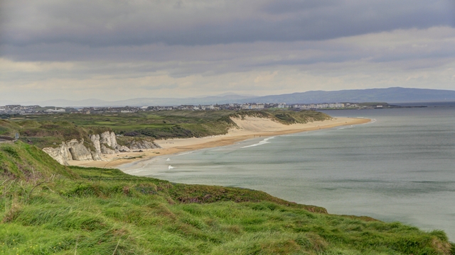
A view of the coast in Northern Ireland.
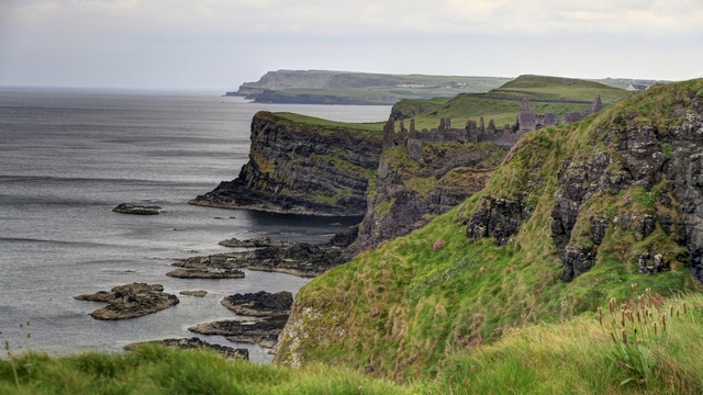
Some more coast.
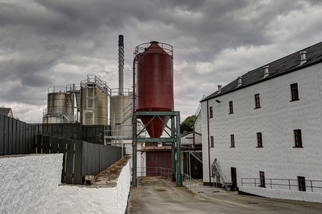
Arriving in the town of Bushmill we headed straight for the Bushmill Distillery. We had a lovely tour, except photography wasn't allowed. A wee dram of whiskey was included with the tour. Ed did get a few photographs of the outside of the distillery.
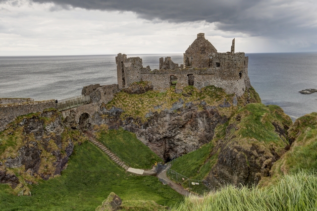
Just outside of Bushmill is the Dunluce Castle. Turns out the castle was onced owned by the MacDonnells --- Ed's mother was a MacDonnell.
The Giant's Causeway is an area of about 40,000 interlocking basalt columns. There are two lines of thought on what created the causeway. The first involves a certain giant by the name of Finn McCool. Finn is having trouble with someone across the water. The Scottish giant Benandonner is threatening Ireland. An enraged Finn grabs chunks of the Antrim coast and throws them into the sea. The rock forms a path for Finn to follow and teach Benandonner a lesson. Bad idea – Benandonner is terrifyingly massive. Finn beats a hasty retreat, followed by the giant, only to be saved by our hero’s quick-thinking wife who disguised him as a baby. The angry Scot saw the baby and decided if the child was that big, the daddy must be really huge. The second explanation is the Giant’s Causeway is the aftermath of volcanic eruption and subsequent cooling.
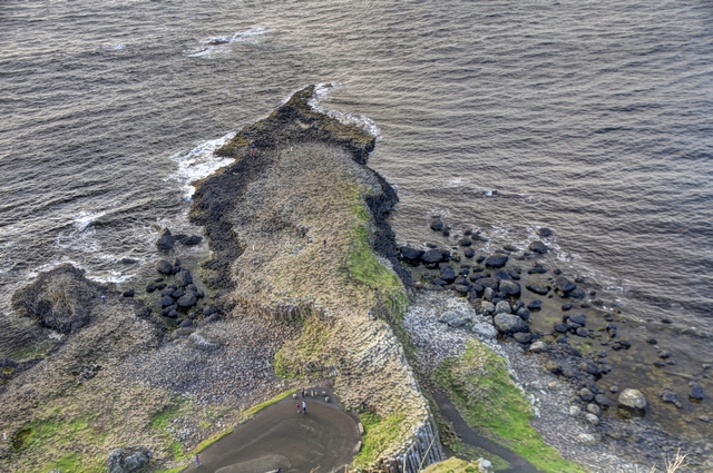
Looking down on the Giant's Causeway.
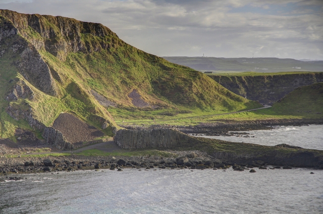
The causeway from across the bay.
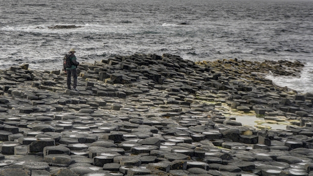
Ed following the giant's path.
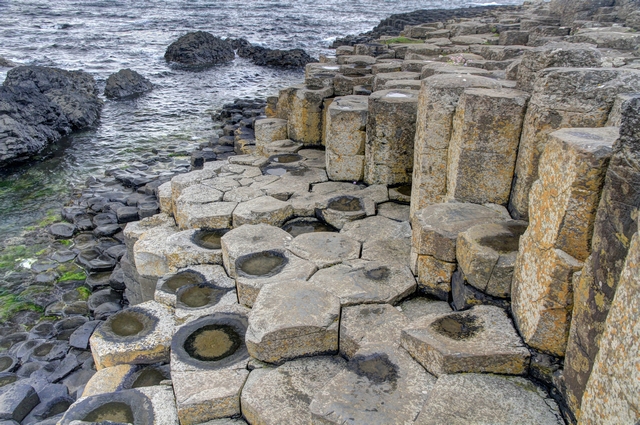
The stones up close.
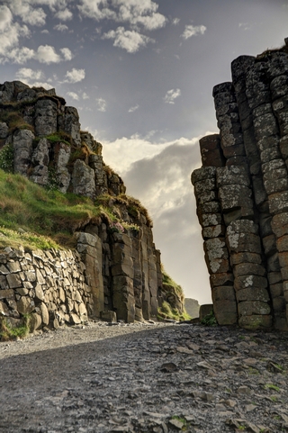
The gateway.
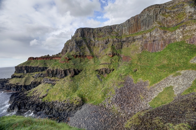
The cliff by the Giant's Causeway. The rock formations are very interesting --- black rock, red rock, and the columns of rock like the Giant's Causeway.
This morning we left Dunfanaghy and drove south then east and then north again to finally reach Bushmill Northern Ireland, home to the Bushmill Irish Whiskey and the Giant's Causeway.
The drive was mostly routine except for missing turns as we went through Derry. Luckily the turning circles helped out and we did some 360 degree turns to get back on the right track.

A view of the coast in Northern Ireland.

Some more coast.

Arriving in the town of Bushmill we headed straight for the Bushmill Distillery. We had a lovely tour, except photography wasn't allowed. A wee dram of whiskey was included with the tour. Ed did get a few photographs of the outside of the distillery.

Just outside of Bushmill is the Dunluce Castle. Turns out the castle was onced owned by the MacDonnells --- Ed's mother was a MacDonnell.
The Giant's Causeway is an area of about 40,000 interlocking basalt columns. There are two lines of thought on what created the causeway. The first involves a certain giant by the name of Finn McCool. Finn is having trouble with someone across the water. The Scottish giant Benandonner is threatening Ireland. An enraged Finn grabs chunks of the Antrim coast and throws them into the sea. The rock forms a path for Finn to follow and teach Benandonner a lesson. Bad idea – Benandonner is terrifyingly massive. Finn beats a hasty retreat, followed by the giant, only to be saved by our hero’s quick-thinking wife who disguised him as a baby. The angry Scot saw the baby and decided if the child was that big, the daddy must be really huge. The second explanation is the Giant’s Causeway is the aftermath of volcanic eruption and subsequent cooling.

Looking down on the Giant's Causeway.

The causeway from across the bay.

Ed following the giant's path.

The stones up close.

The gateway.

The cliff by the Giant's Causeway. The rock formations are very interesting --- black rock, red rock, and the columns of rock like the Giant's Causeway.
2017/05/21: County Dunegal
Category: General
Posted by: The Agnew Family
Tonight Guiness and a Bulmer's cider were the drinks of choice.
Leaving Dunegal town, we drove west to the coast and Slieve League, a mountain on the Atlantic Ocean with some of the highest sea cliffs in Ireland. Of course it was overcast and rainy but least no fog!
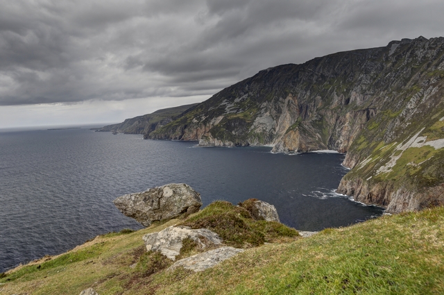
Looking down at the cliffs.
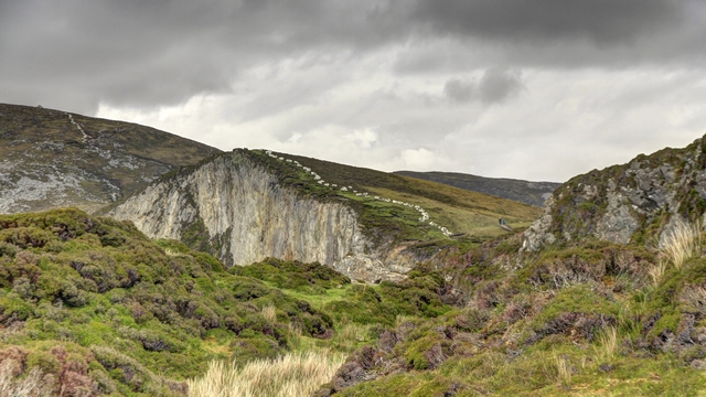
We hiked part way up the mountain for better views. See those white dots in the photo,
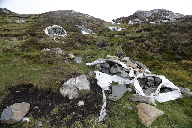
they are bags of rocks. We're guessing that they are dropped by helicoptor and and used to make stepping stone paths.
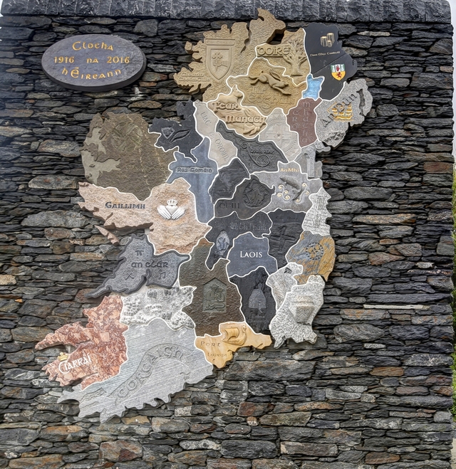
Last year this map of Ireland was finished and put on display. Each section of the map is a piece of carved rock from the county. The photo doesn't do the map justice (but it was raining when Ed took the photo).
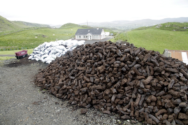
We drove past this pile of peat.
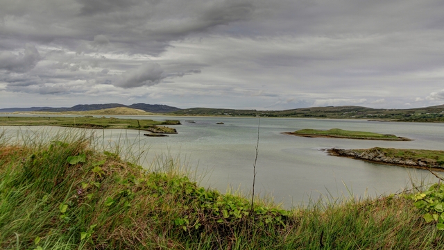
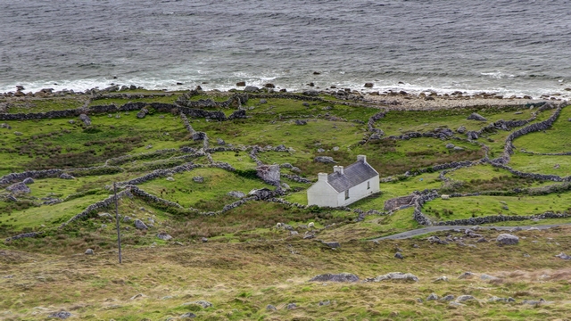
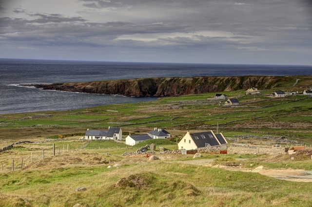
Some views as we drove along more of the coast line.
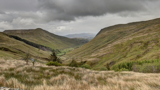
This one isn't coast line --- we drove through a mountain pass and was reward with some stunning views of valleys.
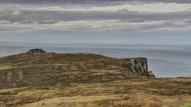
We are staying near Horn Head. From the car park we walked up a hill and decided to not go any further ---- the wind was just about blew me off the hill.
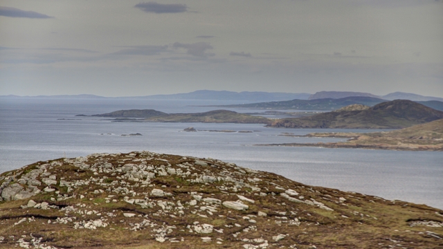
A view east from the Horn Head area.
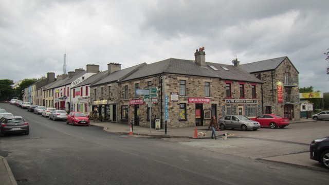
The town of Dunfanaghy is very cute --- lots of pubs and restaurants. This area of the coast has lots of summer cottages.
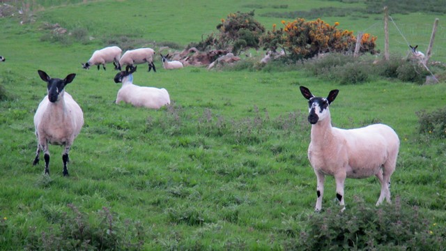
A few of the sheep were curious about us as we walked back to the B&B; after dinner.
Leaving Dunegal town, we drove west to the coast and Slieve League, a mountain on the Atlantic Ocean with some of the highest sea cliffs in Ireland. Of course it was overcast and rainy but least no fog!

Looking down at the cliffs.

We hiked part way up the mountain for better views. See those white dots in the photo,
they are bags of rocks. We're guessing that they are dropped by helicoptor and and used to make stepping stone paths.

Last year this map of Ireland was finished and put on display. Each section of the map is a piece of carved rock from the county. The photo doesn't do the map justice (but it was raining when Ed took the photo).
We drove past this pile of peat.
Some views as we drove along more of the coast line.


This one isn't coast line --- we drove through a mountain pass and was reward with some stunning views of valleys.

We are staying near Horn Head. From the car park we walked up a hill and decided to not go any further ---- the wind was just about blew me off the hill.

A view east from the Horn Head area.
The town of Dunfanaghy is very cute --- lots of pubs and restaurants. This area of the coast has lots of summer cottages.
A few of the sheep were curious about us as we walked back to the B&B; after dinner.
2017/05/20: Stone Age Monuments
Category: General
Posted by: The Agnew Family
And tonight's beer is Guiness and I enjoyed a glass of cider.
Today we had a fair bit of driving to do and two specific stops in mind --- Ceide Fields and Carrowmore Megalithic Cemetary.
Ceide Fields is considered the world's most extensive Stone Age monument. Stone-walled fields, houses and megalithic tombs ---- about a half million tonnes of stone have been found so far, the legacy of a 5,000 year old farming community.
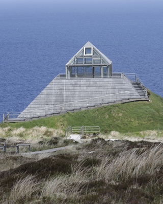
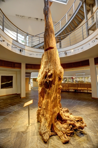
The visitor centre is topped with a glass pyramid. Inside the visitor centre is the remains of a tree. It is estimated that the tree fell into a bog 4,200 to 4,400 years ago and was preserved.
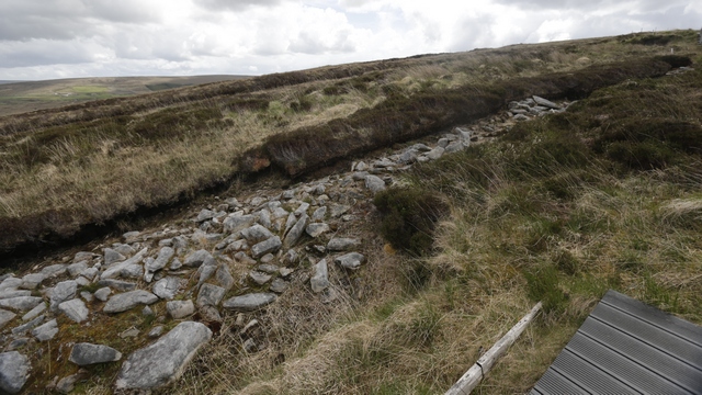
This ancient farming area is now a huge peat bog. It was first discovered in the 1930's when a farmer was digging peat and hit rocks. It wasn't till the 1970's when actual exploration of the area was done.
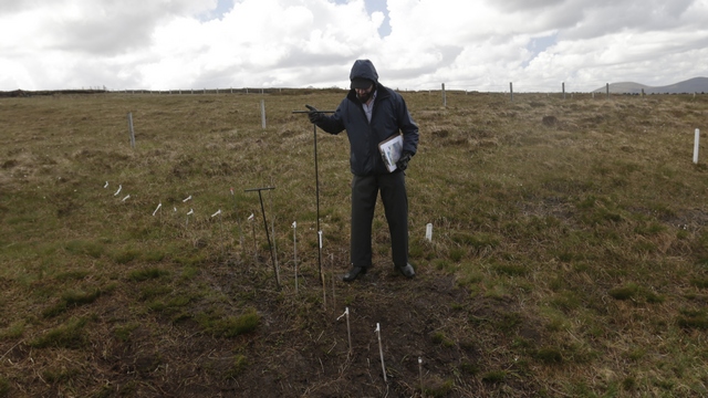
Several methods of mapping out the fields have been used with the simpliest being walking around with a steel rod and pooking it into the bog to find the rocks hidden beneath. When rocks are found bamboo stakes are put in the ground.
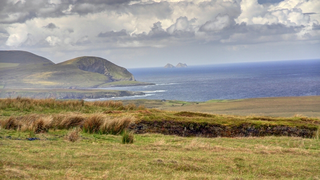
Ceide Fields is by the coast and offers some great views.
Carrowmore Megalithic Cemetary is one of Europes largest Stone Age cemetaries. Some 60 monuments including stone circles, passage tombs and dolmens adorn the rolling hills of this site. Bones have been found in some of the tombs dating back at much as 6,000 years.
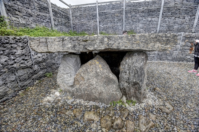
There are several unopened passage tombs in the area sounding Carrowmore. This one was opened many, many years ago, all the stones removed and used elsewhere. It has been rebuilt to show the public what it may have looked like. Many archeologists disagree with the look and the fact that it has been rebuilt.
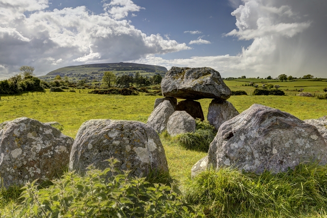
This is the only dolen and stone circle that are intact at the site. High on the hill in the background is an unopened passage tomb believed to the grave of legendary Queen Maeve.
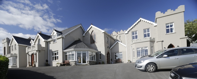
Wow! is all I can say about this B&B.; It's called Rossmore Manor House and it's big and it's beautiful and then there's the view. Behind the car you can see a window, that's my sitting area window. Sitting on a loveseat in front of the window I can see the bay and green hills beyond that. Looking at the photo, there is a door to the right of window. That's are private entrance to the room called The Hobit. This B&B; wins best view .... at least so far.
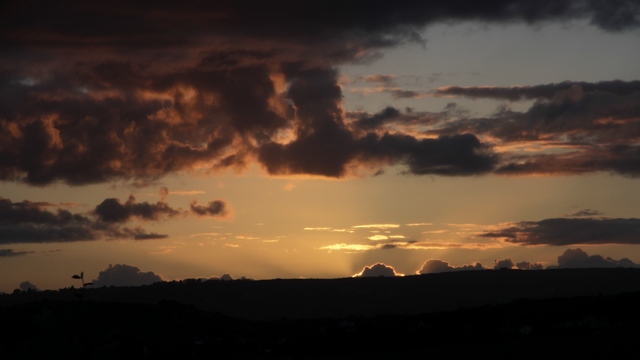
Sunset at the B&B.;
Today we had a fair bit of driving to do and two specific stops in mind --- Ceide Fields and Carrowmore Megalithic Cemetary.
Ceide Fields is considered the world's most extensive Stone Age monument. Stone-walled fields, houses and megalithic tombs ---- about a half million tonnes of stone have been found so far, the legacy of a 5,000 year old farming community.

The visitor centre is topped with a glass pyramid. Inside the visitor centre is the remains of a tree. It is estimated that the tree fell into a bog 4,200 to 4,400 years ago and was preserved.
This ancient farming area is now a huge peat bog. It was first discovered in the 1930's when a farmer was digging peat and hit rocks. It wasn't till the 1970's when actual exploration of the area was done.
Several methods of mapping out the fields have been used with the simpliest being walking around with a steel rod and pooking it into the bog to find the rocks hidden beneath. When rocks are found bamboo stakes are put in the ground.

Ceide Fields is by the coast and offers some great views.
Carrowmore Megalithic Cemetary is one of Europes largest Stone Age cemetaries. Some 60 monuments including stone circles, passage tombs and dolmens adorn the rolling hills of this site. Bones have been found in some of the tombs dating back at much as 6,000 years.

There are several unopened passage tombs in the area sounding Carrowmore. This one was opened many, many years ago, all the stones removed and used elsewhere. It has been rebuilt to show the public what it may have looked like. Many archeologists disagree with the look and the fact that it has been rebuilt.

This is the only dolen and stone circle that are intact at the site. High on the hill in the background is an unopened passage tomb believed to the grave of legendary Queen Maeve.
Wow! is all I can say about this B&B.; It's called Rossmore Manor House and it's big and it's beautiful and then there's the view. Behind the car you can see a window, that's my sitting area window. Sitting on a loveseat in front of the window I can see the bay and green hills beyond that. Looking at the photo, there is a door to the right of window. That's are private entrance to the room called The Hobit. This B&B; wins best view .... at least so far.
Sunset at the B&B.;
2017/05/20: Achill Island
Category: General
Posted by: The Agnew Family
And today's beers are Achill and Clew Bay Sunset.
Achill Island, off the coast of County Mayo (western Ireland) is the largest island off the coast of Ireland. It has a population of around 2,700, is 148 square kilometers and is accessible by a bridge. The island is mountains, peat bog and beautiful beaches.
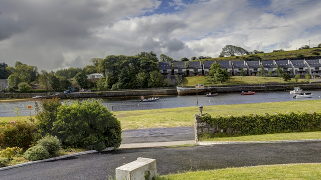
The view from our bedroom window at the B&B; in Newport.
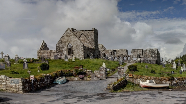
An old abbey just outside of Newport.
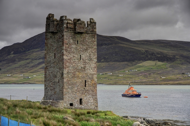
The remains of a castle, a few miles fewer down the road.
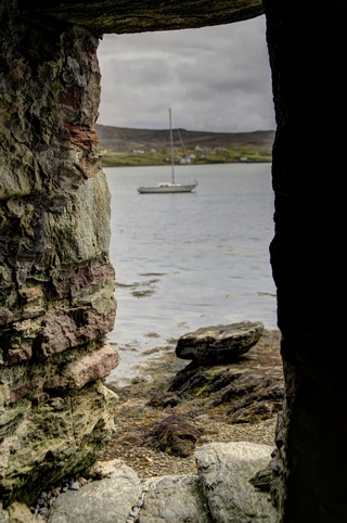
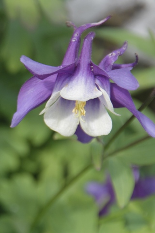
A view from the castle window and a pretty flower.
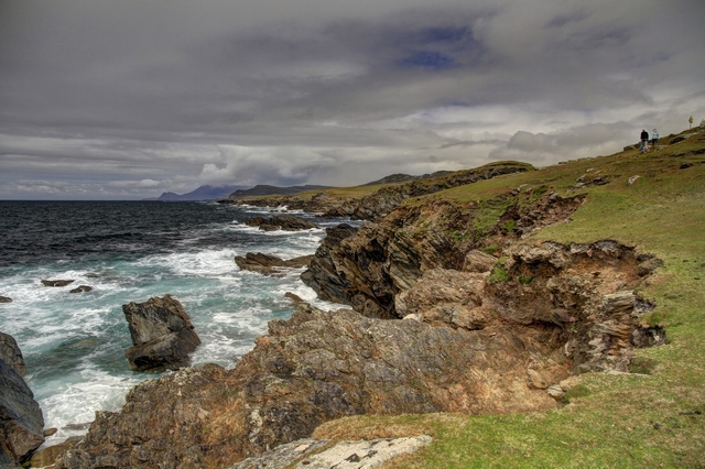
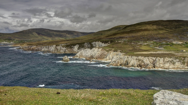
Achill Island has miles of rugged coastline.
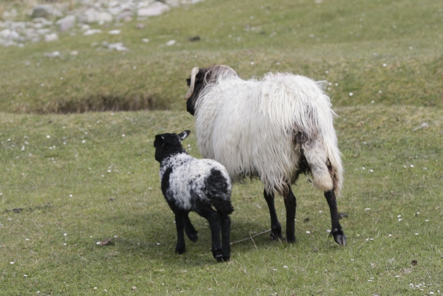
There weren't a lot of cows on the island but the number of sheep made up for it. Many of them were in fenced off areas and almost as many were in open pastures along side the road.
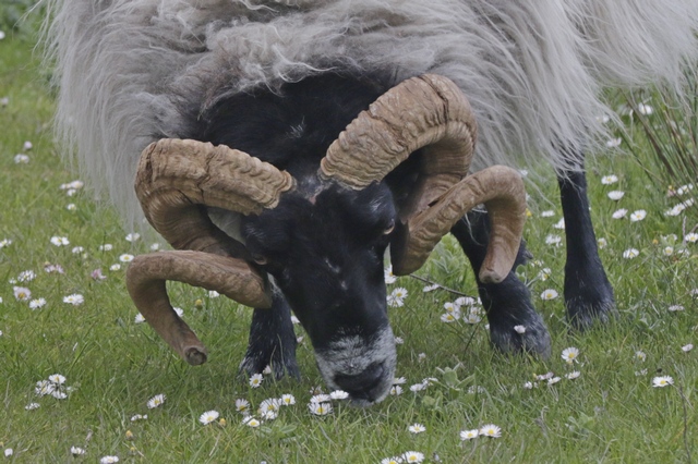
We only saw a couple of sheep that horns like this guys.
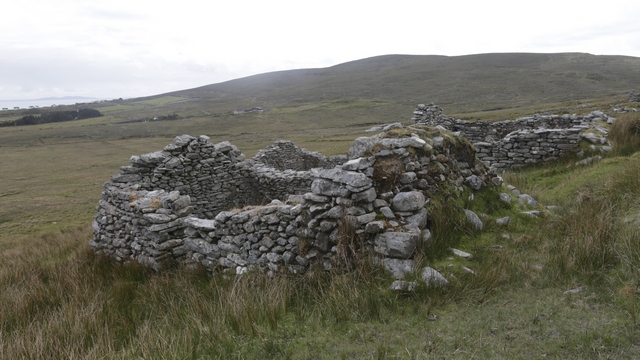
Ruins in "the Deserted Village". There are approximately 80 ruined houses in the village. The houses were built of unmortared stone, which means that no cement or mortar was used to hold the stones together. Each house consisted of just one room and this room was used as a kitchen, living room, bedroom and even a stable. This village is lot to be hundreds of years old.
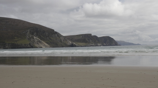
Looking out at the mountains from one of the beautiful beaches on the island.
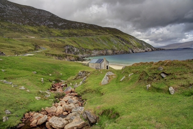
After driving cliff side roads you get to an amazing beach. In the 1960's basking sharks were hunted in this bay.
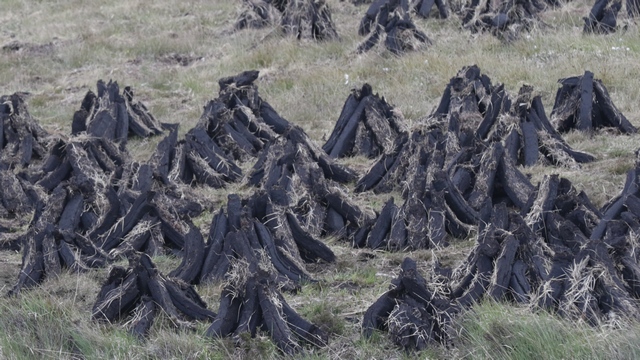
We drove past vast areas where peat is being dug. Plastic bags in the fields was the easiest way to find the fields. As we also saw a lot of stacked peat, we assume that it needs to be dried before it can be packed. We stopped at a cafe for a coffee and they had peat burning in the fireplace.
Achill Island, off the coast of County Mayo (western Ireland) is the largest island off the coast of Ireland. It has a population of around 2,700, is 148 square kilometers and is accessible by a bridge. The island is mountains, peat bog and beautiful beaches.

The view from our bedroom window at the B&B; in Newport.

An old abbey just outside of Newport.

The remains of a castle, a few miles fewer down the road.

A view from the castle window and a pretty flower.

Achill Island has miles of rugged coastline.

There weren't a lot of cows on the island but the number of sheep made up for it. Many of them were in fenced off areas and almost as many were in open pastures along side the road.
We only saw a couple of sheep that horns like this guys.
Ruins in "the Deserted Village". There are approximately 80 ruined houses in the village. The houses were built of unmortared stone, which means that no cement or mortar was used to hold the stones together. Each house consisted of just one room and this room was used as a kitchen, living room, bedroom and even a stable. This village is lot to be hundreds of years old.
Looking out at the mountains from one of the beautiful beaches on the island.

After driving cliff side roads you get to an amazing beach. In the 1960's basking sharks were hunted in this bay.
We drove past vast areas where peat is being dug. Plastic bags in the fields was the easiest way to find the fields. As we also saw a lot of stacked peat, we assume that it needs to be dried before it can be packed. We stopped at a cafe for a coffee and they had peat burning in the fireplace.
2017/05/18: Hiking and Amazing Scenery
Category: General
Posted by: The Agnew Family
And tonight's beer was Smithwick Red and Francisan Wells Cheiftan IPA.
Today we are continueing to head north. There's a lot of beautiful coastline to follow and a hill to hike.
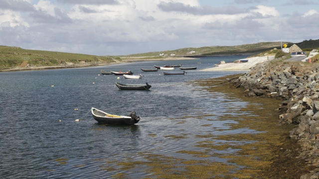
The Sky Road is rated as a wonderful drive. The Upper Sky Road was closed as it was being worked on so we drove the Lower Sky Road.
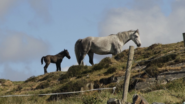
A mare and colt.
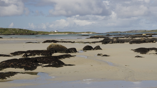
Another section of coast took us to a view an island. When the tide is out you can drive to the island. They even have a horse race here.
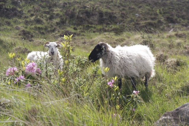
I just can't resist these sheep.
Connemara National Park spans 2000 dramatic hectares of bog, mountain and heath. The park encloses a number of the Twelve Bens (mountains). We opted to hike the lesser Diamond Hill (445 meters in height)--- it's a very popular hike.
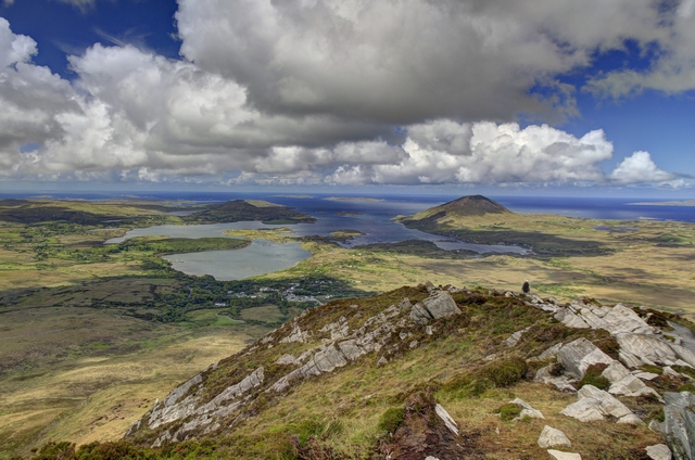
Most of the way up now, looking back at the visitor center. It's the building by itself in front of the trees.
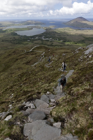
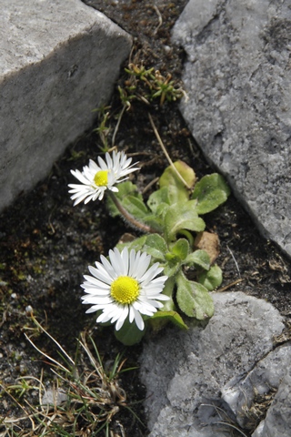
The trail is very wll maintained, gravel paths and stone steps. Yup, that's me climbing some of the steps. This is a brave flower blooming at the top of the hill.
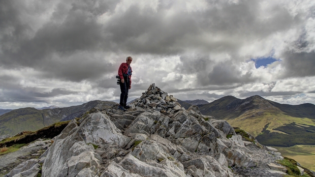
We made it! At least Ed did (I did too as I took the photo).
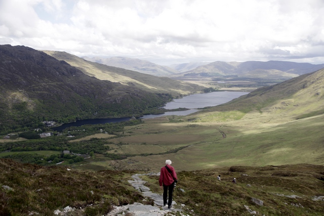
Starting down the backside. On this side you see Kylemore Abbey and Pollacapall Lough (a beautiful lake).
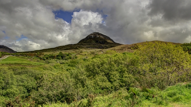
This is Diamond Hill --- doestn't look so high from here.
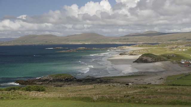
Continueing driving along the coast we find some magfician beaches. I don't associate Ireland with white sand beaches but there are a lot of them here.
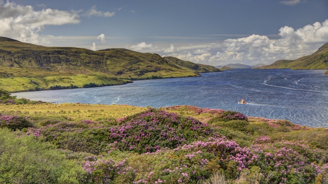
A view up Killary Harbour.
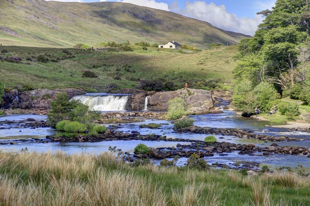
What appears to be a favourite fishing spot by a cute waterfall.
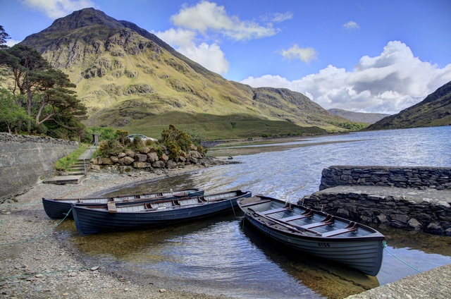
The desolate Doolough Valley. A beautiful lake between green hills.
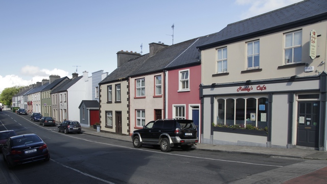
The town of Louisburgh, it was named after Louisburgh, Nova Scotia. Now that's different.
Today we are continueing to head north. There's a lot of beautiful coastline to follow and a hill to hike.
The Sky Road is rated as a wonderful drive. The Upper Sky Road was closed as it was being worked on so we drove the Lower Sky Road.
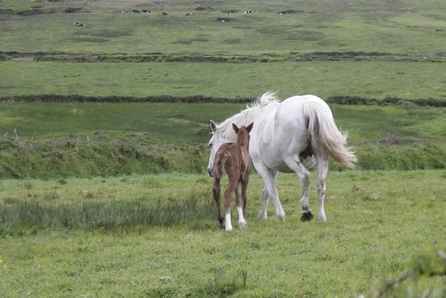
A mare and colt.
Another section of coast took us to a view an island. When the tide is out you can drive to the island. They even have a horse race here.
I just can't resist these sheep.
Connemara National Park spans 2000 dramatic hectares of bog, mountain and heath. The park encloses a number of the Twelve Bens (mountains). We opted to hike the lesser Diamond Hill (445 meters in height)--- it's a very popular hike.

Most of the way up now, looking back at the visitor center. It's the building by itself in front of the trees.
The trail is very wll maintained, gravel paths and stone steps. Yup, that's me climbing some of the steps. This is a brave flower blooming at the top of the hill.

We made it! At least Ed did (I did too as I took the photo).
Starting down the backside. On this side you see Kylemore Abbey and Pollacapall Lough (a beautiful lake).

This is Diamond Hill --- doestn't look so high from here.
Continueing driving along the coast we find some magfician beaches. I don't associate Ireland with white sand beaches but there are a lot of them here.

A view up Killary Harbour.

What appears to be a favourite fishing spot by a cute waterfall.

The desolate Doolough Valley. A beautiful lake between green hills.
The town of Louisburgh, it was named after Louisburgh, Nova Scotia. Now that's different.
2017/05/17: Drive to Clifden
Category: General
Posted by: The Agnew Family
And tonight's beer is Bridewell and Ocean Thieves Cider.
We spent most of the day driving, following the Wild Atlantic Way. A few drops of rain, some cloud but mostly a lot of sun today.
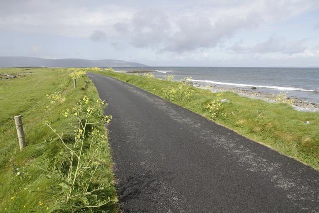
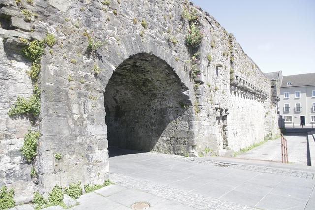
We stopped in Galway for an hour to see the Spanish Arch. Lots of tourist shops and restaurants in the area.
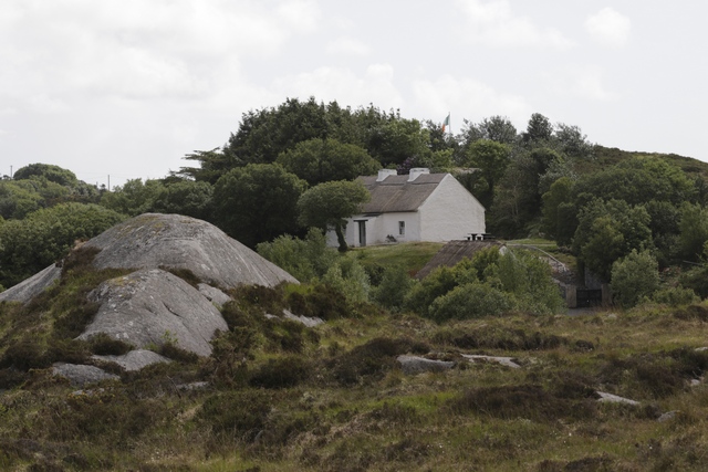
This restored cottage is a national historic site. It was built and used by Patrick Pearse as a summer home and Irish language school for his pupils. Patrick Patrick Pearse was one of the leaders of the 1916 Rising and was executed by the British. The 1916 Rising was the start of Ireland's fight for independence. The people at the heritage site were very informative and the cottage was in an amazing spot.
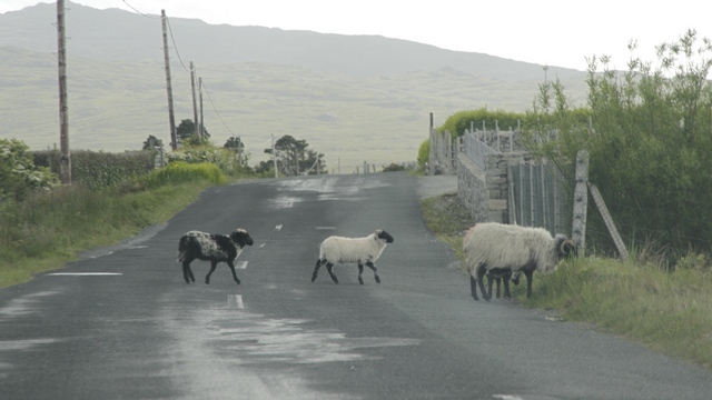
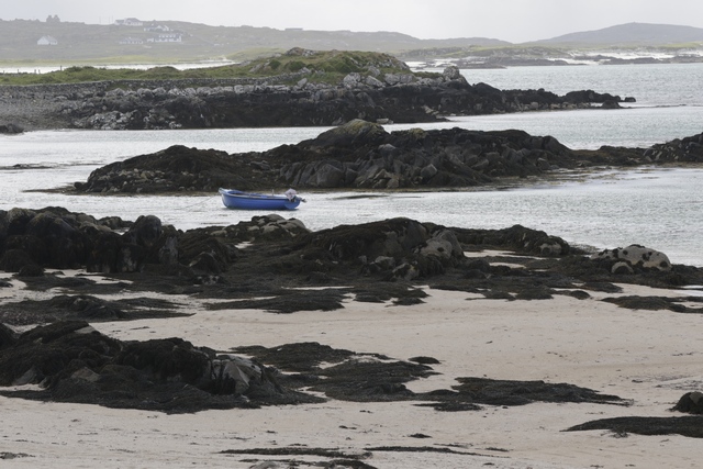
Views along the Wild Atlantic Way, which follows the western coast of the Rupublic of Irelnd.
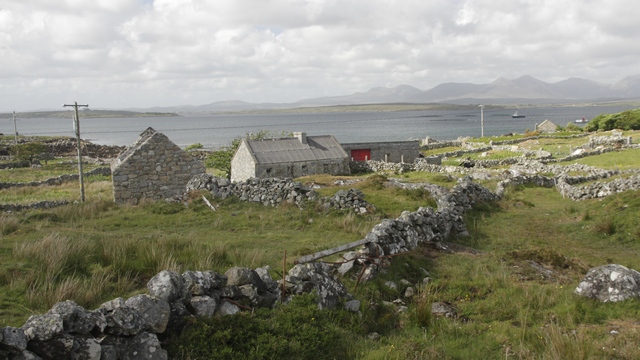
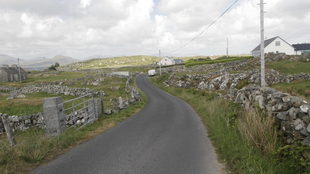
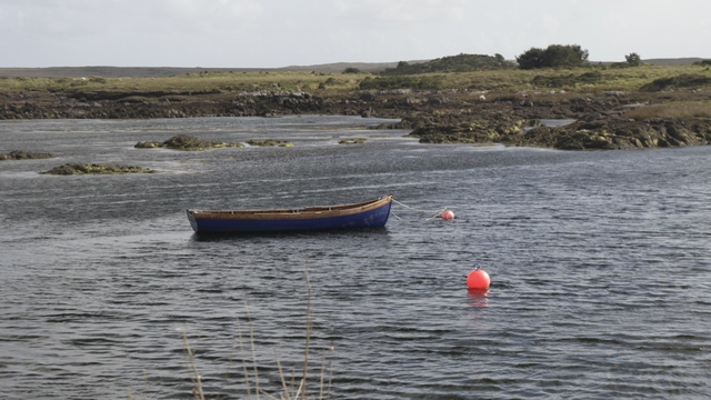
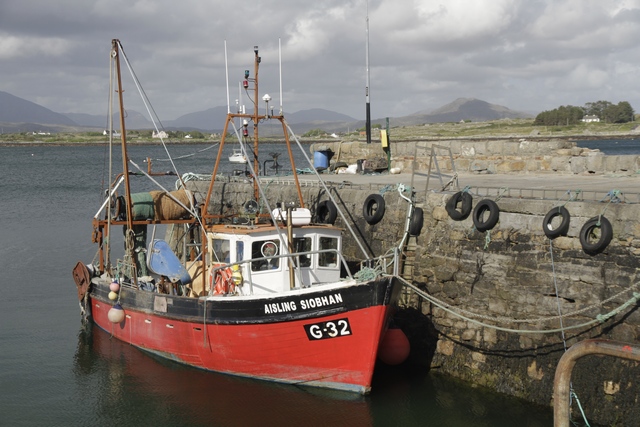
Roundstone is a cute harbour town.
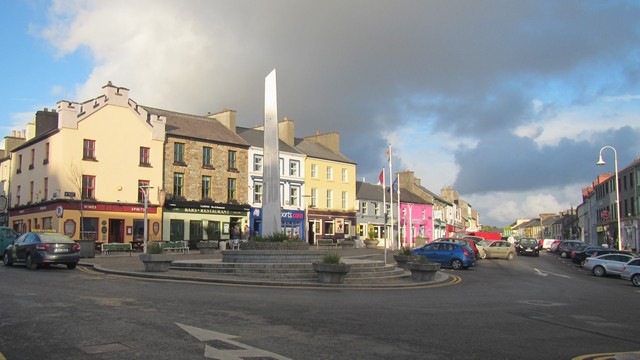
My guide book indicates Clifden's population to be about 2100. Clifden has a good size and colourful downtwon for a small town.
We spent most of the day driving, following the Wild Atlantic Way. A few drops of rain, some cloud but mostly a lot of sun today.
We stopped in Galway for an hour to see the Spanish Arch. Lots of tourist shops and restaurants in the area.
This restored cottage is a national historic site. It was built and used by Patrick Pearse as a summer home and Irish language school for his pupils. Patrick Patrick Pearse was one of the leaders of the 1916 Rising and was executed by the British. The 1916 Rising was the start of Ireland's fight for independence. The people at the heritage site were very informative and the cottage was in an amazing spot.
Views along the Wild Atlantic Way, which follows the western coast of the Rupublic of Irelnd.
Roundstone is a cute harbour town.
My guide book indicates Clifden's population to be about 2100. Clifden has a good size and colourful downtwon for a small town.
2017/05/16: The Burren
Category: General
Posted by: The Agnew Family
And this evening's beer is Harp lager and another wonderful Irish cider.
I can't think of a better way to describe the Burren than to borrow text for the web. This is from the Galway on-line vistor guide.
"The Burren, in North County Clare and parts of South County Galway covering an area of 160 square km, is unique - it is like no other place in Ireland. There are no bogs and very few pastures. Instead there are huge pavements of limestone called 'clints' with vertical fissures in the called 'grikes'. The Burren was under a tropical ocean over 360 million years ago, the result being the area covered with limestone, it was tectonic movement that raised an area of this ancient seabed into a magnificent plateau that we now know as 'The Burren'. The Ice Age ploughed through the area widening the river valleys and leaving behind boulder clay. It was after the Ice Age that the landscape went through periods of tundra and may have even been wooded, evidence suggests that early settlers cut down the forest, and allowed the soil to be eroded away, this has happened in many of the worlds karst regions. Centuries of weathering has produced a terrain of fissured limestone pavements, disappearing lakes, terraced mountains, and underground cave systems."
This morning started with rain and ended up sunny. Dressed for rain, Ed and I drove out to the Burren for a hike.
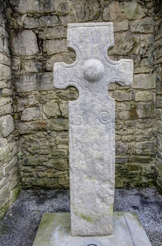
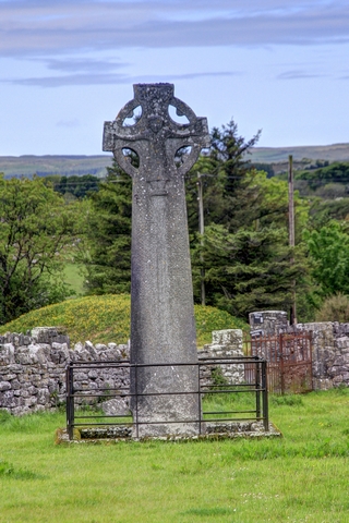
First stop was the small town of Kilfenora where we found these crosses.
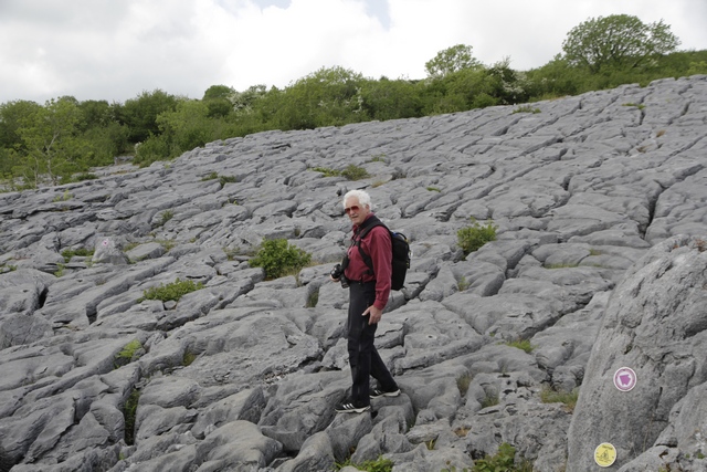
As I forgot Ed's hiking boots at the B&B;, we did at short hike at the National Park. Then we started walking up a road and ended up on a farm loop trail. One we got started we just kept on going. This is some the rock in the Burrent.
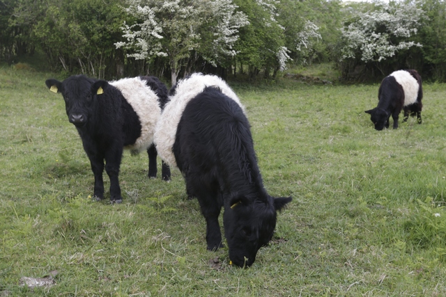
Part of a trail was on a working farm. In one field we met the farmer and some of his Scottish Belted Galloway cows.
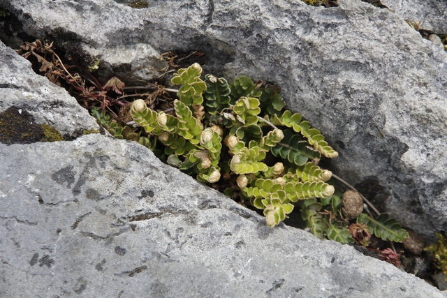
If there was any soil in a hole a plant took root.
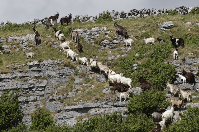
On the ridge above the hiking trail was a herd of goats.
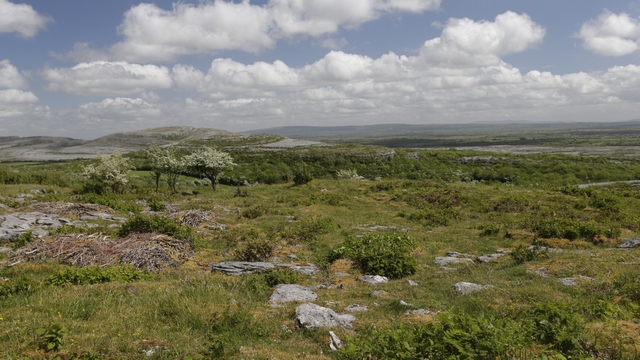
The trail took us up into the hills yeilding some amazing views.
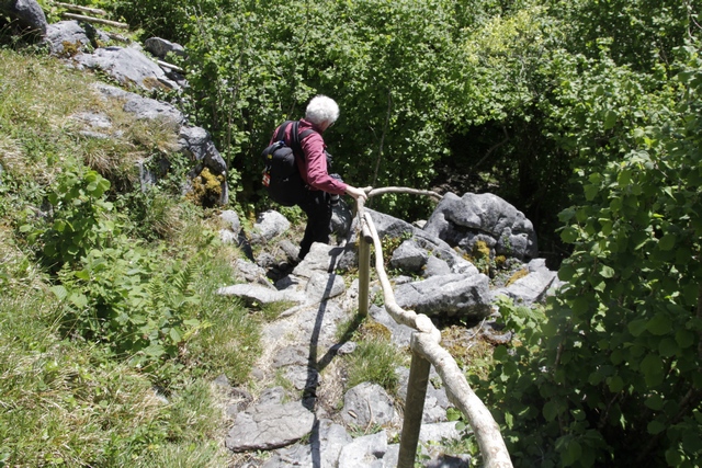
What goes up must come down. The trail going up didn't seem steep, but coming down we hit some steep sections. A few were steep enough that hand rails were fashioned out of tree branches.
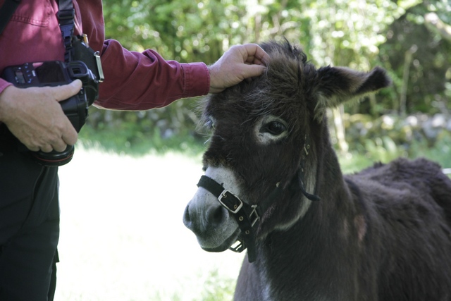
Not sure if guy was a donkey, mule or something else, but he sure was freindly. The trail took us through the field he was hanging out in.
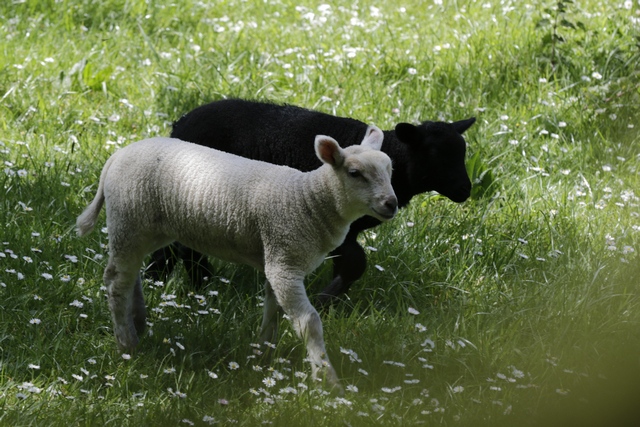
Another field had sheep including these babies. At the end of the hike I found a sign board that indicated the hike was 6 km, would take 2 1/2 to 3 hours and was classified as "hard". Good thing I didn't read the sign board before we started.
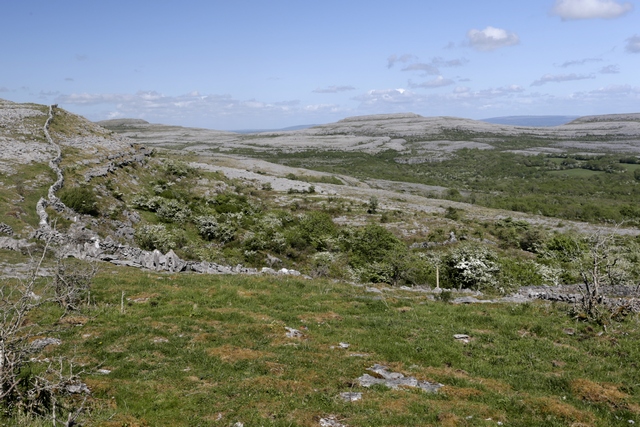
After the hike we started driving back to the coast on some back roads that took us through more of the burren.
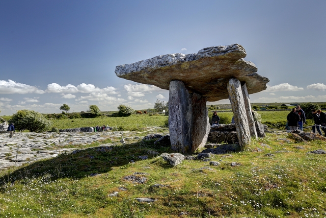
This is the Poulnabrone Dolmen aka the portal tomb
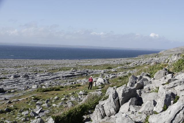
Where the burren meets the sea. Inland, the mountain rose quickly, but here there was a flat expanse of rocks down to the water.
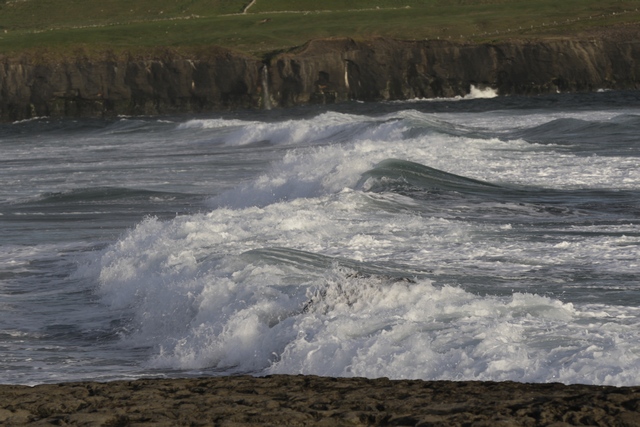
Good waves out by Doolin pier.
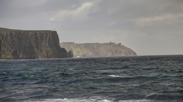
The backside of the Cliffs of Moher seen from Doolin.
I can't think of a better way to describe the Burren than to borrow text for the web. This is from the Galway on-line vistor guide.
"The Burren, in North County Clare and parts of South County Galway covering an area of 160 square km, is unique - it is like no other place in Ireland. There are no bogs and very few pastures. Instead there are huge pavements of limestone called 'clints' with vertical fissures in the called 'grikes'. The Burren was under a tropical ocean over 360 million years ago, the result being the area covered with limestone, it was tectonic movement that raised an area of this ancient seabed into a magnificent plateau that we now know as 'The Burren'. The Ice Age ploughed through the area widening the river valleys and leaving behind boulder clay. It was after the Ice Age that the landscape went through periods of tundra and may have even been wooded, evidence suggests that early settlers cut down the forest, and allowed the soil to be eroded away, this has happened in many of the worlds karst regions. Centuries of weathering has produced a terrain of fissured limestone pavements, disappearing lakes, terraced mountains, and underground cave systems."
This morning started with rain and ended up sunny. Dressed for rain, Ed and I drove out to the Burren for a hike.


First stop was the small town of Kilfenora where we found these crosses.
As I forgot Ed's hiking boots at the B&B;, we did at short hike at the National Park. Then we started walking up a road and ended up on a farm loop trail. One we got started we just kept on going. This is some the rock in the Burrent.
Part of a trail was on a working farm. In one field we met the farmer and some of his Scottish Belted Galloway cows.
If there was any soil in a hole a plant took root.
On the ridge above the hiking trail was a herd of goats.
The trail took us up into the hills yeilding some amazing views.
What goes up must come down. The trail going up didn't seem steep, but coming down we hit some steep sections. A few were steep enough that hand rails were fashioned out of tree branches.
Not sure if guy was a donkey, mule or something else, but he sure was freindly. The trail took us through the field he was hanging out in.
Another field had sheep including these babies. At the end of the hike I found a sign board that indicated the hike was 6 km, would take 2 1/2 to 3 hours and was classified as "hard". Good thing I didn't read the sign board before we started.
After the hike we started driving back to the coast on some back roads that took us through more of the burren.

This is the Poulnabrone Dolmen aka the portal tomb
Where the burren meets the sea. Inland, the mountain rose quickly, but here there was a flat expanse of rocks down to the water.
Good waves out by Doolin pier.

The backside of the Cliffs of Moher seen from Doolin.
2017/05/15: Loop Head and the Cliffs of Moher
Category: General
Posted by: The Agnew Family
And this evening’s beers are Burren Gold and Burren Red, a lager and an ale brewed by the Burren Micro Brewery.
It was pouring rain when I woke up this morning which made me happy that we had delayed our morning departure. By time we had eaten another amazing Irish breakfast, the rain was down to a drizzle. We had stayed in the town Tarbert as it is home to a ferry across the Shannon Estuary.
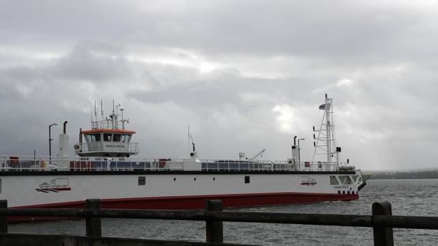
This ferry took us across the estuary. The ferry can carry 50 cars or equivalent vehicles --- this packed ferry had at 4 transport trucks, a few smaller trucks, 4 tourist bus and a number of cars.
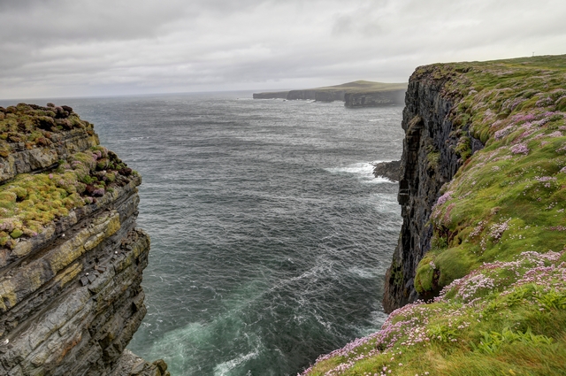
We drove Loop Head, the southern most point on the the north side of the estuary. Our plan for today is to drive north along the coast to the Cliffs of Moher.
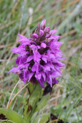
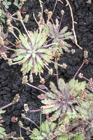
In drizzle and mist you can find things other than the view to photograph. My guide book describes the views as “gobsmacking”. Considering how beautiful the views are in the mist, I think the guide book is probably correct in it’s view.
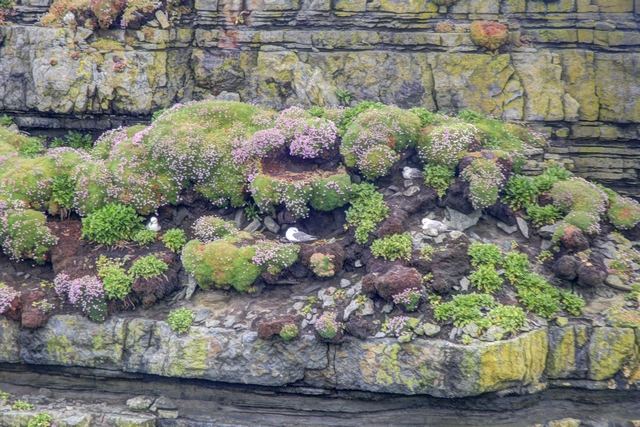
Nature's rock garden for the gulls.
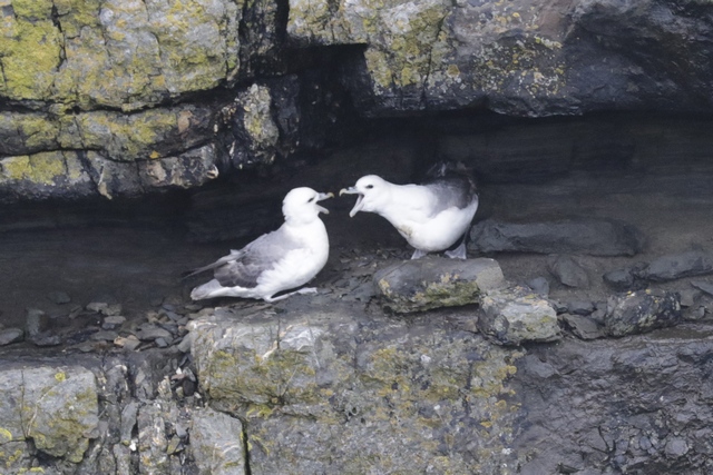
Squawking
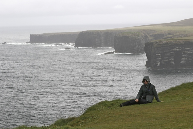
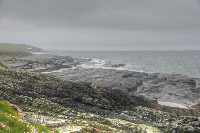
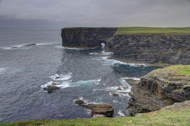
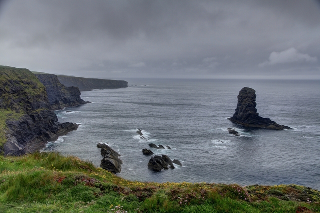
Some of the views as we drove north along the coast.
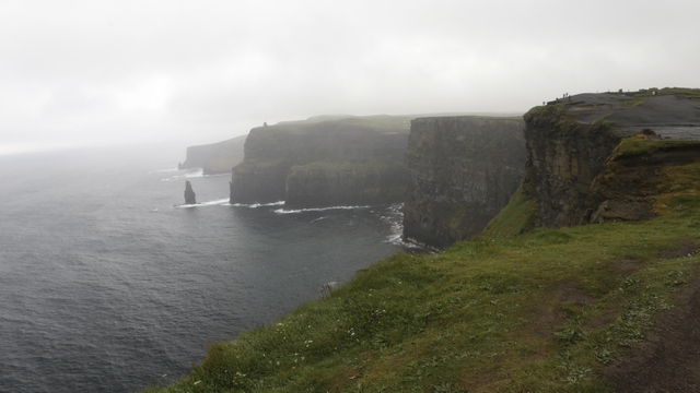
The Cliffs of Moher are a huge tourist attraction --- lots of buses, large parking lot, tourist shops and lots and lots of people. Unfortunately, the weather took a turn for the worse
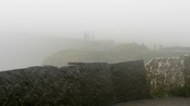
as the clouds dropped. If you look closely at the photo you’ll see people looking at the view.
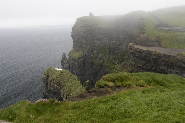
We did get to see a bit of the cliffs when we first arrived. One person’s solution to the lack of view was to take photos of the slide presentation in the visitor center.
Puffins nest along the cliffs and we were able to see them with binoculars.
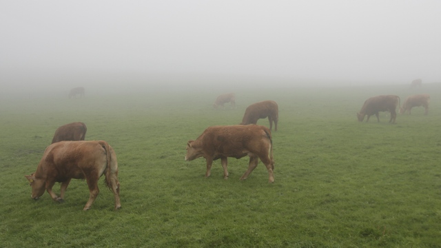
My attempt at an art photo …. Ghost cows.
It was pouring rain when I woke up this morning which made me happy that we had delayed our morning departure. By time we had eaten another amazing Irish breakfast, the rain was down to a drizzle. We had stayed in the town Tarbert as it is home to a ferry across the Shannon Estuary.
This ferry took us across the estuary. The ferry can carry 50 cars or equivalent vehicles --- this packed ferry had at 4 transport trucks, a few smaller trucks, 4 tourist bus and a number of cars.

We drove Loop Head, the southern most point on the the north side of the estuary. Our plan for today is to drive north along the coast to the Cliffs of Moher.

In drizzle and mist you can find things other than the view to photograph. My guide book describes the views as “gobsmacking”. Considering how beautiful the views are in the mist, I think the guide book is probably correct in it’s view.

Nature's rock garden for the gulls.
Squawking
Some of the views as we drove north along the coast.


The Cliffs of Moher are a huge tourist attraction --- lots of buses, large parking lot, tourist shops and lots and lots of people. Unfortunately, the weather took a turn for the worse
as the clouds dropped. If you look closely at the photo you’ll see people looking at the view.
We did get to see a bit of the cliffs when we first arrived. One person’s solution to the lack of view was to take photos of the slide presentation in the visitor center.
Puffins nest along the cliffs and we were able to see them with binoculars.
My attempt at an art photo …. Ghost cows.
2017/05/14: Slea Head Drive
Category: General
Posted by: The Agnew Family
And tonight's beer was Guinness and a hard cider for me.
Maureen told us that we couldn’t leave Killarney without seeing the Rhododendrons at the Muckross Gardens in the Killarney National Park. We were not successful in fitting a rhododendron viewing in yesterday so we drove the short distance to the national park this morning.
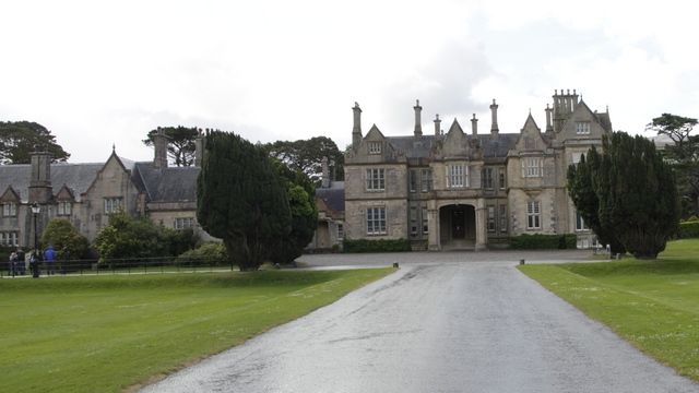
Muckross House is a mansion in the Killarney National Park. Our next visit to Ireland will include more time to explore Muckross House, Farm, Abby, etc and the national park. Mother Nature was making weather during our visit, so we saw the gardens in the rain and the sun.
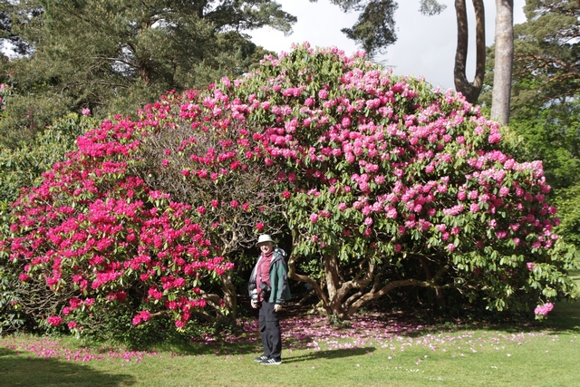
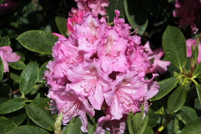
Rhododendrons in many colours graced the garden.
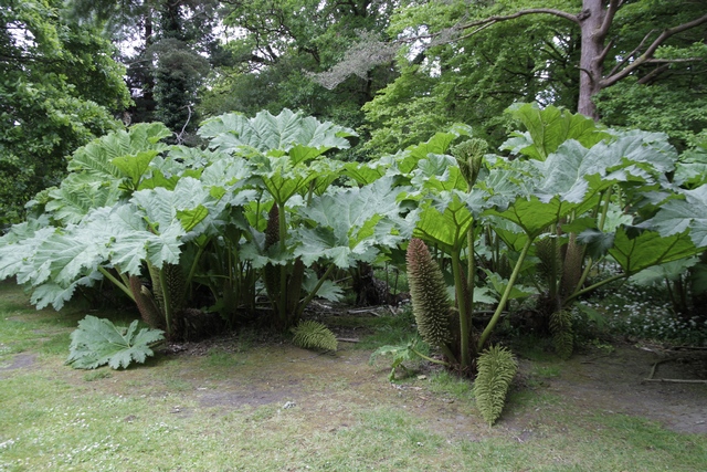
I’m not sure what this plant is but it looks like a relative of rhubarb, only it’s much, much larger (it was taller than me) and had thorns on the stalks and leaves.
The peninsula north, northwest of the Iveragh Peninsula (Ring of Kerry) is the Dingle Peninsula. The scenic drive around this peninsula is called the Slea Head Drive. Again we experienced weather
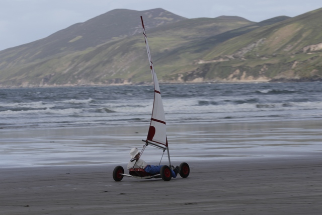
At the top end of the Dingle Peninsula is a wonderful beach called Inch beach. The beach is on land the juts into the bay --- the sand is hard packed and the waves plentiful. We saw people learning to surf, runers practicing for a marathon, land yachts (or sail cart) zooming and dogs having a great time running around.
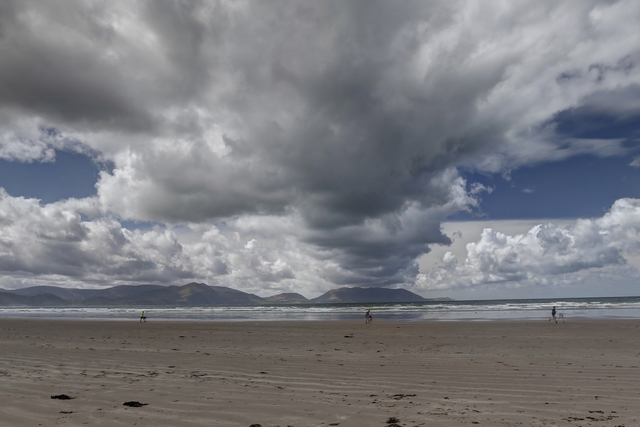
An interesting cloud pattern.
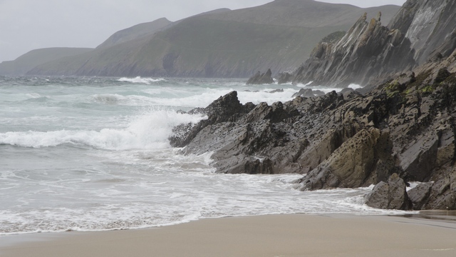
There were lots of waves hitting the rocks along the shore.
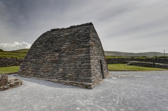
Gallarus Oratory is a chapel that is 800 to 1200 years old. The stones were dry laid creating walls that are almost 4 feet thick.
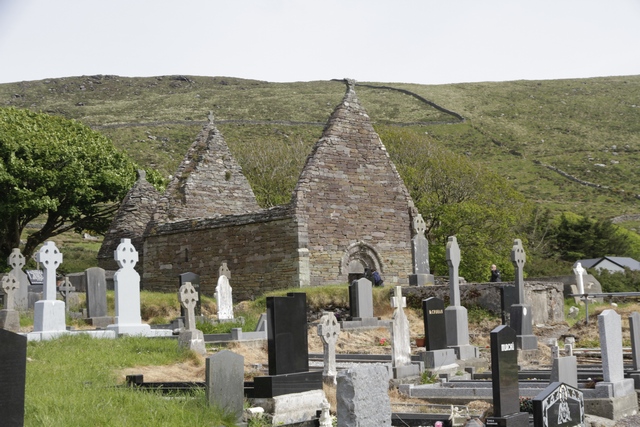
Ruins of a church.
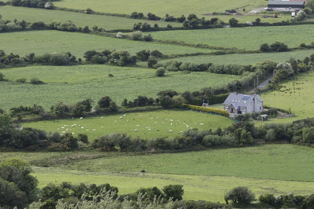
The patchwork of fields dotted with sheep and cows.
Maureen told us that we couldn’t leave Killarney without seeing the Rhododendrons at the Muckross Gardens in the Killarney National Park. We were not successful in fitting a rhododendron viewing in yesterday so we drove the short distance to the national park this morning.
Muckross House is a mansion in the Killarney National Park. Our next visit to Ireland will include more time to explore Muckross House, Farm, Abby, etc and the national park. Mother Nature was making weather during our visit, so we saw the gardens in the rain and the sun.
Rhododendrons in many colours graced the garden.
I’m not sure what this plant is but it looks like a relative of rhubarb, only it’s much, much larger (it was taller than me) and had thorns on the stalks and leaves.
The peninsula north, northwest of the Iveragh Peninsula (Ring of Kerry) is the Dingle Peninsula. The scenic drive around this peninsula is called the Slea Head Drive. Again we experienced weather
At the top end of the Dingle Peninsula is a wonderful beach called Inch beach. The beach is on land the juts into the bay --- the sand is hard packed and the waves plentiful. We saw people learning to surf, runers practicing for a marathon, land yachts (or sail cart) zooming and dogs having a great time running around.

An interesting cloud pattern.
There were lots of waves hitting the rocks along the shore.

Gallarus Oratory is a chapel that is 800 to 1200 years old. The stones were dry laid creating walls that are almost 4 feet thick.
Ruins of a church.
The patchwork of fields dotted with sheep and cows.
2017/05/13: The Rings
Category: General
Posted by: The Agnew Family
And tonight’s beer is Corona ---- ooooops. Today was a very long day, so
we popped into a diner called Eddie Rocket’s City Diner (I'll let you
guess who picked it) at about 9pm for dinner and they only had Heineken,
Coors and Corona. The hamburger he ordered had jalapenos on it so
Corona made sence.
One of the most visited sites in Ireland is the Ring of Kerry. This morning when Maureen (the lady who owns the B&B; where we are staying) gave us the map of the Ring of Kerry she indicated that she thought the Skellig Ring was the nicest part of the route ---- an 18 km extension to the Ring of Kerry. We set out in the rain heading for the start of the Ring of Kerry wondering just how much of the cliffs we would see in the rain and haze.
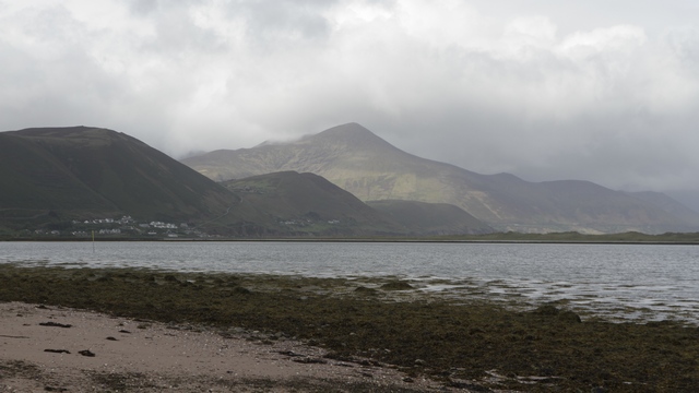
A beach allow the Ring of Kerry
Being a popular site you can imagine the number of tourist buses on the route lumbering down the narrow, twisty, hilly road. About a 1/3 of the way through the Ring of Kerry we had to decide if we were going to drive the Skellig Ring ---- it didn’t take Ed long to decide once I told him the buses didn’t drive the Skellig Ring. It also helped that the rain was not constant and we did see a patch of blue sky. The Skellig Ring starts in Cahersiveen where you catch a ferry to Valencia Island.
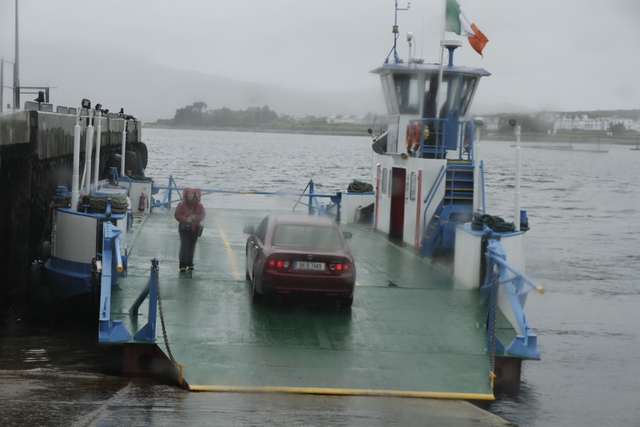
The ferry is small --- maybe holds a ½ dozen cars and it takes about 5 minutes to cross the harbour.
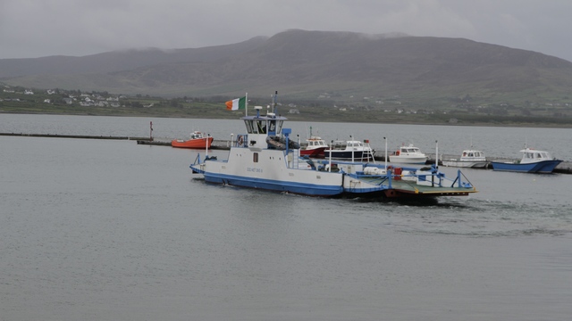
The ferry heading across the harbour.
After walking around the village for a few minutes I said to Ed, “we’ve finally found the Ireland we were looking for” and he agreed.
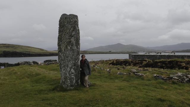
This standing stone has been standing for at least a thousand years.
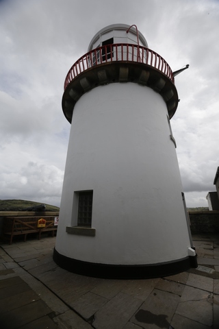
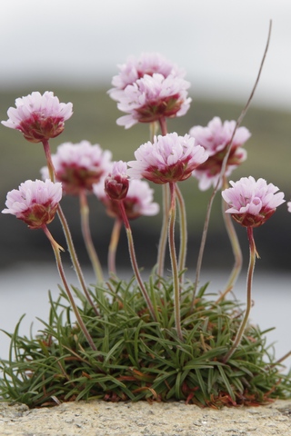
The Valencia Island light house at Cromwell’s Point is only 16 meters tall. Some little flowers growing in a wall.
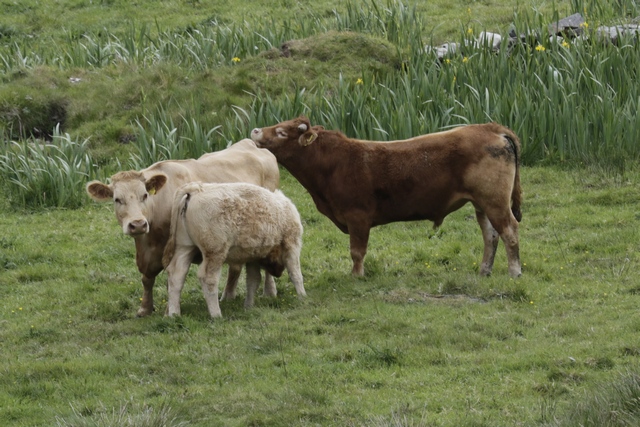
Aw, boney butt --- great for scratching the chin.
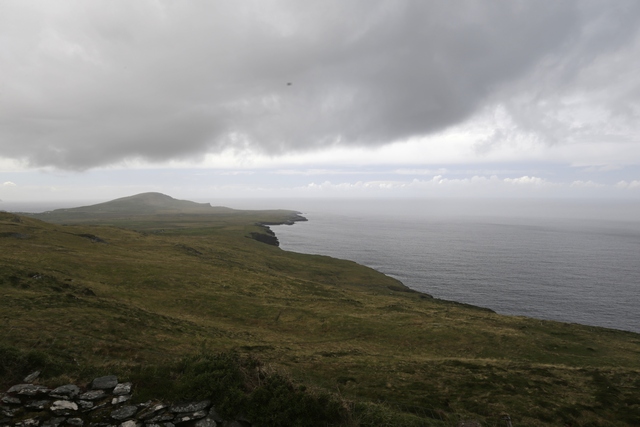
It's hard to see but between the dark clouds and the light clouds is a strip of blue --- it's starting to clear up.
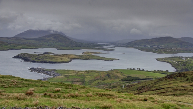
At the highest point on the island looking down on the lighthouse.
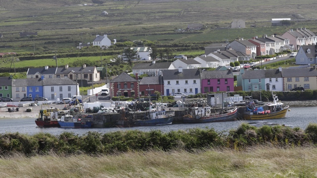
Looking down at Portmagee.
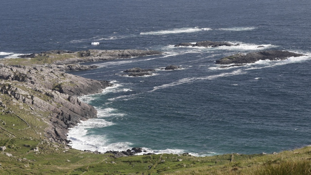
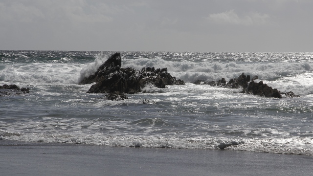
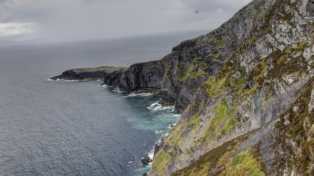
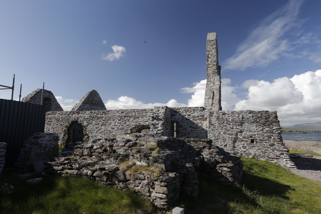
A few views along the Ring of Kerry.
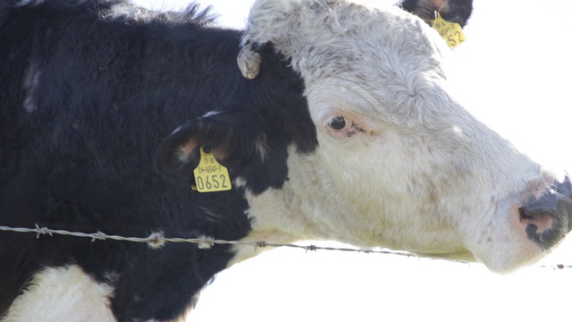
Hmmm... scratching using barb wire, must be a big itch.
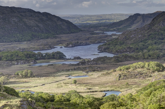
Ladies view in Killarney National Park.
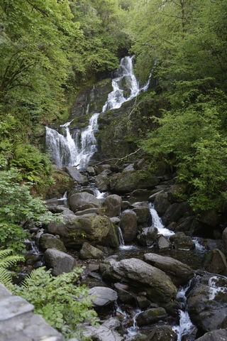
Torc Waterfall.
One of the most visited sites in Ireland is the Ring of Kerry. This morning when Maureen (the lady who owns the B&B; where we are staying) gave us the map of the Ring of Kerry she indicated that she thought the Skellig Ring was the nicest part of the route ---- an 18 km extension to the Ring of Kerry. We set out in the rain heading for the start of the Ring of Kerry wondering just how much of the cliffs we would see in the rain and haze.
A beach allow the Ring of Kerry
Being a popular site you can imagine the number of tourist buses on the route lumbering down the narrow, twisty, hilly road. About a 1/3 of the way through the Ring of Kerry we had to decide if we were going to drive the Skellig Ring ---- it didn’t take Ed long to decide once I told him the buses didn’t drive the Skellig Ring. It also helped that the rain was not constant and we did see a patch of blue sky. The Skellig Ring starts in Cahersiveen where you catch a ferry to Valencia Island.
The ferry is small --- maybe holds a ½ dozen cars and it takes about 5 minutes to cross the harbour.
The ferry heading across the harbour.
After walking around the village for a few minutes I said to Ed, “we’ve finally found the Ireland we were looking for” and he agreed.
This standing stone has been standing for at least a thousand years.
The Valencia Island light house at Cromwell’s Point is only 16 meters tall. Some little flowers growing in a wall.
Aw, boney butt --- great for scratching the chin.
It's hard to see but between the dark clouds and the light clouds is a strip of blue --- it's starting to clear up.

At the highest point on the island looking down on the lighthouse.
Looking down at Portmagee.
A few views along the Ring of Kerry.

Hmmm... scratching using barb wire, must be a big itch.

Ladies view in Killarney National Park.
Torc Waterfall.
2017/05/12: Kilkenny, Rock of Cashel and Killarney
Category: General
Posted by: The Agnew Family
And tonight’s beers are Killarney Helles Lager and Creans Lager brewed in Dingle (not far from Killarney).
This morning we set out early for Kilkenny Castle. Along the way we stopped at a shoe repair shop to pick up a cross strap for Ed’s camera pack. We had stopped in just before closing yesterday and the fellow said he would make one first thing this morning. Ed is now a happy camper as the pack no longer falls off his shoulder.
Kilkenny Castle was built in 1195 to control a fording-point of the River Nore and the junction of several routeways. In 1935 most of the furnishings ard art work were sold and the family moved back to England. The building fell into disrepair and in 1967 Kilkenny Castle was transferred to the people of Kilkenny for £50. It took many years and millions of pounds to do the major restorations required to bring the castle.
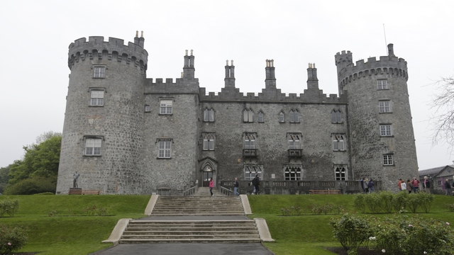
The back of the castle.
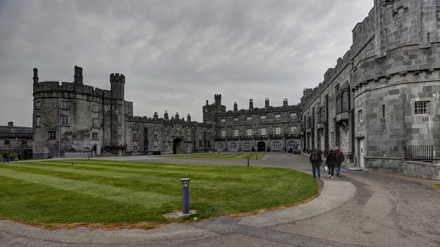
The front of the castle.
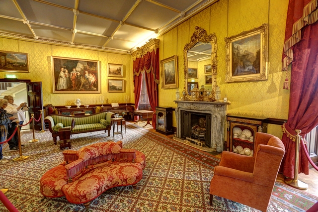
The parlor --- the odd looking chair at the front left corner of the photo is a courting chair. The courters sat in the large sections with their backs together and the chaperones sat on the two ends.
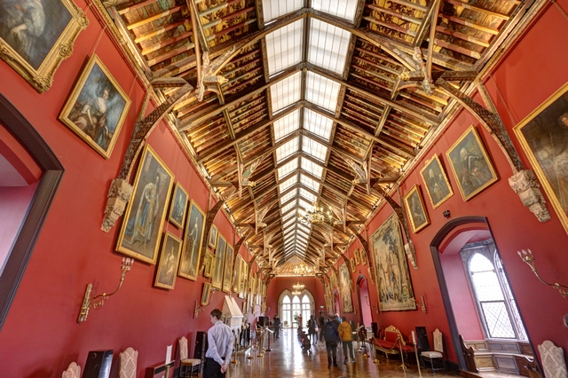
The gallery. The glass in the ceiling was added during one of the restorations.
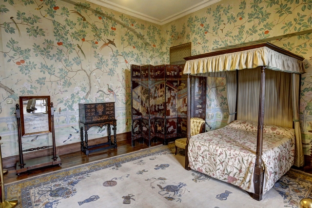
One of the bedrooms.
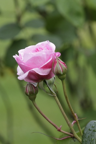
Roses are starting to bloom. This is one of the roses in the castles rose garden.
For more than 1000 years the Rock of Cashel was a symbol of power and the seat of kings and churchmen who ruled over the region. The actual Rock of Cashel is the hill the buildings were erected on.
It was drizzling and hard drizzling while we were here so not as many outdoor shots as usual.
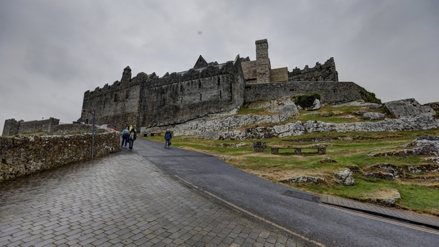
You can see how the hill helps to add to the fortication.
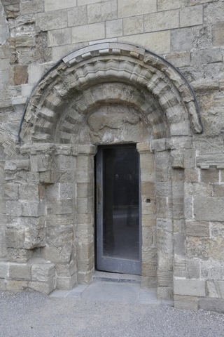
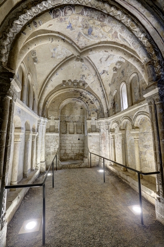
The entrance door to Cormac's Chapel. Cormac's Chapel is probably the first Romanesque church in Ireland. It dates from 1127. This is the first year since 2009 that chapel has been seen without scaffolding that was used to allow conservation works. The photo on the right is of the interior of the chapel.
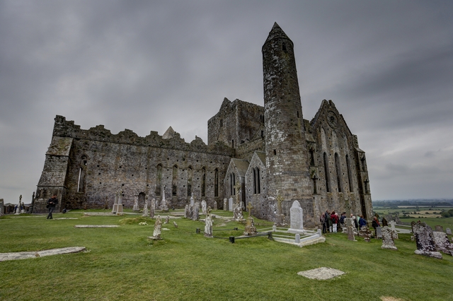
The back of the Gothic Cathedral and the round tower. The cathedral was built in the 15th century.
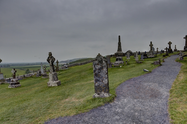
The graveyard and some of the view from the hill. You are suppose to be able to see for miles, just not today.
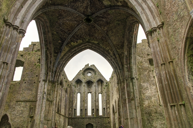
The interior of the cathedral.
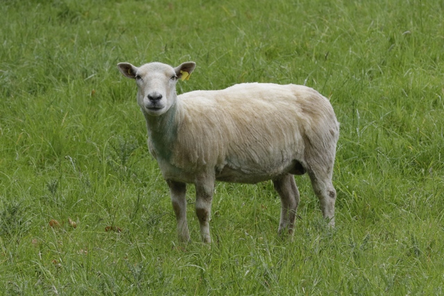
The token sheep photo of the day.
After a couple of hours driving we made it to Killarney where we are spending 2 nights. The B&B; we booked is lovely. We timed our arrival perfectly --- tomorrow morning's scones were coming out of the oven and so we each had a piping hot fresh baked scone .... yum.
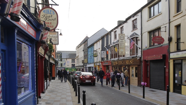
Killarney is definitely a tourist town.
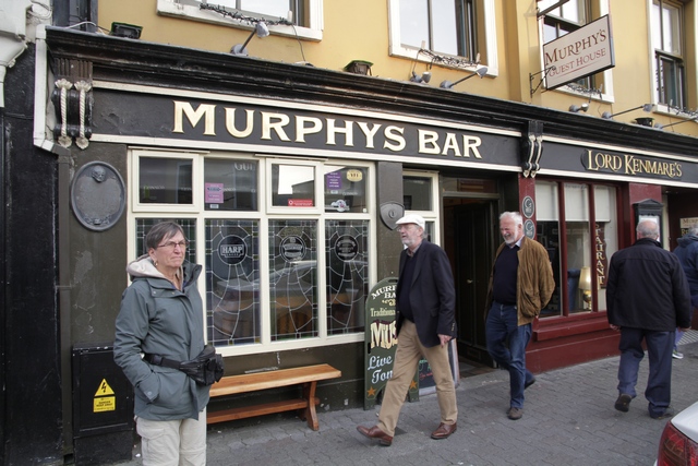
We had a very nice dinner at Murphy's Pub.
This morning we set out early for Kilkenny Castle. Along the way we stopped at a shoe repair shop to pick up a cross strap for Ed’s camera pack. We had stopped in just before closing yesterday and the fellow said he would make one first thing this morning. Ed is now a happy camper as the pack no longer falls off his shoulder.
Kilkenny Castle was built in 1195 to control a fording-point of the River Nore and the junction of several routeways. In 1935 most of the furnishings ard art work were sold and the family moved back to England. The building fell into disrepair and in 1967 Kilkenny Castle was transferred to the people of Kilkenny for £50. It took many years and millions of pounds to do the major restorations required to bring the castle.
The back of the castle.

The front of the castle.

The parlor --- the odd looking chair at the front left corner of the photo is a courting chair. The courters sat in the large sections with their backs together and the chaperones sat on the two ends.

The gallery. The glass in the ceiling was added during one of the restorations.

One of the bedrooms.
Roses are starting to bloom. This is one of the roses in the castles rose garden.
For more than 1000 years the Rock of Cashel was a symbol of power and the seat of kings and churchmen who ruled over the region. The actual Rock of Cashel is the hill the buildings were erected on.
It was drizzling and hard drizzling while we were here so not as many outdoor shots as usual.

You can see how the hill helps to add to the fortication.

The entrance door to Cormac's Chapel. Cormac's Chapel is probably the first Romanesque church in Ireland. It dates from 1127. This is the first year since 2009 that chapel has been seen without scaffolding that was used to allow conservation works. The photo on the right is of the interior of the chapel.

The back of the Gothic Cathedral and the round tower. The cathedral was built in the 15th century.

The graveyard and some of the view from the hill. You are suppose to be able to see for miles, just not today.

The interior of the cathedral.
The token sheep photo of the day.
After a couple of hours driving we made it to Killarney where we are spending 2 nights. The B&B; we booked is lovely. We timed our arrival perfectly --- tomorrow morning's scones were coming out of the oven and so we each had a piping hot fresh baked scone .... yum.
Killarney is definitely a tourist town.
We had a very nice dinner at Murphy's Pub.
2017/05/11: Just Missed Prince Charles
Category: General
Posted by: The Agnew Family
And tonight's beer is Costellos The Red, a craft beer brewed in
Kilkenny. I opted for a half pint of Smithwick's Red that was brewed for
in Kilkenny for hundreds of years. Unfortunately, it was bought by
Guinness in 1965 and stopped being brewed in Kilkenny in 2012.
Happily the sun was shining this morning when we woke up. We went back to Glendalough so we could finish our visit of the display on St. Kevin. As the sun was shining so nicely we decided to do another visit of the grounds. The visit was shortened when we released just how many other people were visiting the site --- must have been more than 20 tourist buses and a bunch more filled with school children.
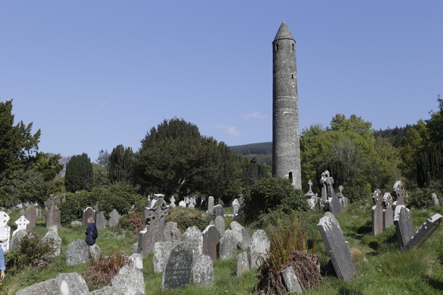
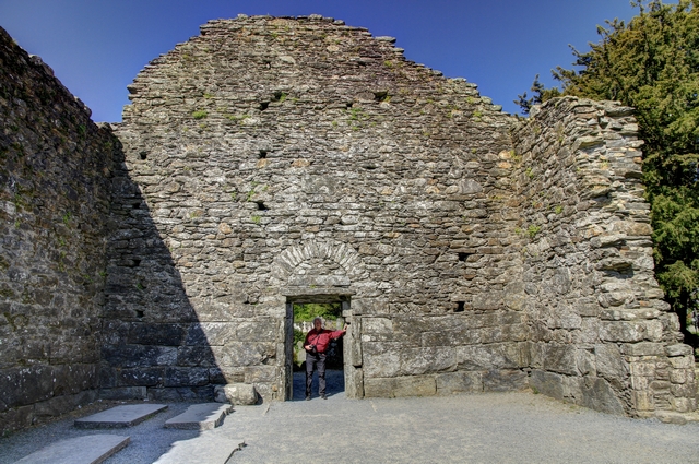
As we were leaving Glendalough the clouds arrived threatening rain. Luckily the rain didn't amount to more than a few sprinkles.
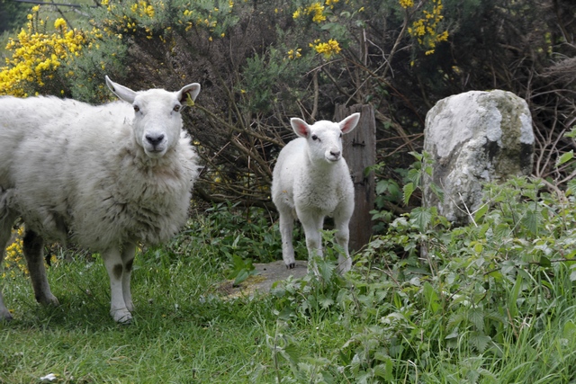
An ewe and her lamb grazing by the side of the road.
Kilkenny is our destination for today, about 100 km or 1 1/2 hours drive. Our B&B; is located about a 15 minute walk to downtown so we landed in their parking lot and headed out on foot. The owner of the B&B; informed us that we might not be able to see Kilkenny Castle today because Prince Charles and Camilla visited the castle this morning. Turned out she was correct. The visit was only an hour or so this morning but the castle remained closed for the day as cleanup was required. Oh well, tomorrows plans will have to be adjusted to fit a visit to the castle in. The amount of work created by a Royal visit is incredible. Streets are barricaded, some sewers are welded shut while other access plates are taped closed, parking machines and anything else that could be opened are taped closed. Even though I complained about the inconvenience the Royal visit caused me, I can’t image what it would be like to require an entourage and protection on every trip I took.
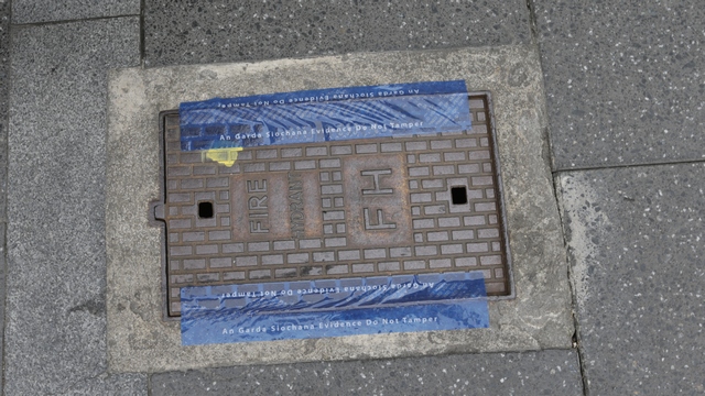
One of the taped access covers.
We spent the remainder of the afternoon wandering around the historic area of Kilkenny.
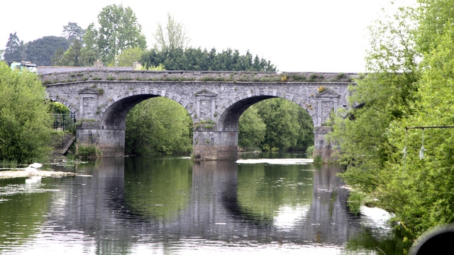
One of the bridges that cross the river.
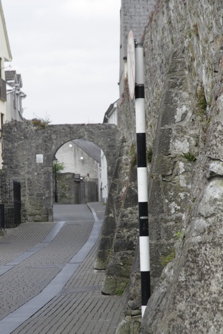
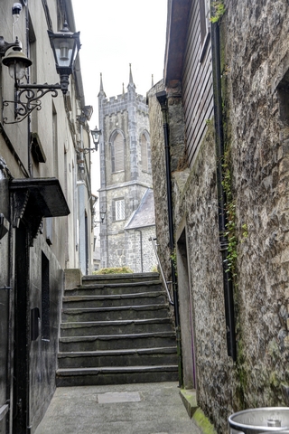
Part of the old city wall and the gate leading into the city. Interesting view through an alley looking at the tower of one of the many historic buildings in town.
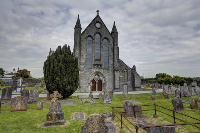
An end wall of St. Canice's Cathedral.
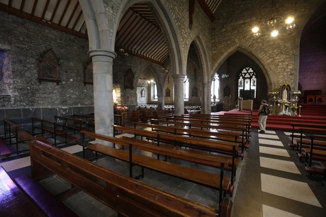
Inside Black Abby.
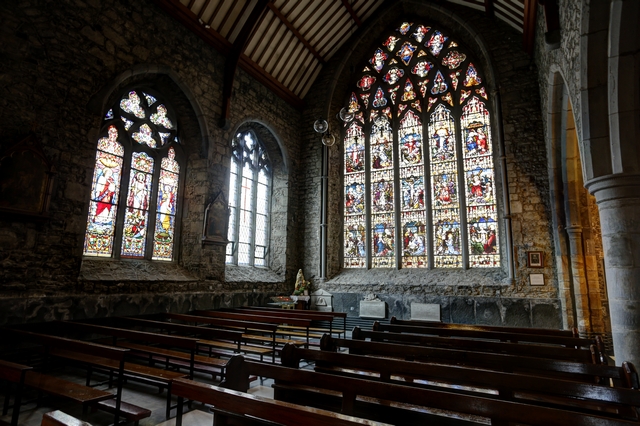
One of the impressive stained glass windows in Black Abbey.
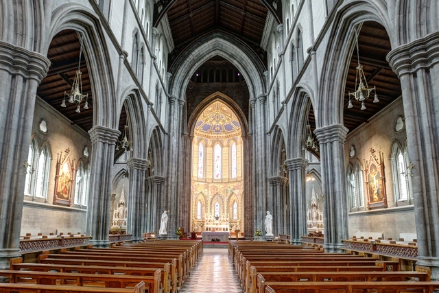
The inside of St. Mary's Cathedral.
We even saw a few interesting birds today.
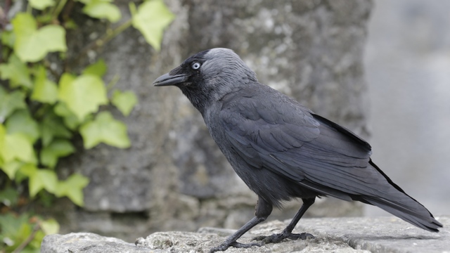
Jackdaw
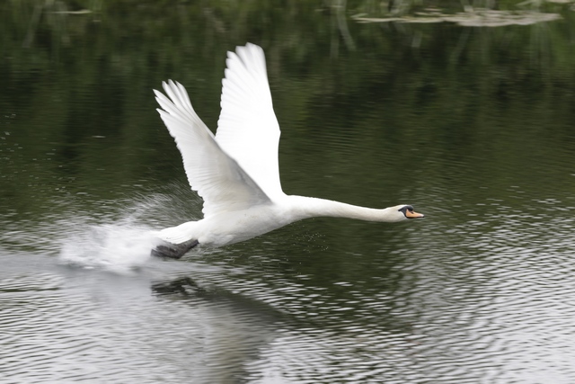
I don't remember ever seeing a swan take off. This guy sure made it look hard. He seemed to be hopping on the water before he finally flew about 100 meters.
Happily the sun was shining this morning when we woke up. We went back to Glendalough so we could finish our visit of the display on St. Kevin. As the sun was shining so nicely we decided to do another visit of the grounds. The visit was shortened when we released just how many other people were visiting the site --- must have been more than 20 tourist buses and a bunch more filled with school children.

As we were leaving Glendalough the clouds arrived threatening rain. Luckily the rain didn't amount to more than a few sprinkles.
An ewe and her lamb grazing by the side of the road.
Kilkenny is our destination for today, about 100 km or 1 1/2 hours drive. Our B&B; is located about a 15 minute walk to downtown so we landed in their parking lot and headed out on foot. The owner of the B&B; informed us that we might not be able to see Kilkenny Castle today because Prince Charles and Camilla visited the castle this morning. Turned out she was correct. The visit was only an hour or so this morning but the castle remained closed for the day as cleanup was required. Oh well, tomorrows plans will have to be adjusted to fit a visit to the castle in. The amount of work created by a Royal visit is incredible. Streets are barricaded, some sewers are welded shut while other access plates are taped closed, parking machines and anything else that could be opened are taped closed. Even though I complained about the inconvenience the Royal visit caused me, I can’t image what it would be like to require an entourage and protection on every trip I took.
One of the taped access covers.
We spent the remainder of the afternoon wandering around the historic area of Kilkenny.
One of the bridges that cross the river.

Part of the old city wall and the gate leading into the city. Interesting view through an alley looking at the tower of one of the many historic buildings in town.

An end wall of St. Canice's Cathedral.
Inside Black Abby.

One of the impressive stained glass windows in Black Abbey.

The inside of St. Mary's Cathedral.
We even saw a few interesting birds today.
Jackdaw
I don't remember ever seeing a swan take off. This guy sure made it look hard. He seemed to be hopping on the water before he finally flew about 100 meters.
2017/05/10: Made It!!! We're in beautiful Green Ireland
Category: General
Posted by: The Agnew Family
And tonight’s beer is Hop House 13 Lager, a local beer brewed in Dublin (local as we’re less than 70 km from Dublin).
Our flight from Toronto was uneventful … just the way I like it. We left Toronto about 11:20pm. I knew we would get food on the flight but I didn’t expect to get dinner at midnight.
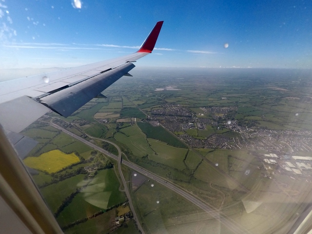
Our first stop is the small town of Glendalough in the Wicklow mountains about 70 km from Dublin airport. Ed did a good job of getting us there --- first it was the M50 to get around Dublin then I got him off the highway onto a road that drove us through the Wicklow mountains. This was an interesting road, barely wide enough for 2 cars ---- oh then there were the sections that were barely wide enough for one car. And he did this while sleep deprived , driving on the wrong side of the road with a manual transmission. Think he’s ready to handle the roads for the rest of the trip.
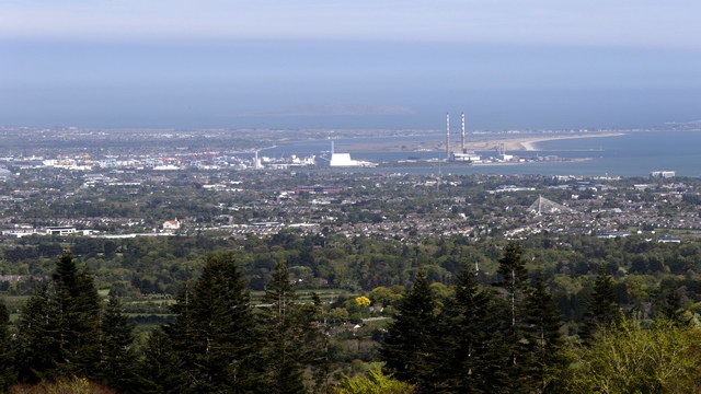
Looking back at Dublin as we start the drive through the Wicklow mountains.
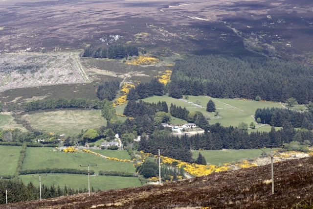
Some of the beautiful countryside.
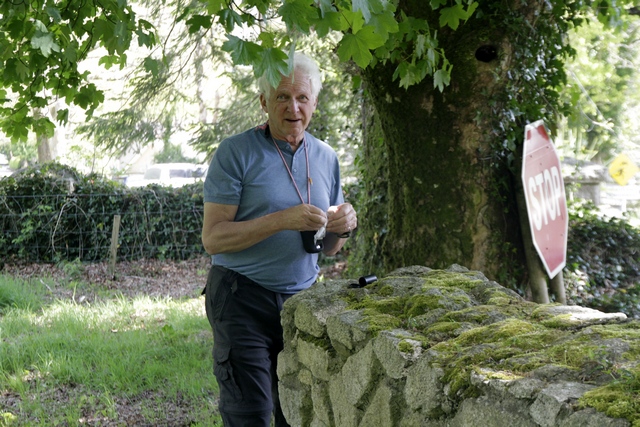
Ed’s first geocache in Ireland. You didn’t think he’d wait long to find one did you?
Glendalough, the valley of two lakes, is renowned for its early medieval monastic settlement founded by St. Kevin in the 6th century. A boy named Kevin (later to become St. Kevin) came to this area and is said to have “lived in the hollow of a tree”. There are many stories of animals and birds befriending him. Eventually he left his solitude and returned with other monks to form a monastic community. Kevin died in approximately 618AD.
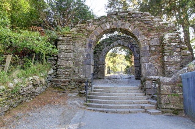
The gateway to the monastic city of Glendalough.
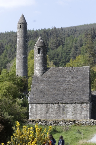
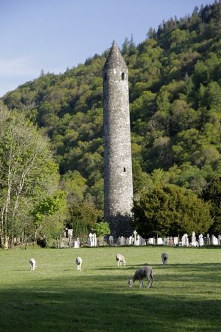
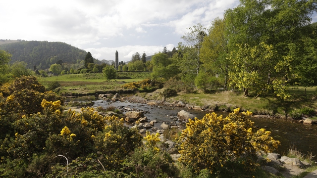
St. Kevin’s Church and the Round Tower. The roof of the round tower was rebuilt in 1876 using original stones.
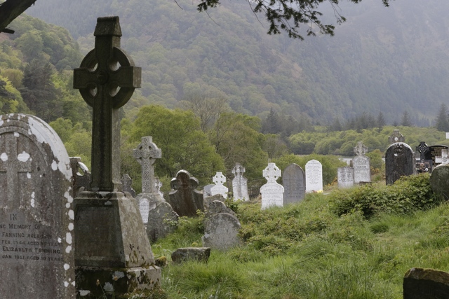
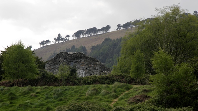
A couple photos of the monastic city.
The upper lake.
Riversdale B&B; where we spent the night.
Our flight from Toronto was uneventful … just the way I like it. We left Toronto about 11:20pm. I knew we would get food on the flight but I didn’t expect to get dinner at midnight.
Our first stop is the small town of Glendalough in the Wicklow mountains about 70 km from Dublin airport. Ed did a good job of getting us there --- first it was the M50 to get around Dublin then I got him off the highway onto a road that drove us through the Wicklow mountains. This was an interesting road, barely wide enough for 2 cars ---- oh then there were the sections that were barely wide enough for one car. And he did this while sleep deprived , driving on the wrong side of the road with a manual transmission. Think he’s ready to handle the roads for the rest of the trip.
Looking back at Dublin as we start the drive through the Wicklow mountains.
Some of the beautiful countryside.
Ed’s first geocache in Ireland. You didn’t think he’d wait long to find one did you?
Glendalough, the valley of two lakes, is renowned for its early medieval monastic settlement founded by St. Kevin in the 6th century. A boy named Kevin (later to become St. Kevin) came to this area and is said to have “lived in the hollow of a tree”. There are many stories of animals and birds befriending him. Eventually he left his solitude and returned with other monks to form a monastic community. Kevin died in approximately 618AD.

The gateway to the monastic city of Glendalough.
St. Kevin’s Church and the Round Tower. The roof of the round tower was rebuilt in 1876 using original stones.
A couple photos of the monastic city.

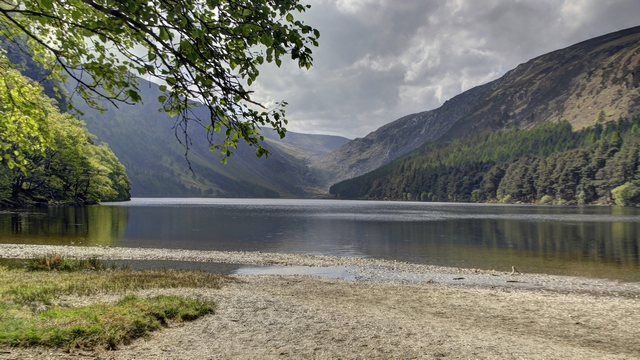
The upper lake.
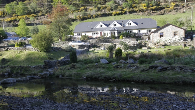
Riversdale B&B; where we spent the night.
2017/05/08: Count Down
Category: General
Posted by: The Agnew Family
We're almost ready to leave for Ireland. One thing that needs to be done
is to test the "travel computer". It's a smaller computer so it's
easier to travel with. The only draw back is the lack of speed, but I'll
be on vacation so do I really need speed?
2017/05/01: Spring has Sprung
Category: General
Posted by: The Agnew Family
It's been a long time since I have updated my blog. I'd like to be able
to say that I've been really busy but that is not the case. Ed and I
returned safe and sound from our trip to Florida and started to work on
enjoying winter in Ontario. It didn't take long and I had the dreaded
"winter cold". Just I as was starting to feel better, Ed decided it was
his turn to have the dreaded "winter cold". Before I had a chance to
fully recover the cold came back with a vengeance. Ed also got to
experience a re-occurrence. After close to two months fighting colds, I
think both of us are healthy again. And it's none too soon as we're
leaving for Ireland in eight days! I'm hoping to update the blog daily
during the trip ... all of the B&B;'s we've booked say they have
good internet.
