2016/09/29: Off to Market
Category: General
Posted by: The Agnew Family
St. Jacobs has a wonderful farmers market. It's an hours drive so I
don't get there very but I do make a point of going in the fall to buy
some fruit and vegetables for the freezer. I go a little wild at the
market as I want to buy all the different vegetables I see. Luckily
Ellen was with me so went halves on a number of items, that and filling
the car and running out of monetary funds controlled the number of
purchases I made. We did manage to buy eggplants, zucchini, red and
green peppers, apples for apple sauce, apples for pie, carrots,
cucumbers, cauliflower, broccoli, tomatoes, apple fritters (Ed requested
those), fish, schnitzel etc.
When we stopped for lunch we shared a picnic table with a couple from Ottawa who were in town picking up their son's "working" dog. Their son has Autism and the dog has been trained to help him. It's amazing the number of ways dogs can help people.
After we bought everything on our list at the market we headed over the outlet mall. I may have run out of cash but my credit cards still worked.
It was a lot of fun buying everything but now the work begins ---- the cooking and freezing. In the middle of winter I'll be happy to open my freezer and find all the wonder foods I bought and prepared today and over the next few days.
2016/09/28: Happy Birthday Mom!
Category: General
Posted by: The Agnew Family
Today is my mother's 93rd birthday and we are meeting my mother,
brother, cousin and cousin's husband for lunch in New Dundee (just west
of Kitchener, about an hour and a half drive).
Our route took us past Harriston and the site of the IPM that was in the process of being dismantled.
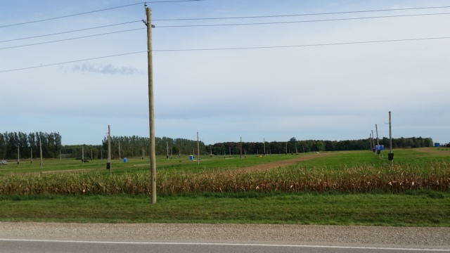
This was the campground.
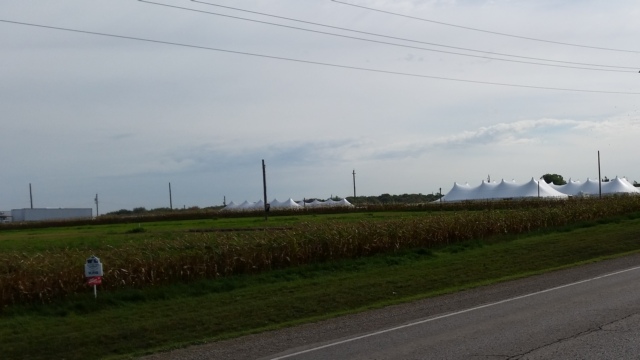
The photo was taken a fair distance away but this was the exhibition area. Not only was it a lot of work to put up but it also took a about a week to dismantling.
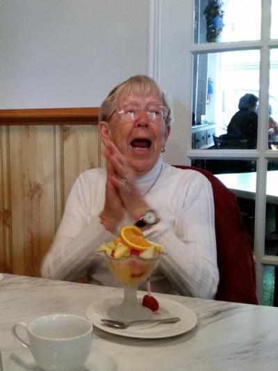
What do you do with the candle when the birthday girl orders a fruit cup? Cut a strawberry in half and stick the candle in it. I think my mother had a great time.
Our route took us past Harriston and the site of the IPM that was in the process of being dismantled.

This was the campground.

The photo was taken a fair distance away but this was the exhibition area. Not only was it a lot of work to put up but it also took a about a week to dismantling.

What do you do with the candle when the birthday girl orders a fruit cup? Cut a strawberry in half and stick the candle in it. I think my mother had a great time.
2016/09/24: Doors Open
Category: General
Posted by: The Agnew Family
The first Doors Open Day took place in France in 1984. The idea soon
spread to a number of countries and in 2000 the City of Toronto launched
the first Doors Open Event in North America. I'm not sure when Doors
Open started in Walkerton but we've attended the event at least three
times (it runs bi-annually in Walkerton).
This year we visited a property that use to be a dairy farm but now is a Bed and Breakfast and a Sugar Bush.
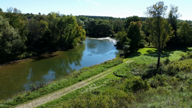
They also have a great view of the Saugeen River.
On the tour were several private homes that were built in the 1880's or 1890's that have been restored, the old Walkerton Armoury, the Baptist Church and the private gardens at a garden center. As usual it was really interesting to tour the different sites.
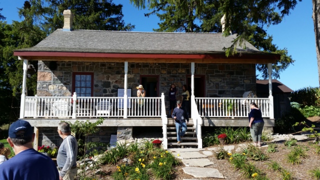
The Flasch Family Homestead was also on the tour. This three-level stone dwelling was built by John Flach in 1864. In 1996, his great-granddaughter took ownership of this mixed-farming property. The house has been restored over the past two years.
This year we visited a property that use to be a dairy farm but now is a Bed and Breakfast and a Sugar Bush.

They also have a great view of the Saugeen River.
On the tour were several private homes that were built in the 1880's or 1890's that have been restored, the old Walkerton Armoury, the Baptist Church and the private gardens at a garden center. As usual it was really interesting to tour the different sites.

The Flasch Family Homestead was also on the tour. This three-level stone dwelling was built by John Flach in 1864. In 1996, his great-granddaughter took ownership of this mixed-farming property. The house has been restored over the past two years.
2016/09/23: International Plowing Match
Category: General
Posted by: The Agnew Family
I'm not sure why the International Plowing Match (IPM) has
"international" in it's name as it is held in Ontario each year.
Apparently Europe has Plowing Competitions but at least to the casual
observer they don't seem to be related to our plowing matches. For some
reason Ed and Victor like to go the the IPM when it's held in south
western Ontario --- I think it has something to do with tractors. This
year the IPM was held just south of Harriston, a mere half hour from
Walkerton so Anne, Victor, Ed and I went to check it out.
For a minute I will digress and tell you what is involved in setting up the IPM from the view of someone driving past the site occasionally. About 6 to 8 weeks before the IPM electrical poles start appearing in fields. Some of the poles are in the "campground" providing electricity to the approximately 1000 camp sites and the remainder are in the main site for the exhibitors. About 4 weeks before the IPM wire is on the poles and tents begin to appear. Just over 2 weeks before the IPM (we were leaving for New Brunswick) more tents were set up and large rocks, trees and plants were appearing in gardens.
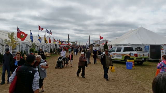
There were a number of exhibits
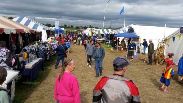
and lots of vendors.
This year the Mounted Police Musical Ride performed, there was jousting, a horse show, plowing competitions and much more. Unfortunately our timing was bad and we missed most of the performances. Every time we go to the IPM I say "next time I want to watch the plowing" .... maybe next near I'll get to see the plowing.
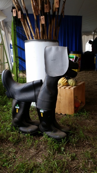
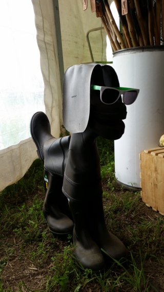
Something you can make if you ever have a bunch of old boots.
For a minute I will digress and tell you what is involved in setting up the IPM from the view of someone driving past the site occasionally. About 6 to 8 weeks before the IPM electrical poles start appearing in fields. Some of the poles are in the "campground" providing electricity to the approximately 1000 camp sites and the remainder are in the main site for the exhibitors. About 4 weeks before the IPM wire is on the poles and tents begin to appear. Just over 2 weeks before the IPM (we were leaving for New Brunswick) more tents were set up and large rocks, trees and plants were appearing in gardens.

There were a number of exhibits

and lots of vendors.
This year the Mounted Police Musical Ride performed, there was jousting, a horse show, plowing competitions and much more. Unfortunately our timing was bad and we missed most of the performances. Every time we go to the IPM I say "next time I want to watch the plowing" .... maybe next near I'll get to see the plowing.


Something you can make if you ever have a bunch of old boots.
2016/09/20: Home
Category: General
Posted by: The Agnew Family
Today included a drive across the top end of Toronto. This is the part
of the drive east that Ed hates the most. Today we were pleasantly
surprised, we made it across the city to the 410 where we exit to start
heading north without any slowdowns. Getting onto the 410 was slow but I
think construction was to blame.
About a half hour away from home I got a phone call reminding me of an appointment in 2 days time that I didn't know I had. The letter telling me about the appointment arrived after we had left on vacation and not expecting anything important in the mail I didn't ask anyone to open mail for me. Learned my lesson about that. Now to reorganize my plans for the rest of the week.
About a half hour away from home I got a phone call reminding me of an appointment in 2 days time that I didn't know I had. The letter telling me about the appointment arrived after we had left on vacation and not expecting anything important in the mail I didn't ask anyone to open mail for me. Learned my lesson about that. Now to reorganize my plans for the rest of the week.
2016/09/19: Visting Friends
Category: General
Posted by: The Agnew Family
As our friends Deb and Luc live just off the 401 a reasonable days drive
from home we stopped to have another visit and spend the night. The
drive from Quebec City was uneventful. Ed did comment at one point the
Quebec drivers were courteous at least one at the cloverleaf where
Autoroute 20 and Autoroute 30 meet. The car who was about to merge onto
the highway gave us lots of room to get off the highway before he tried
to get on the highway. Ed really appreciated that.
2016/09/18: Quebec City
Category: General
Posted by: The Agnew Family
The drive from Kouchibouguac National Park to home could be done in
three long days of driving, but when we factored in timing for driving
through Toronto, stopping and visiting our friends in Johnstown and the
amount of time Ed wanted to drive in a day it made sense to add a fourth
day. The fourth day could be a short day of driving with time to do a
little sight seeing. Quebec City seemed like a logical place to stop ---
lots to see, we haven't been here in more than 30 years and there's a
campground just outside of Levis (on the river across from Quebec City)
that we like.
It was a beautiful day so we walked around the old walled city and here are a few photos.
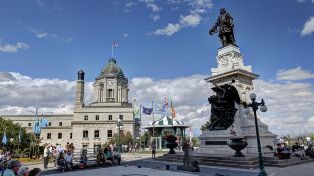
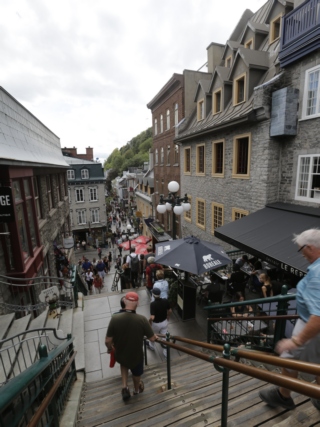
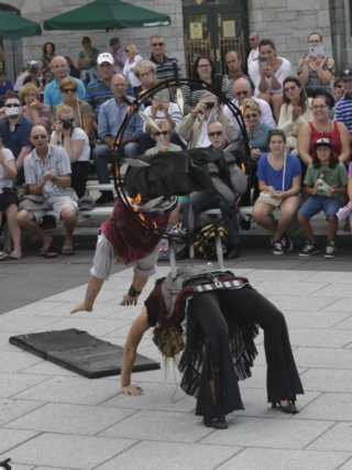
We stopped for a few minutes and watch some street performers. The finale of the show was the fellow diving through a hoop that had knives attached to it and it was on fire.
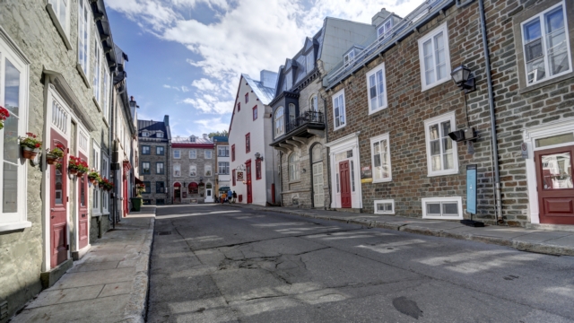
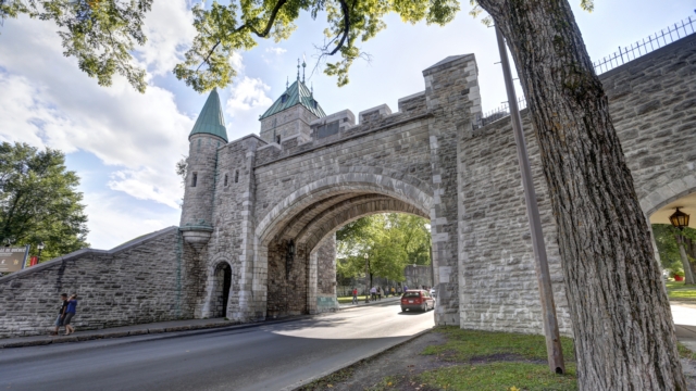
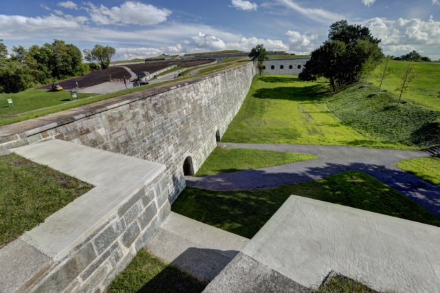
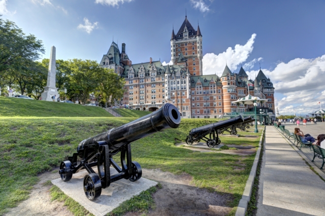
Chateau Frontenac
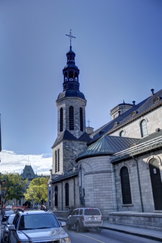
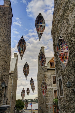
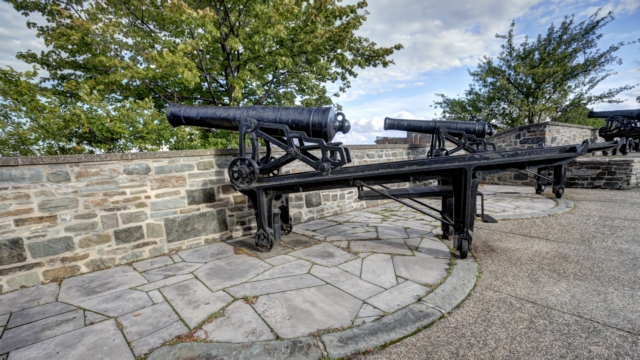
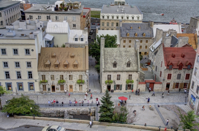
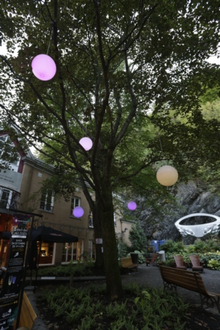
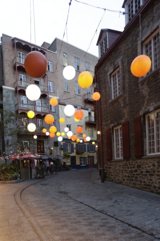
As night fell so did the rain. It was our cue to return to the campground.
It was a beautiful day so we walked around the old walled city and here are a few photos.

We stopped for a few minutes and watch some street performers. The finale of the show was the fellow diving through a hoop that had knives attached to it and it was on fire.


Chateau Frontenac


As night fell so did the rain. It was our cue to return to the campground.
2016/09/17: Timed That Right
Category: General
Posted by: The Agnew Family
Today we start the trip home. We left Kouchibouguac National Park and
drove north thru Bathurst and Campbellton, crossing the Quebec border
and ending up in Rivičre-du-Loup. The first part of the drive was thru a
hilly area with lots of trees then we followed several rivers and a
lake finally driving south along the St. Lawrence River.
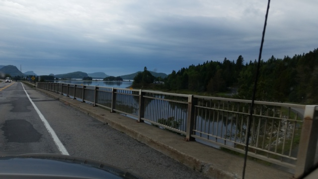
There were some pretty views but they are hard to catch using your cell phone while the vehicle is moving.
After about six hours of driving we arrived at the town campground in Rivičre-du-Loup. The campground is a block away from the St. Lawrence and there is a pedestrian loop trail that takes you to a point of land where a ferry crosses the river.
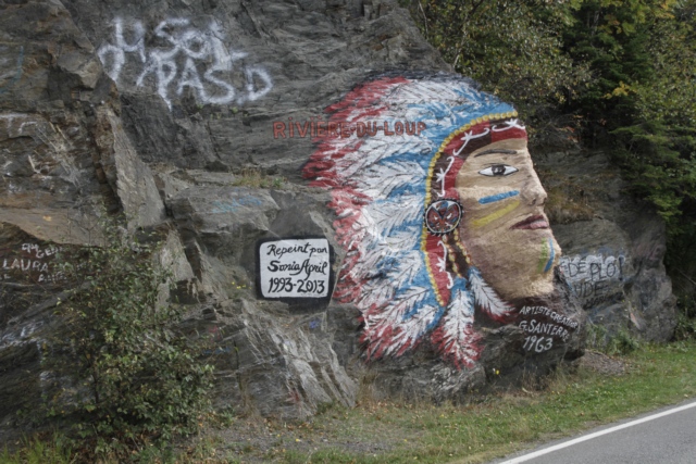
This painting of an Indian Head was done in 1963. On the occasion of it's 50th anniversary, the painting was restored by well-known area artist Sonia April.
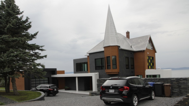
There are a number of interesting homes along the road. We found this one particularly interesting.
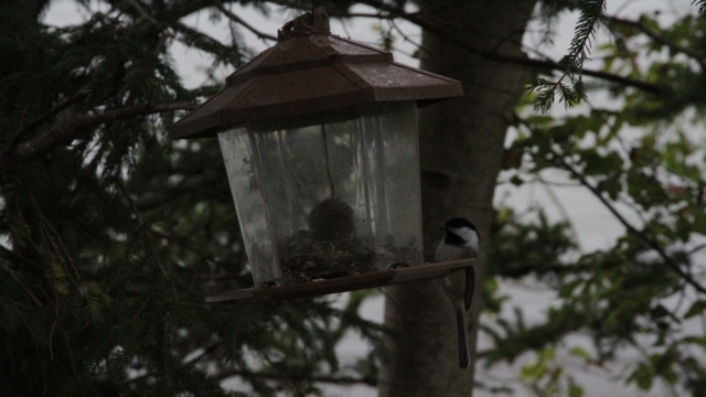
Birder feeders are placed along the trail, making the chickadees very friendly. We were about four feet from the bird feeder when Ed shot the photo.
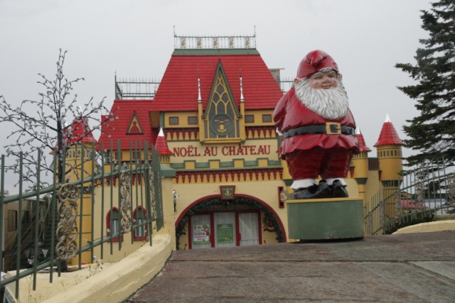
Santa was out welcoming people to his house.
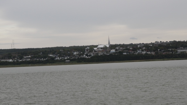
The afternoon was overcast so we didn't have much of a view. Looking across the water at Rivičre-du-Loup.
During our walk it was spitting a little. As we arrived at the trailer it started to rain much harder and continued thru the evening. Timed returning from the walk perfectly.

There were some pretty views but they are hard to catch using your cell phone while the vehicle is moving.
After about six hours of driving we arrived at the town campground in Rivičre-du-Loup. The campground is a block away from the St. Lawrence and there is a pedestrian loop trail that takes you to a point of land where a ferry crosses the river.
This painting of an Indian Head was done in 1963. On the occasion of it's 50th anniversary, the painting was restored by well-known area artist Sonia April.
There are a number of interesting homes along the road. We found this one particularly interesting.
Birder feeders are placed along the trail, making the chickadees very friendly. We were about four feet from the bird feeder when Ed shot the photo.
Santa was out welcoming people to his house.
The afternoon was overcast so we didn't have much of a view. Looking across the water at Rivičre-du-Loup.
During our walk it was spitting a little. As we arrived at the trailer it started to rain much harder and continued thru the evening. Timed returning from the walk perfectly.
2016/09/16: A Day Without Driving ---- Ed Rejoices
Category: General
Posted by: The Agnew Family
After some careful consideration, Ed and I decided that we were due for a
day without driving so we decided to hang out in Kouchibouguac NP
today. There are some geocaches hidden in the park and yesterday during
our ride we found a number of them. Four were left unfound, so today’s
mission was to find the remaining four caches. Since we had decided to
not drive today we hopped on our bicycles and headed for the furthest
cache. My guesstimate of the distance to the cache was 7.5 km but it
was actually 11.3 km. (I guess I’m not a good guesser when it comes to
distances or I'm not very good at reading park maps).
The first cache was at the “two bridges” --- a pedestrian bridge goes beneath the road bridge.
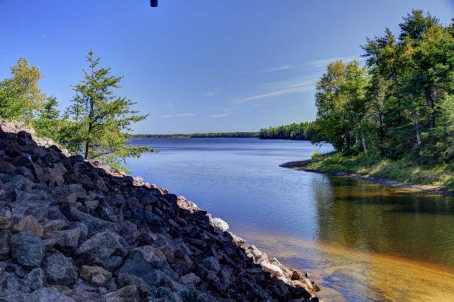
The view from the pedestrian bridge.
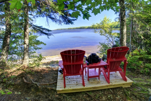
The second cache required some hiking --- a round trip of 3.3 km, but finding the cache (especial since Ed had given up and I found it) and the view made the hike worthwhile. It was a nice spot to enjoy lunch.
While we were riding on the bike trail we noticed a fair bit of bear scat but didn’t think too much about it as moving bike tires on pea gravel is fairly noisy and noise scares animals off. Boy was I surprised and excited when I saw a black bear crossing the path about 50 meters ahead of us --- Ed wasn’t looking ahead during the 2 seconds the bear was on the trail and missed the whole thing.
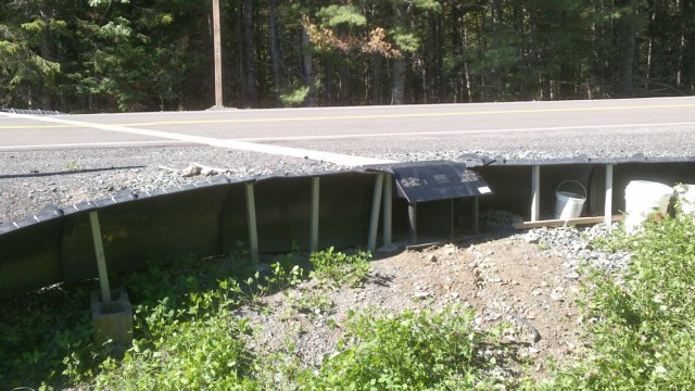
Kouchibouguac NP is making some changes to highway 17 where it passes thru the park in an effort to make conservation gains. One of the changes is to build tunnels under the highway so species such as turtles, salamanders and frogs can cross the highway safely from the water to the woods and back. Fifty centimeter high fences are also being installed to funnel or guide the animals that need to cross the road to the tunnel. The white strip going across the road is the tunnel (it looks like it allows water and light in), the flap is where the tunnel is, on either side of the tunnel are the funnels. It’ll be interesting to check back in a couple of years to see it this project was successful.
The third cache was also a hike to a view, probably a 2 km round trip. The view was nice but nothing special. The fourth and last cache was found down a trail into the bog, another 2 km hike. A viewing tower was built on the edge of the peat bog resulting in a 360 degree view of the forest and the bog.
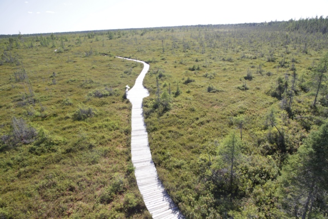
Looking out over the bog from the top of the tower.
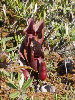
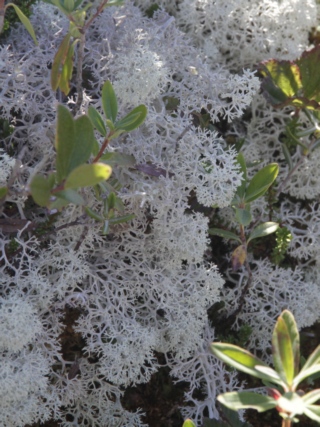
The bog is home to some interesting plants. The pitcher plant eats insects. I think the white plant is a lichen (photos on the internet that look like this plant are referred to as Reindeer Lichen or Reindeer Moss).
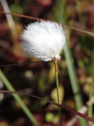
Cotton grass grows in acid bogs around the world. The head feels like fur, at least to me.
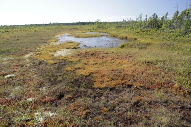
Another view of the bog.
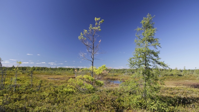
Trees have a difficult time growing in peat bogs. Some of the small trees in this bog are over a 100 years old, older than many of the larger trees in woods at the edge of the bog.
The GPS indicated that we traveled a total distance of 33 km today. We road about 23 km so we hiked the other 10km. Tomorrow we begin our trek home so we’ll get to rest our achy bodies --- don’t know about Ed but my muscles are telling me I hiked and rode wearing a back pack.
The first cache was at the “two bridges” --- a pedestrian bridge goes beneath the road bridge.

The view from the pedestrian bridge.

The second cache required some hiking --- a round trip of 3.3 km, but finding the cache (especial since Ed had given up and I found it) and the view made the hike worthwhile. It was a nice spot to enjoy lunch.
While we were riding on the bike trail we noticed a fair bit of bear scat but didn’t think too much about it as moving bike tires on pea gravel is fairly noisy and noise scares animals off. Boy was I surprised and excited when I saw a black bear crossing the path about 50 meters ahead of us --- Ed wasn’t looking ahead during the 2 seconds the bear was on the trail and missed the whole thing.

Kouchibouguac NP is making some changes to highway 17 where it passes thru the park in an effort to make conservation gains. One of the changes is to build tunnels under the highway so species such as turtles, salamanders and frogs can cross the highway safely from the water to the woods and back. Fifty centimeter high fences are also being installed to funnel or guide the animals that need to cross the road to the tunnel. The white strip going across the road is the tunnel (it looks like it allows water and light in), the flap is where the tunnel is, on either side of the tunnel are the funnels. It’ll be interesting to check back in a couple of years to see it this project was successful.
The third cache was also a hike to a view, probably a 2 km round trip. The view was nice but nothing special. The fourth and last cache was found down a trail into the bog, another 2 km hike. A viewing tower was built on the edge of the peat bog resulting in a 360 degree view of the forest and the bog.
Looking out over the bog from the top of the tower.
The bog is home to some interesting plants. The pitcher plant eats insects. I think the white plant is a lichen (photos on the internet that look like this plant are referred to as Reindeer Lichen or Reindeer Moss).
Cotton grass grows in acid bogs around the world. The head feels like fur, at least to me.
Another view of the bog.
Trees have a difficult time growing in peat bogs. Some of the small trees in this bog are over a 100 years old, older than many of the larger trees in woods at the edge of the bog.
The GPS indicated that we traveled a total distance of 33 km today. We road about 23 km so we hiked the other 10km. Tomorrow we begin our trek home so we’ll get to rest our achy bodies --- don’t know about Ed but my muscles are telling me I hiked and rode wearing a back pack.
2016/09/16: Kouchibouguac --- Say That Fast or Even at All
Category: General
Posted by: The Agnew Family
Kouchibouguac (not an easy word to say) National Park is about an hour
north of Shediac on the Gulf of St. Lawrence. Kouchibouguac is a Mi'kmaq
word that means "rivers of long tides". Established in 1969, the Park
protects square 238km of marshes, forests, bogs, coastal dunes,
estuaries and rivers. To the park visitors this is a playground of
beaches and bike trails.
Not that Ed and I have visited a lot of national parks in past few years but this one has features we're not accustomed in public parks. The campground is large with big sites (pretty normal) and some of the sites have three services ---- water, electric and sewer (unusual). Unfortunately, cell phone coverage is not very good to non-existent but wi-fi is actually pretty good (at least when the park isn't too busy). We were told they have "broadband service" so not blindingly fast but not too bad either.
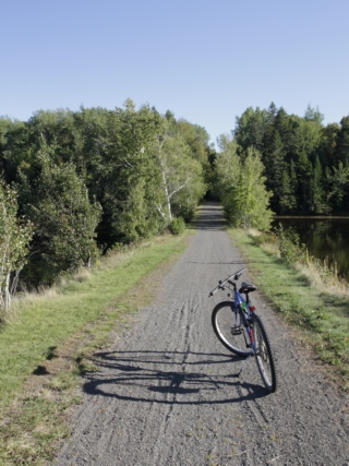
There are 60 km of bike trails in the park, so Ed unloaded the bikes from the trailer for the first time this trip and we set off to explore the park.
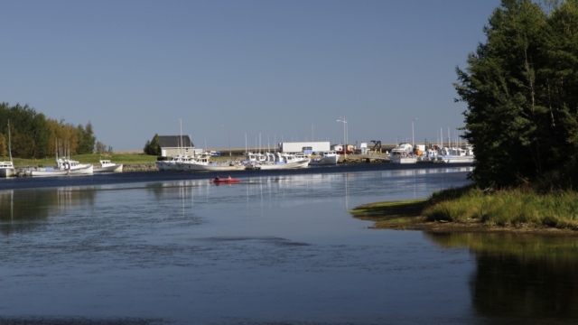
Across the river from the main campground and still in the park is an active fishing port.
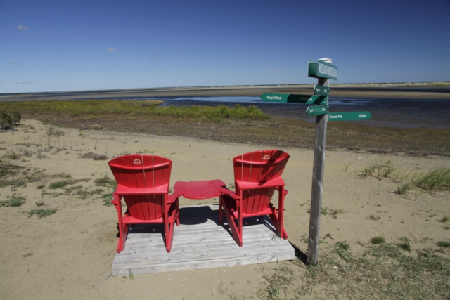
The parks services people do find great spots to put the red chairs. This park also put up sign posts by the chairs indicating distances to other national parks.
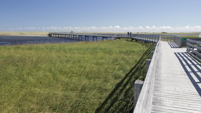
There is a huge coastal dune that is linked to the mainland by a 1.2 km boardwalk.
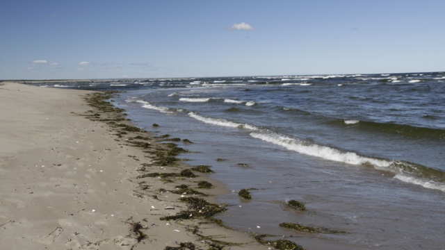
There is a long beach on the dune for park visitors to enjoy.
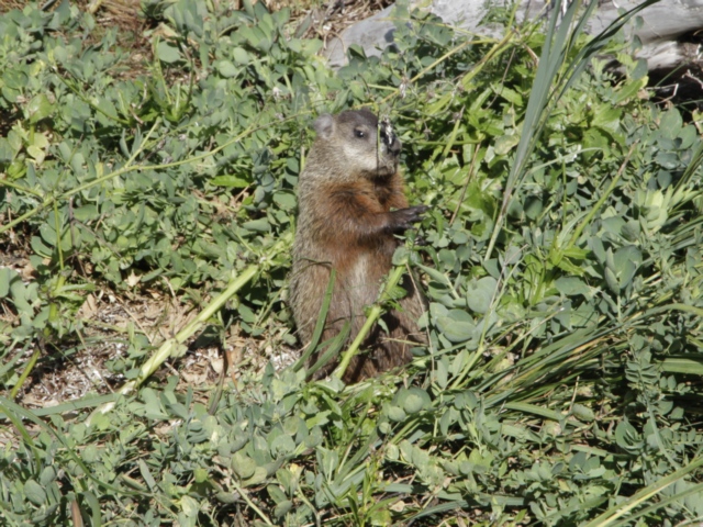
We think this little guy is a member of the woodchuck family.
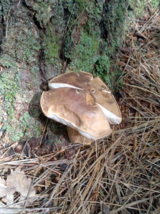
My "art shot". A cute mushroom.
It is was really nice to ride around the park. The trails are mostly flat though there were several unexpected downhills followed by uphills, very wide and covered in pea gravel. Using the distances indicated on the park map I think Ed and I road just over 30 kilometers. On top of that we did a some walking. No wonder I was tired when we returned to the trailer.
Not that Ed and I have visited a lot of national parks in past few years but this one has features we're not accustomed in public parks. The campground is large with big sites (pretty normal) and some of the sites have three services ---- water, electric and sewer (unusual). Unfortunately, cell phone coverage is not very good to non-existent but wi-fi is actually pretty good (at least when the park isn't too busy). We were told they have "broadband service" so not blindingly fast but not too bad either.
There are 60 km of bike trails in the park, so Ed unloaded the bikes from the trailer for the first time this trip and we set off to explore the park.
Across the river from the main campground and still in the park is an active fishing port.
The parks services people do find great spots to put the red chairs. This park also put up sign posts by the chairs indicating distances to other national parks.
There is a huge coastal dune that is linked to the mainland by a 1.2 km boardwalk.
There is a long beach on the dune for park visitors to enjoy.
We think this little guy is a member of the woodchuck family.

My "art shot". A cute mushroom.
It is was really nice to ride around the park. The trails are mostly flat though there were several unexpected downhills followed by uphills, very wide and covered in pea gravel. Using the distances indicated on the park map I think Ed and I road just over 30 kilometers. On top of that we did a some walking. No wonder I was tired when we returned to the trailer.
2016/09/14: A Little Side Trip
Category: General
Posted by: The Agnew Family
Two years ago Ed, Zaph and I drove thru Nova Scotia on our way to
Newfoundland and we drove thru Nova Scotia on our way home. Would you
believe Ed forgot to look for geocaches in Nova Scotia? I know, it's
hard to believe but he did so top priority for today is to drive to Nova
Scotia and find three geocaches. This was actually pretty easy as there
were two at the Information Center and another one a couple of
kilometers down the road.
First stop of day was Fort Beausejour - Fort Cumberland National Historic Site in New Brunswick. The buildings were closed but you could walk around the site.
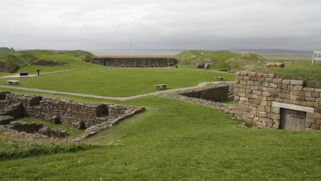
It is a beautiful spot. The fort was built by the French but taken over by the British thus the two names.
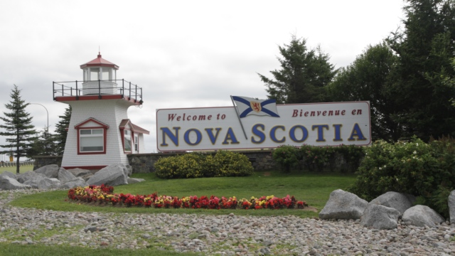
Proof we made it to Nova Scotia. This is one of the nicest and prettiest information centers we have ever stopped at.
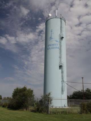
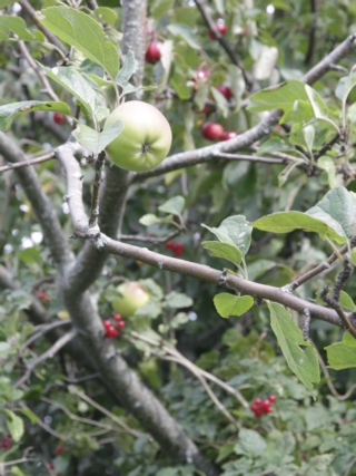
On our drive back to Shediac we followed the coast. Port Elgin is a cute coastal village, much smaller than the Port Elgin near home. A park along the water is the home to this interesting tree --- there were apples, cherries and another berry.
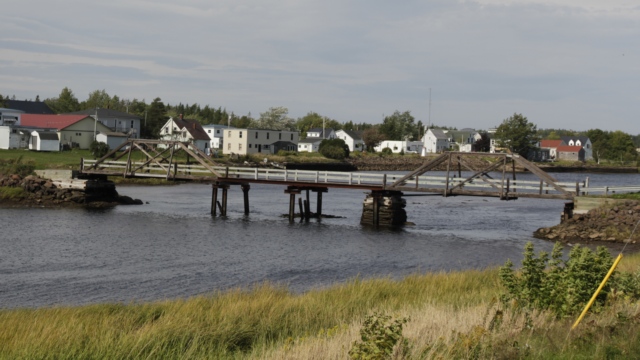
This pedestrian bridge looked a little rickety but I think it was a converted railway bridge so it should be pretty solid. On the drive we saw a number of villages and lots of cute houses and a lot of trailer parks.
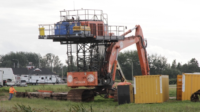
If you live near the ocean this site probably isn't new to you but it's a first for Ed and I. A backhoe with an elevated cab. Makes sense if you're working where there's a tide.
The Confederation Bridge joins Prince Edward Island and New Brunswick. The curved, 12.9 kilometer (8 mile) long bridge is the longest in the world crossing ice-covered water, and more than a decade after its construction, it endures as one of Canada’s top engineering achievements of the 20th century. After four years of construction using crews of more than five thousand local workers, the Confederation Bridge opened to traffic on May 31, 1997, at a total construction cost of one billion dollars. ( borrowed from their website and modified)
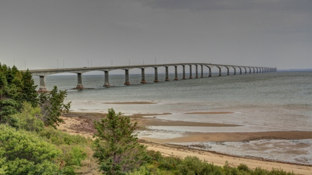
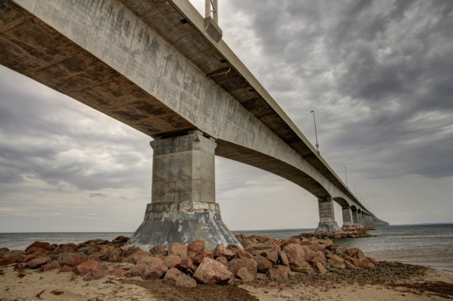
A shot from the beach. There is a nature reserve at the foot of the New Brunswick side of the bridge.
I was a little surprised that Ed didn't want to do a short excursion to PEI but he didn't think a couple of geocaches were worth the $26 toll for driving across the bridge.
As it seems with a lot of our days we run out of time. It was supper time and the rain that had been threatening all afternoon arrived when we finally reached the small town of Cap-Pele. The village is known as the smoked herring capital of Canada with over 95% of the smoked herring in Canada being produced here. I know this isn't important to most people but I LOVE smoke herring (actually all smoked fishes). We tried to buy some but they were sold out. The village's sandy beaches are among the most beautiful in Eastern Canada and the water is the warmest from North of Carolina.
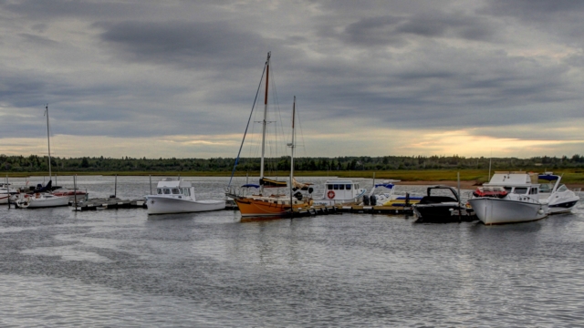
The village is home to a large fishing fleet. Driving thru town we passed a number of fish and lobster processing plants and smoke houses (you could tell by the crates full of wood).
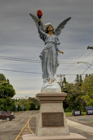
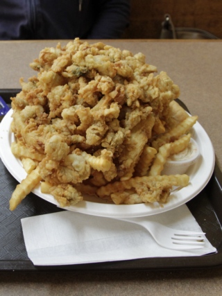
Angel of Cap-Pele was built in 1935 and the local priest obtained a permit from the highway engineer authorizing him to place the monument in it's current location. The angel protects the farmers and fishermen around Cap-Pele. Yesterday Ed and I bought lobsters which we enjoyed for dinner but we still wanted to try clam strips. As it was super time and we were hungry and there was a restaurant that had clam strips we stopped for dinner. Luckily, we saw an order come out from the kitchen so we knew to only order one plate. This is clam strips, three pieces of fish (hiding under the clam strips) and french fries on the bottom. I ate what I could and Ed did his best but left some fries.
First stop of day was Fort Beausejour - Fort Cumberland National Historic Site in New Brunswick. The buildings were closed but you could walk around the site.
It is a beautiful spot. The fort was built by the French but taken over by the British thus the two names.
Proof we made it to Nova Scotia. This is one of the nicest and prettiest information centers we have ever stopped at.
On our drive back to Shediac we followed the coast. Port Elgin is a cute coastal village, much smaller than the Port Elgin near home. A park along the water is the home to this interesting tree --- there were apples, cherries and another berry.
This pedestrian bridge looked a little rickety but I think it was a converted railway bridge so it should be pretty solid. On the drive we saw a number of villages and lots of cute houses and a lot of trailer parks.
If you live near the ocean this site probably isn't new to you but it's a first for Ed and I. A backhoe with an elevated cab. Makes sense if you're working where there's a tide.
The Confederation Bridge joins Prince Edward Island and New Brunswick. The curved, 12.9 kilometer (8 mile) long bridge is the longest in the world crossing ice-covered water, and more than a decade after its construction, it endures as one of Canada’s top engineering achievements of the 20th century. After four years of construction using crews of more than five thousand local workers, the Confederation Bridge opened to traffic on May 31, 1997, at a total construction cost of one billion dollars. ( borrowed from their website and modified)


A shot from the beach. There is a nature reserve at the foot of the New Brunswick side of the bridge.
I was a little surprised that Ed didn't want to do a short excursion to PEI but he didn't think a couple of geocaches were worth the $26 toll for driving across the bridge.
As it seems with a lot of our days we run out of time. It was supper time and the rain that had been threatening all afternoon arrived when we finally reached the small town of Cap-Pele. The village is known as the smoked herring capital of Canada with over 95% of the smoked herring in Canada being produced here. I know this isn't important to most people but I LOVE smoke herring (actually all smoked fishes). We tried to buy some but they were sold out. The village's sandy beaches are among the most beautiful in Eastern Canada and the water is the warmest from North of Carolina.

The village is home to a large fishing fleet. Driving thru town we passed a number of fish and lobster processing plants and smoke houses (you could tell by the crates full of wood).

Angel of Cap-Pele was built in 1935 and the local priest obtained a permit from the highway engineer authorizing him to place the monument in it's current location. The angel protects the farmers and fishermen around Cap-Pele. Yesterday Ed and I bought lobsters which we enjoyed for dinner but we still wanted to try clam strips. As it was super time and we were hungry and there was a restaurant that had clam strips we stopped for dinner. Luckily, we saw an order come out from the kitchen so we knew to only order one plate. This is clam strips, three pieces of fish (hiding under the clam strips) and french fries on the bottom. I ate what I could and Ed did his best but left some fries.
2016/09/14: The Atlantic Ocean
Category: General
Posted by: The Agnew Family
Another beautiful day --- can't believe we've had two in a row. We have
left the Bay of Fundy and are in Shediac on the Atlantic Ocean.
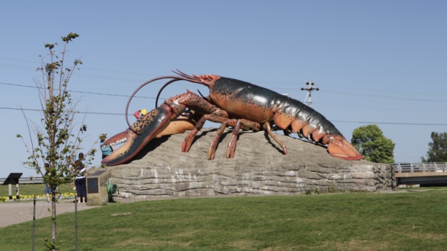
You know you've arrived in Shediac when you see the giant lobster. Shedica is known as the lobster capital of the world, at least that's what they claim.
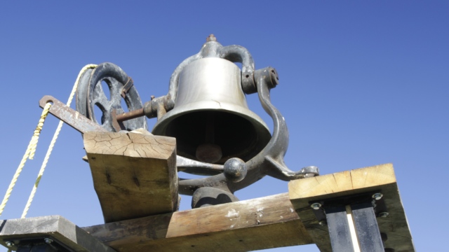
We drove a little ways up the coast and found a pioneer museum. I found the story of the bell to be very interesting. St-Phillipe church's bell originated from Kingston, Ontario in 1909. It was built in the Canadian Locomotive Company's factory for a steam engine. In November 1935 the locomotive was sent to be dismantled. It was very common for small churches to buy bells from locomotives, therefore the bell found itself at St-Phillip's church. When the church was demolished in 2011 the bell was donated to the museum.
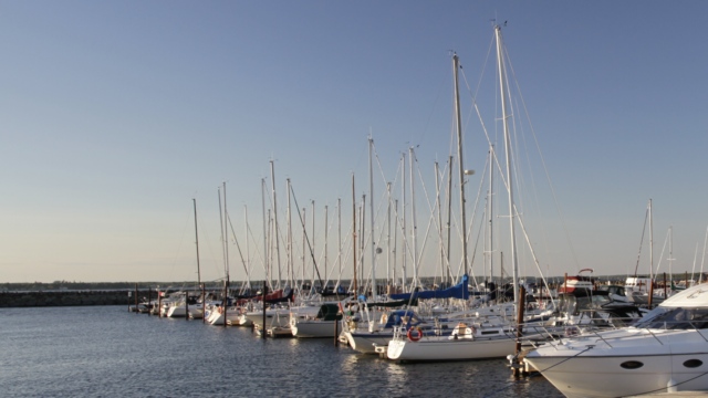
One of the marinas in Shediac.
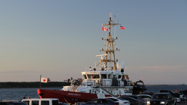
The RCMP / Police Corporal Kaeble VC was in the harbour.
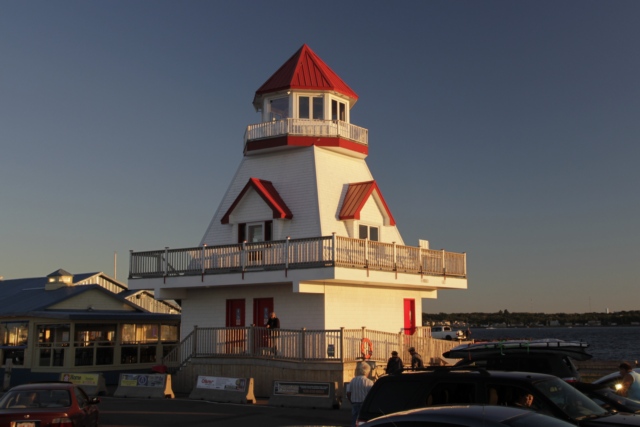
The lighthouse picked up a warm glow from the setting sun.
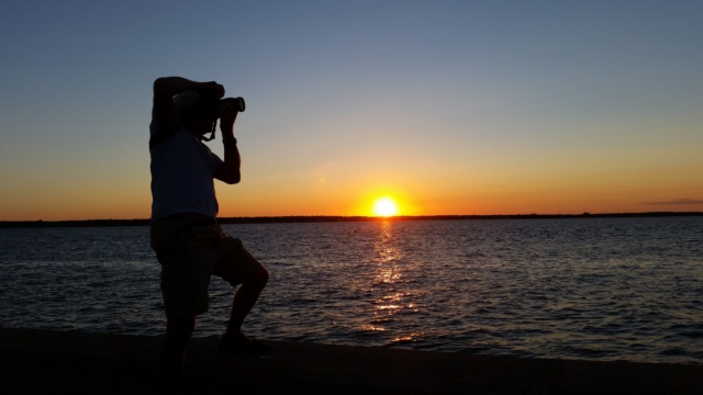
Beautiful sunset.
You know you've arrived in Shediac when you see the giant lobster. Shedica is known as the lobster capital of the world, at least that's what they claim.
We drove a little ways up the coast and found a pioneer museum. I found the story of the bell to be very interesting. St-Phillipe church's bell originated from Kingston, Ontario in 1909. It was built in the Canadian Locomotive Company's factory for a steam engine. In November 1935 the locomotive was sent to be dismantled. It was very common for small churches to buy bells from locomotives, therefore the bell found itself at St-Phillip's church. When the church was demolished in 2011 the bell was donated to the museum.
One of the marinas in Shediac.
The RCMP / Police Corporal Kaeble VC was in the harbour.
The lighthouse picked up a warm glow from the setting sun.

Beautiful sunset.
2016/09/12: That's Some Tide
Category: General
Posted by: The Agnew Family
When Ed and I started planning our trip to New Brunswick we studied the
tide charts for the Hopewell Rocks and planned our trip around the day
that had both a low tide and a high tide during 9am and 5pm (the current
open hours for Hopewell Rocks) or close enough. Today was one of the
days --- hide tide was at 8:52am and low tide was at 15:29. We arrived
at the park just after 9am so we were able to see the rocks just after
high tide.
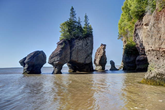
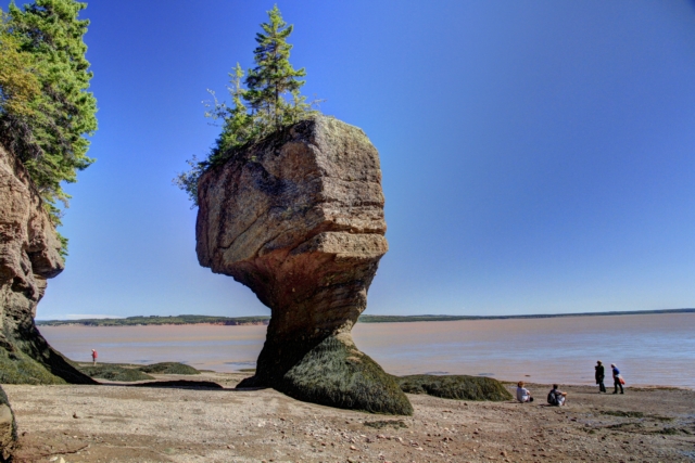
This photo was taken between a half hour and an hour after high tide.
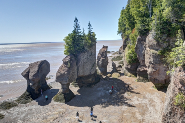
The rocks at about 12 noon, 3 hours after high tide. The beach was starting to be accessible. The water is just on the far side of the rocks.
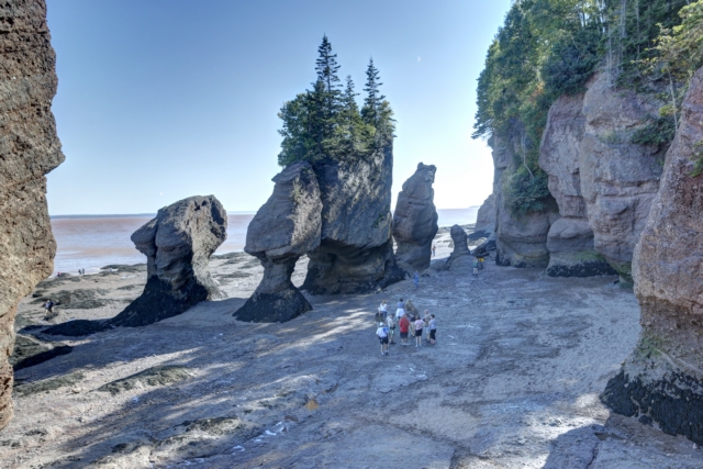
The rocks at low tide. The beach was out at least one hundred yards. While studying the tide charts we also learned that not only the time of the tide changes but also the height of the tide. Today we saw one of the lower high tides (33.8 feet) and higher low tides (11.5 feet). In September high tides can be as high as 41.3 feet and low tides can be as low as 4.3 feet.
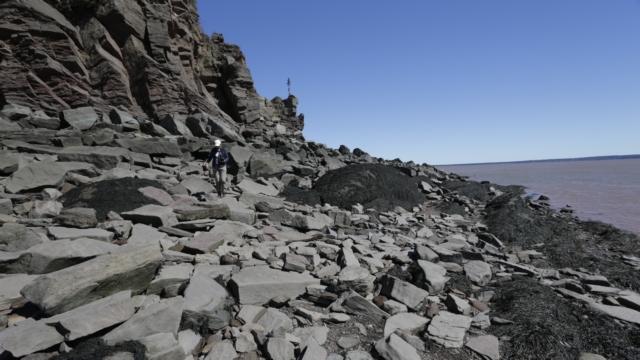
We walked the length of the beach about 2 hours before low tide so we had to scramble over a lot of rocks. It was less than an hour before low tide we when walked back up the beach and we were able to avoid most of the rocks.
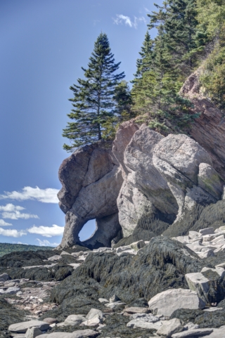
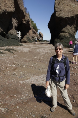
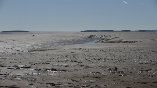
At either end of the rocks were mud flats. The mud flats are home to a tiny shrimp that birds, especially the Arctic-breeding birds I mentioned in the blog two days ago, love to eat.
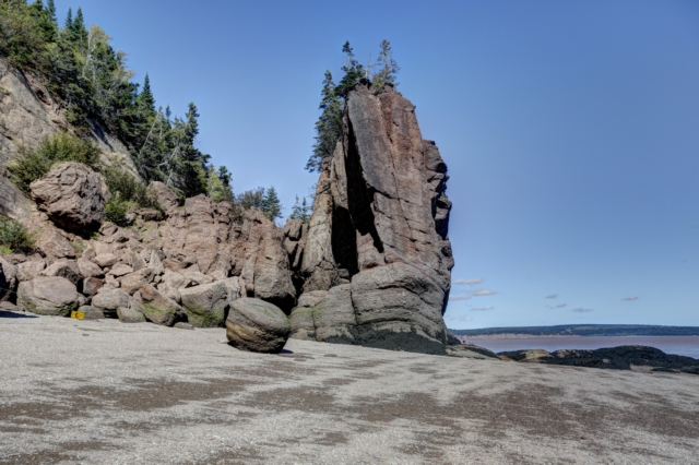
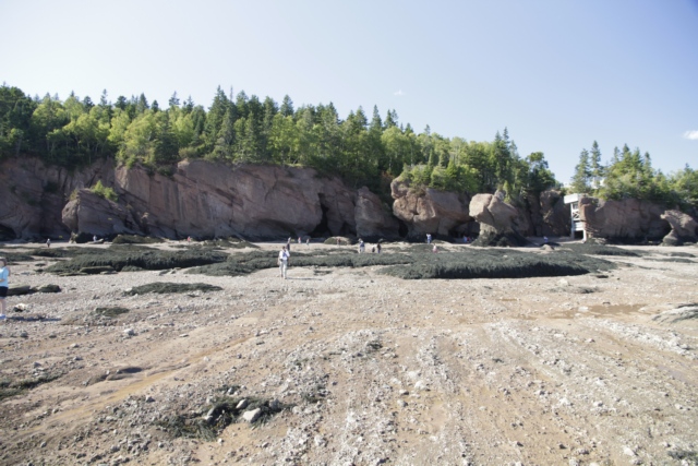
Standing at water's edge looking back at the rocks.
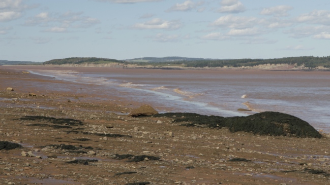
The chocolate waters of the Bay of Fundy. The colour comes from the rocks on the floor of the bay.

This photo was taken between a half hour and an hour after high tide.

The rocks at about 12 noon, 3 hours after high tide. The beach was starting to be accessible. The water is just on the far side of the rocks.

The rocks at low tide. The beach was out at least one hundred yards. While studying the tide charts we also learned that not only the time of the tide changes but also the height of the tide. Today we saw one of the lower high tides (33.8 feet) and higher low tides (11.5 feet). In September high tides can be as high as 41.3 feet and low tides can be as low as 4.3 feet.

We walked the length of the beach about 2 hours before low tide so we had to scramble over a lot of rocks. It was less than an hour before low tide we when walked back up the beach and we were able to avoid most of the rocks.

At either end of the rocks were mud flats. The mud flats are home to a tiny shrimp that birds, especially the Arctic-breeding birds I mentioned in the blog two days ago, love to eat.

Standing at water's edge looking back at the rocks.
The chocolate waters of the Bay of Fundy. The colour comes from the rocks on the floor of the bay.
2016/09/11: Hiking We Will Go ....
Category: General
Posted by: The Agnew Family
This is day 5 with limited internet access and it makes me realize how
dependent we’ve become on the internet. Wondering what the weather
forecast is, just look it up ---- ooops no internet at the trailer.
Want to check the credit card statement ---- ooops no internet at the
trailer. Wondering what’s going on in the world, read about it on the
internet --- ooops no internet at the trailer. Writing my blog is also
more difficult as I can’t just look up information. We’re enjoying being
in this semi-remote area but part of us is looking forward to going
home and having good internet access.
We’re paying for the great weather we had yesterday with a cloudy, bit of fog and chance of rain kind of day. The weather is OK to hike in so we put on the hiking boots, grabbed the back pack and rain jackets and headed out. First stop is the Tracey Lake Trail --- yep it has a geocache on it.
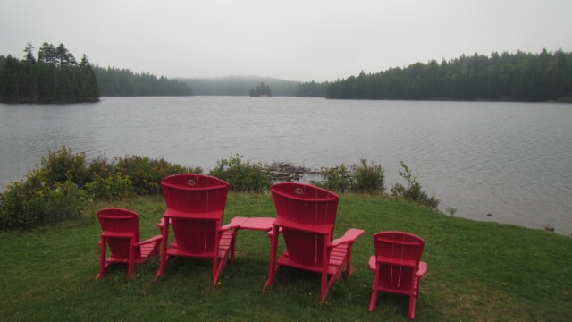
The trail starts at Bennett Lake. I’m really liking the National Park’s red chairs, they’re comfortable to sit on and they add a splash of colour to an otherwise dull photo. The geocache was about 1 ˝ km down the trail, so the resulting hike was about 3 km.
The next geocache was at Laverty Falls, a 2.2 km hike in. The weather was holding so we decided to hike the Moosehorn Trail back making an advertised 7.3 km loop. Ed figured we hiked just under 9 km on this loop trail when we included the diversions of hiking around the various waterfalls.
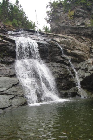
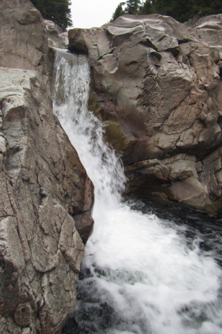
The photo on the left is Laverty Falls. The photo on the right is one of three waterfalls we saw on the Moosehorn Trail.
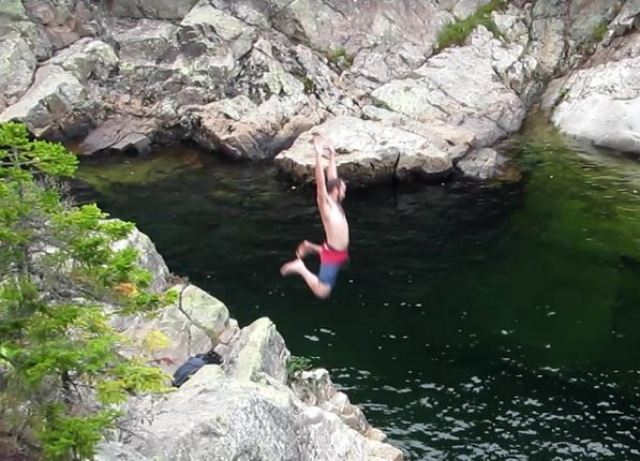
At one of the falls was a deep pool where some young people (early twenties) were jumping off the rocks. Oh, to be young and adventurous again.
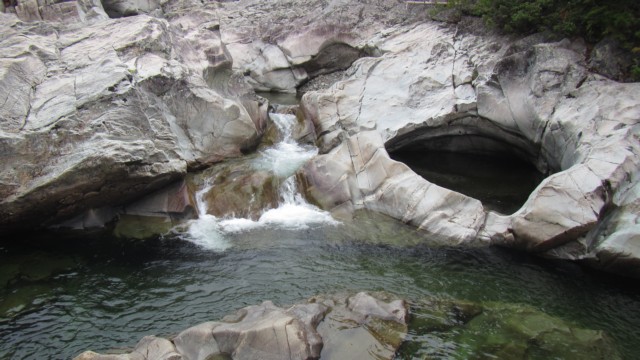
The falls were nice and the rock formations interesting.
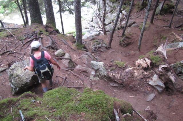
The Moosehorn Trail was a little more difficult than the Laverty Falls Trails. This is one section of the trail. There were several good ups and downs and lots of rocks to clamber over.
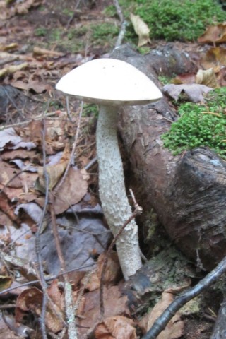
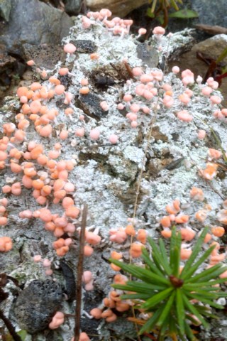
Not a lot of flowers along the trail but some interesting mushrooms and moss.
There was still daylight left and it was only raining a bit so we drove to a road that bordered the park to look for a few more geocaches.
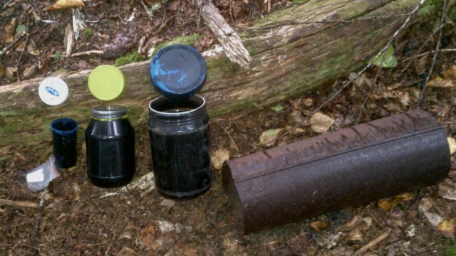
I thought this one was interesting ---- the paper definitely wasn’t going to get wet with all of those containers stacked inside each other.
We’re paying for the great weather we had yesterday with a cloudy, bit of fog and chance of rain kind of day. The weather is OK to hike in so we put on the hiking boots, grabbed the back pack and rain jackets and headed out. First stop is the Tracey Lake Trail --- yep it has a geocache on it.
The trail starts at Bennett Lake. I’m really liking the National Park’s red chairs, they’re comfortable to sit on and they add a splash of colour to an otherwise dull photo. The geocache was about 1 ˝ km down the trail, so the resulting hike was about 3 km.
The next geocache was at Laverty Falls, a 2.2 km hike in. The weather was holding so we decided to hike the Moosehorn Trail back making an advertised 7.3 km loop. Ed figured we hiked just under 9 km on this loop trail when we included the diversions of hiking around the various waterfalls.
The photo on the left is Laverty Falls. The photo on the right is one of three waterfalls we saw on the Moosehorn Trail.

At one of the falls was a deep pool where some young people (early twenties) were jumping off the rocks. Oh, to be young and adventurous again.
The falls were nice and the rock formations interesting.
The Moosehorn Trail was a little more difficult than the Laverty Falls Trails. This is one section of the trail. There were several good ups and downs and lots of rocks to clamber over.

Not a lot of flowers along the trail but some interesting mushrooms and moss.
There was still daylight left and it was only raining a bit so we drove to a road that bordered the park to look for a few more geocaches.

I thought this one was interesting ---- the paper definitely wasn’t going to get wet with all of those containers stacked inside each other.
Category: General
Posted by: The Agnew Family
The sun was shining when we woke this morning and it shined all day. Not
one bit of fog. The weather really co-operated today --- we could look
out over the water and see Nova Scotia and we could look down the coast
and see the peninsula that is the Fundy Trail about 50 kilometers south
west.
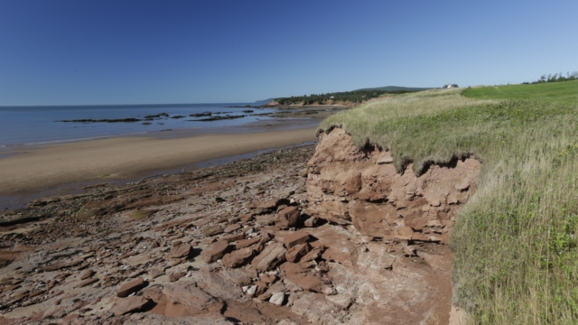
A beach just outside of Alma
Cape Enrage is about 20 kilometers east of Alma along the coast. There is a lighthouse, beach, rappelling, zip line and a restaurant. Sharon, one of the women who is employed at Cape Enrage is a fountain of knowledge about Cape Enrage and the surrounding area. With a name like Cape Enrage one would expect violent water but the water is actually quite calm. I guess there were enough stormy conditions for the French description of the coast to be 'cape of rage'.
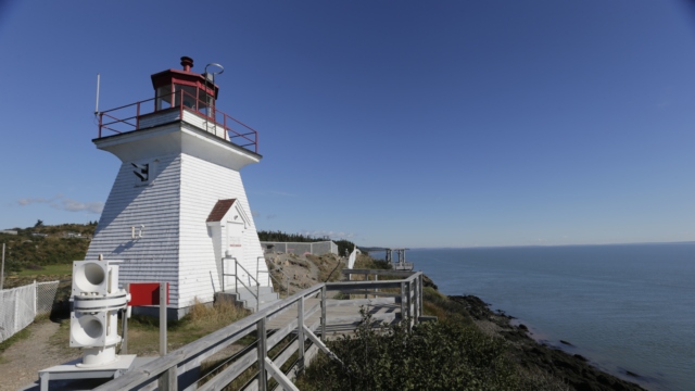
The lighthouse marks Cape Enrage. When the lighthouse was converted to modern equipment (i.e. the lighthouse keeper was no longer required) it quickly fell into disrepair. A number of years later, a teacher, the son of a lighthouse keeper, received permission to repair the lighthouse. He recruited students to help do the repairs enticing them with outdoor activities like repelling from the cliff. This was the start of the Not-for Profit Organization that currently maintains the property
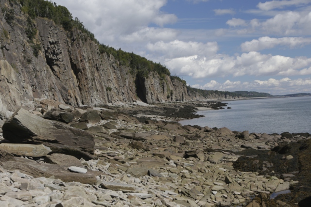
Cape Enrage is on an island called Barn Marsh Island. It's beach is rocky and only accessible for a couple of hours before and after low tide. Fossils that have been strewn from the cliffs can be found on the beach.
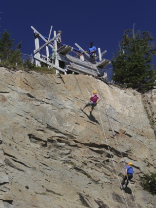
Ed and I watch a couple of women repelling from the cliff. I was tempted to try it but not tempted enough to actually do it.
Using Sharon’s directions Ed and I set off to explore the area.
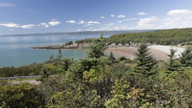
From atop a hill at Cape Enrage we saw beautiful Barn March Beach. We stopped to explore the beach and found one of the geocaches placed Province of New Brunswick here.
Mary’s Point is known as a good birding area. Between mid July and mid August over 300,000 thousand Semipalmated Sandpipers as well as large numbers of other Artic-breeding shorebirds stop here during their migration to South America. There were only a few gulls on the beach but it’s a pretty beach at low tide.
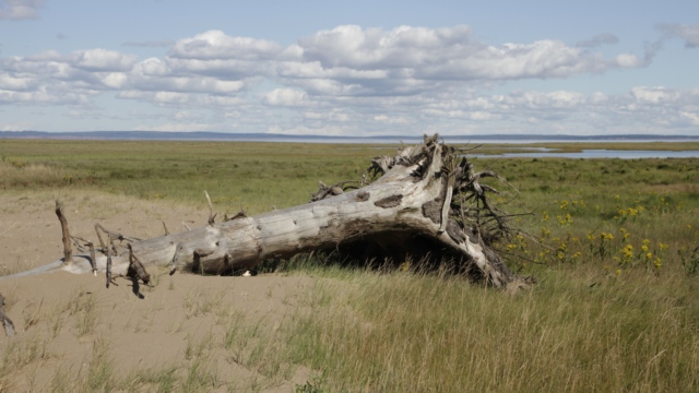
The beach at Mary’s Point.
Just down the road from the beach is Shipyard Park. Sharon told us that one woman was the driving force behind the park.
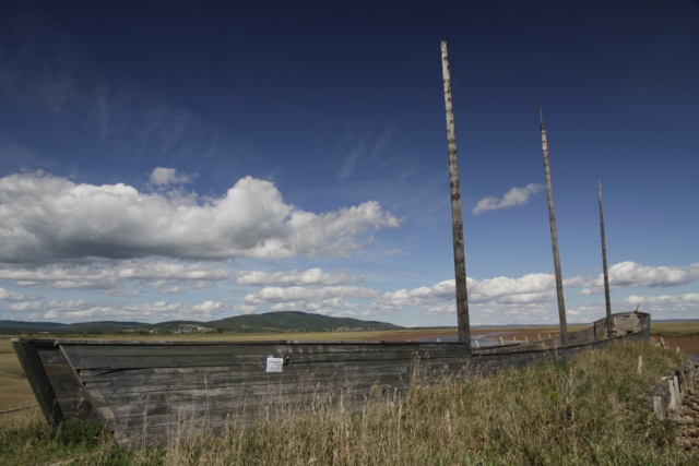
It looks like an old boat but it’s actually just a mock up of a boat. The masts are telephone poles and the sides are built on the ground.
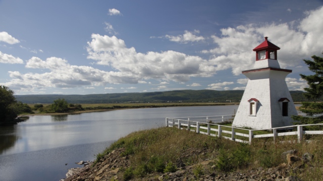
This is the Anderson Hollow Lighthouse from Waterside NB and it has been relocated 4 times and is currently in Shipyard Park at Harvey Bank
.
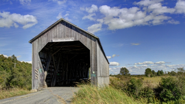
Yes, another covered bridge. This one is the Sawmill Creek Bridge built in 1905. In 1975 a concrete bridge was built on the new road and this bridge was closed to traffic.
A beach just outside of Alma
Cape Enrage is about 20 kilometers east of Alma along the coast. There is a lighthouse, beach, rappelling, zip line and a restaurant. Sharon, one of the women who is employed at Cape Enrage is a fountain of knowledge about Cape Enrage and the surrounding area. With a name like Cape Enrage one would expect violent water but the water is actually quite calm. I guess there were enough stormy conditions for the French description of the coast to be 'cape of rage'.
The lighthouse marks Cape Enrage. When the lighthouse was converted to modern equipment (i.e. the lighthouse keeper was no longer required) it quickly fell into disrepair. A number of years later, a teacher, the son of a lighthouse keeper, received permission to repair the lighthouse. He recruited students to help do the repairs enticing them with outdoor activities like repelling from the cliff. This was the start of the Not-for Profit Organization that currently maintains the property
Cape Enrage is on an island called Barn Marsh Island. It's beach is rocky and only accessible for a couple of hours before and after low tide. Fossils that have been strewn from the cliffs can be found on the beach.
Ed and I watch a couple of women repelling from the cliff. I was tempted to try it but not tempted enough to actually do it.
Using Sharon’s directions Ed and I set off to explore the area.
From atop a hill at Cape Enrage we saw beautiful Barn March Beach. We stopped to explore the beach and found one of the geocaches placed Province of New Brunswick here.
Mary’s Point is known as a good birding area. Between mid July and mid August over 300,000 thousand Semipalmated Sandpipers as well as large numbers of other Artic-breeding shorebirds stop here during their migration to South America. There were only a few gulls on the beach but it’s a pretty beach at low tide.
The beach at Mary’s Point.
Just down the road from the beach is Shipyard Park. Sharon told us that one woman was the driving force behind the park.
It looks like an old boat but it’s actually just a mock up of a boat. The masts are telephone poles and the sides are built on the ground.
This is the Anderson Hollow Lighthouse from Waterside NB and it has been relocated 4 times and is currently in Shipyard Park at Harvey Bank
.

Yes, another covered bridge. This one is the Sawmill Creek Bridge built in 1905. In 1975 a concrete bridge was built on the new road and this bridge was closed to traffic.
2016/09/09: Yeah! More Sun Than Fog
Category: General
Posted by: The Agnew Family
Take a wild guess about this morning’s weather ---- yup your correct. It
was foggy with a bit of rain. We’re packing up and moving about 50
kilometers east along the Bay of Fundy today. Driving trailer friendly
roads makes the route just over a hundred kilometres and about 2 hours.
As we drive northeast and inland, the skies clear and we actually see
the sun but as we drive southeast and nearer the coast the fog returns a
bit. We’re staying in a campground in Fundy National Park that is
about a 5 minute drive down a very big hill to the village of Alma.
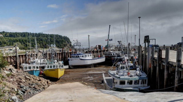
The tide was out when we visited the harbour in Alma. We walked around town checking out the gift shop and restaurants. I was a little surprised by the prices --- $23 for a souvenir T-shirt and $24 for a bowl of chowder and a lobster roll. Seems a little expensive too me but they do have a captured audience here.
Brochures I have read on Fundy NP indicate that Point Wolfe is one of the most scenic areas in the park and as the sun is shining we head out for Point Wolfe. Along the way we stop at Dickson. Falls. A scenic kilometer loop trail takes you to the falls.
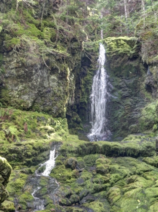
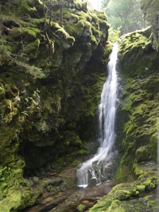
The area surrounding the falls and the brook are luscious --- several varieties of ferns and lots of moss makes everything very green.
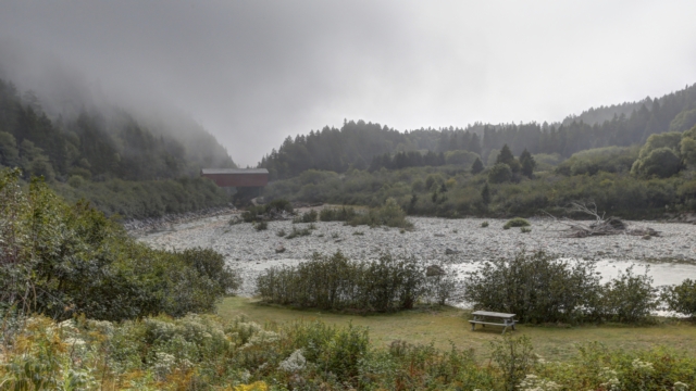
Just before Wolfe Point is a covered bridge and the start of the coastal trail. Fundy National Park has embraced geocaching and placed a number of caches around the park. There’s a cache less than 600 meters from the start of the costal trail so Ed convinces me to hike to the cache with him. The GPS measures the distance as the crow flies and doesn’t indicate anything about the terrain. Turned out the cache was over 800 meters away following the trail and the first 200 meters felt like they were straight up.
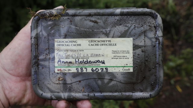
Found it! I did complain going up the hill but it was a nice invigorating hike.
By time we got to the beach at Wolfe Point the fog was beginning to roll in.
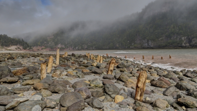
In the late 1800’s Wolfe Point was home to both a copper mine and a lumber mill. This is what’s left of the dockage.
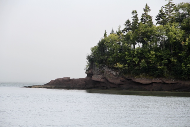
Up the coast from Wolfe Point is Herring Cove, home to another thriving community in the late 1800's. Now it’s a picnic area, trail head and a beautiful beach.
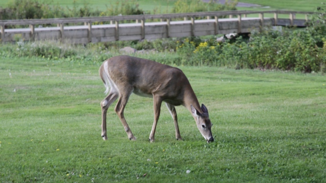
Our first wildlife sighting on the trip. This deer crossed the road in front of us and stopped to graze on the golf course. I think it knew it was in the National Park and people wouldn’t hurt it.
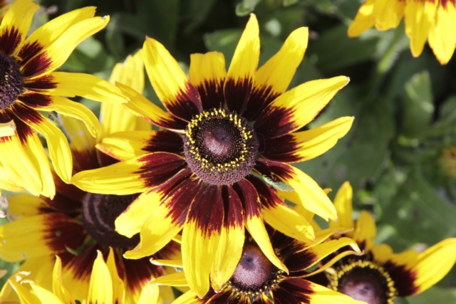
I’ll end with a bit of sunshine. The park has down a wonderful job with some flowerbeds.

The tide was out when we visited the harbour in Alma. We walked around town checking out the gift shop and restaurants. I was a little surprised by the prices --- $23 for a souvenir T-shirt and $24 for a bowl of chowder and a lobster roll. Seems a little expensive too me but they do have a captured audience here.
Brochures I have read on Fundy NP indicate that Point Wolfe is one of the most scenic areas in the park and as the sun is shining we head out for Point Wolfe. Along the way we stop at Dickson. Falls. A scenic kilometer loop trail takes you to the falls.

The area surrounding the falls and the brook are luscious --- several varieties of ferns and lots of moss makes everything very green.

Just before Wolfe Point is a covered bridge and the start of the coastal trail. Fundy National Park has embraced geocaching and placed a number of caches around the park. There’s a cache less than 600 meters from the start of the costal trail so Ed convinces me to hike to the cache with him. The GPS measures the distance as the crow flies and doesn’t indicate anything about the terrain. Turned out the cache was over 800 meters away following the trail and the first 200 meters felt like they were straight up.
Found it! I did complain going up the hill but it was a nice invigorating hike.
By time we got to the beach at Wolfe Point the fog was beginning to roll in.

In the late 1800’s Wolfe Point was home to both a copper mine and a lumber mill. This is what’s left of the dockage.
Up the coast from Wolfe Point is Herring Cove, home to another thriving community in the late 1800's. Now it’s a picnic area, trail head and a beautiful beach.
Our first wildlife sighting on the trip. This deer crossed the road in front of us and stopped to graze on the golf course. I think it knew it was in the National Park and people wouldn’t hurt it.
I’ll end with a bit of sunshine. The park has down a wonderful job with some flowerbeds.
Category: General
Posted by: The Agnew Family
aside written September 9: We left the park with the really slow
internet (apparently the only internet available to the park) and are
now at Fundy National Park. Ed and I are sitting in the truck at the
entrance to the campground accessing the internet --- it doesn't reach
any of the campsites. It's about the speed of dial up but at least it
works.
Light rain and fog greeted us this morning when we awoke but hopefully it won't interfere with the day we have planned. Today we are visiting Sain John, the largest city in New Brunswick, which is about 40 kilometers west of St. Martin.
One of the top tourist attractions in Saint John is the “Reversing Rapids”. The Saint John River starts inland and flows to the ocean. Just before the harbour and the Bay of Fundy the river drops a number of feet creating rapids. The Bay of Fundy high tide is higher than the normal river height so the ocean water pushes back against the river water causing the river to run backwards. At least is how I think this is why it happens. We arrived in Saint John around low tide and shot some photos of the river. We returned at high tide and took photos in approximately the same locations.
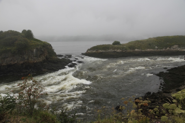
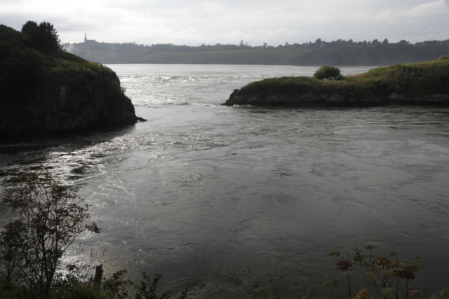
low tide, the water is lower creating rougher water as it flows over the rocks
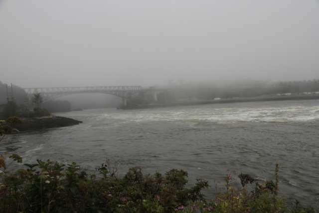
high tide, the water appears much calmer as it is higher, clearing the rocks
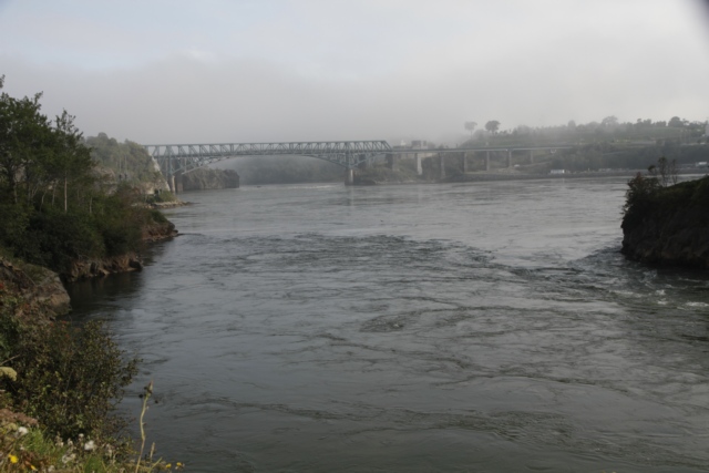
low tide
high tide
I’m not sure how well these photos show the differences but it was really a weird feeling watching the water flow up the river in the evening after we had seen it flowing down river in the morning.
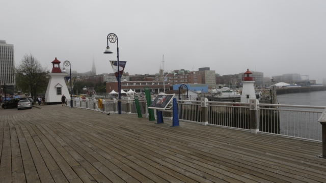
Saint John has a beautiful board walk around the harbour.
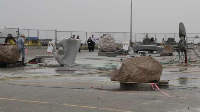
This is the third Sculpture Symposium to be held in Saint John. Eight sculptors from around the world are chosen to participate in each Symposium. Each sculptor is assigned to a city in New Brunswick where they help decide the location for a new a sculpture. The sculptor then chooses the “rock” and creates the sculpture over a 6 week period. This is the area where the sculpturing is taking place.
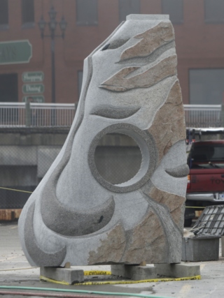
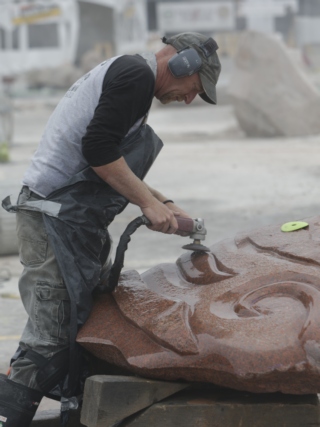
An almost completed sculpture. The different colours are all natural to the rock. A sculptor hard at work.
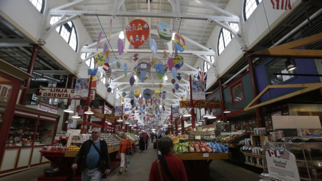
While on the hunt for some seafood chowder and fish and chips for lunch, Ed and I found the Saint John City Market and some wonderful chowder and fish and chips. The Saint John City Market is the oldest continuing farmer’s market in Canada. It is also a National Historic Site.
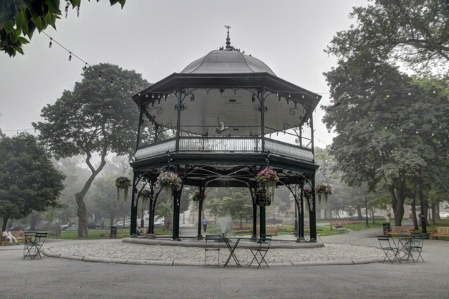
The King Edward VII Memorial Bandstand, with its copper roof and its filigree metal framework, was constructed in 1908 as a gift to the city. The bandstand is found in Kings Square.
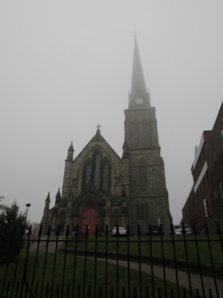
The church of St. Andrew and St. David is a Provincial Historic Site. The fog was getting thick enough that it was obscuring the spire.
Light rain and fog greeted us this morning when we awoke but hopefully it won't interfere with the day we have planned. Today we are visiting Sain John, the largest city in New Brunswick, which is about 40 kilometers west of St. Martin.
One of the top tourist attractions in Saint John is the “Reversing Rapids”. The Saint John River starts inland and flows to the ocean. Just before the harbour and the Bay of Fundy the river drops a number of feet creating rapids. The Bay of Fundy high tide is higher than the normal river height so the ocean water pushes back against the river water causing the river to run backwards. At least is how I think this is why it happens. We arrived in Saint John around low tide and shot some photos of the river. We returned at high tide and took photos in approximately the same locations.
low tide, the water is lower creating rougher water as it flows over the rocks
high tide, the water appears much calmer as it is higher, clearing the rocks
low tide
high tide
I’m not sure how well these photos show the differences but it was really a weird feeling watching the water flow up the river in the evening after we had seen it flowing down river in the morning.
Saint John has a beautiful board walk around the harbour.
This is the third Sculpture Symposium to be held in Saint John. Eight sculptors from around the world are chosen to participate in each Symposium. Each sculptor is assigned to a city in New Brunswick where they help decide the location for a new a sculpture. The sculptor then chooses the “rock” and creates the sculpture over a 6 week period. This is the area where the sculpturing is taking place.
An almost completed sculpture. The different colours are all natural to the rock. A sculptor hard at work.
While on the hunt for some seafood chowder and fish and chips for lunch, Ed and I found the Saint John City Market and some wonderful chowder and fish and chips. The Saint John City Market is the oldest continuing farmer’s market in Canada. It is also a National Historic Site.

The King Edward VII Memorial Bandstand, with its copper roof and its filigree metal framework, was constructed in 1908 as a gift to the city. The bandstand is found in Kings Square.
The church of St. Andrew and St. David is a Provincial Historic Site. The fog was getting thick enough that it was obscuring the spire.
2016/09/07: Fundy Trail
Category: General
Posted by: The Agnew Family
When I opened the window this morning I was greeted with limited vision
….everything was grey. It was foggy. Our plan for the day was to drive
to the Fundy Trail, a 10 kilometre multipurpose trail (driving, biking
and walking) and view the beautiful Fundy Bay coastline. Crossing our
fingers we set out for the day.
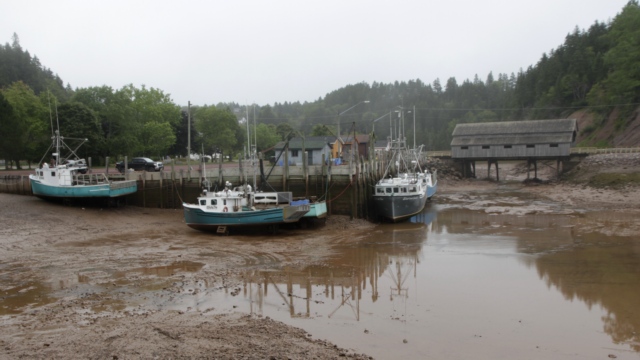
It was closing in on low tide when we drove thru St. Martins. The boats were hard on and there was no water under the bridge.
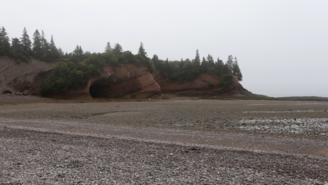
Remember the photo of the sea caves yesterday. Well this is what it looks like without water. We walked out to the caves and even around the corner where we found a hidden cove with it’s own cave. Walking around on the sea bed reminded me of a snow shoe trek to the grotto near Tobermory where we walked around the caves on the ice. It has an eerie unreal feeling to it.
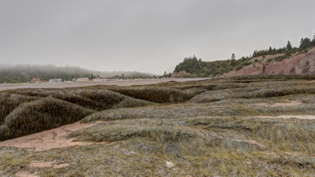
You can actually walk a fair distance from shore. Looking over a kelp bed at the shoreline.
Leaving the caves we head for The Fundy Trail. When we arrive at the gate we are told that the multiuse trail is still 10 kilometres long but the auto parkway has been extended to 19 kilometres. Our plan is to drive to the end of the parkway and work our way back to the gate. As it’s still foggy we alter the plan slightly and decide to stop at places that aren’t as effected by the fog.
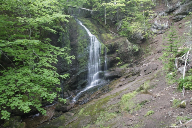
First stop is Fuller Falls. Cute little waterfalls ---- I assume there’s a lot more water going over the falls in the spring.
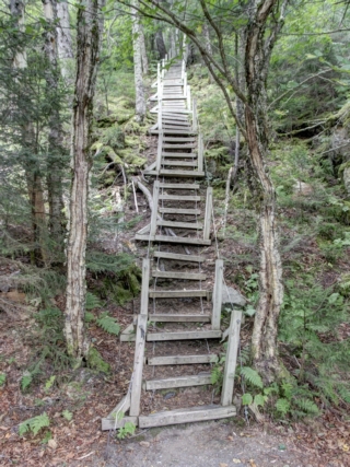
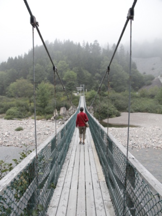
Then there’s the cable stairs to get to the waterfalls ---- cable hand rails and the steps (4 by 4’s) are connected with cable and in some cases they are not in contact with the earth. This is 84 meter long pedestrian suspension bridge crosses the Salmon River. It was near low tide when we crossed it, so not a lot of water under the bridge.
We arrived at the end of the road and the fog had not dissipated, so you take photos of things you can see,
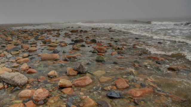
like the stones on the beach and the waves rolling in,
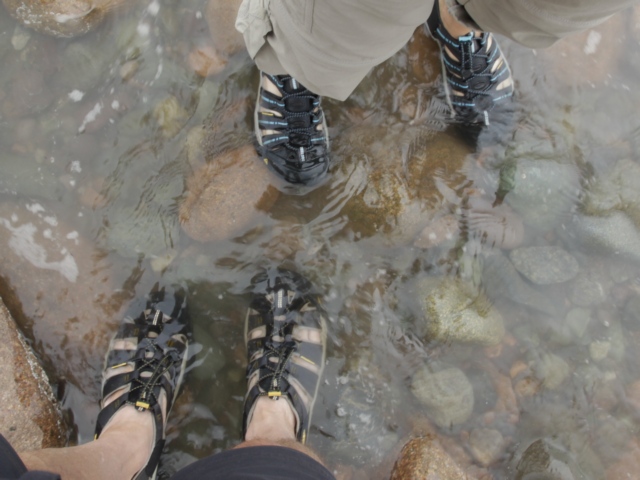
or feet in the water
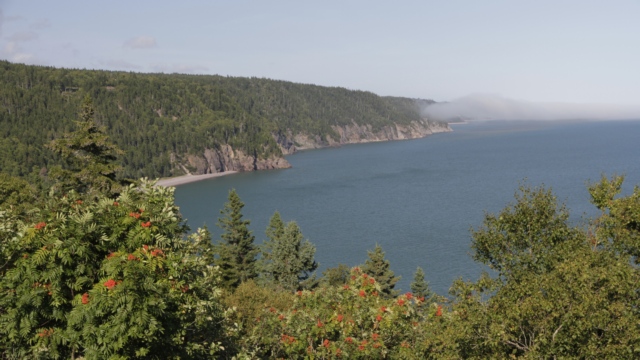
Finally the fog dissipated and we were able to see the coastline. It was as beautiful as the pamphlets described.
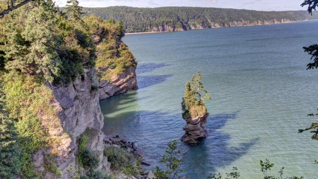
The Flower Pot is one of the many rock formations you can see while visiting the Fundy Trail.
The Fundy Trail closes at 5pm but as the sun was still shining we decided to check out the village of Quaco just a few miles from St. Martin.
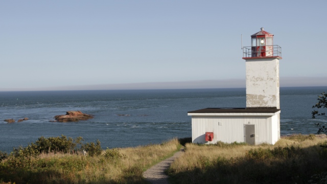
First stop was the lighthouse. It’s not a pretty lighthouse but the view is good.
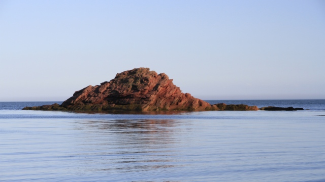
We drove to the end of road in Quaco and saw a path that looked like it went to the water. Following it we found a secluded beach. This rock was shining is the setting sun.
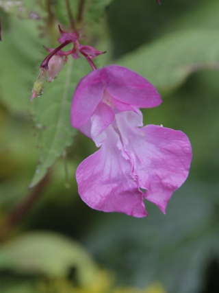
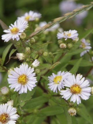
It’s been awhile since I posted photos of flowers. These are two of the many flowers we saw today.
It was closing in on low tide when we drove thru St. Martins. The boats were hard on and there was no water under the bridge.
Remember the photo of the sea caves yesterday. Well this is what it looks like without water. We walked out to the caves and even around the corner where we found a hidden cove with it’s own cave. Walking around on the sea bed reminded me of a snow shoe trek to the grotto near Tobermory where we walked around the caves on the ice. It has an eerie unreal feeling to it.

You can actually walk a fair distance from shore. Looking over a kelp bed at the shoreline.
Leaving the caves we head for The Fundy Trail. When we arrive at the gate we are told that the multiuse trail is still 10 kilometres long but the auto parkway has been extended to 19 kilometres. Our plan is to drive to the end of the parkway and work our way back to the gate. As it’s still foggy we alter the plan slightly and decide to stop at places that aren’t as effected by the fog.
First stop is Fuller Falls. Cute little waterfalls ---- I assume there’s a lot more water going over the falls in the spring.

Then there’s the cable stairs to get to the waterfalls ---- cable hand rails and the steps (4 by 4’s) are connected with cable and in some cases they are not in contact with the earth. This is 84 meter long pedestrian suspension bridge crosses the Salmon River. It was near low tide when we crossed it, so not a lot of water under the bridge.
We arrived at the end of the road and the fog had not dissipated, so you take photos of things you can see,

like the stones on the beach and the waves rolling in,
or feet in the water
Finally the fog dissipated and we were able to see the coastline. It was as beautiful as the pamphlets described.

The Flower Pot is one of the many rock formations you can see while visiting the Fundy Trail.
The Fundy Trail closes at 5pm but as the sun was still shining we decided to check out the village of Quaco just a few miles from St. Martin.
First stop was the lighthouse. It’s not a pretty lighthouse but the view is good.
We drove to the end of road in Quaco and saw a path that looked like it went to the water. Following it we found a secluded beach. This rock was shining is the setting sun.
It’s been awhile since I posted photos of flowers. These are two of the many flowers we saw today.
2016/09/06: Covered Bridges and Caves
Category: General
Posted by: The Agnew Family
This morning we left Fredericton and drove south thru Saint John and
east along the Bay of Fundy to St. Martin. St. Martin is a picturesque
village that was founded by Loyalists in 1783.
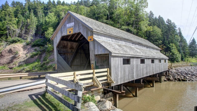
There are two covered bridges in St. Martin.
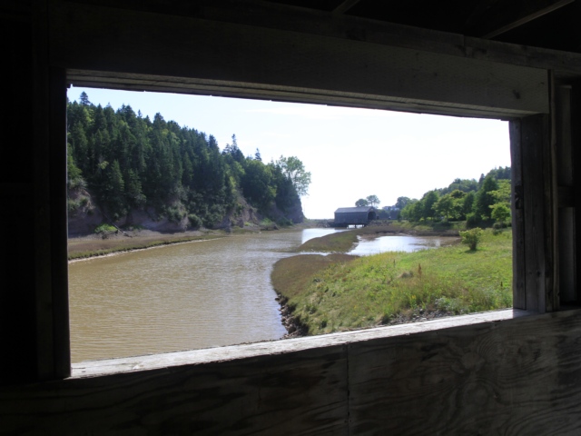
Looking at a covered bridge from the window of the second covered bridge.
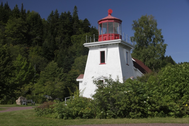
The lighthouse is a gift shop.
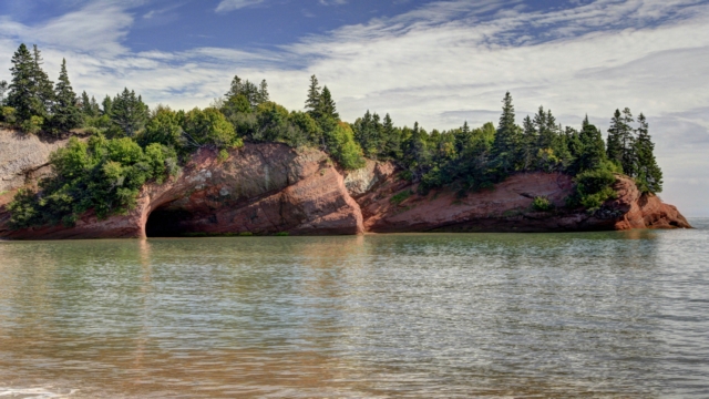
The villages premier attraction is the St. Martins sea caves. At low tide you can walk on ocean floor out to the sea caves, caverns and arches.
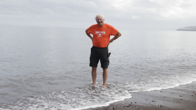
The campground is by the ocean. Ed and I went for a walk on the stone beach and he tested the water --- said it wasn't too bad.
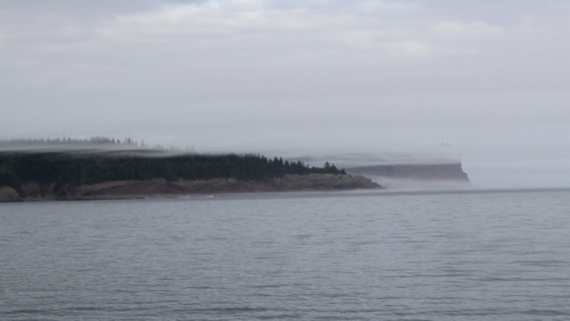
The fog rolled in.
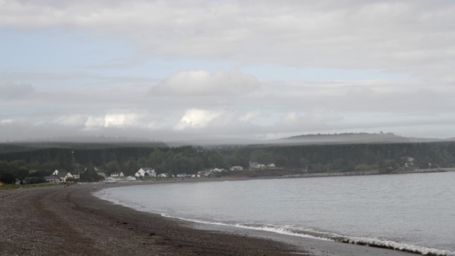
Looking down the beach at St. Martin.
We received some sad news today.
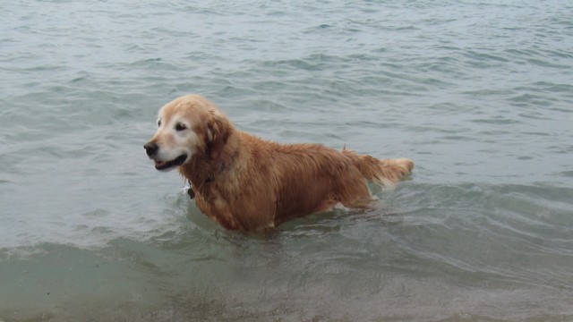
Rest in Peace Miss Maggie. We will miss you.

There are two covered bridges in St. Martin.
Looking at a covered bridge from the window of the second covered bridge.
The lighthouse is a gift shop.

The villages premier attraction is the St. Martins sea caves. At low tide you can walk on ocean floor out to the sea caves, caverns and arches.
The campground is by the ocean. Ed and I went for a walk on the stone beach and he tested the water --- said it wasn't too bad.
The fog rolled in.
Looking down the beach at St. Martin.
We received some sad news today.
Rest in Peace Miss Maggie. We will miss you.
2016/09/05: Waterfalls, Bridges and Buildings
Category: General
Posted by: The Agnew Family
Today's destination is Fredericton, the capital of New Brunswick. Along
the route is the town of Grand Falls which is situated on the Saint John
River. The town derives its name from a waterfall created by a series
of rock ledges over which the river drops 23 metres.
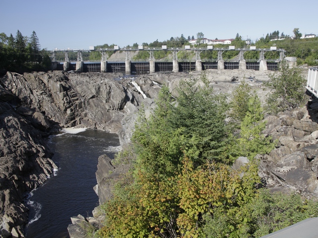
A hydroelectric dam is situated above the falls. This is your typical late summer photo of the falls ---- a little bit of water and a lot of rocks. In the spring the water covers the rocks.
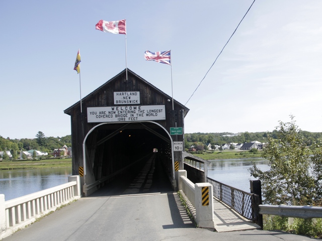
A bit further down the road is the town of Hartland. The Hartland bridge, 1,282 feet long, is the world's longest covered bridge. The framework consists of seven small Howe Truss bridges joined together on six piers.
Fredericton is situated on the Saint John River. It's known for its Historic Garrison District.
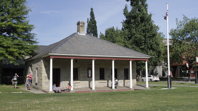
The 1828 Guard House. When we walked up to the guard house a young man in period costume approached us and asked if we wanted to see the guard house. We said yes, so he gave us a tour of the guard house and of the Soldier's Barracks. Timed this one right as it was the last day of the tours for this year.
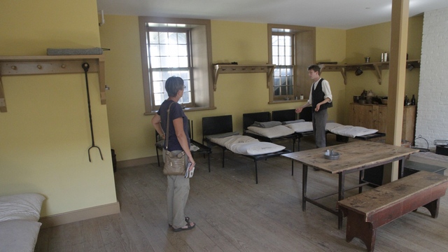
Inside the soldier's barracks. Fourteen men shared a room, four of whom could be married. The wife and any children shared the soldier's bed (the children slept under the bed with the chamber pot).
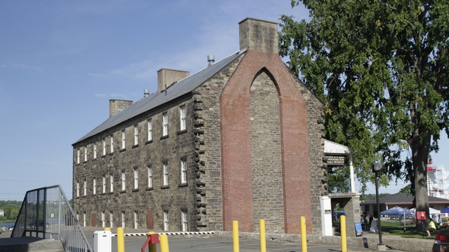
The officer's quarters. The building was built in sections with the chimney at the end of the section. On the ground you could see where the next section of the building was to be added.
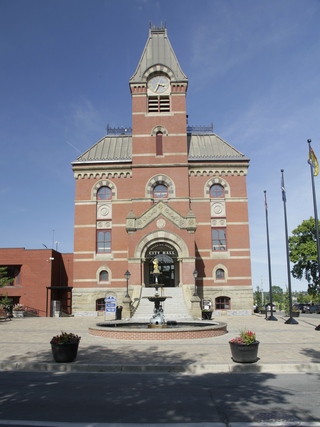
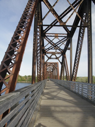
Old city hall was erected in 1876. The fountain in front of city hall was constructed in 1885. Freddy, "the little nude dude" as he is affectionately called sits on top of the fountain. An old CN rail bridge has been converted to a trail bridge connecting the north and south sides of Fredericton. The bridge is part of the Trans Canada Trail network and is 1,905 feet long.
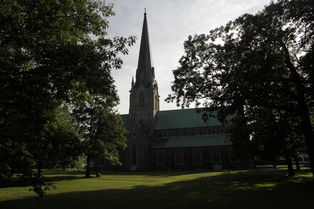
Christ Church Cathedral is considered to be the first cathedral in North America. Building began in 1845 and was completed in 1853.
We stayed at an RV park 8 km west of downtown. A view from near our trailer.
A hydroelectric dam is situated above the falls. This is your typical late summer photo of the falls ---- a little bit of water and a lot of rocks. In the spring the water covers the rocks.
A bit further down the road is the town of Hartland. The Hartland bridge, 1,282 feet long, is the world's longest covered bridge. The framework consists of seven small Howe Truss bridges joined together on six piers.
Fredericton is situated on the Saint John River. It's known for its Historic Garrison District.
The 1828 Guard House. When we walked up to the guard house a young man in period costume approached us and asked if we wanted to see the guard house. We said yes, so he gave us a tour of the guard house and of the Soldier's Barracks. Timed this one right as it was the last day of the tours for this year.
Inside the soldier's barracks. Fourteen men shared a room, four of whom could be married. The wife and any children shared the soldier's bed (the children slept under the bed with the chamber pot).
The officer's quarters. The building was built in sections with the chimney at the end of the section. On the ground you could see where the next section of the building was to be added.
Old city hall was erected in 1876. The fountain in front of city hall was constructed in 1885. Freddy, "the little nude dude" as he is affectionately called sits on top of the fountain. An old CN rail bridge has been converted to a trail bridge connecting the north and south sides of Fredericton. The bridge is part of the Trans Canada Trail network and is 1,905 feet long.
Christ Church Cathedral is considered to be the first cathedral in North America. Building began in 1845 and was completed in 1853.
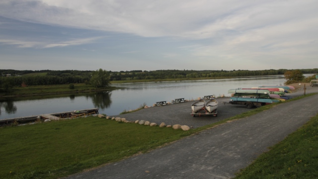
We stayed at an RV park 8 km west of downtown. A view from near our trailer.
2016/09/04: New Brunswick Here We Come
Category: General
Posted by: The Agnew Family
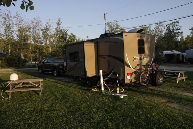
Today was a driving day. We left Deb and Luc’s house in Johnstown just
after 9 am and about 8 hours later arrived at Camping Panoramic in Saint
Jacques, New Brunswick (part of Edmonston). Our route took us south of
Montreal and Quebec City, along the St. Lawrence River and past some
beautiful countryside.
2016/09/03: Johnstown Area
Category: General
Posted by: The Agnew Family
Today Deb and Luc toured us around the area. We started the day with a
nice breakfast at Bobby’s Restaurant in Prescott. Then we stopped by
their building where Luc has set up his business.
Just down the road is the historic location Battle of the Windmill.
This is the site of a bloody four day battle that took place November 12 thru 16 1838 between a rebel group of American Invaders and the “Patriot Hunters”, the defending British regulars and the Canadian militia. Today this historic windmill serves as a memorial to those who fought and lost their lives in the Battle of the Windmill. In 1873 the grist windmill was converted to a lighthouse by the Canadian Department of Marine.
View from one of the windmill windows.
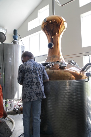
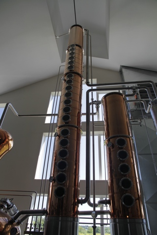
The King’s Lock Craft Distillery and the Windmill Brewery are new businesses in Johnstown. They share a building but operate separately. We stopped to sample some of their products and tour the facility.
Driving about 15 minutes north of Johnstown brought us to the Blue Gypsy Winery --- couldn’t leave wine out of the mix. This winery is different from your average winery, as they don’t use grapes to produce wine. Their wines included Blueberry, Cranberry, Ginger, Chocolate Mead, Caramel Mead, and Chai Spiced Mead. Mead is a honey wine. For $5 you can taste all of their wines and take home a souvenir glass. As I’m a fan of ginger I had expected to like the ginger wine but it was the only one that I could say I really didn’t like --- Ed finished my sample. The blueberry was very nice but the caramel mead is the one that Ed and I agreed to bring home with us. Can't wait to sample the caramel mead with an apple tart.
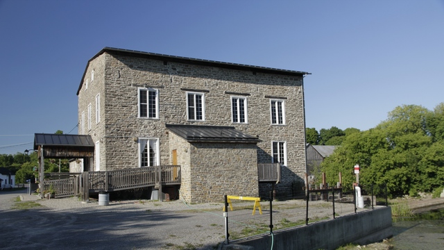
On the drive back to Johnstown we stopped at Spencerville. The shops were closed for the day but we checked out the outside of the old mill and the pond.
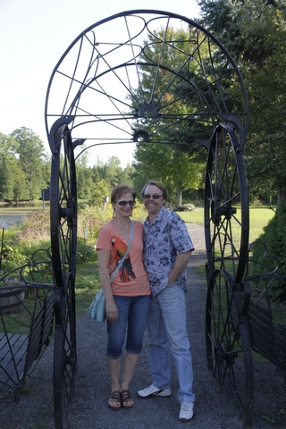
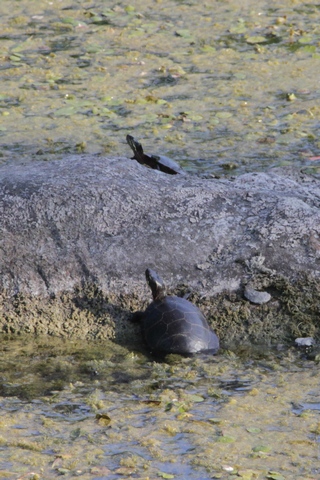
Deb and Luc and some turtles in the pond.
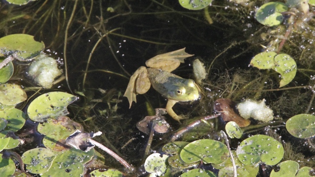
One of the many frogs we saw hopping around the lily pads.
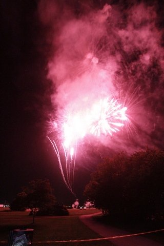
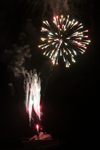
After dinner we drove back to Prescott to watch the end of fireworks show presented by the town and Hand Fireworks.
Just down the road is the historic location Battle of the Windmill.
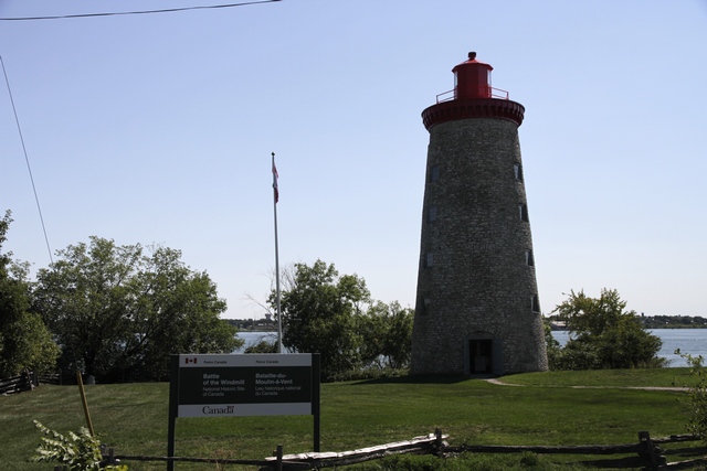
This is the site of a bloody four day battle that took place November 12 thru 16 1838 between a rebel group of American Invaders and the “Patriot Hunters”, the defending British regulars and the Canadian militia. Today this historic windmill serves as a memorial to those who fought and lost their lives in the Battle of the Windmill. In 1873 the grist windmill was converted to a lighthouse by the Canadian Department of Marine.
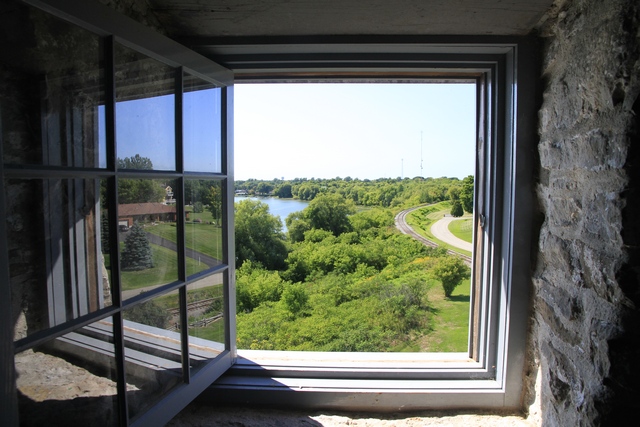
View from one of the windmill windows.
The King’s Lock Craft Distillery and the Windmill Brewery are new businesses in Johnstown. They share a building but operate separately. We stopped to sample some of their products and tour the facility.
Driving about 15 minutes north of Johnstown brought us to the Blue Gypsy Winery --- couldn’t leave wine out of the mix. This winery is different from your average winery, as they don’t use grapes to produce wine. Their wines included Blueberry, Cranberry, Ginger, Chocolate Mead, Caramel Mead, and Chai Spiced Mead. Mead is a honey wine. For $5 you can taste all of their wines and take home a souvenir glass. As I’m a fan of ginger I had expected to like the ginger wine but it was the only one that I could say I really didn’t like --- Ed finished my sample. The blueberry was very nice but the caramel mead is the one that Ed and I agreed to bring home with us. Can't wait to sample the caramel mead with an apple tart.
On the drive back to Johnstown we stopped at Spencerville. The shops were closed for the day but we checked out the outside of the old mill and the pond.
Deb and Luc and some turtles in the pond.
One of the many frogs we saw hopping around the lily pads.
After dinner we drove back to Prescott to watch the end of fireworks show presented by the town and Hand Fireworks.
2016/09/02: On an Adventure
Category: General
Posted by: The Agnew Family
The trailer has been sitting in the side year for more than a year
looking sad and wishing it could go somewhere. Finally we gave in,
readied the trailer for a trip and we’re off on an adventure. This is
going to be a short trip for us --- somewhere between 14 and 18 days.
Our destination is New Brunswick. This is a province we have driven thru
several times but for a number of reasons didn’t take the time to check
it out.
Today we leave home … Ed hesitating a little because he wasn’t sure he wanted to drive thru Toronto on the Friday of a long weekend. There were several slow downs due to merging traffic and of course the ever present construction. We also saw one car pulled onto the side of the highway with a flat tire ---- it’s amazing how much that can slow traffic down.
Tonight’s stop is at the home of friends. We met Deb and Luc many years ago when we played tennis in Carlisle. Last year they moved from Waterdown to Johnstown. The local campground was full so we parked in their driveway.
Johnstown is a small town about 8 km east of Prescott. The easiest way to find it on the map is to look for a bridge crossing the river to the US. If it highway 16 in Canada and Highway 812 in the US you’ve found Johnstown.