2016/05/26: Home
Category: General
Posted by: The Agnew Family
After a restful day of doing nothing other than visiting it's time to drive home.
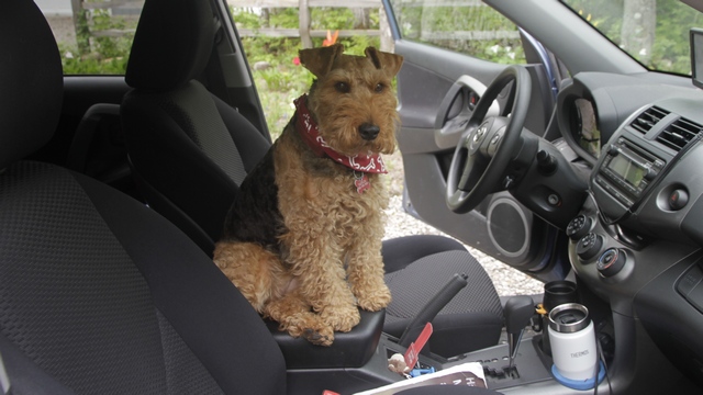
Caity likes car rides and was hoping for one today. Unfortunately, she had to stay home.
After 49 days and 14,720 kilometers we are home and we saw and did everything on our list and did it under budget.
We stayed at 25 motel / hotels, homes of 4 friends and 2 campgrounds and we learned a lot about traveling in a car.
Now to start planning the next trip.
2016/05/24: Quick Stop in Holland
Category: General
Posted by: The Agnew Family
Michigan that is.
About 10 miles north of Saugatuck is Holland. In 1847 a group of Dutch emigrants on their way to Wisconsin decided to stay in Michigan founding Holland. Holland is well know for it's tulip festival (which we missed by about a week), dutch village and Windmill.
As we just had a couple of hours we decided to visit Windmill Island rather than trying to see the entire town.
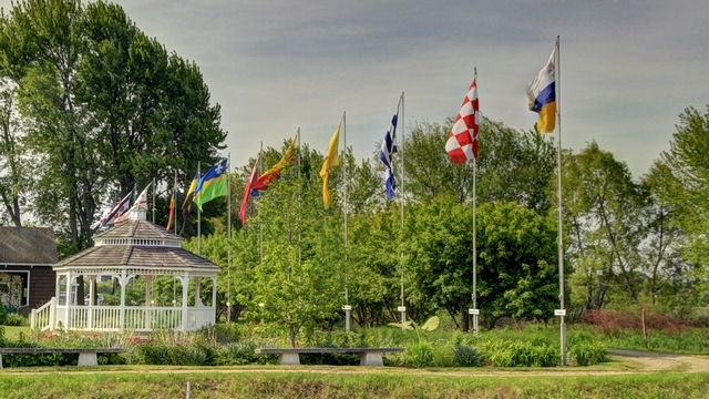
The Netherlands is a small country that is made up of 12 provinces. These are the provincial flags.
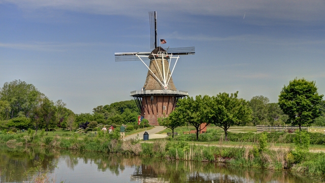
Windmill Island Gardens is a municipal park located in the city of Holland, Michigan. It is home to the 251-year-old windmill De Zwaan, the only authentic, working Dutch windmill in the United States. De Zwaan arrived in Michigan in October 1964. It was rebuilt and opened to the public in April 1965.
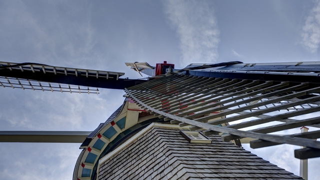
A tour through the windmill explains the milling process and gives you an up close look at the windmill.
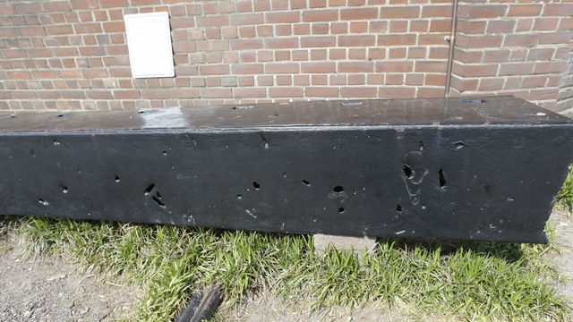
The windmill brings a lot of history with it. In the past couple of years the blades have been replaced but this old blade is on display. The holes are from bullets from WWII.
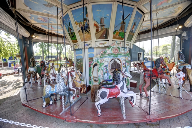
An 1908 Dutch carousel is also on the island.
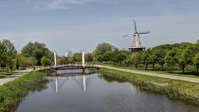
Leaving Holland we drive to Wolverine to visit our friends John and Carol and get a dog (Caity) and cat (Justy) fix.
About 10 miles north of Saugatuck is Holland. In 1847 a group of Dutch emigrants on their way to Wisconsin decided to stay in Michigan founding Holland. Holland is well know for it's tulip festival (which we missed by about a week), dutch village and Windmill.
As we just had a couple of hours we decided to visit Windmill Island rather than trying to see the entire town.

The Netherlands is a small country that is made up of 12 provinces. These are the provincial flags.

Windmill Island Gardens is a municipal park located in the city of Holland, Michigan. It is home to the 251-year-old windmill De Zwaan, the only authentic, working Dutch windmill in the United States. De Zwaan arrived in Michigan in October 1964. It was rebuilt and opened to the public in April 1965.

A tour through the windmill explains the milling process and gives you an up close look at the windmill.
The windmill brings a lot of history with it. In the past couple of years the blades have been replaced but this old blade is on display. The holes are from bullets from WWII.

An 1908 Dutch carousel is also on the island.

Leaving Holland we drive to Wolverine to visit our friends John and Carol and get a dog (Caity) and cat (Justy) fix.
2016/05/24: Continuing East
Category: General
Posted by: The Agnew Family
Geocaching was "necessary" in both Iowa and Illinois today as Ed hasn't
geocached in either state. The caches in Iowa weren't exciting but Ed
found a cute one in Illinois.
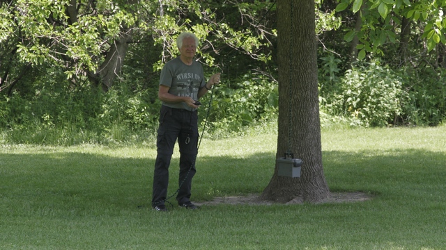
Up,Up, 'N Away A rope was untied so the cache could be lowered. After signing the log the cache was hoisted up again and the rope looped around the tree and tied.
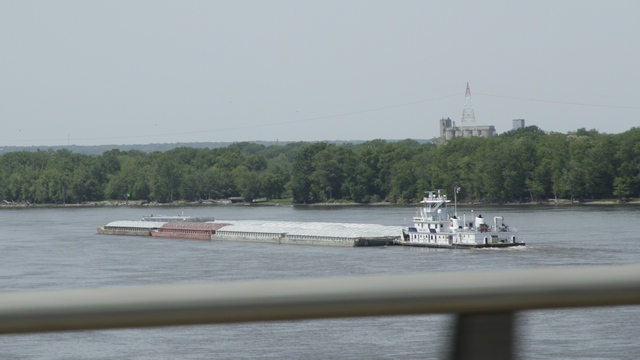
There wasn't a lot of exciting scenery but we did cross the Mississippi River.
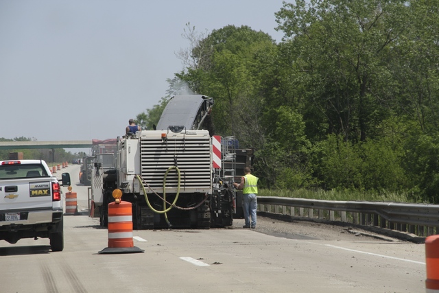
and we saw lots of construction today.
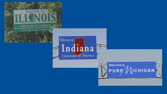
We started today in Iowa and ended up in Michigan driving through Illinois and Indiana.
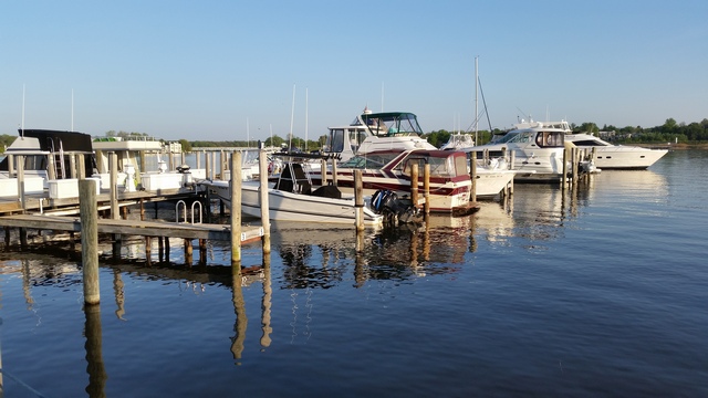
We stopped for the night in Saugatuck, Michigan which is on Kalamazoo lake. We had dinner on an outside patio by the water.
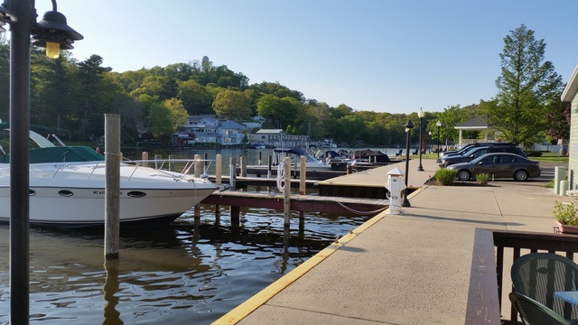
The view from our table.
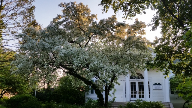
I don't think I've ever seen this many blossoms on a tree.
Up,Up, 'N Away A rope was untied so the cache could be lowered. After signing the log the cache was hoisted up again and the rope looped around the tree and tied.
There wasn't a lot of exciting scenery but we did cross the Mississippi River.
and we saw lots of construction today.

We started today in Iowa and ended up in Michigan driving through Illinois and Indiana.
We stopped for the night in Saugatuck, Michigan which is on Kalamazoo lake. We had dinner on an outside patio by the water.

The view from our table.


I don't think I've ever seen this many blossoms on a tree.
2016/05/22: Heading East Again
Category: General
Posted by: The Agnew Family
After a wonderful breakfast with Herb and Rosetta we were on the road again.
In Ed's quest for finding geocaches in all the US states we toured around the Burr Oak area on our own.
You can tell where the rivers are by the number of trees.
We had seen lots of cows but this was the first flock of goats we saw.
The GPS took us down some interesting roads.
I'm guessing that there's been accidents at this corner.
After Ed found a few geocaches, it was back to Nebraska and I80. After a few hours we found ourselves in Iowa. Both states are flat with lots of farms.
Ed was facinated by the walking irragators.
I think this was the longest irragator we saw.
We stopped for the night in Coralville, Iowa. The town is in the middle of the US with the only water in sight being a river, yet the town is named for Coral reefs. Turns out coral formations were found in the limestone rocks in 1866. It was shortly after the coral discovery that the town was named.
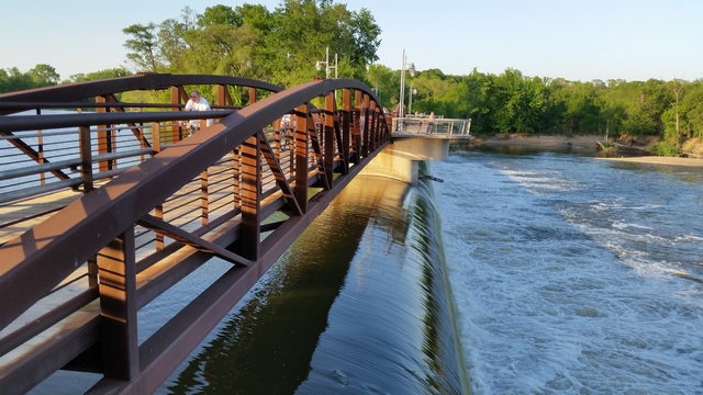
There is a nice walk near the old power dam in Coralville.
2016/05/21: Touring Around Herb and Rosetta's Farm
Category: General
Posted by: The Agnew Family
Herb is officially a retired farmer. Herb's nephew does most of the
farming these days though Herb will get on a tractor and help out when
needed. Rosetta is a retired music teacher though you still find her
playing the organ and piano at church or accompanying a menu's choir in
Texas or directoring choir.
We started the day with a tour of the local area including the farms. The first thing I noticed is that Kansas isn't that different from Bruce County --- Kansas is a little flatter and Bruce County's trees are a little bigger. The next thing I noticed is Kansas's space is bigger --- that probably doesn't make sense but I don't know how else to describe it. The open space just feels bigger (hopefully the pictures will help explain).
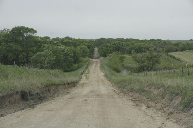
The main roads are paved but the farm roads (which are most of the roads) are dirt.
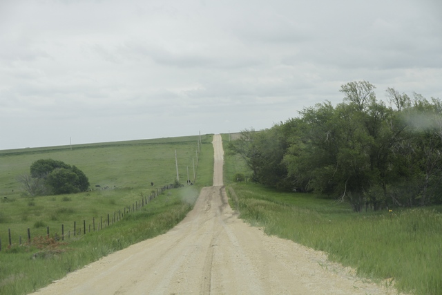
Corn and soy bean are being planted and it's just about time to harvest the winter wheat.
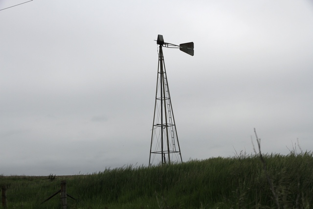
The population of the county where Herb and Rosetta live has dropped dramatically. A lot of young people have moved to the cities and with the new large farm machinery a farmer can farm several thousand acres with part time help.
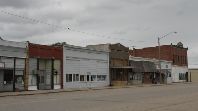
The town of Burr Oak is not as busy as it once was. In fact all the schools in the county have been consolidated into one school.
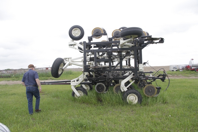
Herb is not only a farmer but also a designer as he has built pieces of farm machinery that made farming easier for him.
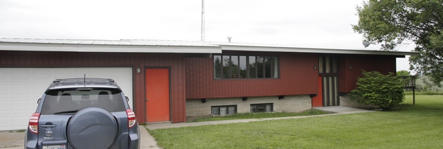
Herb and Rosetta designed and built their home completing it 1975. Ed and I designed and built our Mountsberg home completing in in 1986. The funny thing is the homes had a lot in common --- passive solar, bedrooms on the lower level, cathedral ceiling on the upper floor, etc.
After the tour we drove to Superior, a town in Nebraska about 20 minutes from Herb and Rosetta's place, to visit Lorna (another person we knew from Texas). We had last seen Lorna in Arizona in 2013. It's her fault that Ed and I own ATV's as she introduced us to riding in the desert. We had a great visit with her as well.
We started the day with a tour of the local area including the farms. The first thing I noticed is that Kansas isn't that different from Bruce County --- Kansas is a little flatter and Bruce County's trees are a little bigger. The next thing I noticed is Kansas's space is bigger --- that probably doesn't make sense but I don't know how else to describe it. The open space just feels bigger (hopefully the pictures will help explain).
The main roads are paved but the farm roads (which are most of the roads) are dirt.
Corn and soy bean are being planted and it's just about time to harvest the winter wheat.
The population of the county where Herb and Rosetta live has dropped dramatically. A lot of young people have moved to the cities and with the new large farm machinery a farmer can farm several thousand acres with part time help.
The town of Burr Oak is not as busy as it once was. In fact all the schools in the county have been consolidated into one school.
Herb is not only a farmer but also a designer as he has built pieces of farm machinery that made farming easier for him.
Herb and Rosetta designed and built their home completing it 1975. Ed and I designed and built our Mountsberg home completing in in 1986. The funny thing is the homes had a lot in common --- passive solar, bedrooms on the lower level, cathedral ceiling on the upper floor, etc.
After the tour we drove to Superior, a town in Nebraska about 20 minutes from Herb and Rosetta's place, to visit Lorna (another person we knew from Texas). We had last seen Lorna in Arizona in 2013. It's her fault that Ed and I own ATV's as she introduced us to riding in the desert. We had a great visit with her as well.
2016/05/20: The Arch
Category: General
Posted by: The Agnew Family
Our friends in Arkansas and our friends in Kansas both suggested that we
stop and visit the Great Platte River Road Archway Monument.
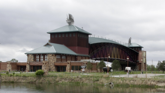
The Archway is a museum of and monument to Nebraska's and the Platte River valley's role in westward expansion. The museum tells the stories of travelling across the US from the time of the early pioneers till the road became Interstate 80. The Archway is directly over the highway.
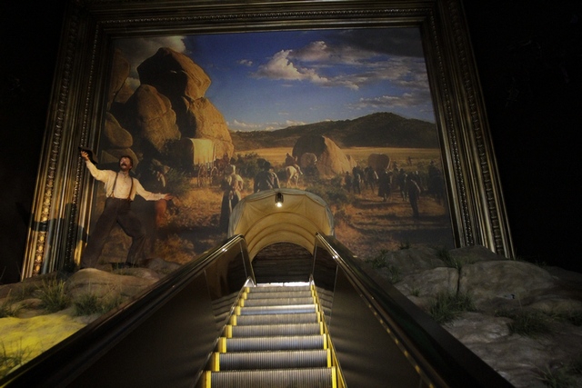
The museum is an audio visual experience. As you walk through the exhibits you hear the history on headphones.
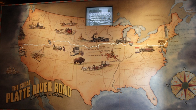
Ed and I found it very interesting to hear the history of the interstate that we have been driving on for several days.
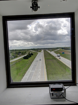
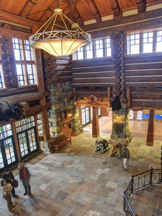
A view of I80 from the museum --- they even have a radar unit so you can see how fast people are driving. The 2nd photo is a view of the lobby.
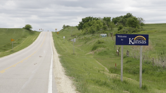
We have arrived in Kansas. We've been wanting to visit friends who live just south of the Nebraska border in Kansas for several years. It's exciting to have finally made it to Herb and Rosetta's farm.
The Archway is a museum of and monument to Nebraska's and the Platte River valley's role in westward expansion. The museum tells the stories of travelling across the US from the time of the early pioneers till the road became Interstate 80. The Archway is directly over the highway.
The museum is an audio visual experience. As you walk through the exhibits you hear the history on headphones.
Ed and I found it very interesting to hear the history of the interstate that we have been driving on for several days.


A view of I80 from the museum --- they even have a radar unit so you can see how fast people are driving. The 2nd photo is a view of the lobby.
We have arrived in Kansas. We've been wanting to visit friends who live just south of the Nebraska border in Kansas for several years. It's exciting to have finally made it to Herb and Rosetta's farm.
2016/05/20: Laramie, Wyoming to Kearney, Nebraska
Category: General
Posted by: The Agnew Family
We continue to drive east.
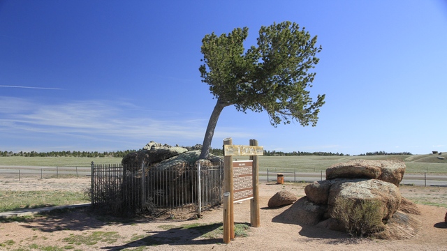
A Tree in a Rock is found in the median between the east and west bound lanes of Interstate 80. This tree has been fascinating people since the 1860's when the first Union Pacific train rolled by.
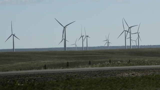
Lots of windmills out here.
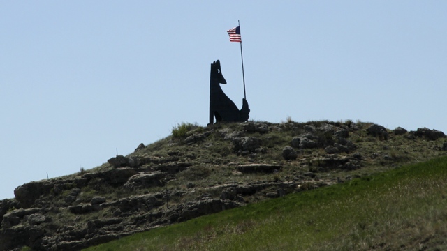
We made it to Nebraska.
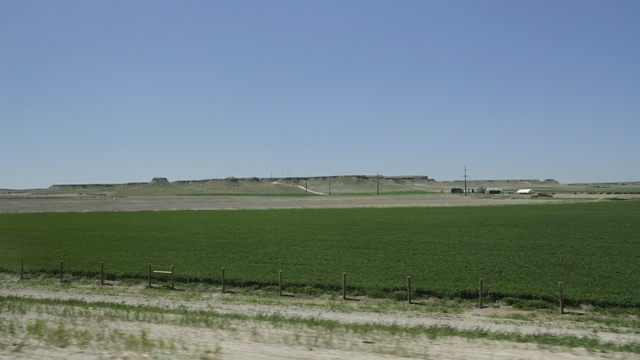
Nebraska has a lot of farmland and it's flat .... with a few bumps.
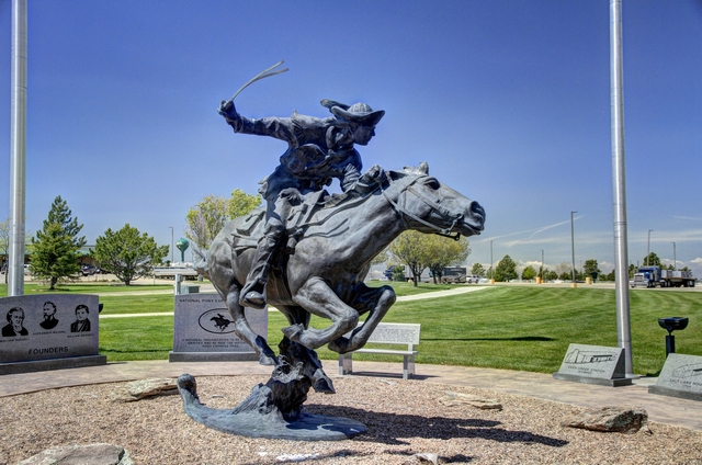
We stopped at a Cabela's and did a little shopping. Outside was a monument honoring the Pony Express.
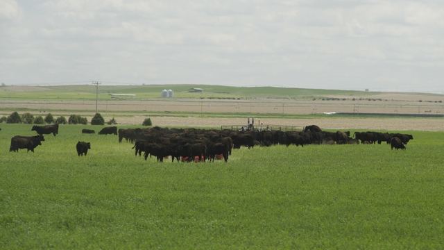
Lots of cattle in Nebraska.
A Tree in a Rock is found in the median between the east and west bound lanes of Interstate 80. This tree has been fascinating people since the 1860's when the first Union Pacific train rolled by.
Lots of windmills out here.
We made it to Nebraska.
Nebraska has a lot of farmland and it's flat .... with a few bumps.

We stopped at a Cabela's and did a little shopping. Outside was a monument honoring the Pony Express.
Lots of cattle in Nebraska.
2016/05/19: Salt Lake City, Utah to Laramie, Wyoming
Category: General
Posted by: The Agnew Family
We've been enjoying the drive east. The weather has been good with
mostly sun and cloud mix and just a little rain thrown in. The scenery
is beautiful and keeps changing.
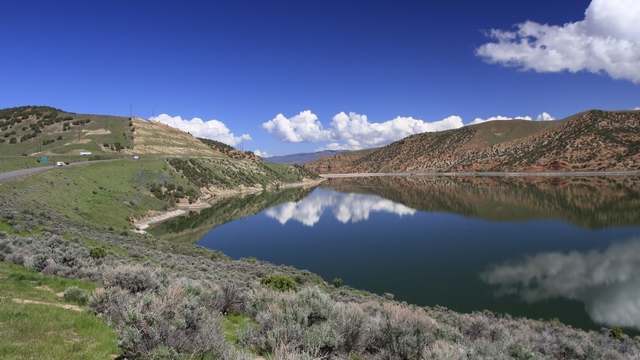
A lake in Utah.
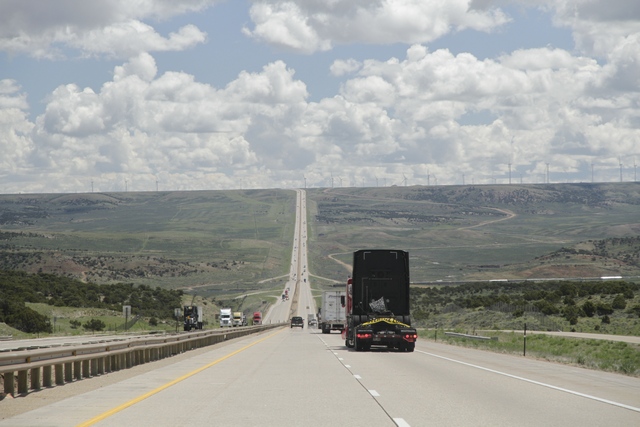
Not sure which state we were in when this photo was taken.
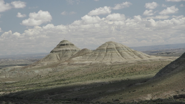
Wyoming
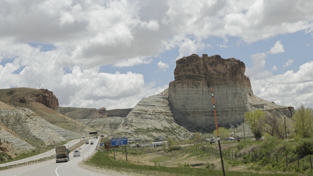
Wyoming
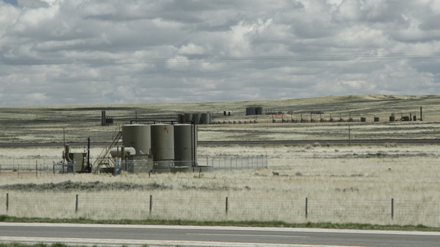
The hills were behind us and the land was mostly flat. Then I noticed these containers dotting the fields. We have no idea what they are for.
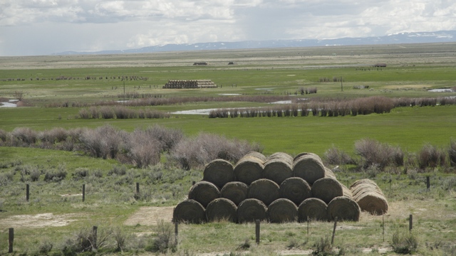
The piles of hay bales made more sense.
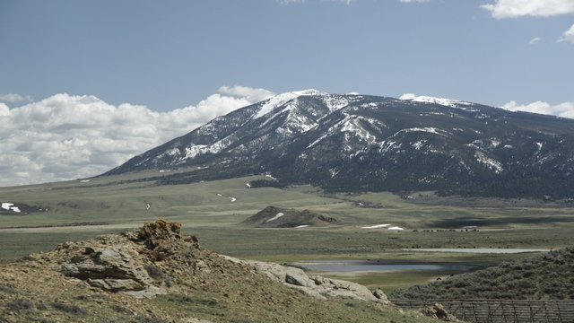
Gaining some altitude and hills.
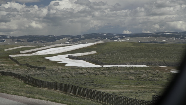
Remnants of snow behind "snow" fences. You know they get a lot of snow out here when you drive past signs that say "Road closed when flashing" and gates that cross the highway.
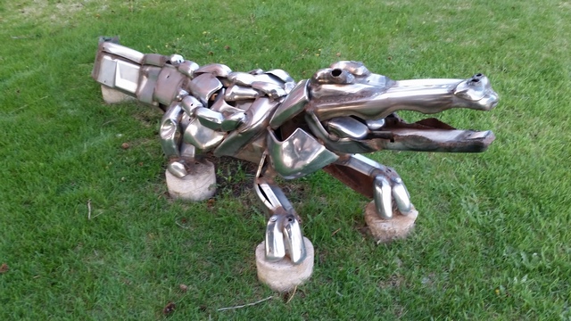
An ornament on a front lawn in Laramie. Ed was picking up a couple of geocaches and one was in the crocodile.
A lake in Utah.
Not sure which state we were in when this photo was taken.
Wyoming
Wyoming
The hills were behind us and the land was mostly flat. Then I noticed these containers dotting the fields. We have no idea what they are for.
The piles of hay bales made more sense.
Gaining some altitude and hills.
Remnants of snow behind "snow" fences. You know they get a lot of snow out here when you drive past signs that say "Road closed when flashing" and gates that cross the highway.

An ornament on a front lawn in Laramie. Ed was picking up a couple of geocaches and one was in the crocodile.
2016/05/19: Laramie, Wyoming to Kearney, Nebraska
Category: General
Posted by: The Agnew Family
Continuing to drive east on Interstate 80.

The tree in the rock is in the median between the east and west bound lanes of Interstate 80.
The tree in the rock is in the median between the east and west bound lanes of Interstate 80.
2016/05/17: Reno to Salt Lake City
Category: General
Posted by: The Agnew Family
When I was researching our trip to California it looked like Interstate
80 was the obvious route home. Then I read that interstate 80 was really
boring so I looked for an alternate route and found one that went thru
the middle of Nevada and joined up with interstate 70 thru Utah and the
mountains in Colorado. While we were in Reno we looked at the weather
for the this week and determined that we would be driving in the
mountains in the rain so we decided to go back to plane A and drive
interstate 80 and I'm glad we did at least this leg.
Nevada is rolling hills with snow capped mountains in the background and a couple of passes (though not too high) thrown in. Utah is salt flats and hills.
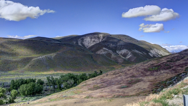
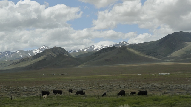
A lot of the area we drove thru is open without without structures. Occasionally, you'd see a mine, a commercial type building in the distance, farms, and cows. Towns were no more than 100 kilometers apart.
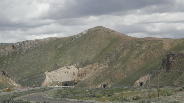
Interesting tunnels, one for each purpose, one for each train track and one for each direction of traffic. (the hill is obscuring one of the traffic tunnels). The tunnels were short as tunnels go.
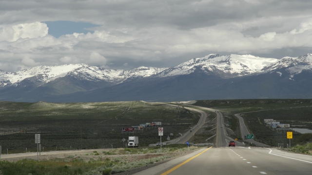
The highway.
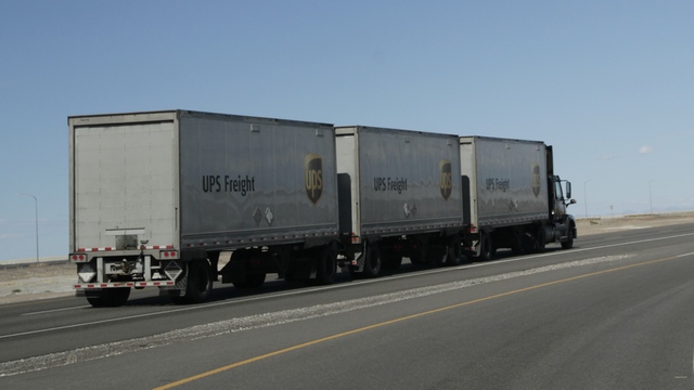
Utah and Nevada allow trains of three trailers pulled by one semi.
So you've been driving thru the a lot of hills and green then you start down a hill and there in front of you are salt flats. The view is stunning --- even Ed gasped at the beauty of it.
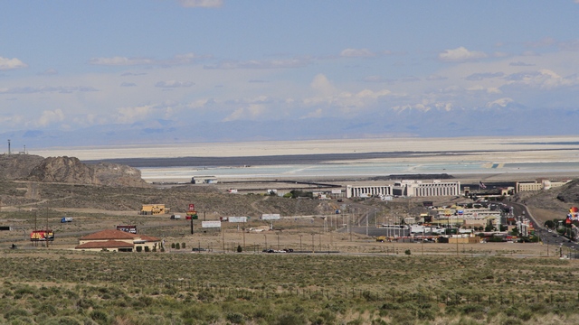
The photo doesn't do the view justice. The flat area just shimmered in the distance. This is the Bonneville Salt Flats which is where racers come to set land speed records.
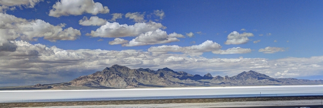
There is a rest area with an observation tower where you can look out over the salt flats.
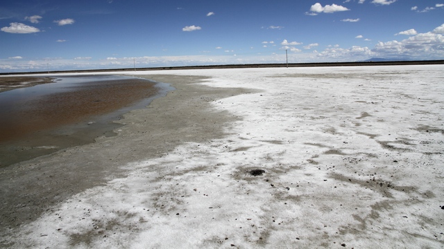
At the edge of the salt flats.
Nevada is rolling hills with snow capped mountains in the background and a couple of passes (though not too high) thrown in. Utah is salt flats and hills.

A lot of the area we drove thru is open without without structures. Occasionally, you'd see a mine, a commercial type building in the distance, farms, and cows. Towns were no more than 100 kilometers apart.
Interesting tunnels, one for each purpose, one for each train track and one for each direction of traffic. (the hill is obscuring one of the traffic tunnels). The tunnels were short as tunnels go.
The highway.
Utah and Nevada allow trains of three trailers pulled by one semi.
So you've been driving thru the a lot of hills and green then you start down a hill and there in front of you are salt flats. The view is stunning --- even Ed gasped at the beauty of it.
The photo doesn't do the view justice. The flat area just shimmered in the distance. This is the Bonneville Salt Flats which is where racers come to set land speed records.

There is a rest area with an observation tower where you can look out over the salt flats.
At the edge of the salt flats.
2016/05/16: Reno
Category: General
Posted by: The Agnew Family
When Ed and I spent a month in Las Vegas in 2005, Ed bet $1 in nickles
once. That was the entire amount he bet during our month there. So, you
ask what are we doing in Reno. We're having a rest day before we start
the long drive home. The room rate at Circus Circus is $59 US a night
(including taxes) and it's a nice three star hotel. We've been staying
in two star motels (Ed's found nice ones) that have been costing us more
the $60 US a night so the two nights at Circus Circus is a bit of a
treat.
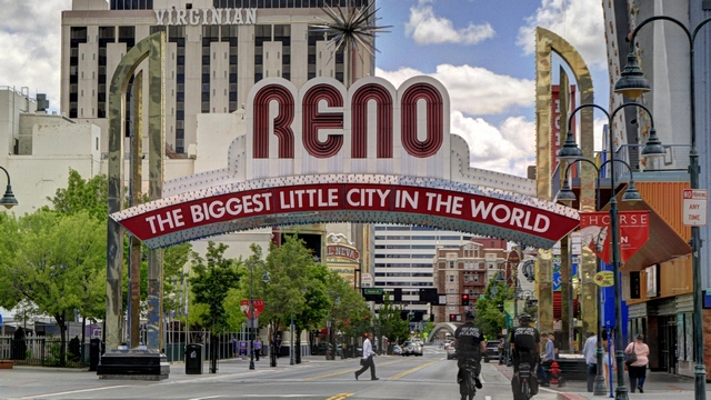
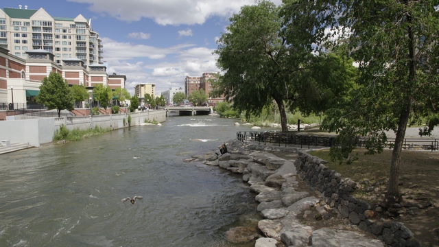
The River Walk.
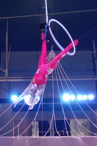
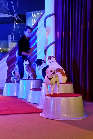
Circus Circus has a mid way and circus acts. The acts run every half hour or so and last between 5 and 10 minutes.

Proof that I actually played a slot machine. I put my $5 in the machine and managed to play for about 15 minutes.

The River Walk.


Circus Circus has a mid way and circus acts. The acts run every half hour or so and last between 5 and 10 minutes.

Proof that I actually played a slot machine. I put my $5 in the machine and managed to play for about 15 minutes.
Category: General
Posted by: The Agnew Family
The drive up the western side of Lake Tahoe is on a narrow winding road with beautiful views.
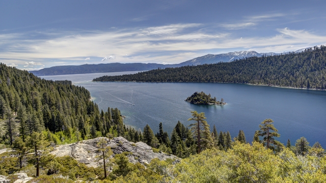
The view at Emerald Bay State Park.
In 1928, Mrs. Lora Josephine Knight bought the land at Emerald's Bay with the desire to build a summer home that would compliment the magnificent natural surroundings. Emerald Bay reminded her of fjords she had seen on numerous travels to Scandinavia. She commissioned her nephew by marriage, Lennart Palme, a Swedish architect, to design the home. Vikingsholm was completed in the fall of 1929. After being sold several times the land and Vikingsholm were donated to the state in the 1950's. A mile walk down a steep hill brings you to Vikingsholm.
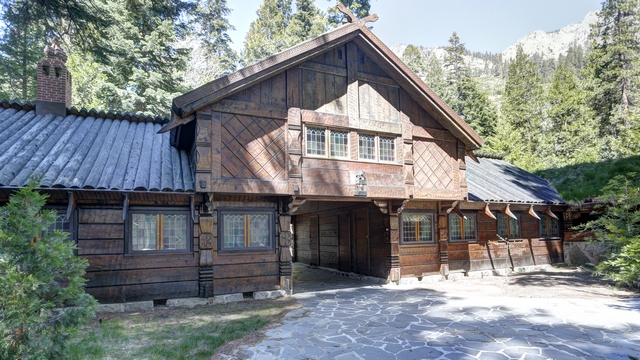
The first view of Vikingsholm.
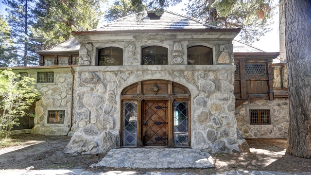
Walking thru the portal takes into the a courtyard and the main door of the castle.
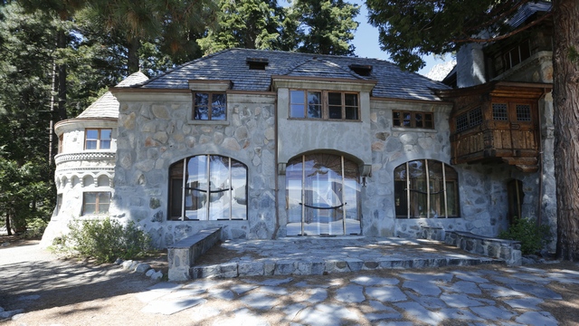
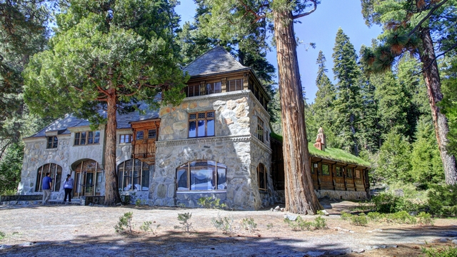
The beach side of Vikingsholm. On the left side is a turret and on the right is a tower. Two of the sides of Vikingsholm have sod roofs.
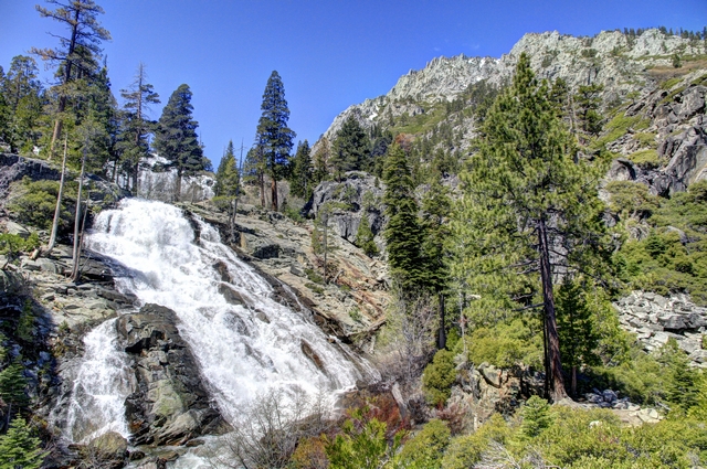
A short hike from Vikingsholm is Eagle Waterfalls.
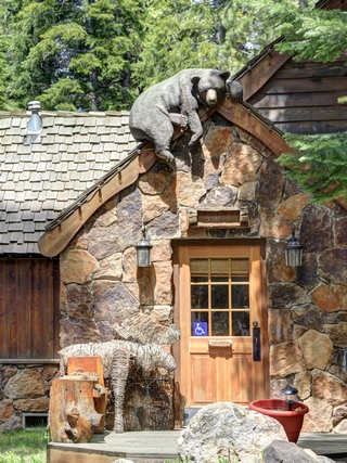
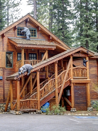
I like the home ornaments we saw as we continued our drive along the lake.
A couple more views.
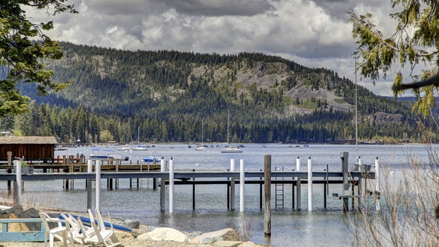
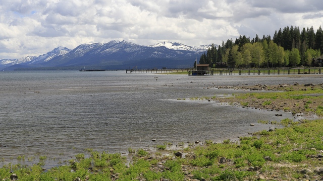
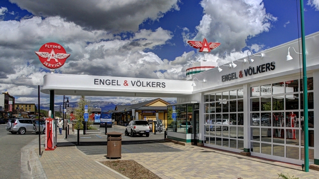
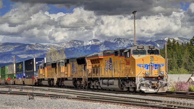
Our last stop in California was Truckee. This is an another "old west town" with a little of route 66 look thrown in.
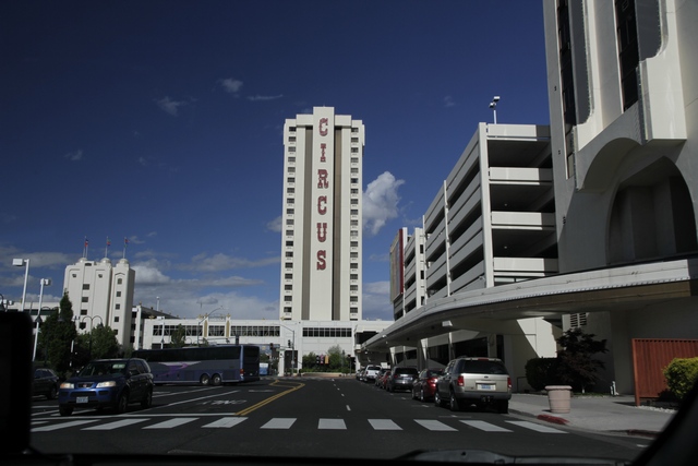
Next stop Circus, Circus in Reno, Nevada.

The view at Emerald Bay State Park.
In 1928, Mrs. Lora Josephine Knight bought the land at Emerald's Bay with the desire to build a summer home that would compliment the magnificent natural surroundings. Emerald Bay reminded her of fjords she had seen on numerous travels to Scandinavia. She commissioned her nephew by marriage, Lennart Palme, a Swedish architect, to design the home. Vikingsholm was completed in the fall of 1929. After being sold several times the land and Vikingsholm were donated to the state in the 1950's. A mile walk down a steep hill brings you to Vikingsholm.

The first view of Vikingsholm.

Walking thru the portal takes into the a courtyard and the main door of the castle.

The beach side of Vikingsholm. On the left side is a turret and on the right is a tower. Two of the sides of Vikingsholm have sod roofs.

A short hike from Vikingsholm is Eagle Waterfalls.


I like the home ornaments we saw as we continued our drive along the lake.
A couple more views.

Our last stop in California was Truckee. This is an another "old west town" with a little of route 66 look thrown in.


Next stop Circus, Circus in Reno, Nevada.
2016/05/14: Last Night in California
Category: General
Posted by: The Agnew Family
During our drive yesterday we drove through a number of small towns and
they all had the "western" look. I found it a bit surprising as I always
thought of Texas and Arizona as the "west". As we thought about it
more, we realized that the area we were driving through was part of the
gold rush and a lot of these towns were established during that time
(1800's) and it's actually the time period that gives the "western"
look. The history of the area is related to the gold rush, but today
instead of seeing mines you see wineries. Last night we stayed in the
town of Placerville and this morning we walked around the old downtown
area including the farmer's market.
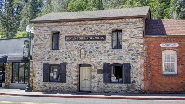
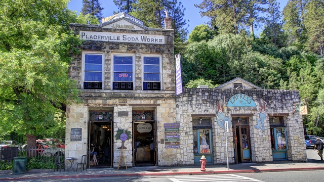
A couple of the old buildings.
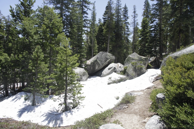
We drove through the mountains to South Lake Tahoe. As the elevation increased we saw snow in the bush. The height of this pass is lower than passes on the other roads I had look at driving which are still closed due to snow.
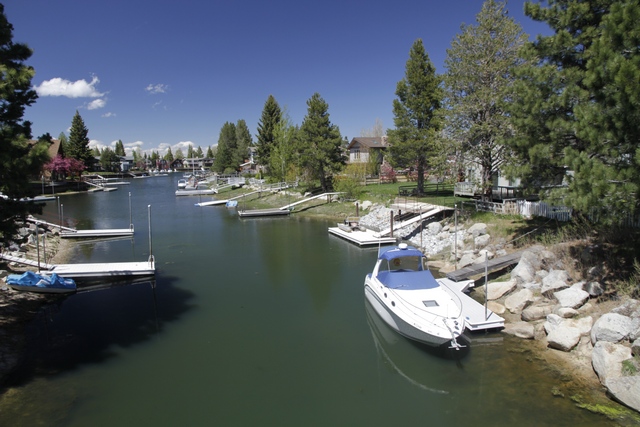
South Lake Tahoe. One way to increase water frontage is to build canals.
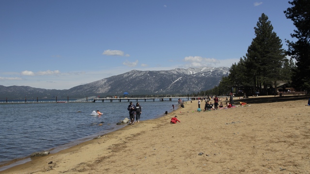
It took awhile but we finally found a beach access point. A few people were sitting on the beach and fewer were in the water --- by my guess the water was maybe 50 to 55 F.
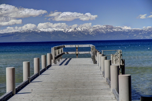
It was an interesting combination of bathing suits and snow capped mountains.
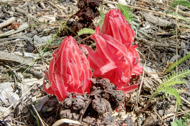
This plant is called sarcodes or snow plant or snow flower. I got this from the internet "Sarcodes is a monotypic genus of a single springtime flowering plant in the heath family (Ericaceae) containing the single species Sarcodes sanguinea, commonly called the snow plant or snow flower. It is a parasitic plant that derives sustenance and nutrients from mycorrhizal fungi that attach to roots of trees. Lacking chlorophyll, it is unable to photosynthesize.[1] Ectomycorrhizal (EM) symbioses involve a mutualism between a plant root and a fungus; the plant provides fixed carbon to the fungus and in return, the fungus provides mineral nutrients, water and protection from pathogens to the plant. The snow plant takes advantage of this mutualism by tapping into the network and stealing sugars from the photosynthetic partner by way of the fungus.[2] This form of parasitism is known as mycoheterotrophy." Maybe too much information but I thought it was interesting.
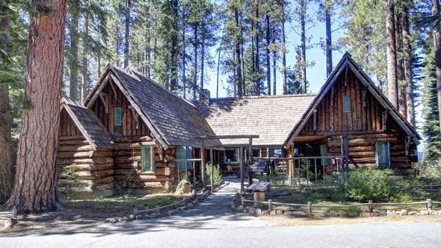
The beach we found was beside the Tallac Historic Site which consists of three estates one is from the late 1890's and the other two from the 1920's. They are examples of "Old Tahoe". This is the Baldwin house.
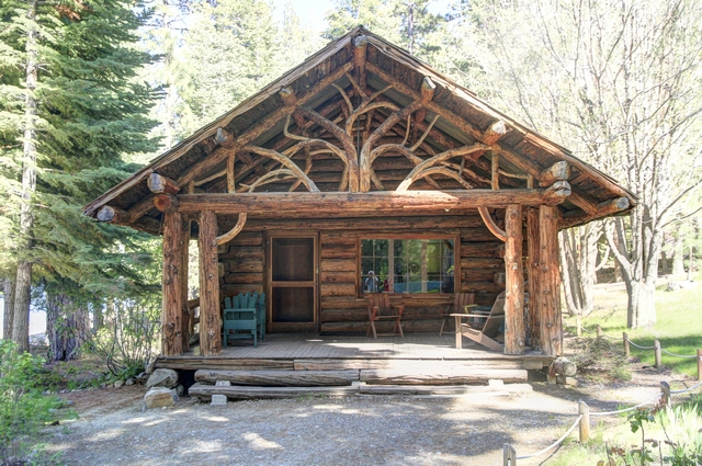
One of the cottages on the Pope estate. The homes are open for tours starting the Memorial Day weekend.

I've been avoiding posting food photos but this pizza tasted as good as it looked. It's called Acapulco Gold and is a cross between a pizza and a taco --- even has a cornmeal crust.
We timed our visit to South Lake Tahoe well as it is shoulder season (even weekend rates are reasonable) --- skiing is done and boating and hiking hasn't started yet.


A couple of the old buildings.
We drove through the mountains to South Lake Tahoe. As the elevation increased we saw snow in the bush. The height of this pass is lower than passes on the other roads I had look at driving which are still closed due to snow.
South Lake Tahoe. One way to increase water frontage is to build canals.
It took awhile but we finally found a beach access point. A few people were sitting on the beach and fewer were in the water --- by my guess the water was maybe 50 to 55 F.

It was an interesting combination of bathing suits and snow capped mountains.

This plant is called sarcodes or snow plant or snow flower. I got this from the internet "Sarcodes is a monotypic genus of a single springtime flowering plant in the heath family (Ericaceae) containing the single species Sarcodes sanguinea, commonly called the snow plant or snow flower. It is a parasitic plant that derives sustenance and nutrients from mycorrhizal fungi that attach to roots of trees. Lacking chlorophyll, it is unable to photosynthesize.[1] Ectomycorrhizal (EM) symbioses involve a mutualism between a plant root and a fungus; the plant provides fixed carbon to the fungus and in return, the fungus provides mineral nutrients, water and protection from pathogens to the plant. The snow plant takes advantage of this mutualism by tapping into the network and stealing sugars from the photosynthetic partner by way of the fungus.[2] This form of parasitism is known as mycoheterotrophy." Maybe too much information but I thought it was interesting.

The beach we found was beside the Tallac Historic Site which consists of three estates one is from the late 1890's and the other two from the 1920's. They are examples of "Old Tahoe". This is the Baldwin house.

One of the cottages on the Pope estate. The homes are open for tours starting the Memorial Day weekend.

I've been avoiding posting food photos but this pizza tasted as good as it looked. It's called Acapulco Gold and is a cross between a pizza and a taco --- even has a cornmeal crust.
We timed our visit to South Lake Tahoe well as it is shoulder season (even weekend rates are reasonable) --- skiing is done and boating and hiking hasn't started yet.
2016/05/13: More Big Trees
Category: General
Posted by: The Agnew Family
On the northern California coast we saw coast redwoods (Sequoia
sempervirens), today we are going to see another type of redwood, giant
sequoia (Sequoiadendron giganteum). Giant Sequoia only grow naturally on
the western slope of the Sierra Nevada (California).
The large grove of giant Sequoia trees at Yosemite National Park is closed for renovations so we popped into Calaveras State Park to visit the giant Sequoias there. According to Wikipedia "Giant sequoias are the world's largest single trees and largest living thing by volume. Giant sequoias grow to an average height of 50–85 m (164–279 ft) and 6–8 m (20–26 ft) in diameter. Record trees have been measured to be 94.8 m (311 ft) in height and over 17 m (56 ft) in diameter.[3] The oldest known giant sequoia based on ring count is 3,500 years old. Giant Sequoias are among the oldest living things on Earth."
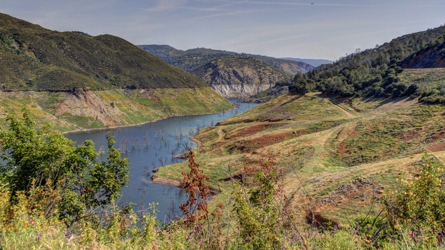
But before we get to the trees so we saw this great view.
We started our visit to the Giant Sequoias by hiking a 5 mile trail in the south grove.
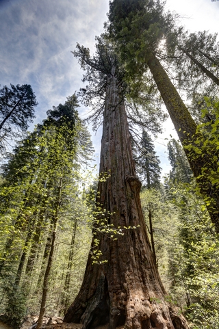
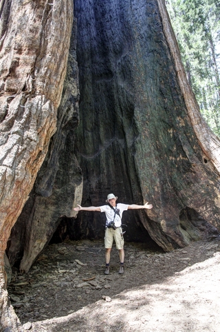
This tree is called Agassiz. This tree is ranked among the largest giant sequoias. Approximate dimensions are 25 feet in diameter at 6 feet above the ground and 250 feet tall. Your first view of the tree is the photo on the left. When you walk around the tree you see the result of fire damage. Ed's standing inside the tree with his arms out stretched to give you an idea of how large the fire scar is.
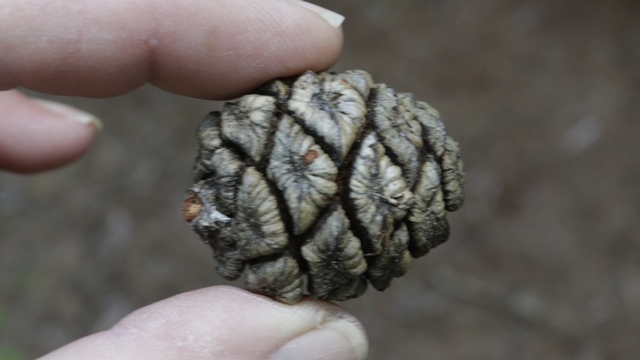
The cone from a Giant Sequoia is the size of an egg.
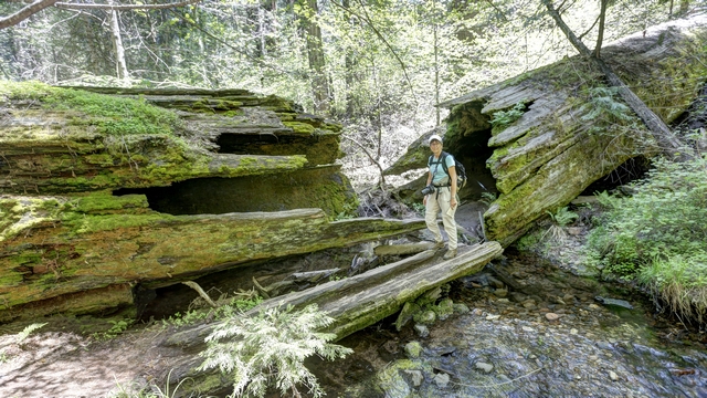
No one knows when this tree fell across the creek but it may have been lying here for centuries.
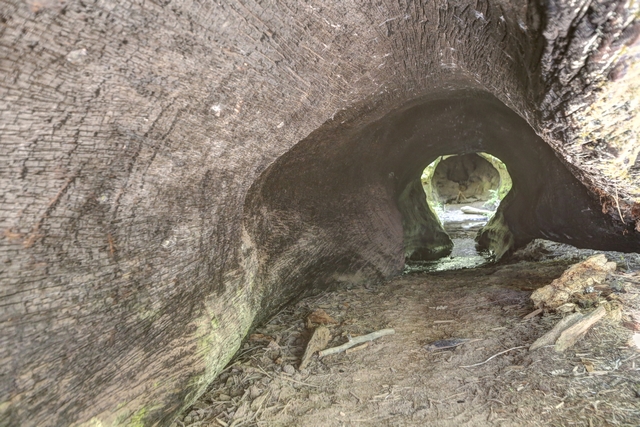
You can walk lengthwise through most of the tree if you don't mind getting your feet wet.
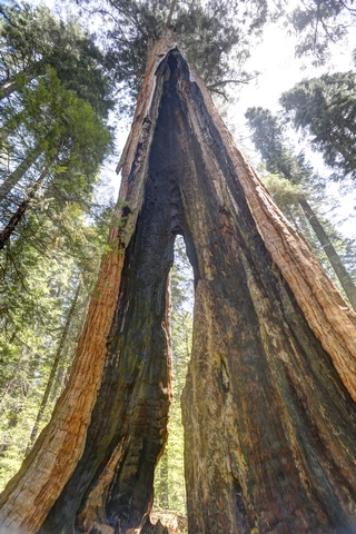
This tree is called Chimney Tree. This tree burned inside so severely that a chimney formed up through its broken top (you could see daylight when you looked up). The tree is still living as the sapwood which is found just inside the bark is transporting water and nutrients.
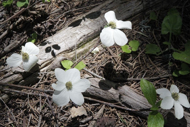
Giant Sequoias are part of the mixed coniferous forest. The most common trees of the mixed coniferous forest are Sugar Pine, White Fir, Incense Cedar, Ponderosa Pine, Mountain Dogwood (the photo is dogwood flowers) and Black Oak.
There is also a north grove at Calaveras State Park. This grove has been an active tourist spot since the late 1850's.
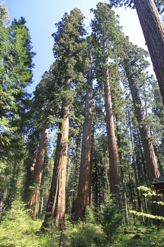
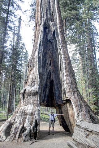
Rounded crowns and large branches (with diameters up to six feet) are typical of the older sequoias. The photo on the left is the Pioneer Cabin Tree. A tunnel was cut into the tree in the late 1880's to attract tourists.
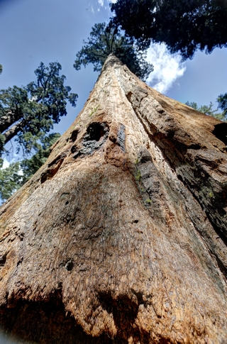
Standing beside a giant sequoia looking up.
The large grove of giant Sequoia trees at Yosemite National Park is closed for renovations so we popped into Calaveras State Park to visit the giant Sequoias there. According to Wikipedia "Giant sequoias are the world's largest single trees and largest living thing by volume. Giant sequoias grow to an average height of 50–85 m (164–279 ft) and 6–8 m (20–26 ft) in diameter. Record trees have been measured to be 94.8 m (311 ft) in height and over 17 m (56 ft) in diameter.[3] The oldest known giant sequoia based on ring count is 3,500 years old. Giant Sequoias are among the oldest living things on Earth."
But before we get to the trees so we saw this great view.

We started our visit to the Giant Sequoias by hiking a 5 mile trail in the south grove.


This tree is called Agassiz. This tree is ranked among the largest giant sequoias. Approximate dimensions are 25 feet in diameter at 6 feet above the ground and 250 feet tall. Your first view of the tree is the photo on the left. When you walk around the tree you see the result of fire damage. Ed's standing inside the tree with his arms out stretched to give you an idea of how large the fire scar is.
The cone from a Giant Sequoia is the size of an egg.

No one knows when this tree fell across the creek but it may have been lying here for centuries.

You can walk lengthwise through most of the tree if you don't mind getting your feet wet.

This tree is called Chimney Tree. This tree burned inside so severely that a chimney formed up through its broken top (you could see daylight when you looked up). The tree is still living as the sapwood which is found just inside the bark is transporting water and nutrients.
Giant Sequoias are part of the mixed coniferous forest. The most common trees of the mixed coniferous forest are Sugar Pine, White Fir, Incense Cedar, Ponderosa Pine, Mountain Dogwood (the photo is dogwood flowers) and Black Oak.
There is also a north grove at Calaveras State Park. This grove has been an active tourist spot since the late 1850's.

Rounded crowns and large branches (with diameters up to six feet) are typical of the older sequoias. The photo on the left is the Pioneer Cabin Tree. A tunnel was cut into the tree in the late 1880's to attract tourists.

Standing beside a giant sequoia looking up.
2016/05/12: Hiking
Category: General
Posted by: The Agnew Family
Our schedule allowed for another half day in Yosemite and instead of
driving to Glacier Point to see the views we decided to hike the Mirror
Lake Trail. It's an easy 2.5 mile trail but activity won over sitting as
we'll soon be doing the big drive home and sitting a lot.
Mirror Lake really isn't a lake at all but more of a very large widening of the creek in the spring. In the summer mirror lake is dry.
Mirror Lake is a beautiful spot and it's was too hard to pick my favourite photo so I've included a few.
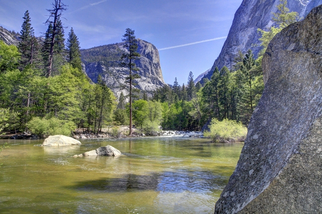
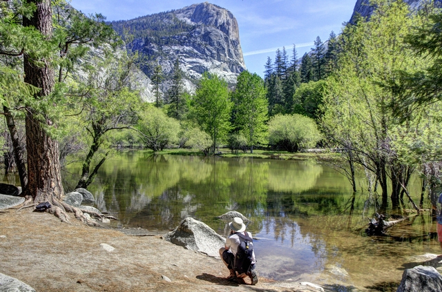
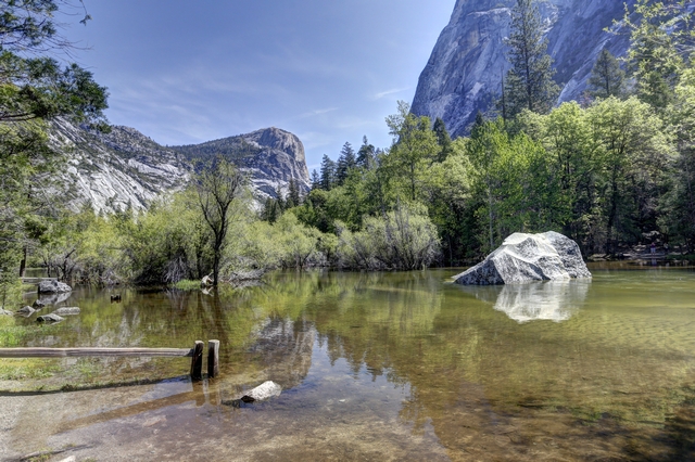
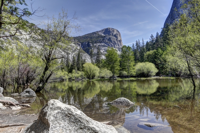
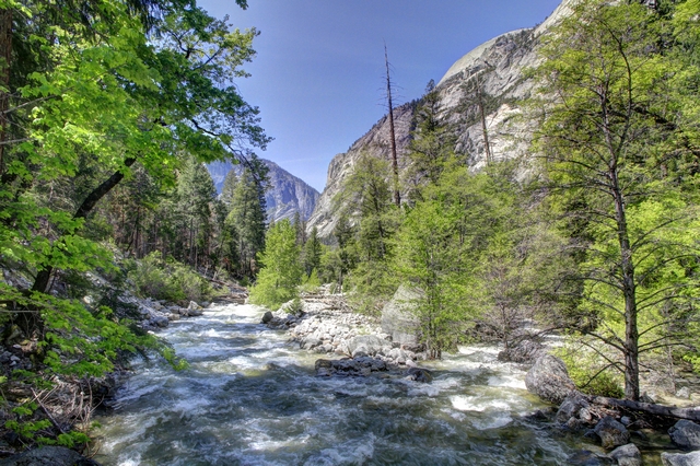
The creek that creates Mirror Lake.
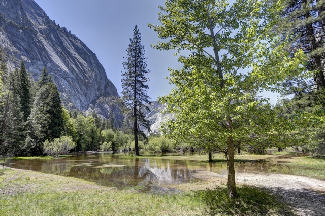
Mirror Lake from the other side.
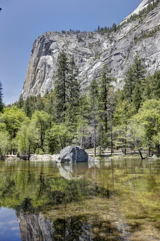
This photo really shows the mirror affect.
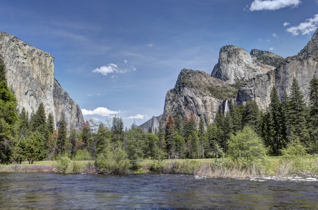
We stopped at a view point as we were driving out of the park to have one last look at Yosemite Valley.
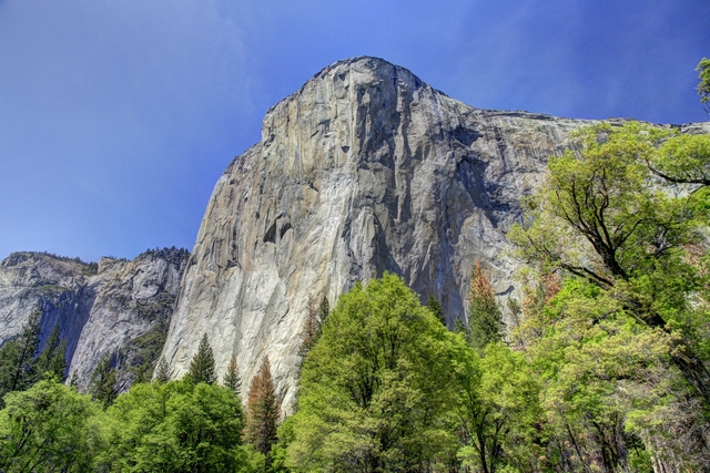
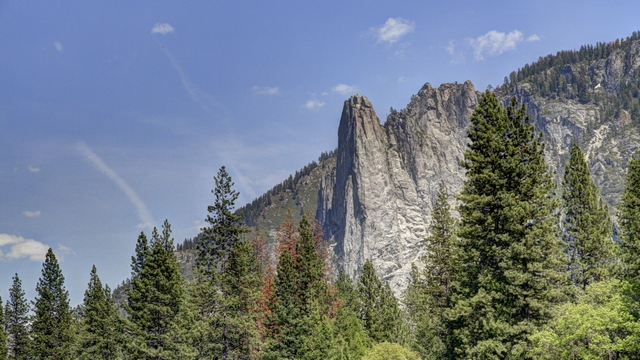
It would have been nice to have had more time to spend at Yosemite but between the price of accommodations and the crowds we were happy to leave. We didn't tent here as you need to reserve a spot about 6 months ahead.
Mirror Lake really isn't a lake at all but more of a very large widening of the creek in the spring. In the summer mirror lake is dry.
Mirror Lake is a beautiful spot and it's was too hard to pick my favourite photo so I've included a few.


The creek that creates Mirror Lake.

Mirror Lake from the other side.

This photo really shows the mirror affect.
We stopped at a view point as we were driving out of the park to have one last look at Yosemite Valley.


It would have been nice to have had more time to spend at Yosemite but between the price of accommodations and the crowds we were happy to leave. We didn't tent here as you need to reserve a spot about 6 months ahead.
2016/05/11: Lots of Rocks and Waterfalls
Category: General
Posted by: The Agnew Family
Yosemite National Park is very beautiful and busier than I expected as
the main season hasn't started yet (Memorial Day is the official start
of the busy season and that's still two weeks away). Even though all of
the open campgrounds and hotels are sold out a lot of services
(restaurants, horseback riding,etc.) are not open yet. I don't think
I'd want to visit Yosemite in the middle of the summer --- I know Ed
wouldn't like it at all. One interesting thing about visiting Yosemite
is that it feels like the United Nations, every where you go you hear
many different languages being spoken.
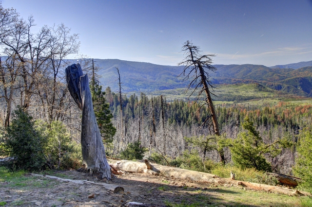
Several years ago there was a fire in and around Yosemite. There are many burnt dead trees, a number of slightly burnt live trees and new growth --- shrubs, young trees and grasses abound.
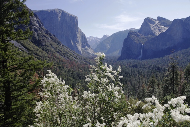
A view across Yosemite Valley from Tunnel View.
May and June are good months to visit Yosemite National Park if you want to see waterfalls. Melting snow in the mountains guarantees lots of water in the waterfalls. The water rushes over the falls so hard and fast that at times it sounds like thunder.
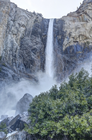
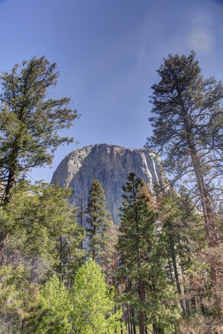
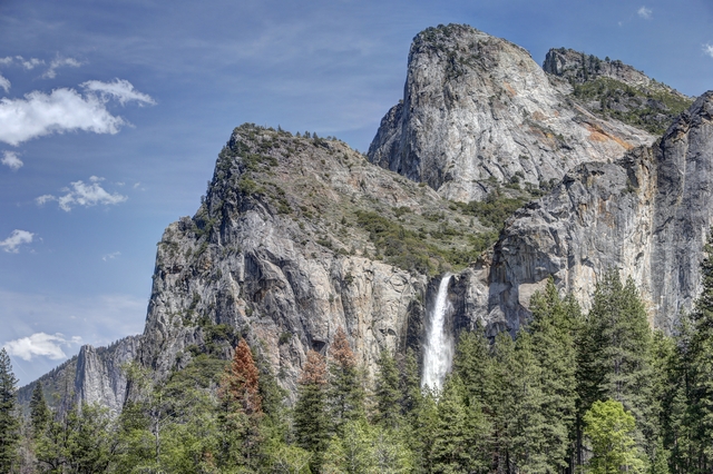
Bridal Veil Falls. Not sure which rock this is.
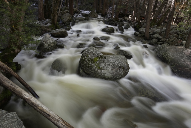
An art shot of the river at the bottom of Bridal Veil falls.
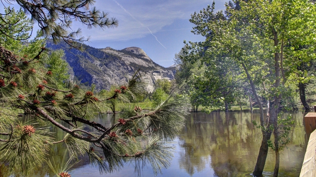
I just like this photo.
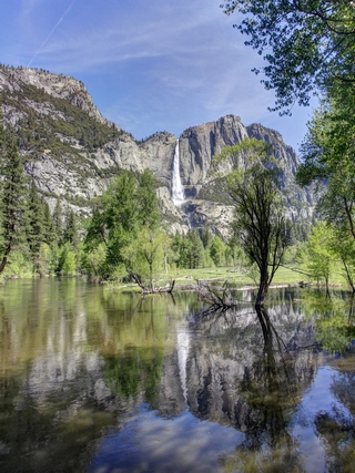
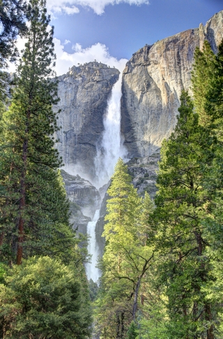
Upper Yosemite Falls can be see from many places in the valley but you can only see Upper and Lower Yosemite Falls together from one trail.
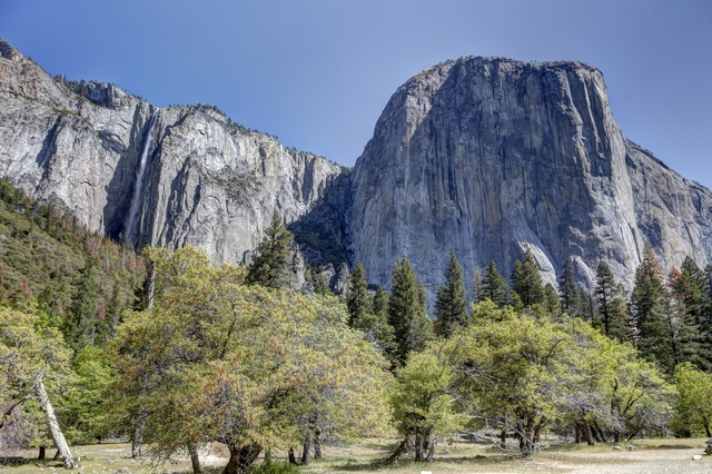
El Capitan is a vertical rock formation. The granite monolith extends about 3,000 feet from base to summit along its tallest face and is one of the world's favorite challenges for rock climbers and BASE jumpers.
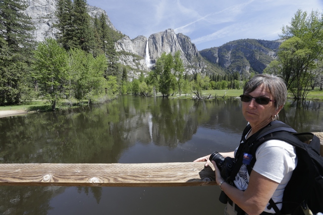
Upper Yosemite Falls and me. Occasionally there needs to be a photo where I'm the main subject.
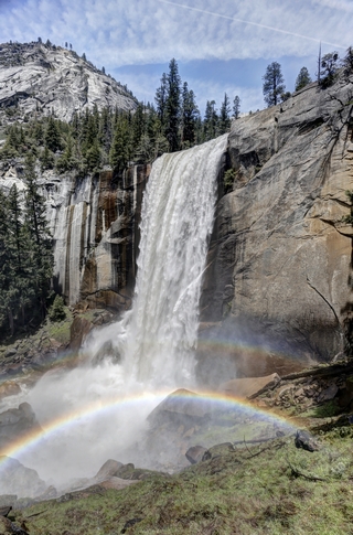
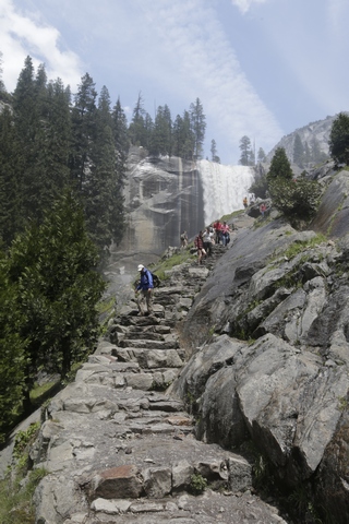
We hiked about three quarters of the way up to the top of Vernal Falls (once we got equal to the falls we decided we had gone far enough) following a trail called the Mist Trail. Part of the hike was like being on the Maid of Mist at Niagara Falls. We were pretty wet by time we stopped hiking. The second photo is me on the way down. I'm the blue person --- I dug my raincoat out of my backpack (didn't make me any drier but kept me warmer).
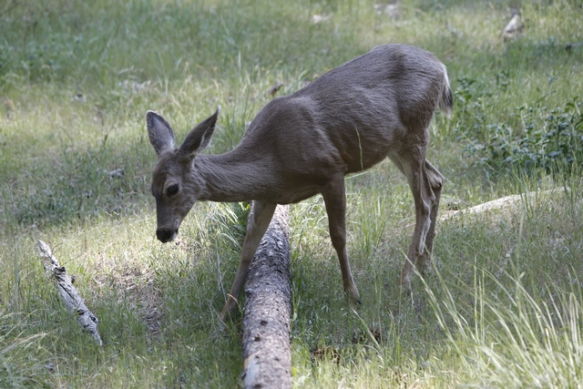
This deer found some tasty food near the entrance to the Lower Yosemite Trail (a very busy area). People were excited and followed it around a bit keeping their distance. The deer didn't care. She ignored everyone and kept eating. The animals that are around Yosemite Village are not afraid of people. In fact, I saw one fast young man reach out and touch a squirrel on it's head.

Several years ago there was a fire in and around Yosemite. There are many burnt dead trees, a number of slightly burnt live trees and new growth --- shrubs, young trees and grasses abound.
A view across Yosemite Valley from Tunnel View.
May and June are good months to visit Yosemite National Park if you want to see waterfalls. Melting snow in the mountains guarantees lots of water in the waterfalls. The water rushes over the falls so hard and fast that at times it sounds like thunder.


Bridal Veil Falls. Not sure which rock this is.
An art shot of the river at the bottom of Bridal Veil falls.

I just like this photo.


Upper Yosemite Falls can be see from many places in the valley but you can only see Upper and Lower Yosemite Falls together from one trail.

El Capitan is a vertical rock formation. The granite monolith extends about 3,000 feet from base to summit along its tallest face and is one of the world's favorite challenges for rock climbers and BASE jumpers.
Upper Yosemite Falls and me. Occasionally there needs to be a photo where I'm the main subject.

We hiked about three quarters of the way up to the top of Vernal Falls (once we got equal to the falls we decided we had gone far enough) following a trail called the Mist Trail. Part of the hike was like being on the Maid of Mist at Niagara Falls. We were pretty wet by time we stopped hiking. The second photo is me on the way down. I'm the blue person --- I dug my raincoat out of my backpack (didn't make me any drier but kept me warmer).
This deer found some tasty food near the entrance to the Lower Yosemite Trail (a very busy area). People were excited and followed it around a bit keeping their distance. The deer didn't care. She ignored everyone and kept eating. The animals that are around Yosemite Village are not afraid of people. In fact, I saw one fast young man reach out and touch a squirrel on it's head.
2016/05/10: Longish Drive
Category: General
Posted by: The Agnew Family
The motel we stayed at last night included a limited menu selection at a
local restaurant as the motel breakfast. The restaurant was about 5 km
away from the motel (but at least it was in the correct direction for
us) and of course took more time than the average continental breakfast
at a motel, plus tipping the waitress was the correct thing to do. Still
$2 for a good breakfast is cheap. There was a variety of choices and we
had plenty to eat and it was tasty. Anyway this was a first for us.
Today is a driving day. We are going from Redding to Buck Meadows (12 miles from the Yosemite's east gate about 500 km. The road was fairly flat and straight as we passed several cities including Sacramento and many fields of orchards.
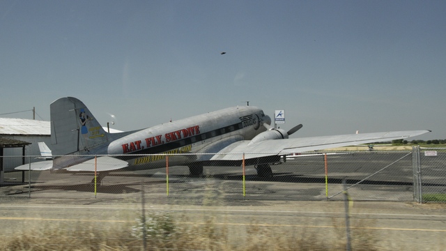
Ed loves DC3s and saw this one beside the highway.
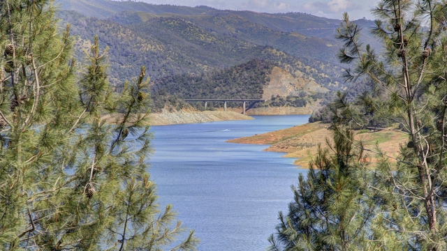
The Don Pedro reservoir. Water from this reservoir goes to San Francisco.
A pretty flower near the motel where we are staying.
Today is a driving day. We are going from Redding to Buck Meadows (12 miles from the Yosemite's east gate about 500 km. The road was fairly flat and straight as we passed several cities including Sacramento and many fields of orchards.
Ed loves DC3s and saw this one beside the highway.

The Don Pedro reservoir. Water from this reservoir goes to San Francisco.
A pretty flower near the motel where we are staying.
2016/05/09: Sun and Warmth
Category: General
Posted by: The Agnew Family
Our drive up the west coast of California is over so it's time to move
inland. We're skipping lots of places and going to Yosemite which is a
two day drive. Instead of back tracking we decided to drive a slightly
longer route going through a small piece of Oregon before re-entering
California. It was a bright sunny day today and the temperature rose
steadily as we moved away from the coast. When we left California we
also left the redwoods behind. It didn't take long for pines to be the
dominate trees we saw.
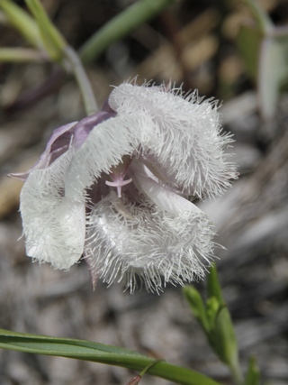
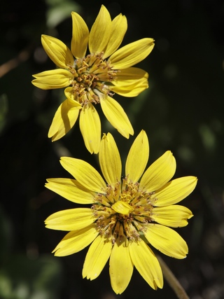
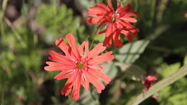
Found these wild flowers when Ed stopped to get a geocache in Oregon.
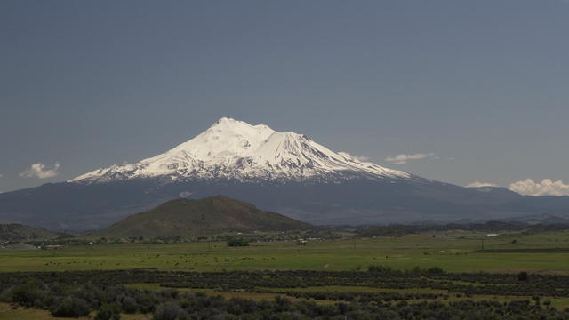
Mount Shasta is a potentially active volcano located at the southern end of the Cascade Range in California. At an elevation of 14,179 feet, it is the second highest peak in the Cascades and the fifth highest in California.
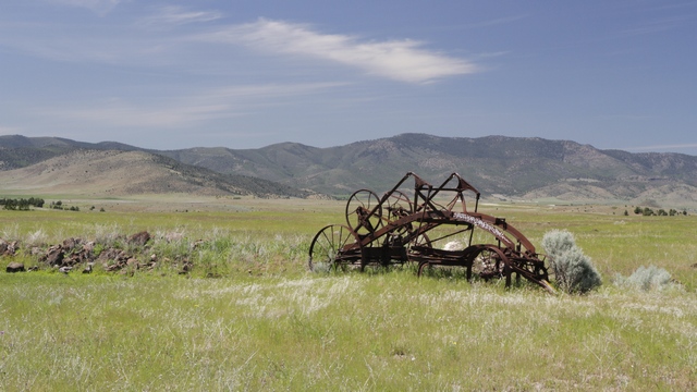
This view was at a rest stop in California.
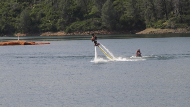
Lake Shasta is a reservoir which is 34.8 miles long and a square area of 46.87 square miles. At the spot we stopped there were two houseboat rental marinas and a marina for owned boats. We've seen a water jet pack on TV but this is the first time we've seen one in person.
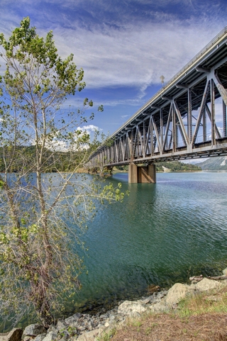
A bridge over Lake Shasta.
We stopped for the night in Redding. The "thing to see" in Redding is the Sundial Bridge.
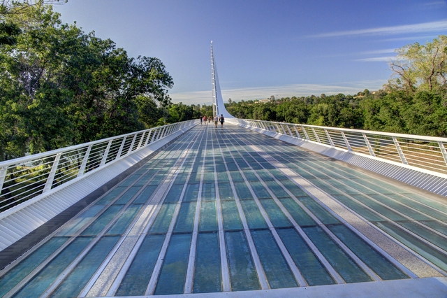
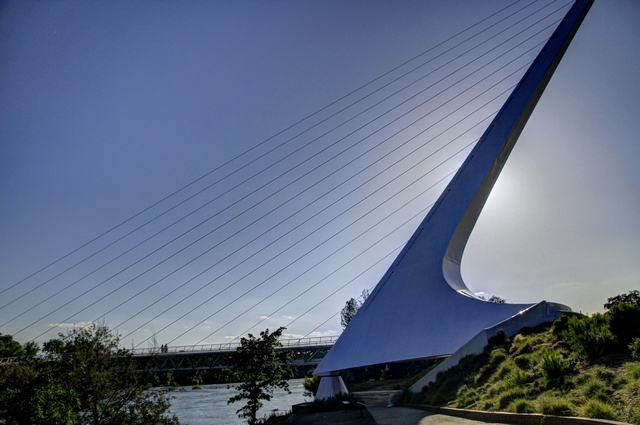
The Sundial Bridge is a cantilever spar cable-stayed bridge for bicycles and pedestrians that spans the Sacramento River and forms a large sundial. It was designed by Santiago Calatrava and completed in 2004 at a cost of US$23,500,000. The floor of the bridge is glass panels.
Tomorrow we finish the drive to Yosemite and will not have internet access for two nights we are there. Should be back on line on Thursday.
Found these wild flowers when Ed stopped to get a geocache in Oregon.
Mount Shasta is a potentially active volcano located at the southern end of the Cascade Range in California. At an elevation of 14,179 feet, it is the second highest peak in the Cascades and the fifth highest in California.
This view was at a rest stop in California.
Lake Shasta is a reservoir which is 34.8 miles long and a square area of 46.87 square miles. At the spot we stopped there were two houseboat rental marinas and a marina for owned boats. We've seen a water jet pack on TV but this is the first time we've seen one in person.

A bridge over Lake Shasta.
We stopped for the night in Redding. The "thing to see" in Redding is the Sundial Bridge.

The Sundial Bridge is a cantilever spar cable-stayed bridge for bicycles and pedestrians that spans the Sacramento River and forms a large sundial. It was designed by Santiago Calatrava and completed in 2004 at a cost of US$23,500,000. The floor of the bridge is glass panels.

Tomorrow we finish the drive to Yosemite and will not have internet access for two nights we are there. Should be back on line on Thursday.
2016/05/08: Last Day of Trees
Category: General
Posted by: The Agnew Family
I think Ed and I both are getting tired and tired of hotels and decided
to camp for a couple of nights (last night and tonight) making today a
quiet day.
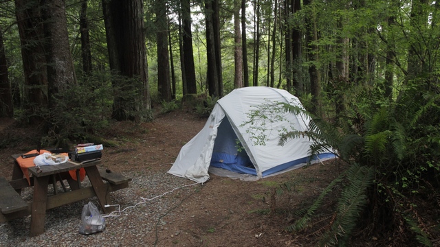
We're camping in a bit of style --- we have electricity and water and are still camped among the redwoods.
There's a scenic route very close to where we are staying that we told was very good.
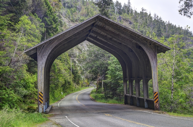
Surprised to see a covered bridge in California.
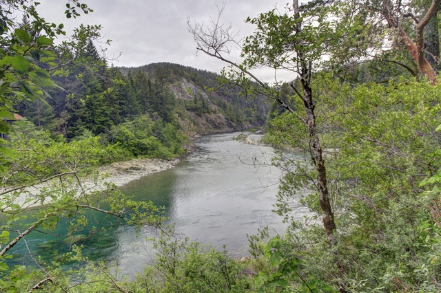
The Smith River runs along side of the Howland Hill Road (the scenic drive).
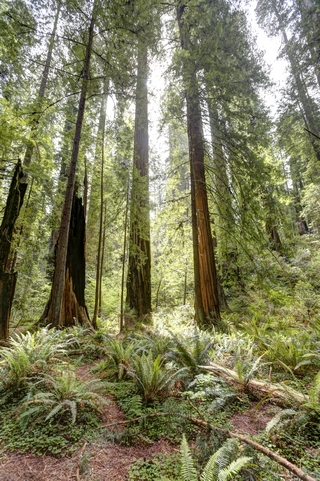
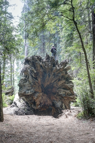
We were much happier today as the sun was shining. We hike in the Stout Grove and came across a group of people sitting on a fallen tree. If you look closely you'll see someone on top of the root mass.
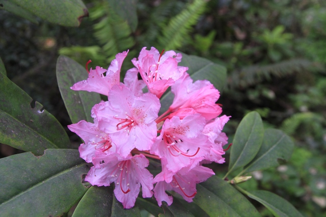
There were lots of rhododendrons here as well.
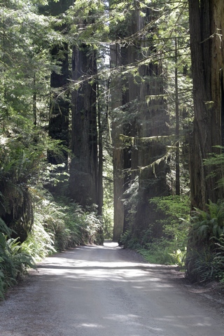
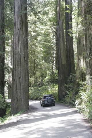
The Howland Hill Road was a true drive thru the redwoods. A lot of the bends in the road were to go around trees and there were a couple of spots where Ed went really slow to squeeze between the trees. We had lots of room at this spot.
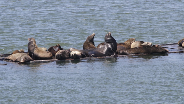
The road ended near Crescent City so we drove in to have a look around. Look who we found lazing about the harbour. We watched the black shiny sea lion climb up.
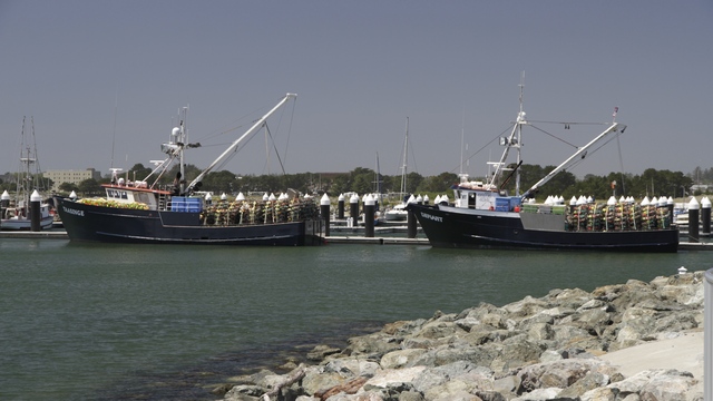
Crab season is late this year, but it must be opening soon. A lot of boats have their crab traps on board and they were busy on the dock moving traps around. We seen lots of tsunami warn signs during our drive up the coast. We better understand the reason for them after our visit to the harbour today. Crescent City has been the victim of several tsunamis --- the ones in 1964 and 2011 destroyed the harbour. Explains the pretty new docks.
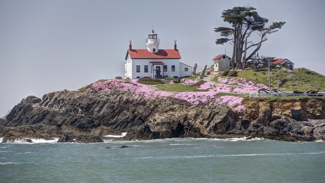
Battery Point Lighthouse. I think the lighthouse is only accessible by road during low tide. It was high tide when we were there and the road was flooded.
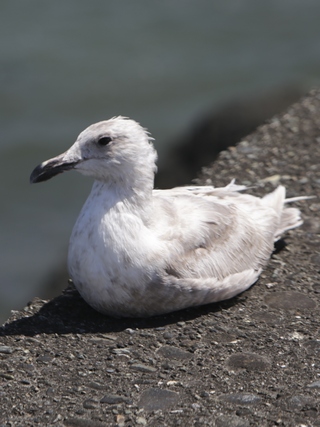
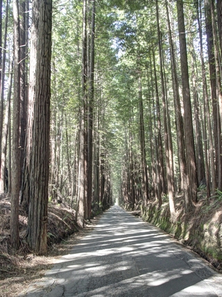
Cute fellow on the pier. As it was a quiet day, Ed managed to sneak some geocaching in. One of the caches took us down this tree lined road.
We're camping in a bit of style --- we have electricity and water and are still camped among the redwoods.
There's a scenic route very close to where we are staying that we told was very good.

Surprised to see a covered bridge in California.

The Smith River runs along side of the Howland Hill Road (the scenic drive).


We were much happier today as the sun was shining. We hike in the Stout Grove and came across a group of people sitting on a fallen tree. If you look closely you'll see someone on top of the root mass.
There were lots of rhododendrons here as well.
The Howland Hill Road was a true drive thru the redwoods. A lot of the bends in the road were to go around trees and there were a couple of spots where Ed went really slow to squeeze between the trees. We had lots of room at this spot.
The road ended near Crescent City so we drove in to have a look around. Look who we found lazing about the harbour. We watched the black shiny sea lion climb up.
Crab season is late this year, but it must be opening soon. A lot of boats have their crab traps on board and they were busy on the dock moving traps around. We seen lots of tsunami warn signs during our drive up the coast. We better understand the reason for them after our visit to the harbour today. Crescent City has been the victim of several tsunamis --- the ones in 1964 and 2011 destroyed the harbour. Explains the pretty new docks.

Battery Point Lighthouse. I think the lighthouse is only accessible by road during low tide. It was high tide when we were there and the road was flooded.

Cute fellow on the pier. As it was a quiet day, Ed managed to sneak some geocaching in. One of the caches took us down this tree lined road.
2016/05/07: Foggy, foggy day
Category: General
Posted by: The Agnew Family
Ah, weather just the way the Redwoods like it. Cool, foggy, drizzly ---
perfect. Well, not so great for photos --- same tune I've been whining
for several days now.
Last night after dinner we walked around Eureka cameraless missing several great photo ops. So, this morning we toured Eureka. There's a beautiful harbour and a quaint Victorian downtown.
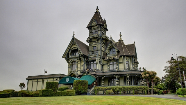
The Carson Mansion is owned by a private club (The Ingomar Club) that maintains the building and grounds while providing fine dining and social experiences for its members.
Continuing north we reach The Redwoods State and National Parks.
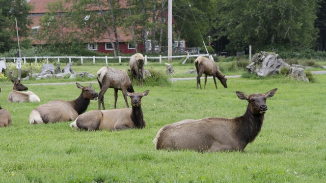
We know we've arrived when we see this herd of Elk. There are seven herds of elk in the park.
Lady Bird Johnson Grove is stands of old-growth redwood, Douglas fir and tanoak and is the site where Lady Bird Johnson dedicated Redwood National Park in 1968.
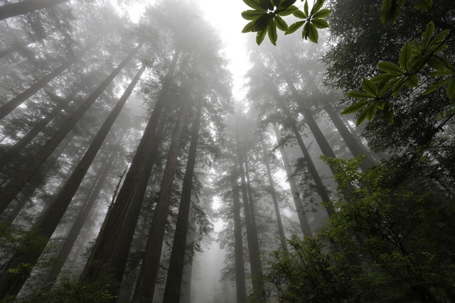
This stand of redwoods is different from the ones we walked through yesterday. The trees seem larger in diameter (which means they are older), the density of trees is less leading to more variety in under growth.
This grove is also home to some wildflowers and rhododendrons.
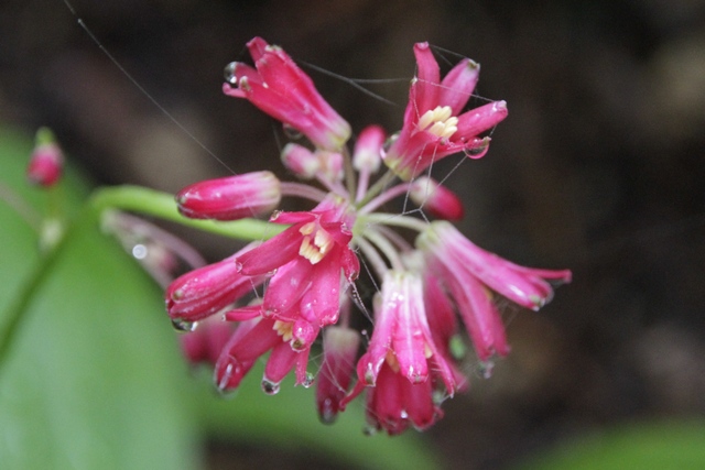
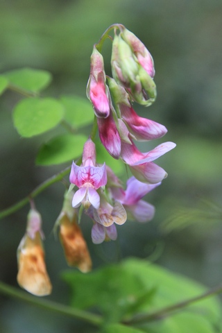
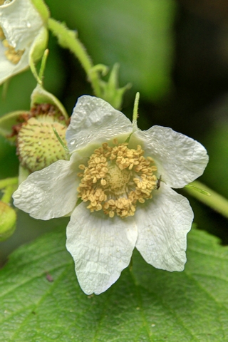
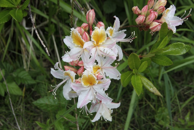
The rhododendrons added an entire new dimension (colour) to the walking around a redwood stand.
Another interesting place in the park is Fern canyon.
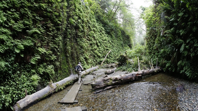
Fern Canyon is a narrow canyon where the 50 foot walls are completely covered by ferns and mosses and are dripping with moisture. Steven Spielberg chose Fern Canyon as a location for Jurassic Park 2: The Lost World.
We hiked another trail called the Cathedral Trees Trail which took us pass many very large trees and groups of trees (3, 4 or more trees growing close together and sometimes merging at the bottom).
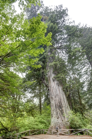
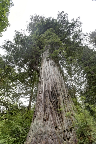
One tree the trail took us to was the big tree. In the left photo I'm standing beside the tree and the right photo is looking up.The big tree is
height 304 feet or 92.6 meters
diameter 21.6 feet or 6.6 meters
circumference 68 feet or 20.7 meters
estimated age 1500 years
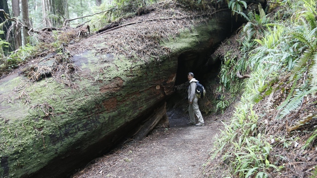
Instead of cutting a chunk out of the tree, they made a tunnel.
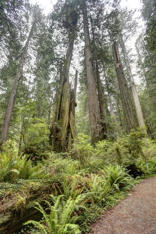
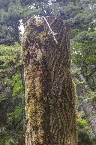
The floor of the forest is generally covered by ferns. The part of tree in the photo on the right should have an interesting story to tell. There are several chainsaw score marks on the trunks in about 3 foot increments and a chainsaw chain stuck in the top cut about 12 feet from the ground. Too bad the tree wouldn't talk.
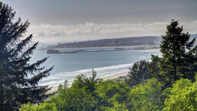
We plan to spend the night just north of Crescent City. About 5 minutes south of Crescent City, the sun appeared and we had clear sky. Just because it was sunny we stopped and took this photo as we were descending to Crescent City.
Last night after dinner we walked around Eureka cameraless missing several great photo ops. So, this morning we toured Eureka. There's a beautiful harbour and a quaint Victorian downtown.

The Carson Mansion is owned by a private club (The Ingomar Club) that maintains the building and grounds while providing fine dining and social experiences for its members.
Continuing north we reach The Redwoods State and National Parks.
We know we've arrived when we see this herd of Elk. There are seven herds of elk in the park.
Lady Bird Johnson Grove is stands of old-growth redwood, Douglas fir and tanoak and is the site where Lady Bird Johnson dedicated Redwood National Park in 1968.
This stand of redwoods is different from the ones we walked through yesterday. The trees seem larger in diameter (which means they are older), the density of trees is less leading to more variety in under growth.
This grove is also home to some wildflowers and rhododendrons.

The rhododendrons added an entire new dimension (colour) to the walking around a redwood stand.
Another interesting place in the park is Fern canyon.
Fern Canyon is a narrow canyon where the 50 foot walls are completely covered by ferns and mosses and are dripping with moisture. Steven Spielberg chose Fern Canyon as a location for Jurassic Park 2: The Lost World.
We hiked another trail called the Cathedral Trees Trail which took us pass many very large trees and groups of trees (3, 4 or more trees growing close together and sometimes merging at the bottom).


One tree the trail took us to was the big tree. In the left photo I'm standing beside the tree and the right photo is looking up.The big tree is
height 304 feet or 92.6 meters
diameter 21.6 feet or 6.6 meters
circumference 68 feet or 20.7 meters
estimated age 1500 years
Instead of cutting a chunk out of the tree, they made a tunnel.


The floor of the forest is generally covered by ferns. The part of tree in the photo on the right should have an interesting story to tell. There are several chainsaw score marks on the trunks in about 3 foot increments and a chainsaw chain stuck in the top cut about 12 feet from the ground. Too bad the tree wouldn't talk.

We plan to spend the night just north of Crescent City. About 5 minutes south of Crescent City, the sun appeared and we had clear sky. Just because it was sunny we stopped and took this photo as we were descending to Crescent City.
2016/05/06: I've Never Been in So Many Photos
Category: General
Posted by: The Agnew Family
We drove north up the coast some more but again it was hazy so didn't
bother with taking a lot of photos. Did manage to get one that I think
is OK.
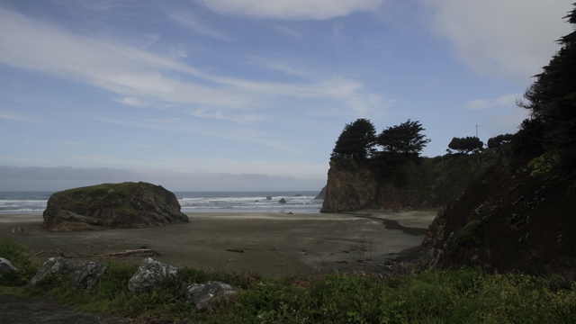
Ed stopped to find a geocache so I snapped a few photos.
Hard to believe but Ed was actually getting tired of all the hills and turns and was happy when the road turned inland and became a little straighter and flatter. Maybe it was seeing a police car, flares on the road and a car down an embankment that made Ed tire of the coastal road.
Avenue of Giants is a section of the old highway 101 that runs pretty much parrallel to the freeway (the new highway 101). The road gets it name from the many groves of redwoods that the road passes thru.
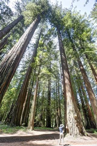
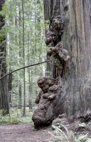
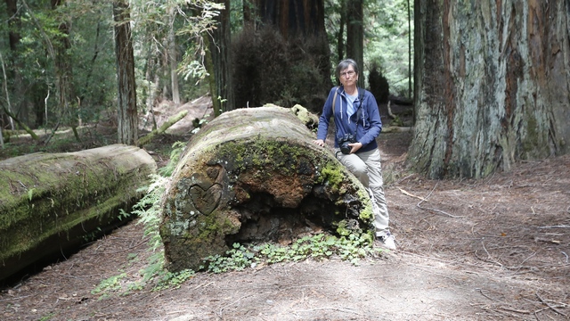
Ed and I are in a lot of the photos today to help show the size of the trees. Here I'm taking a photo. The photo on the right is of some burls on a redwood.
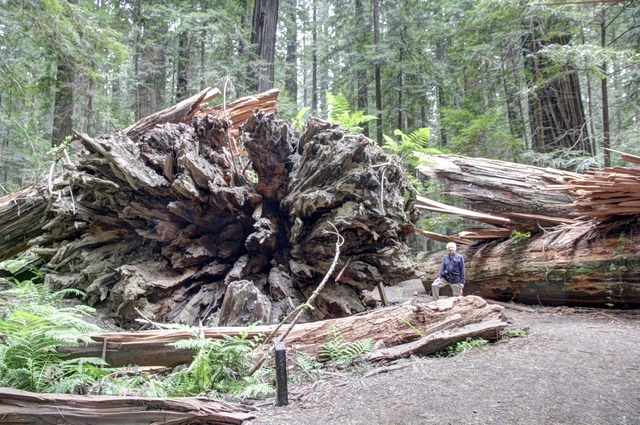
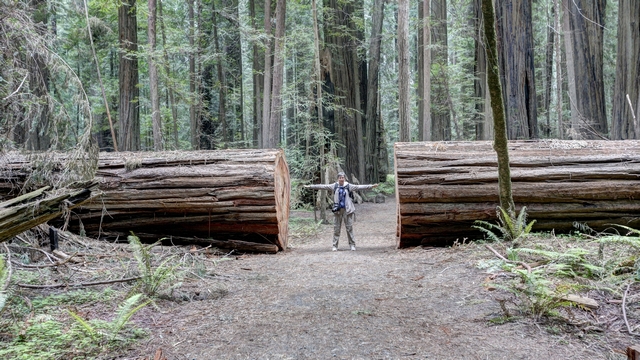
The Dyerville Giant, stood here for as long as 1600 years, was 362 feet tall and was considered the tallest tree in the park before it's fall on March 24, 1991. taller, larger and older than any other tree around it. The redwood’s crash to the ground moved the earth so much that it registered on a nearby seismograph and one local, who heard the impact from half a mile away, thought a train had crashed. Ed standing by the roots.
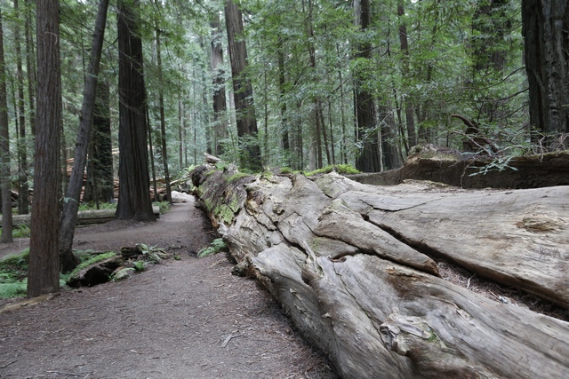
Looking down the Dyerville Giant.
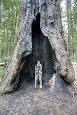
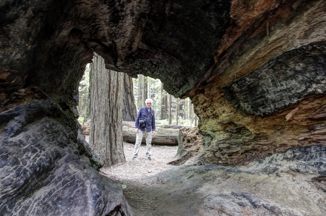
Redwoods are amazing trees. They can suffer damage from a fire and still survive. This tree is still alive.
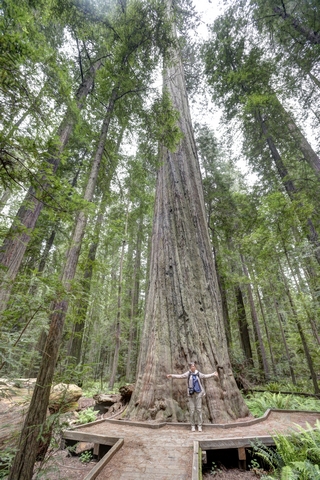
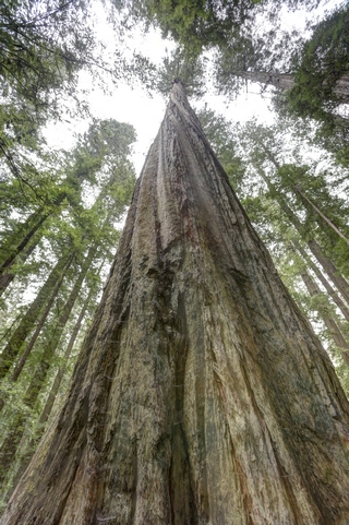
Me in front off the Founders Tree and looking up the Founders Tree.
Seen enough photos of trees?
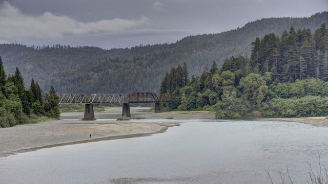
Bridge over the Eel River.
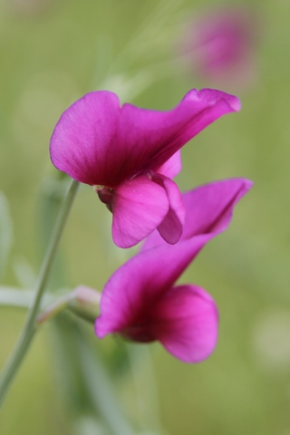
Didn't see a lot of flowers today ---- just trees and ferns in the Redwood Forest.
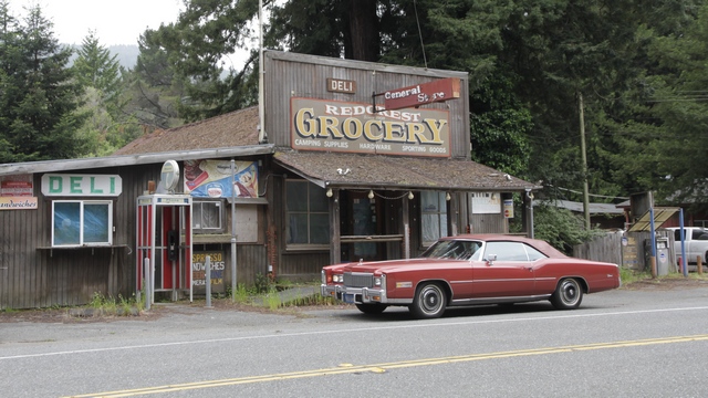
An old store in Redcrest.
Ed stopped to find a geocache so I snapped a few photos.
Hard to believe but Ed was actually getting tired of all the hills and turns and was happy when the road turned inland and became a little straighter and flatter. Maybe it was seeing a police car, flares on the road and a car down an embankment that made Ed tire of the coastal road.
Avenue of Giants is a section of the old highway 101 that runs pretty much parrallel to the freeway (the new highway 101). The road gets it name from the many groves of redwoods that the road passes thru.


Ed and I are in a lot of the photos today to help show the size of the trees. Here I'm taking a photo. The photo on the right is of some burls on a redwood.


The Dyerville Giant, stood here for as long as 1600 years, was 362 feet tall and was considered the tallest tree in the park before it's fall on March 24, 1991. taller, larger and older than any other tree around it. The redwood’s crash to the ground moved the earth so much that it registered on a nearby seismograph and one local, who heard the impact from half a mile away, thought a train had crashed. Ed standing by the roots.
Looking down the Dyerville Giant.

Redwoods are amazing trees. They can suffer damage from a fire and still survive. This tree is still alive.


Me in front off the Founders Tree and looking up the Founders Tree.
Seen enough photos of trees?

Bridge over the Eel River.
Didn't see a lot of flowers today ---- just trees and ferns in the Redwood Forest.
An old store in Redcrest.
2016/05/05: Point Reyes National Seashore
Category: General
Posted by: The Agnew Family
Another overcast day, though it looked promising a few time. The sun
would try to pop through the fog and you'd see a bit of blue then the
fog was back. We even had a bit of rain during the drive north.
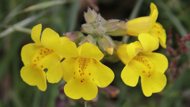
No matter the weather the flowers are always pretty.
Point Reyes National Seashore was established in 1962 to protect Point Reyes Peninsula from proposed development. The peninsula is separated from the rest of Marin County and almost all of the continental US by a rift zone of the San Andreas Fault, about half of which is sunk below sea level and forms Tomales Bay. As we drove through the National Seashore we were surprised to see a couple of small towns and many large dairy and cattle operations. From what I've read I guess the park was established to stop development but "the park" is OK with the agricultural uses of the land.
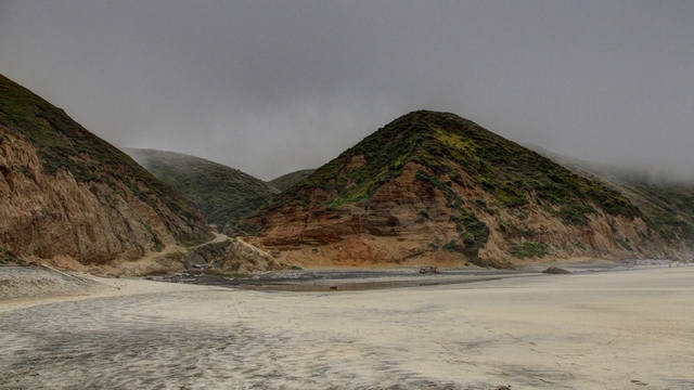
We hiked down to one of the beaches. It was foggy so no point in shoreline photos but the coastline was beautiful.
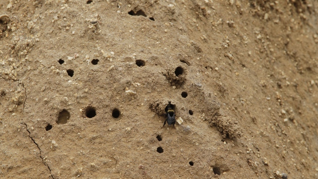
A bumblebee nest, if you look close you can see a bumblebee heading into one of the holes.
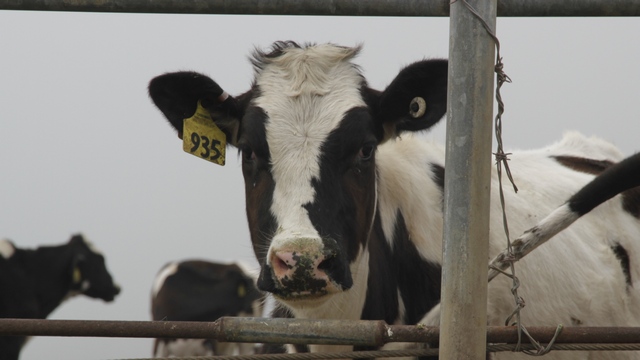
One of the many cows we saw on the more than a dozen ranches.
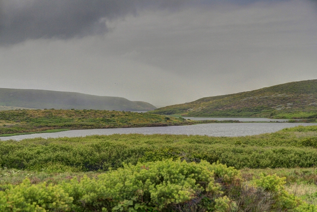
The entire peninsula was beautiful ---- rolling hills and lush green vegetation.
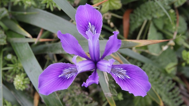
Another bit of colour.
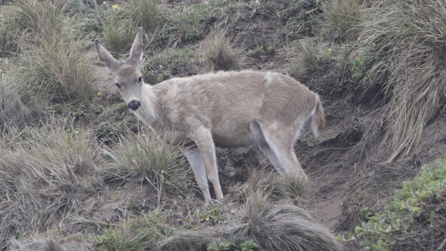
We saw several deer in the park.
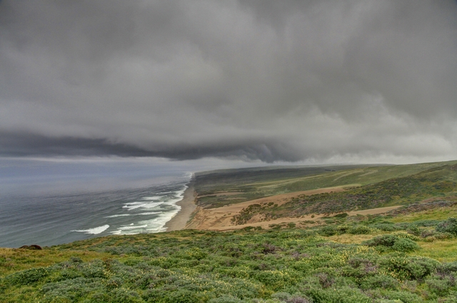
At one end of the peninsula is a lighthouse. This shoreline is near the lighthouse.
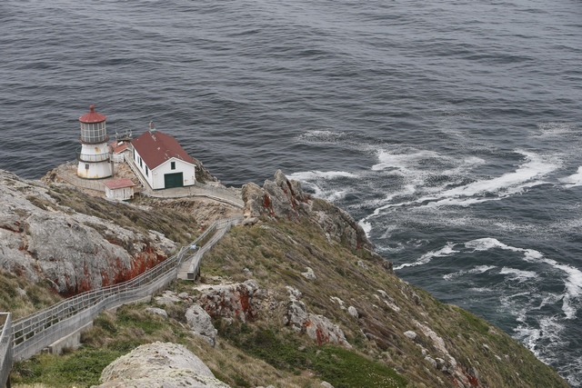
Unfortunately, we were here on a day when the lighthouse was closed but we still managed a few photos.
After spending sometime at the National Seashore we continued our drive north along the coast. This stretcg us my favourite part of the California coastline --- not as rugged as the section by Big Sur but green hills sloping down to the water, lots of s-bends in the road and lots of changes in elevation
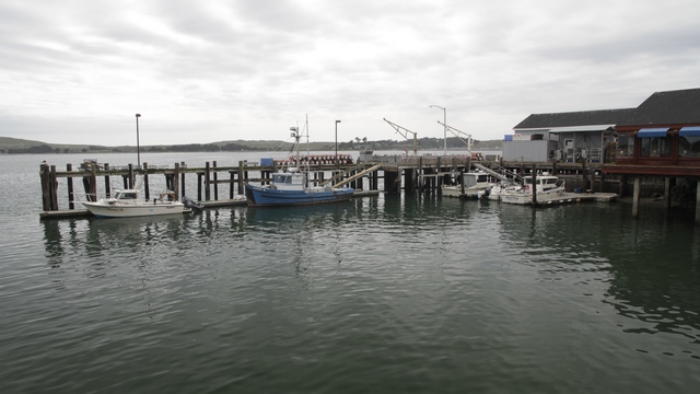
In some places the road went down to the water and there'd be a small town.
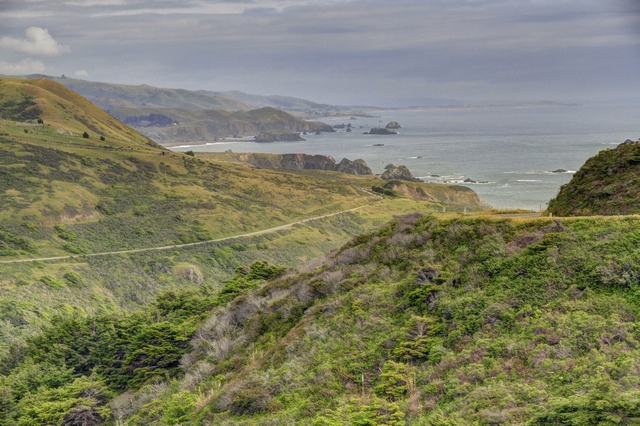
Other spots were rugged with the road winding along the cliff.
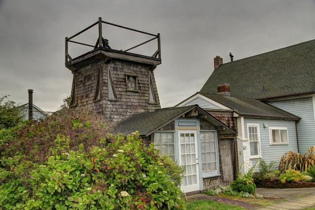
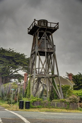
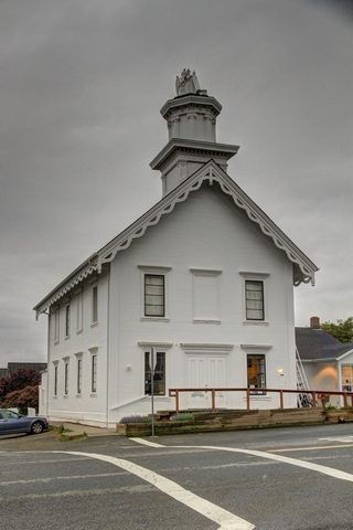
We past through the town of Mendocino, which is well known for it's east coast look and water towers.
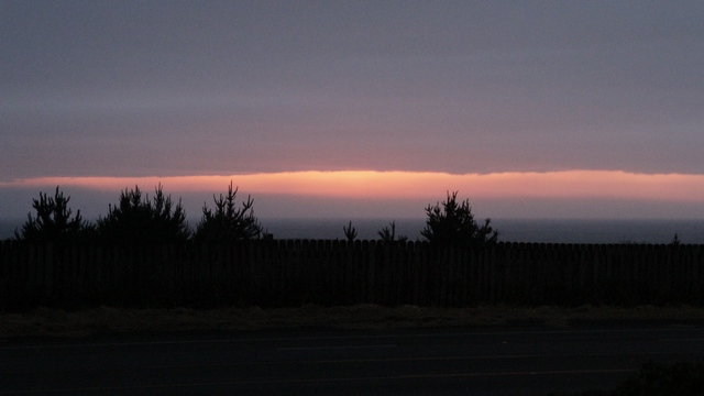
Red sky at night, sailors delight ---- hopefully an omen for a nice day tomorrow.
No matter the weather the flowers are always pretty.
Point Reyes National Seashore was established in 1962 to protect Point Reyes Peninsula from proposed development. The peninsula is separated from the rest of Marin County and almost all of the continental US by a rift zone of the San Andreas Fault, about half of which is sunk below sea level and forms Tomales Bay. As we drove through the National Seashore we were surprised to see a couple of small towns and many large dairy and cattle operations. From what I've read I guess the park was established to stop development but "the park" is OK with the agricultural uses of the land.

We hiked down to one of the beaches. It was foggy so no point in shoreline photos but the coastline was beautiful.
A bumblebee nest, if you look close you can see a bumblebee heading into one of the holes.
One of the many cows we saw on the more than a dozen ranches.

The entire peninsula was beautiful ---- rolling hills and lush green vegetation.
Another bit of colour.
We saw several deer in the park.

At one end of the peninsula is a lighthouse. This shoreline is near the lighthouse.
Unfortunately, we were here on a day when the lighthouse was closed but we still managed a few photos.
After spending sometime at the National Seashore we continued our drive north along the coast. This stretcg us my favourite part of the California coastline --- not as rugged as the section by Big Sur but green hills sloping down to the water, lots of s-bends in the road and lots of changes in elevation
In some places the road went down to the water and there'd be a small town.

Other spots were rugged with the road winding along the cliff.

We past through the town of Mendocino, which is well known for it's east coast look and water towers.


Red sky at night, sailors delight ---- hopefully an omen for a nice day tomorrow.
2016/05/04: The Other Side
Category: General
Posted by: The Agnew Family
A left turn out of the hotel parking lot was impossible --- between
traffic and pedistrians the right hand turn was hard enough. Five right
hand turns later (one road was on an angle saving me a turn) we're back
on Broadway driving past the hotel and heading out of the city. I'm
happy we're going north as the traffic coming south into the city is
stop and go. I also get to drive across the Golden Gate bridge while Ed
is busy taking photos.
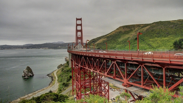
The bridge from a view point on the north side of the bridge.
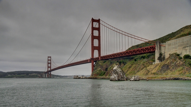
The bridge from a lower vantage point.
As you can see from these two photos, it is a dull, cool, grey day. It actually got a bit worse with fog rolling in. We saw some beautiful sceney along the coast but didn't even bother with photos.
We pulled into a Nike missile base and started wandering around. Unfortunatley, they were not open to the public, it was a tour for a class of grade 5 students so our visit was cut short. Ed was a little disappointed as he had a toy nike missile when he was a kid.
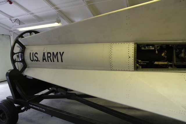
A nike missile.
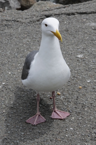
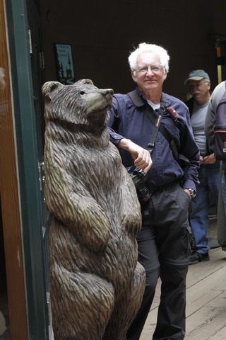
We stop at a place called "Hamburgers" in Sausalito for a burger. There were a couple of tables in the restaurant but we opted to sit by the water to enjoy our burgers. This fellow (the gull) stared at us the entire time. Ed found a new friend at Muir Woods National Monument.
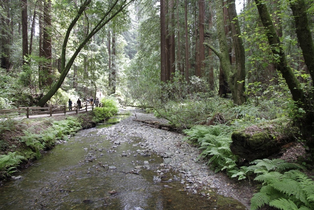
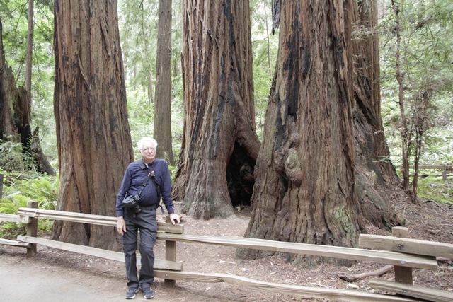
Muir Woods National Monument protects 554 acres of which 240 acres are old growth coast redwood forests, one of a few such stands remaining in the San Francisco Bay Area.
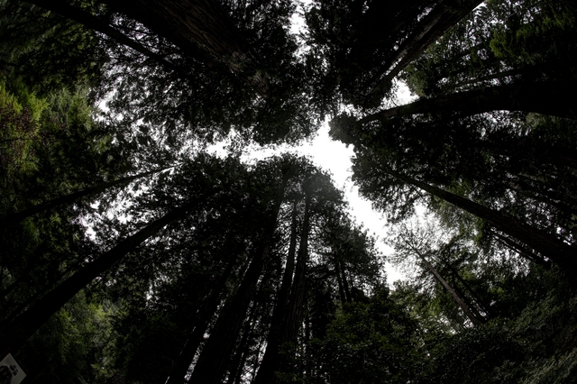
Looking up.
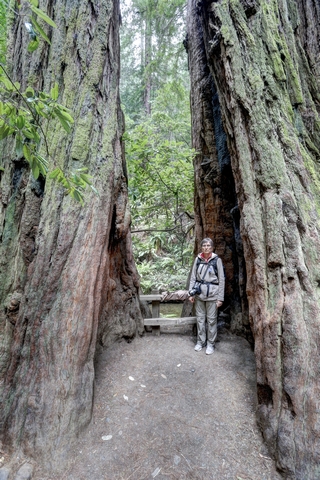
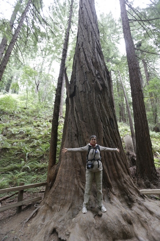
I was used as a reference to show the size of the trees.
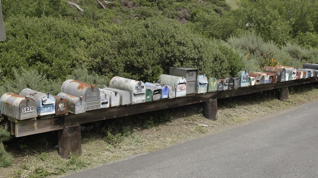
Wouldn't this be a good alternative to the "super mailboxes" Canada Post wants to use.
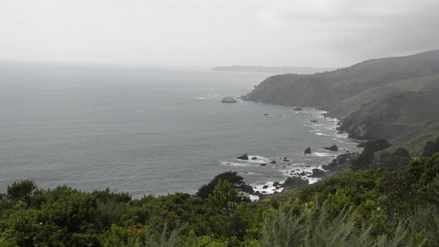
We drove a loop that included Muir Beach, Stinson Beach and Mt. Tamalpais State Park, saw some beautiful scenery and got some yucky photos.
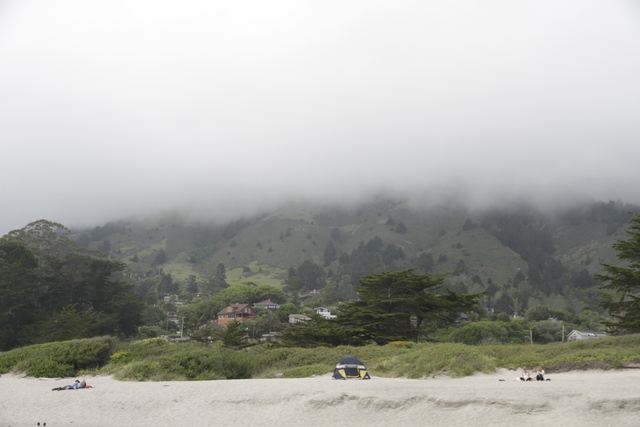
The top of the photo is fog, I had hoped the fog would give the photo some mystery or suspense but I failed.

The bridge from a view point on the north side of the bridge.

The bridge from a lower vantage point.
As you can see from these two photos, it is a dull, cool, grey day. It actually got a bit worse with fog rolling in. We saw some beautiful sceney along the coast but didn't even bother with photos.
We pulled into a Nike missile base and started wandering around. Unfortunatley, they were not open to the public, it was a tour for a class of grade 5 students so our visit was cut short. Ed was a little disappointed as he had a toy nike missile when he was a kid.
A nike missile.
We stop at a place called "Hamburgers" in Sausalito for a burger. There were a couple of tables in the restaurant but we opted to sit by the water to enjoy our burgers. This fellow (the gull) stared at us the entire time. Ed found a new friend at Muir Woods National Monument.
Muir Woods National Monument protects 554 acres of which 240 acres are old growth coast redwood forests, one of a few such stands remaining in the San Francisco Bay Area.

Looking up.

I was used as a reference to show the size of the trees.
Wouldn't this be a good alternative to the "super mailboxes" Canada Post wants to use.
We drove a loop that included Muir Beach, Stinson Beach and Mt. Tamalpais State Park, saw some beautiful scenery and got some yucky photos.
The top of the photo is fog, I had hoped the fog would give the photo some mystery or suspense but I failed.
2016/05/03: Rock and Hill
Category: General
Posted by: The Agnew Family
Visiting "The Rock" or Alcatraz is on most peoples "must do" list wheen
they go to San Francisco. Ed and I are no exception, it was a must do
item. The National Park Service has done a great job with this tourist
attraction --- a pleasant though short boat ride takes you to the
island. The boat load of people are greated by a park ranger, given a
little bit of history and a lot of do nots and sent on there way up to
the hill to the cell block where a audio tour awaits. The audio tour was
well done, so were the talks that were given by different rangers. I
would definitely give this tour an A+.
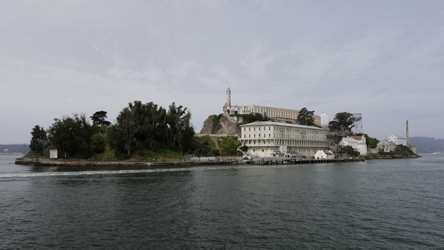
Arriving at Alcatraz.
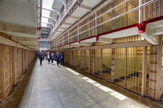
One of the cell blocks --- one of the pluses for inmates was the one occupant per cell. They didn't have to worry about their cell mate not liking them or liking them too much.
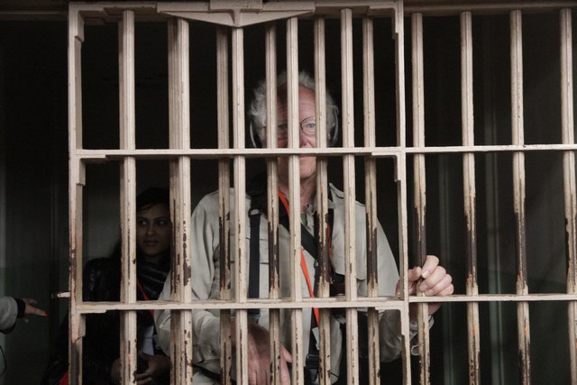
Ed testing a cell out.
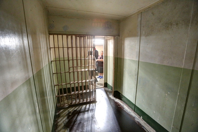
Inside a cell looking out.
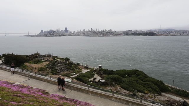
Looking at San Francisco from Alcatraz.
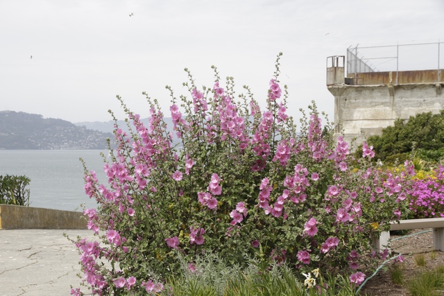
My favourite part of the prison was the garden. They were full of beautiful flowers --- national park volunteers take care of the gardens.
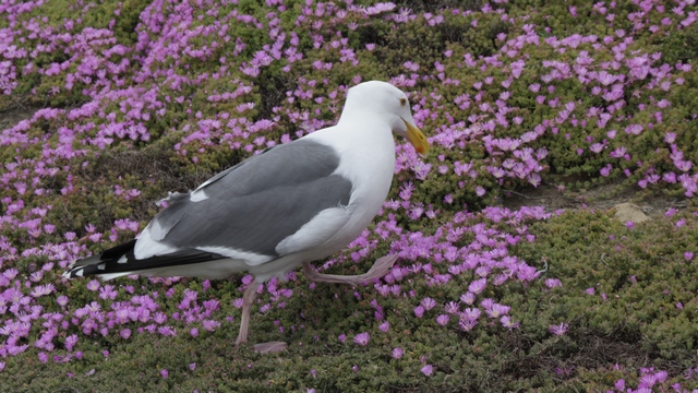
The birds were a close second. At least four species of birds (cormerants, snowy egrets, black crowned night heron, gulls) nest on the island.
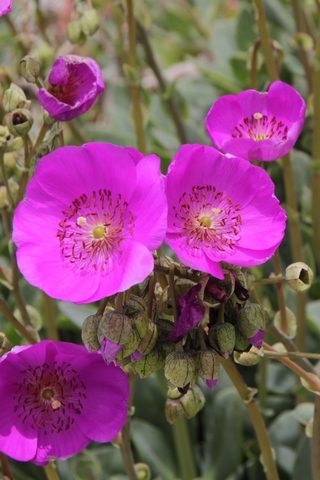
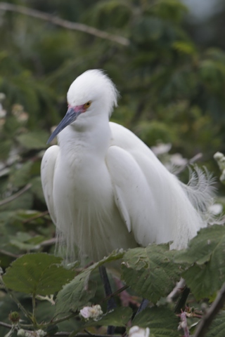
More flowers and a snowy egret.
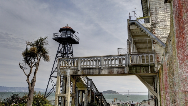
One of the guard towers.
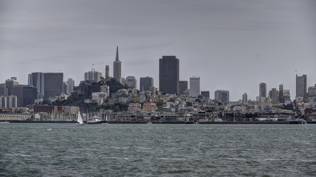
Back on the boat heading to San Francisco.
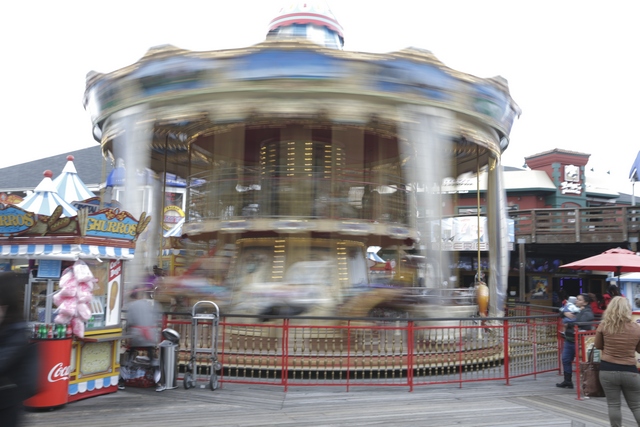
We stopped at Fisherman's Wharf --- the carousel was whizzing by.
On the way back to the hotel we walked upped Telegraph Hill to the Coit Tower. The tower was closed but the views were good.
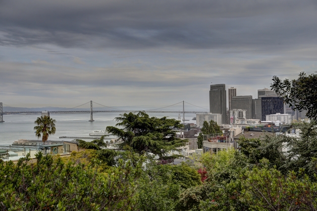
The Bay Bridge.
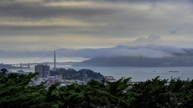
The Golden Gate Bridge.
A couple of photos to show you just how steep some of the roads are.
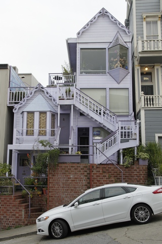
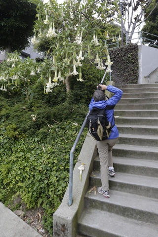
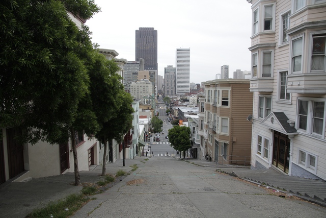
Arriving at Alcatraz.

One of the cell blocks --- one of the pluses for inmates was the one occupant per cell. They didn't have to worry about their cell mate not liking them or liking them too much.
Ed testing a cell out.

Inside a cell looking out.
Looking at San Francisco from Alcatraz.
My favourite part of the prison was the garden. They were full of beautiful flowers --- national park volunteers take care of the gardens.
The birds were a close second. At least four species of birds (cormerants, snowy egrets, black crowned night heron, gulls) nest on the island.
More flowers and a snowy egret.

One of the guard towers.

Back on the boat heading to San Francisco.
We stopped at Fisherman's Wharf --- the carousel was whizzing by.
On the way back to the hotel we walked upped Telegraph Hill to the Coit Tower. The tower was closed but the views were good.

The Bay Bridge.

The Golden Gate Bridge.
A couple of photos to show you just how steep some of the roads are.
2016/05/02: There's a lot of Hills in this City
Category: General
Posted by: The Agnew Family
We are only spending three nights in San Francisco so that gave us a
couple of hours yesterday and two full days. Since the time is limited
we made a list of things we'd want to see and do and picked the top
couple. We ticked off Chinatown yesterday, and the first thing on
today's list was ride a cable car.
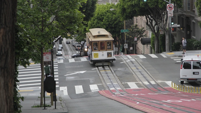
After a half hour or so walk from our hotel to Powell and Market Streets and just under an hour it was finally our turn to get on a cable car. I guess riding a cable car is on a lot of people's list.
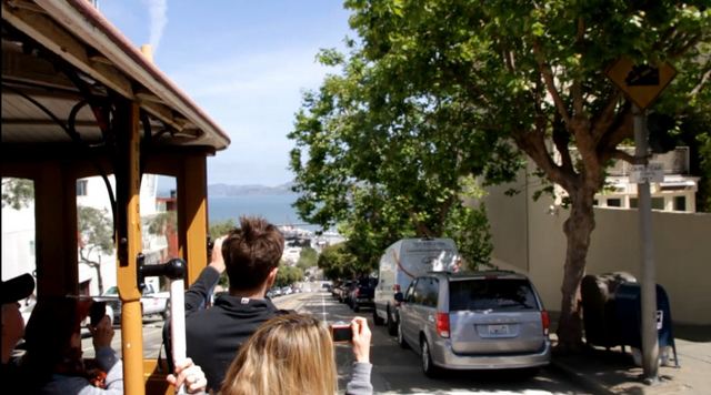
We were lucky and managed seats up front beside the brake man. Ed and the brakeman had a bonding moment when the brakeman noticed that he and Ed have the same watch. Part way through the ride we ended up with a couple standing in front of us and just before the last big downhill, the woman and Ed switched places. Ed had really wanted to stand and hang on, which is what he was doing when he took this photo.
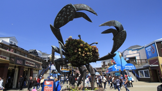
A crabby fellow near fisherman's wharf.
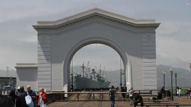
Looking at old navy ship through a gate.
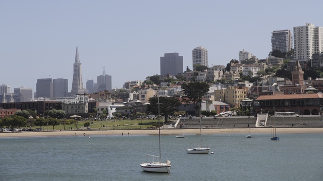
Ed and I walked for miles and miles .... ok just a couple of miles, along the waterfront. This photo was taken from an old fishing pier.
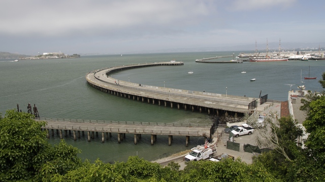
The pier curving to the right is the one we took the previous picture from.
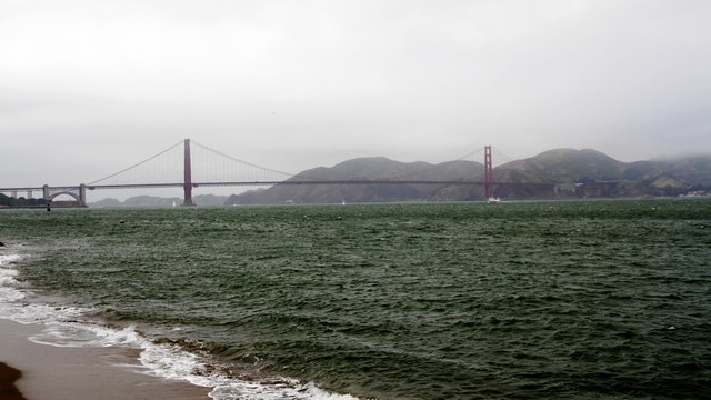
Finally, we could see the Gold Gate bridge.
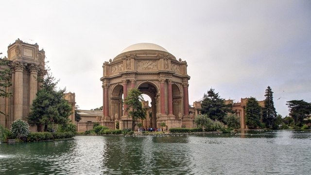
The Palace of Fine Arts is a structure originally constructed for the 1915 Panama-Pacific Exposition. The structure was rebuilt in 1965.
Our friends Connie and Henry live in Thousand Oaks just outside of LA. Unfortunately, Henry was in Vancouver and Connie was in Toronto when we drove near Thousand Oaks. They both arrived home a few days later and decided to visit two of their daughters who live in San Francisco and meet up with us during our stay here. Happily, Connie and Henry were able to pick us up near the Palace of Fine Arts and we went out for a late lunch. I was also very happy that they drove us back to our hotel .... no more walking today. Turned out we are staying about 10 blocks from the apartment building where both daughters live.
After a half hour or so walk from our hotel to Powell and Market Streets and just under an hour it was finally our turn to get on a cable car. I guess riding a cable car is on a lot of people's list.
We were lucky and managed seats up front beside the brake man. Ed and the brakeman had a bonding moment when the brakeman noticed that he and Ed have the same watch. Part way through the ride we ended up with a couple standing in front of us and just before the last big downhill, the woman and Ed switched places. Ed had really wanted to stand and hang on, which is what he was doing when he took this photo.
A crabby fellow near fisherman's wharf.
Looking at old navy ship through a gate.
Ed and I walked for miles and miles .... ok just a couple of miles, along the waterfront. This photo was taken from an old fishing pier.
The pier curving to the right is the one we took the previous picture from.
Finally, we could see the Gold Gate bridge.

The Palace of Fine Arts is a structure originally constructed for the 1915 Panama-Pacific Exposition. The structure was rebuilt in 1965.
Our friends Connie and Henry live in Thousand Oaks just outside of LA. Unfortunately, Henry was in Vancouver and Connie was in Toronto when we drove near Thousand Oaks. They both arrived home a few days later and decided to visit two of their daughters who live in San Francisco and meet up with us during our stay here. Happily, Connie and Henry were able to pick us up near the Palace of Fine Arts and we went out for a late lunch. I was also very happy that they drove us back to our hotel .... no more walking today. Turned out we are staying about 10 blocks from the apartment building where both daughters live.
2016/05/01: If You're Going to San Francisco
Category: General
Posted by: The Agnew Family
Yes, we're going to San Francisco today but I didn't wear flowers in my
hair (hope you remember the 1967 song "If You're Going to San Francisco"
by Scott MKenzie).
We made a few stops on the way. The first one being Santa Cruz. As it was a Sunday it was very busy, if fact everywhere there was a beach it was busy.
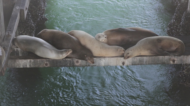
We walked out on the warf and heard a lot of noise coming from under the warf. When we looked down this is what we saw:
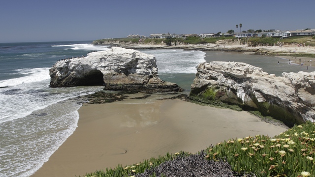
Even though the water temperature is only in the high 50F, there were a lot of people in the water. Some just playing, others paddle boarding and lots surfing (the surfers wear wet or dry suits). Ed and I walked part of the boardwalk (not sure why they call it a boardwalk it's a paved pathway for bikes and pedestrians.
One of the beautiful views.
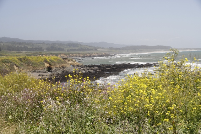
At a pull off we saw fields of wild flowers.
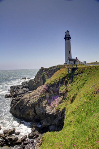
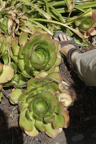
Another stop was at this lighthouse. I'm sure they're not hens and chicks but they look like hens and chicks. I put my foot beside them for a size comparison.
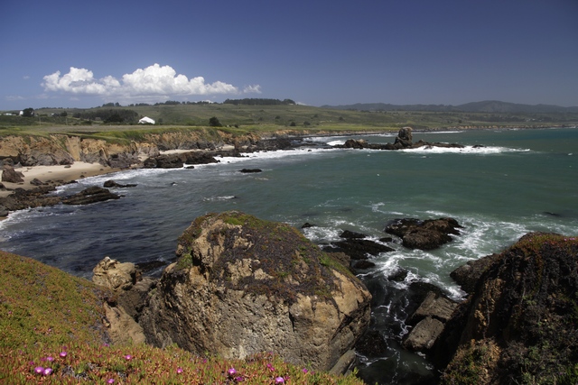
The coastline near the lighthouse.
Ed really doesn't like driving in cities so that's my job and I don't like heights so driving roads with shear drop offs are Ed's job. Unfortunately, I took over driving in Santa Cruz and drove the coast highway to San Francisco and got to experience some roads of the type I don't like. Luckily, we were driving north so we were on the inside lane so it's wasn't too bad. Then we were in San Francisco. The route in took us over relatively normal roads until there was a really steep road ahead of us --- yeah I got to turn and then we were at the hotel. Soon as we unloaded the car we went exploring.
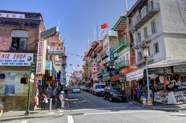
China town.
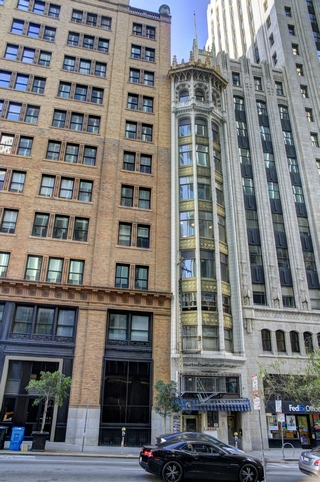
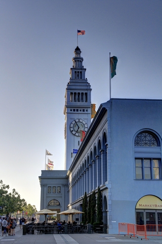
Loved the skinny building between the other two normal size buildings. The clock tower on the ferry building.
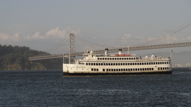
A ship in front of the Bay Bridge.
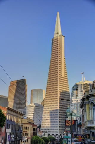
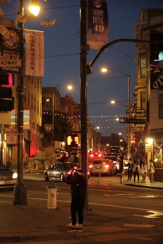
Transamerica Pyramid. A night sceen near our hotel.
Our hotel is quite acceptable and in a very interesting location. To the east is Chinatown, to west (2 blocks away) are the strip clubs.
We made a few stops on the way. The first one being Santa Cruz. As it was a Sunday it was very busy, if fact everywhere there was a beach it was busy.
We walked out on the warf and heard a lot of noise coming from under the warf. When we looked down this is what we saw:
Even though the water temperature is only in the high 50F, there were a lot of people in the water. Some just playing, others paddle boarding and lots surfing (the surfers wear wet or dry suits). Ed and I walked part of the boardwalk (not sure why they call it a boardwalk it's a paved pathway for bikes and pedestrians.
One of the beautiful views.
At a pull off we saw fields of wild flowers.

Another stop was at this lighthouse. I'm sure they're not hens and chicks but they look like hens and chicks. I put my foot beside them for a size comparison.
The coastline near the lighthouse.
Ed really doesn't like driving in cities so that's my job and I don't like heights so driving roads with shear drop offs are Ed's job. Unfortunately, I took over driving in Santa Cruz and drove the coast highway to San Francisco and got to experience some roads of the type I don't like. Luckily, we were driving north so we were on the inside lane so it's wasn't too bad. Then we were in San Francisco. The route in took us over relatively normal roads until there was a really steep road ahead of us --- yeah I got to turn and then we were at the hotel. Soon as we unloaded the car we went exploring.

China town.


Loved the skinny building between the other two normal size buildings. The clock tower on the ferry building.
A ship in front of the Bay Bridge.

Transamerica Pyramid. A night sceen near our hotel.
Our hotel is quite acceptable and in a very interesting location. To the east is Chinatown, to west (2 blocks away) are the strip clubs.