2014/07/18: Home Sweet Home
Category: General
Posted by: The Agnew Family
The drive from Quebec to Ontario was reasonably uneventful. I really
love the new Montreal by-pass --- it makes that leg of the drive much
more enjoyable. Near Napanee Ontario we were reminded of the dangers of
driving. Around 4pm we ended up in stopped then slow traffic for about
10 kilometers. There was no traffic on the eastbound lanes except for a
couple of "clean up" trucks and three vehicles moving badly damaged
vehicles. A google search found an accident that had occurred at 1am
involving 2 transport trucks and a passenger vehicle.
Tuesday morning we left the campground around 9am hoping to be behind the rush hour traffic as we drove through Toronto. There was a bit of traffic but not bad. Just before we left Ed bought a new GPS (the old GPS couldn't handle a map update because it didn't have enough memory and you can't add memory) that is intended for RV's. This GPS has a feature that ties into traffic reports. If there's a traffic tie up, a side map shows you where the tie up is and it indicates the amount of time you will be delayed. Of course this feature only works in certain areas but those are probably the areas where it'll be useful.
The last couple of days having been busy. I've unloaded most of the things we need out of the trailer, cleaned the trailer refrigerator, did at least 8 loads of laundry, weeded the flower beds, vegetable garden and raspberry patch, cleaned the inside of the car and made a trip down to Burlington. My sister and great niece from Texas are visiting my mom for a few days, so I thought Burlington is closer than Texas and went for a visit. A couple more days of catch up and I should be back to regular life.
2014/07/13: Parlez vous Francais?
Category: General
Posted by: The Agnew Family
We stopped at a park just outside of Lévis, Quebec and happily don't
have to use our really bad high school French as the fellow at the
counter speaks excellent English. They even have English on the signs
(below the French of course) in the park. It was a nice, uneventful
drive with just a spattering of construction to deal with.
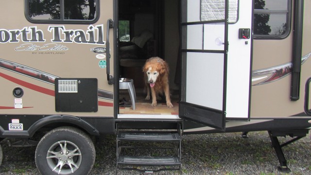
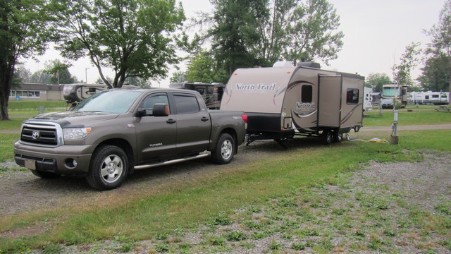
Ed and I both prefer the feel of this park over the one we stayed at last night. Part of it may be the weekend crowd is gone from this park where it was in full swing at last night's park.
Ed and I both prefer the feel of this park over the one we stayed at last night. Part of it may be the weekend crowd is gone from this park where it was in full swing at last night's park.
2014/07/12: Ferry and New Brunswick
Category: General
Posted by: The Agnew Family
We arrived at the ferry docks in Channel-Port aux Basque and found out
the procedure for going on the ferry was a little different than it was
in North Sydney. After checking in, we were stopped and asked if we had
any plants, potatoes or carrots on board. Anything that could have
Newfoundland soil on it could not leave Newfoundland. The woman than
informed us that she needed to board the RV and check. No problem, we
didn’t have any of the offending items. After clearing the inspection we
drove into a large building and stopped by a fellow with a fire hose
who proceeded to hose down both the truck and the RV. We had driven down
dirt roads and had plenty of dust and dirt on the truck so Ed was happy
to get it hosed down.
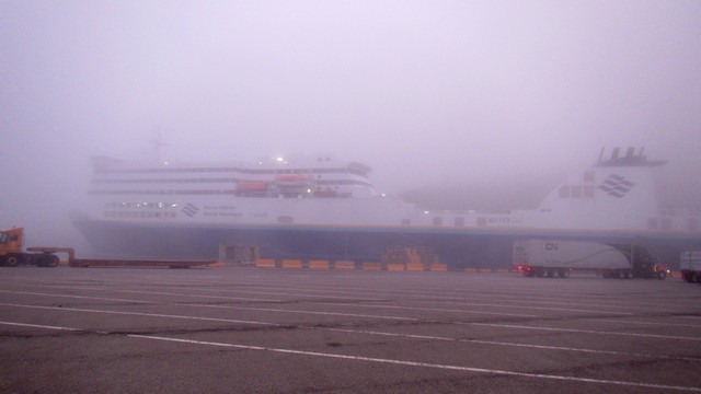
It seemed only right that the drive to the ferry involved fog. This ship, that looks like a cruise ship, is the ferry.
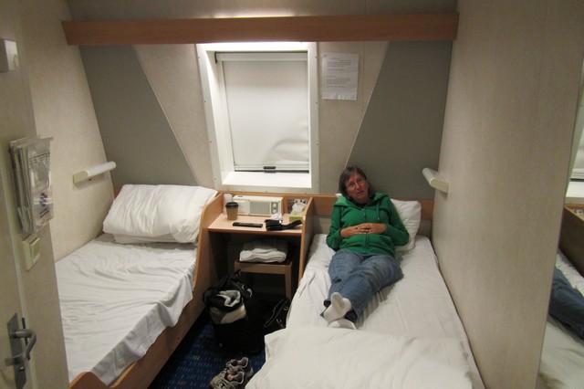
When we booked the ferry we had booked regular seating. On the way to Newfoundland we wandered into the reserved seating area (the door was open). Much better. So about a week ago we phoned the ferry company and tried to book a cabin --- no cabins were available so we booked reserved seating and were put on the waiting list for a cabin. Shortly before the ship pulled out our name was called --- a cabin was available. The cabins were small but each one has a bathroom and a television. We lucked out and had a window looking out over the bow of the ship. If you’re taking the ferry at night it is definitely the way to go, especially if you plan on driving in the morning.
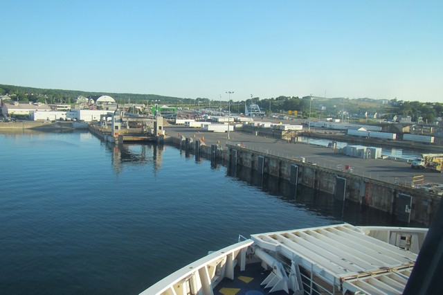
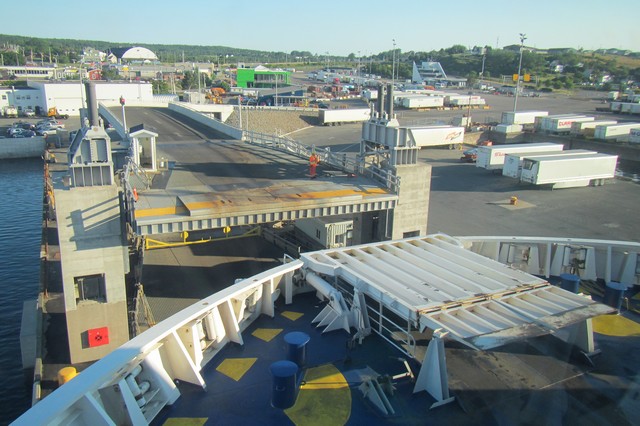
Pulling into the dock in North Sydney.
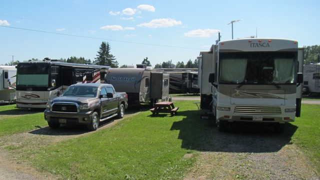
After about five hours of driving we arrived at Camper’s City in Moncton New Brunswick. City is the correct word for the place ---- row upon row of motorhomes, trailers and tents. Our truck and trailer looks small when parked between two motor homes. Unfortunately, this park is affiliated with some large US parks so they use Tengo Net as their internet provider. We didn’t feel like paying $5 to access the Internet so no surfing or updating tonight. Posted this Monday evening where we only had to pay $2 for Internet. What happened to free Internet that we experienced in Newfoundland.
It seemed only right that the drive to the ferry involved fog. This ship, that looks like a cruise ship, is the ferry.
When we booked the ferry we had booked regular seating. On the way to Newfoundland we wandered into the reserved seating area (the door was open). Much better. So about a week ago we phoned the ferry company and tried to book a cabin --- no cabins were available so we booked reserved seating and were put on the waiting list for a cabin. Shortly before the ship pulled out our name was called --- a cabin was available. The cabins were small but each one has a bathroom and a television. We lucked out and had a window looking out over the bow of the ship. If you’re taking the ferry at night it is definitely the way to go, especially if you plan on driving in the morning.
Pulling into the dock in North Sydney.
After about five hours of driving we arrived at Camper’s City in Moncton New Brunswick. City is the correct word for the place ---- row upon row of motorhomes, trailers and tents. Our truck and trailer looks small when parked between two motor homes. Unfortunately, this park is affiliated with some large US parks so they use Tengo Net as their internet provider. We didn’t feel like paying $5 to access the Internet so no surfing or updating tonight. Posted this Monday evening where we only had to pay $2 for Internet. What happened to free Internet that we experienced in Newfoundland.
2014/07/11: Sad to Say Good-bye to Newfoundland
Category: General
Posted by: The Agnew Family
Happy 14th Birthday Zaph!!!
Think we hit the jackpot today as far as looking for farmland went. We drove some roads in the Codroy Valley that we hadn't been down before and found several farms, lots of fields of cut hay, some baled hay, a tractor baling some hay and some cows. It's nice to know that there is some agriculture still happening in Newfoundland.
We think part of this farm is used for sod.
In the background you can see cut hay and a couple of large round bales.
There's still lots of ponds around --- this one was called Loch Lomond.
We also took some time to take a walk down a wetland trail. We saw several different birds and what we think was a mink.
We'll be leaving shortly to catch the 11:45pm ferry to North Sydney with mixed feelings. I'm sad to be leaving Newfoundland especially the out ports. I really loved all the little harbour towns. But I'm also looking forward to going home and experiencing the adventures waiting there for me.
2014/07/11: A Hidden Gem
Category: General
Posted by: The Agnew Family
When Ed checked in yesterday he was told that a 28 vehicle caravan was
arriving on this morning's ferry. The ferry was late so Ed took some
photos of the park before it was full.
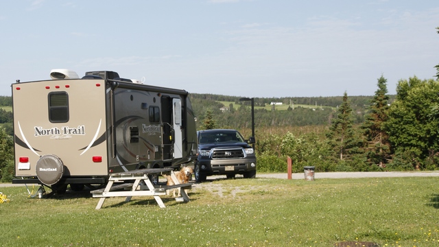
The section we're in doesn't have a lot of trees but it has a great view across the valley and Zaph likes it here as there's grass to sit on. Tonight the park has a different look to it --- huge motor homes everywhere.
The park has developed a small newspaper that they give you when you check in. In it there is a write up with a couple of day trips. So, we decided to follow the one that took you to Rose Blanch, an out port at the end of the road traveling east from Channel-Port aux Basque.
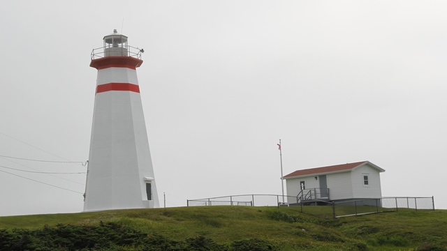
First stop was the light house at Cape Ray (between Doyles and Channel-Port aux Basque). The lighthouse was built in 1871 and marks the southern tip of the French Shore.
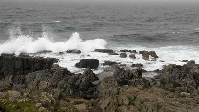
It was a bit windy causing waves to crash onto the shore.
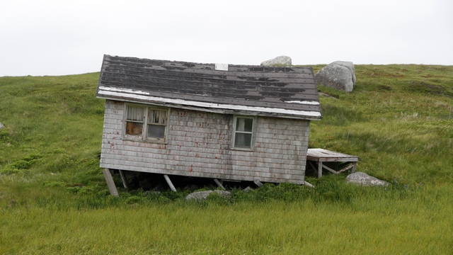
I thought the road from Cape Ray accessed the TCH (Trans Canada Highway) from two points, so we continued to drive east. The road changed to dirt, not a good sign, but we continued driving. After a couple of kilometers we ended up by the beach in J.T. Cheeseman Provincial Park. We continued on a road by the shore where we saw this interesting building. A fellow on an ATV drove by and told us the road was block ahead. Turning around we drove back into the provincial park and out through the campground to the TCH. I even got to use the 4 wheel drive on the truck for a bit of the drive.
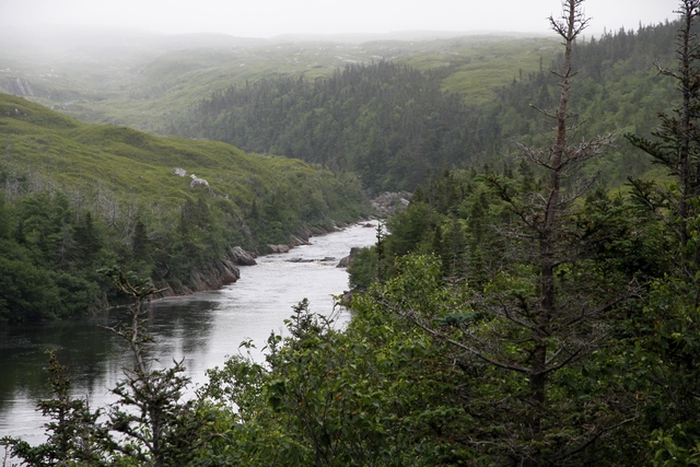
I think this is the Isle aux Morts River. Oh, it's foggy along this coast, it was sunny when we left Doyles.
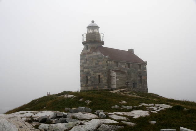
Rose Blanche Lighthouse was built in 1871 using granite from a nearby quarry. The lighthouse was in use from 1873 to the 1940's. The lighting apparatus was supplied by Robert Louis Stevenson's father and uncle's engineering company in Scotland. It was reconstructed fully in 1999. Near the lighthouse is a trail, gift shop and fisherman museum. A nice place to spend a few hours.
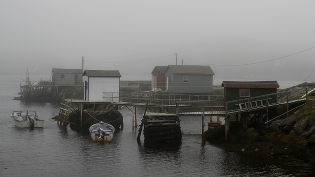
The rocks at Diamond Cove are white and sparkley reminding you of diamonds. We stopped to take a photo near a house where a man was mowing the lawn. The man turned off his lawn mower and walked over to the truck, I rolled down the window not know what to expect. The man started asking me about our trip ... he then asked if we wanted some rocks and went to his backyard and brought us a couple. A little further down the road into the cove we saw this dock.
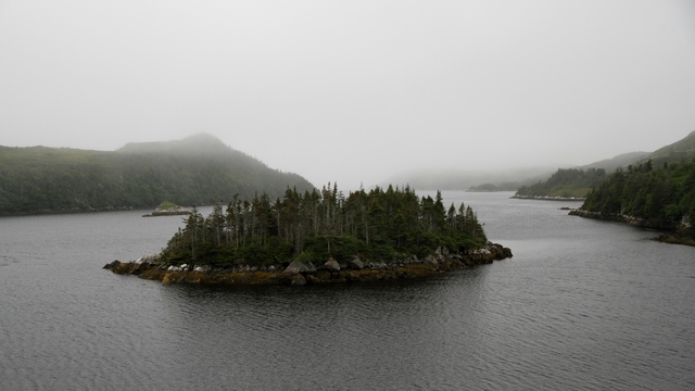
Lots of little islands, reminded me a bit of Georgian Bay.
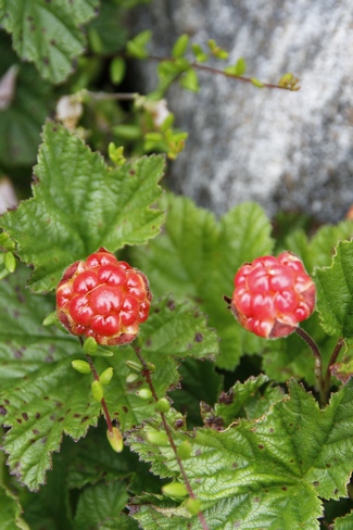
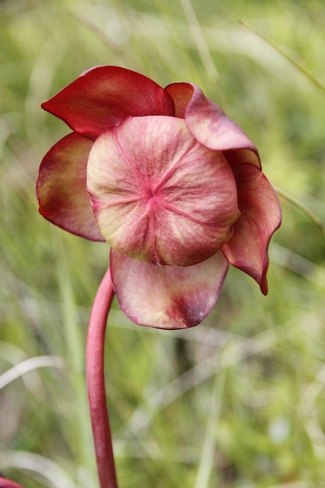
The little town of Isle aux Morts is proud of George Harvey, his daughter Anne, son Tom and their dog Hairyman (a Newfoundland) who rescued the passengers of a sinking ship in 1928. The community centre is set up with a restaurant in it called Hairyman's Safe Haven Cafe (it also sells local crafts) --- they also use it for jam sessions and dances. We stopped to have a coffee and ended up having a bite to eat. The Harvey trail took us along the shore where we saw Bake-apple growing (it starts red looking like a raspberry and turns golden coloured when ripe and is tart to the taste). The photo on the right is a pitcher plant in full bloom.
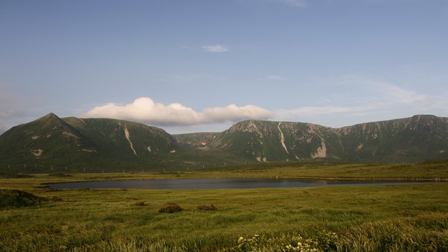
About 20 kilometers north of Channel-Port aux Basque is an area called Wreckhouse. Winds have been recorded at 200 kilometers an hour and are capable of knocking rail cars off the track (in fact the winds did). Today the winds occasionally blow transport trucks off the road.
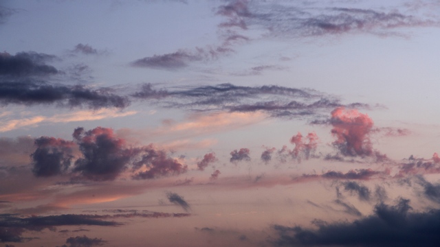
Back at the park enjoying the sunset.
The section we're in doesn't have a lot of trees but it has a great view across the valley and Zaph likes it here as there's grass to sit on. Tonight the park has a different look to it --- huge motor homes everywhere.
The park has developed a small newspaper that they give you when you check in. In it there is a write up with a couple of day trips. So, we decided to follow the one that took you to Rose Blanch, an out port at the end of the road traveling east from Channel-Port aux Basque.
First stop was the light house at Cape Ray (between Doyles and Channel-Port aux Basque). The lighthouse was built in 1871 and marks the southern tip of the French Shore.
It was a bit windy causing waves to crash onto the shore.
I thought the road from Cape Ray accessed the TCH (Trans Canada Highway) from two points, so we continued to drive east. The road changed to dirt, not a good sign, but we continued driving. After a couple of kilometers we ended up by the beach in J.T. Cheeseman Provincial Park. We continued on a road by the shore where we saw this interesting building. A fellow on an ATV drove by and told us the road was block ahead. Turning around we drove back into the provincial park and out through the campground to the TCH. I even got to use the 4 wheel drive on the truck for a bit of the drive.
I think this is the Isle aux Morts River. Oh, it's foggy along this coast, it was sunny when we left Doyles.
Rose Blanche Lighthouse was built in 1871 using granite from a nearby quarry. The lighthouse was in use from 1873 to the 1940's. The lighting apparatus was supplied by Robert Louis Stevenson's father and uncle's engineering company in Scotland. It was reconstructed fully in 1999. Near the lighthouse is a trail, gift shop and fisherman museum. A nice place to spend a few hours.
The rocks at Diamond Cove are white and sparkley reminding you of diamonds. We stopped to take a photo near a house where a man was mowing the lawn. The man turned off his lawn mower and walked over to the truck, I rolled down the window not know what to expect. The man started asking me about our trip ... he then asked if we wanted some rocks and went to his backyard and brought us a couple. A little further down the road into the cove we saw this dock.
Lots of little islands, reminded me a bit of Georgian Bay.
The little town of Isle aux Morts is proud of George Harvey, his daughter Anne, son Tom and their dog Hairyman (a Newfoundland) who rescued the passengers of a sinking ship in 1928. The community centre is set up with a restaurant in it called Hairyman's Safe Haven Cafe (it also sells local crafts) --- they also use it for jam sessions and dances. We stopped to have a coffee and ended up having a bite to eat. The Harvey trail took us along the shore where we saw Bake-apple growing (it starts red looking like a raspberry and turns golden coloured when ripe and is tart to the taste). The photo on the right is a pitcher plant in full bloom.
About 20 kilometers north of Channel-Port aux Basque is an area called Wreckhouse. Winds have been recorded at 200 kilometers an hour and are capable of knocking rail cars off the track (in fact the winds did). Today the winds occasionally blow transport trucks off the road.
Back at the park enjoying the sunset.
2014/07/09: Codroy Valley
Category: General
Posted by: The Agnew Family
Today we drove about 360 kilometers to the town of Doyles, about 40
kilometers from the ferry in Channel-Port aux Basques. We're staying
here till we catch the ferry to North Sydney on Friday night.
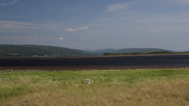
Once again it was a beautiful day for driving, so after we landed we went for a drive around the area. I think Ed was a little tired of driving so I got to drive for a change.
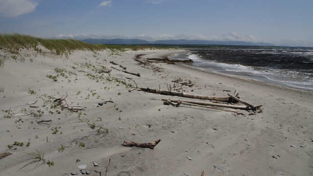
Nearby is a large estuary which is home to many birds. We hope to explore this sometime in the next couple of days.
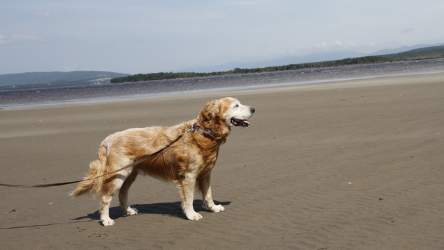
Zaph was looking forward to a romp on a sandy beach today. We found not one but two sandy beaches (one on the Grand Codroy River and one across the road on the Gulf of St. Lawrence. Unfortunately, our walk was cut short as blowing sand was like being sand blasted.
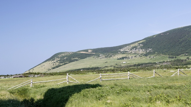
This area is different than a lot of the other areas we have visited. There are actually grassy fields. Today we saw a few small farms including a dairy operation.
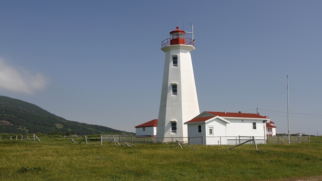
Of course we saw a few harbours, a fish plant, some fishing boats and a light house. This is the Cape Anguille Lighthouse.
Once again it was a beautiful day for driving, so after we landed we went for a drive around the area. I think Ed was a little tired of driving so I got to drive for a change.
Nearby is a large estuary which is home to many birds. We hope to explore this sometime in the next couple of days.
Zaph was looking forward to a romp on a sandy beach today. We found not one but two sandy beaches (one on the Grand Codroy River and one across the road on the Gulf of St. Lawrence. Unfortunately, our walk was cut short as blowing sand was like being sand blasted.
This area is different than a lot of the other areas we have visited. There are actually grassy fields. Today we saw a few small farms including a dairy operation.
Of course we saw a few harbours, a fish plant, some fishing boats and a light house. This is the Cape Anguille Lighthouse.
2014/07/08: Rain, Fog and Yup, More Icebergs
Category: General
Posted by: The Agnew Family
Woke up to rain this morning and it continued to rain for most of the
day. There’s not a lot to see in this area but we wanted to see what we
could, so off in the rain we went. We started by driving to Robert’s
Arm, a town north east of South Brook.
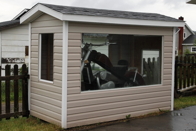
As we were driving past some houses we noticed this building at the end of one driveway. We stopped to have a look at the life sized carved wooden motorcycle. You can understand why the owner wanted to show it off.
When we drove into Triton we saw a sign for a Whale exhibit. It was raining a little harder, so we said let’s stop and have a look. Almost didn’t go in when we saw the fee of $5 per adult (seemed a little pricey to look at some whale bones). Turned out it was well worth the cost. The fellow on duty is a retired school teacher and he gave us a tour of the whale skeleton and other items in the exhibit.
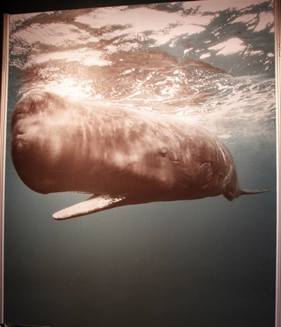
This photo is of a picture of a sperm whale --- it is the largest toothed whale, is the second deepest diving whale, is able to stay under water for up to 90 minutes and has the largest brain of any animal on earth. It also has the largest “nose” of all the whales.
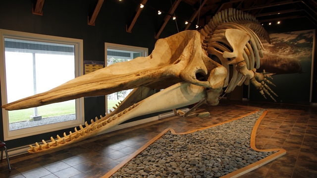
The skeleton is from a sperm whale that washed up on the south west coast of Newfoundland. A team of men from Triton went down to the coast to recover the bones. This process involved removing the skin, meat, etc. from the bones and separating the bones. The bones were brought back to Triton and cleaned by putting them in bay allowing crustaceans to clean the bones. Once the bones were cleaned they were sent to Drumheller Alberta to be reassembled. The skeleton was then returned to Triton where it was put on display.
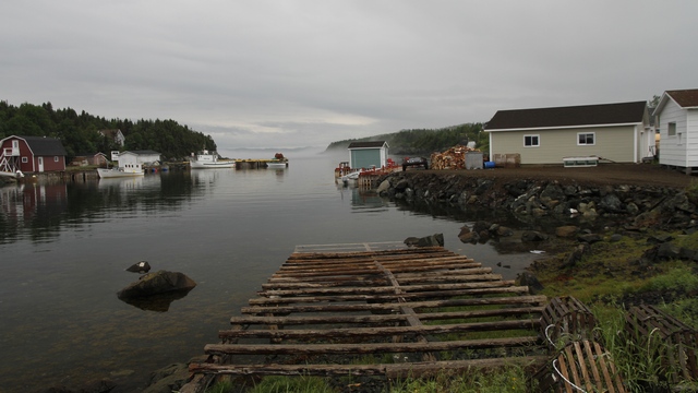
On our drive we saw several mussel farms, at least a half dozen ice bergs as well as docks and boat. Oh, did I mention fog. You can see some in the background.
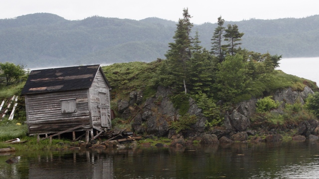
Most of the buildings we have seen are in very good conditions. It’s nice to see old weathered buildings.
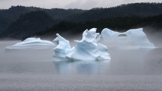
There were three icebergs and some “berger bits” in the bay at Brighton. The fog added some mystery.
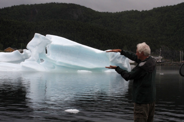
Couldn’t resist having a bit of fun. One of the “berger bits” floated near shore. It was fizzing much like soda pop. As the ice was melting it was releasing trapped air.
As we were driving past some houses we noticed this building at the end of one driveway. We stopped to have a look at the life sized carved wooden motorcycle. You can understand why the owner wanted to show it off.
When we drove into Triton we saw a sign for a Whale exhibit. It was raining a little harder, so we said let’s stop and have a look. Almost didn’t go in when we saw the fee of $5 per adult (seemed a little pricey to look at some whale bones). Turned out it was well worth the cost. The fellow on duty is a retired school teacher and he gave us a tour of the whale skeleton and other items in the exhibit.
This photo is of a picture of a sperm whale --- it is the largest toothed whale, is the second deepest diving whale, is able to stay under water for up to 90 minutes and has the largest brain of any animal on earth. It also has the largest “nose” of all the whales.
The skeleton is from a sperm whale that washed up on the south west coast of Newfoundland. A team of men from Triton went down to the coast to recover the bones. This process involved removing the skin, meat, etc. from the bones and separating the bones. The bones were brought back to Triton and cleaned by putting them in bay allowing crustaceans to clean the bones. Once the bones were cleaned they were sent to Drumheller Alberta to be reassembled. The skeleton was then returned to Triton where it was put on display.
On our drive we saw several mussel farms, at least a half dozen ice bergs as well as docks and boat. Oh, did I mention fog. You can see some in the background.
Most of the buildings we have seen are in very good conditions. It’s nice to see old weathered buildings.
There were three icebergs and some “berger bits” in the bay at Brighton. The fog added some mystery.
Couldn’t resist having a bit of fun. One of the “berger bits” floated near shore. It was fizzing much like soda pop. As the ice was melting it was releasing trapped air.
Category: General
Posted by: The Agnew Family
We’re sitting in Eddy’s Restaurant … um not my Eddy’s restaurant but a
restaurant called Eddy’s Restaurant, accessing the Internet. It’s about 1
km from Kona Beach Campground (in South Brook) and is the nearest wifi
hot spot. Surprisingly, this is the first campground to not have
Internet access, but may be not so surprisingly as this campground is
full of Newfoundlanders on vacation and they may not want Internet.
It’s a very nice campground on a large pond with a big sandy beach. The
hardest part of no Internet is no weather report (we also cannot get any
radio stations or TV stations).
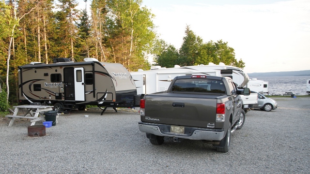
The campground has two areas --- beach and wooded. We’re in the beach area, about 4 sites up from the water but only one trailer partially blocks my view.
Leaving Terra Nova, we continue our journey west across Newfoundland. It was a beautiful day for driving and as we arrived in South Brook in the early afternoon we went exploring near Springdale. Springdale is a long, narrow town as it is wedged between the mountains and the ocean. In days gone by, the economy for the Springdale area was based on mining and logging. Today components of it’s economy are boat building, steel fabrication and aluminum casting.
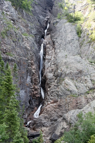
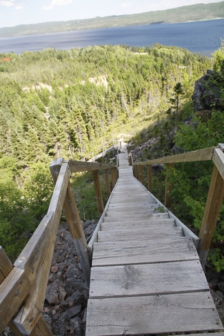
Rattling Brook Falls is near the village of Rattling Brook. The viewing platform is accessed by a boardwalk and a few stairs.
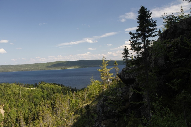
You also get a great view of the bay.
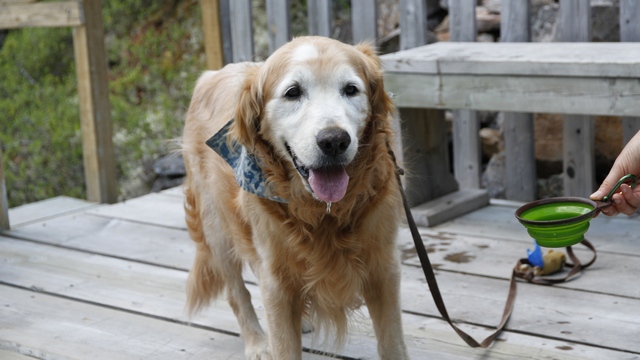
Zaph’s not too spoiled --- I carry water and a collapsed dog bowl so he can have a drink when he’s thirsty.
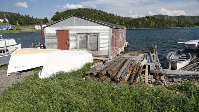
Even though this is not a commercial fishing area, there are still lots of docks, with dock houses and boats.
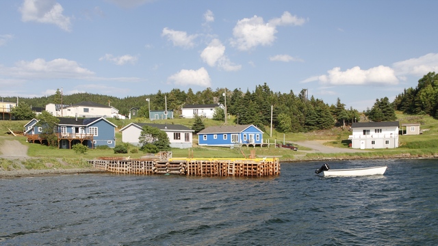
The village of Harry’s Harbour is also picturesque. To get here we drove through Nicky’s Nose Cove --- just how did this village get it’s name. Did the cove remind someone of Nicky’s Nose?
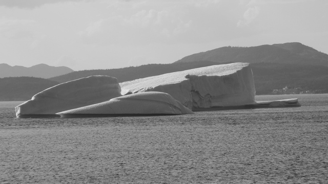
Yup, more icebergs. This one was about a ½ kilometre from us. (It's not your eyes, it's in black and white)]
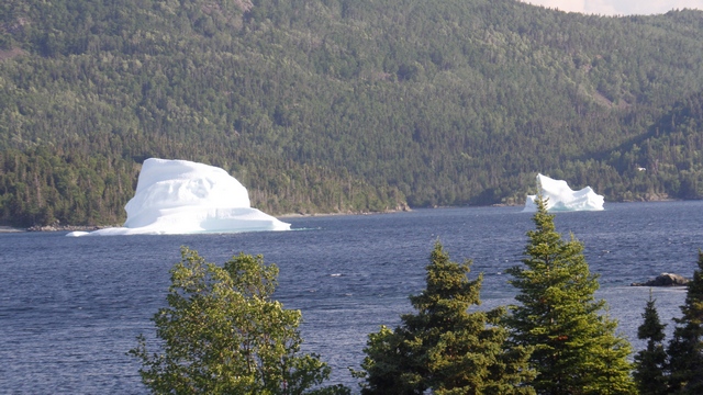
On the other side of Harry’s Harbour there were more icebergs.
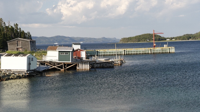
Jackson Cove has a small commercial fishing dock.
The campground has two areas --- beach and wooded. We’re in the beach area, about 4 sites up from the water but only one trailer partially blocks my view.
Leaving Terra Nova, we continue our journey west across Newfoundland. It was a beautiful day for driving and as we arrived in South Brook in the early afternoon we went exploring near Springdale. Springdale is a long, narrow town as it is wedged between the mountains and the ocean. In days gone by, the economy for the Springdale area was based on mining and logging. Today components of it’s economy are boat building, steel fabrication and aluminum casting.
Rattling Brook Falls is near the village of Rattling Brook. The viewing platform is accessed by a boardwalk and a few stairs.
You also get a great view of the bay.
Zaph’s not too spoiled --- I carry water and a collapsed dog bowl so he can have a drink when he’s thirsty.
Even though this is not a commercial fishing area, there are still lots of docks, with dock houses and boats.
The village of Harry’s Harbour is also picturesque. To get here we drove through Nicky’s Nose Cove --- just how did this village get it’s name. Did the cove remind someone of Nicky’s Nose?
Yup, more icebergs. This one was about a ½ kilometre from us. (It's not your eyes, it's in black and white)]
On the other side of Harry’s Harbour there were more icebergs.
Jackson Cove has a small commercial fishing dock.
2014/07/06: A Day Without Driving ....
Category: General
Posted by: The Agnew Family
is a day of rest for Ed.
The forecast had predicted rain this morning and clearing the afternoon. The weatherman was a little off, it was nice this morning and rained this afternoon. Don't know if this was any of the remnants from Arthur or another front.
The park has a number of hiking trails, one of them went from the campground to the information center. We decided to hike this one. Terra Nova National Park is on Newman Sound. The terrain reminds me a lot of the Bruce Peninsula and Northern Ontario.
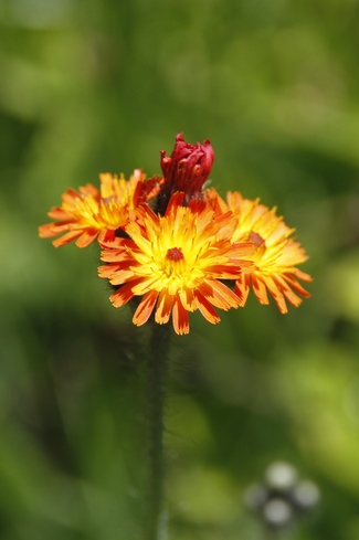
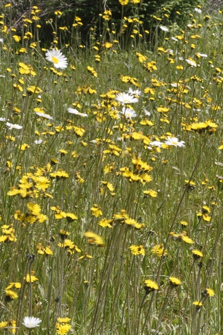
Lots of wild flowers on our walk.
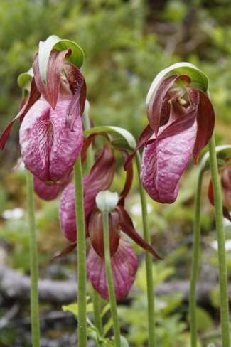
The flowers on the right are Lady Slippers.
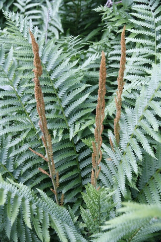
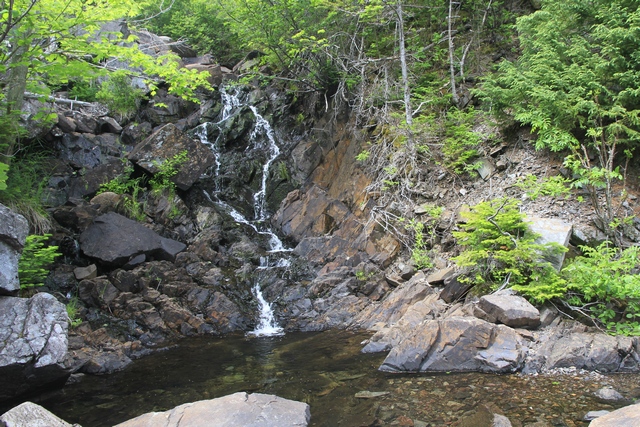
Pissamere Falls. Probably flowing better this evening after the rain.
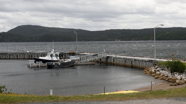
The Information Center for the park has a dock. Boat tours run out of here.
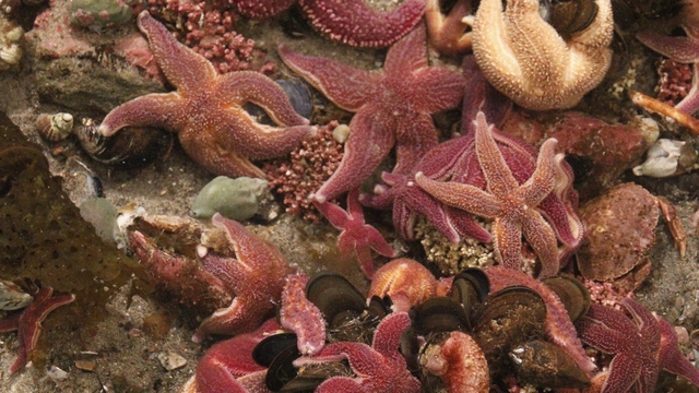
Inside the information center is a touch tank. Kids were having a great time picking up starfish, crabs, etc.
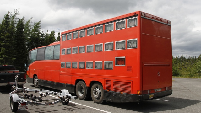
We've seen this vehicle a few times in the last three days. A tour company from Germany brought this vehicle to North America and offers tours in different areas, like Eastern Canada and Alaska. The front half of the bus offers regular coach seating. The back section of the bus is bunk sleeping.
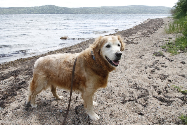
Zaph wondering why he couldn't go swimming.
The forecast had predicted rain this morning and clearing the afternoon. The weatherman was a little off, it was nice this morning and rained this afternoon. Don't know if this was any of the remnants from Arthur or another front.
The park has a number of hiking trails, one of them went from the campground to the information center. We decided to hike this one. Terra Nova National Park is on Newman Sound. The terrain reminds me a lot of the Bruce Peninsula and Northern Ontario.
Lots of wild flowers on our walk.
The flowers on the right are Lady Slippers.
Pissamere Falls. Probably flowing better this evening after the rain.
The Information Center for the park has a dock. Boat tours run out of here.
Inside the information center is a touch tank. Kids were having a great time picking up starfish, crabs, etc.
We've seen this vehicle a few times in the last three days. A tour company from Germany brought this vehicle to North America and offers tours in different areas, like Eastern Canada and Alaska. The front half of the bus offers regular coach seating. The back section of the bus is bunk sleeping.
Zaph wondering why he couldn't go swimming.
2014/07/05: Onward thru the Fog
Category: General
Posted by: The Agnew Family
There was one geocache in Trinity. When Ed, Zaph and I were out walking
we attempted to find the cache but didn't succeed. This morning we
decided to follow the instructions and try again. We found it! and also
found a great view of Trinity.
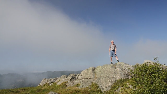
The trail to the cache took us to the top of a hill about 370 feet above Trinity.
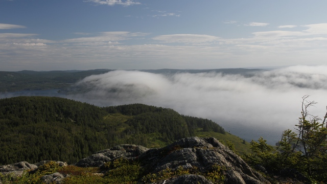
This morning the fog tried to come ashore ... it was like it was a live. A lot of fun to watch.
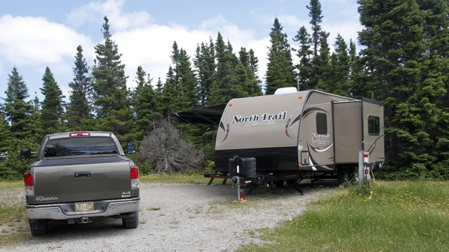
On the move again today. This time we traveled a whole 112 kilometers west to Terra Nova National Park. This is our first public park of the trip and we're roughing it --- 30 amp electrical but no water and no sewer. Actually feels good.
As Newfoundland is expecting the remnants of Hurricane Arthur tomorrow we decided to drive around the area this afternoon while the weather is good. We figure we can always go for a hike in the rain.
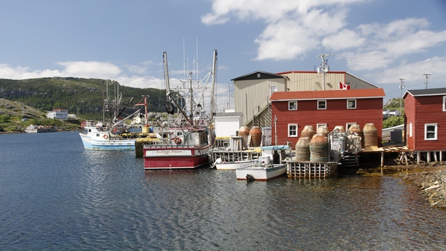
We did some geocaching and ended up in the town of Salvage at the end of the Eastport Peninsula. Salvage is the oldest European settlement along this part of the coast. It is still an active fishing community.
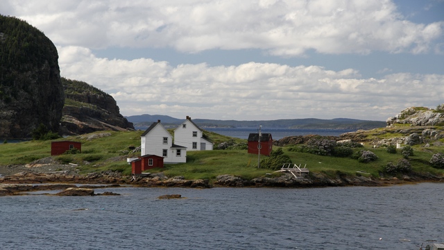
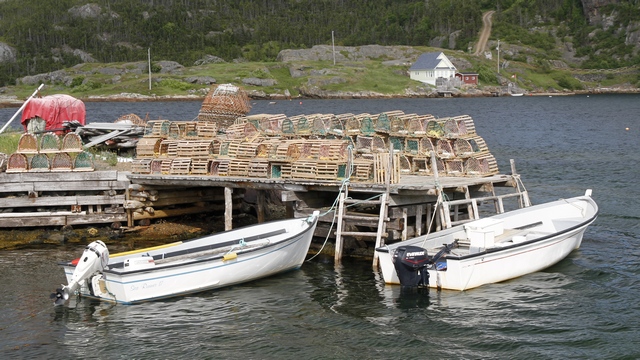
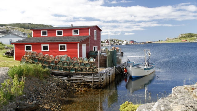
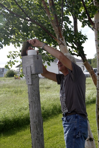
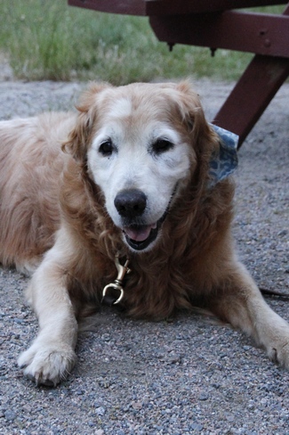
Now this was an easy geocache. The fellow put a box on post on the edge of his property. The cache was inside the box.
The trail to the cache took us to the top of a hill about 370 feet above Trinity.
This morning the fog tried to come ashore ... it was like it was a live. A lot of fun to watch.
On the move again today. This time we traveled a whole 112 kilometers west to Terra Nova National Park. This is our first public park of the trip and we're roughing it --- 30 amp electrical but no water and no sewer. Actually feels good.
As Newfoundland is expecting the remnants of Hurricane Arthur tomorrow we decided to drive around the area this afternoon while the weather is good. We figure we can always go for a hike in the rain.
We did some geocaching and ended up in the town of Salvage at the end of the Eastport Peninsula. Salvage is the oldest European settlement along this part of the coast. It is still an active fishing community.
Now this was an easy geocache. The fellow put a box on post on the edge of his property. The cache was inside the box.
2014/07/04: Bonavista Peninsula
Category: General
Posted by: The Agnew Family
We had been told to be sure to visit Bonavista, so today was the day. We
drove north from Trinity, looking for geocaches on the way. We found
several and then we found
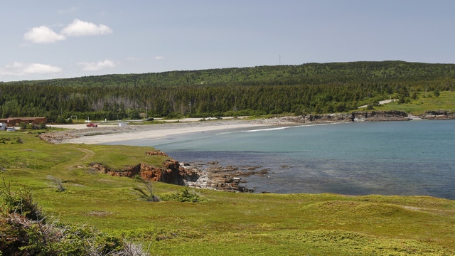
Sandy Beach, yup that's what it is called. It's the nicest sandy beach we've found in Newfoundland (I'm sure there's many more) and it's in Elliston.
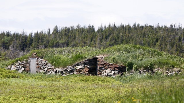
Elliston declared it self the "Root Cellar Capital of the World" in 2000. There are 133 documented root cellars, with some of them built as early as 1839.
Bird Island is also found in Elliston --- a puffin colony you can see from the mainland.
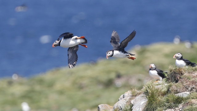
Ed got some great shots.
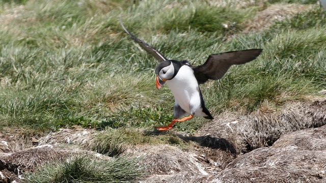
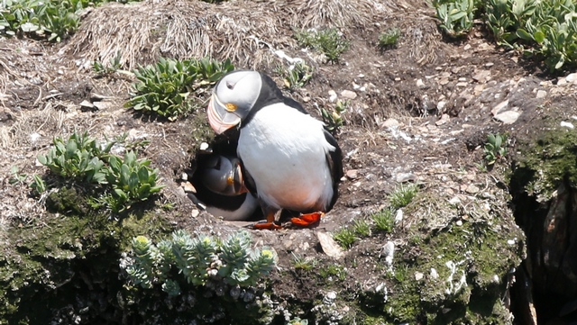
One puffin is sitting in the burrow and it's mate is standing near by.
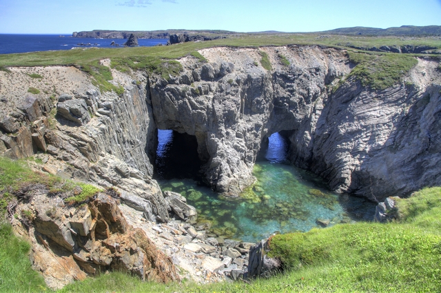
The "dungeon" at Dungeon Provincial Park. A collapsed sea cave with a natural archway carved out by sea action.
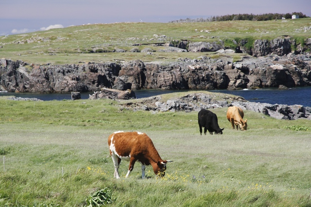
At Dungeon Provincial Park we saw some land perfect for grazing. First we saw several horses, then we saw cow patties and finally cows. Probably at least 20. We saw a number of fields of grass on the Bonavista Peninsula.
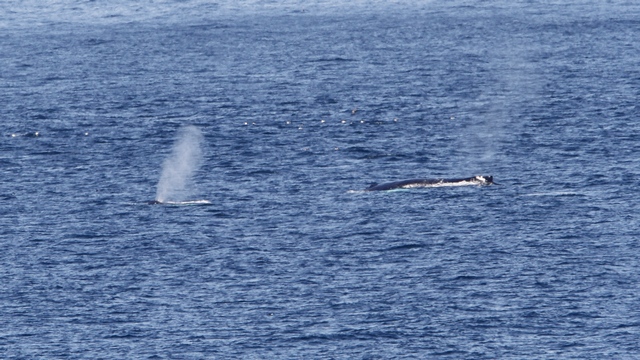
Both in Elliston and Cape Bonavista we saw a number of whales. Unfortunately, they were pretty far out. Ed did manage to get a shot of two whales that spent a fair bit of time swimming together.
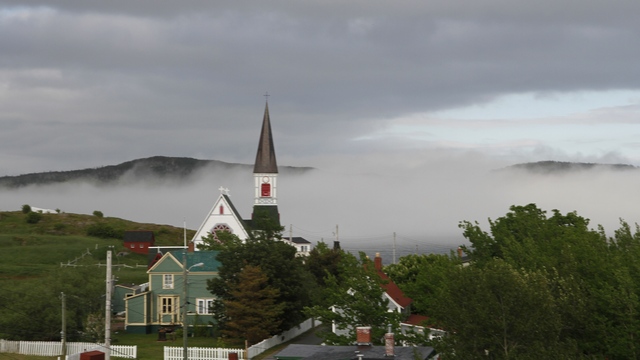
We drove into Trinity around 6:30 to have dinner. The temperature had dropped dramatically and the fog was rolling in.
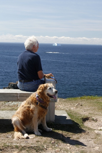
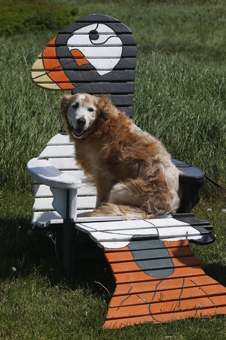
Zaph and Ed at Cape Bonavista ... see the iceberg in the distance.
Sandy Beach, yup that's what it is called. It's the nicest sandy beach we've found in Newfoundland (I'm sure there's many more) and it's in Elliston.
Elliston declared it self the "Root Cellar Capital of the World" in 2000. There are 133 documented root cellars, with some of them built as early as 1839.
Bird Island is also found in Elliston --- a puffin colony you can see from the mainland.
Ed got some great shots.
One puffin is sitting in the burrow and it's mate is standing near by.

The "dungeon" at Dungeon Provincial Park. A collapsed sea cave with a natural archway carved out by sea action.
At Dungeon Provincial Park we saw some land perfect for grazing. First we saw several horses, then we saw cow patties and finally cows. Probably at least 20. We saw a number of fields of grass on the Bonavista Peninsula.
Both in Elliston and Cape Bonavista we saw a number of whales. Unfortunately, they were pretty far out. Ed did manage to get a shot of two whales that spent a fair bit of time swimming together.
We drove into Trinity around 6:30 to have dinner. The temperature had dropped dramatically and the fog was rolling in.
Zaph and Ed at Cape Bonavista ... see the iceberg in the distance.
2014/07/03: Heat Wave
Category: General
Posted by: The Agnew Family
Change of scenery is in order so we packed up the trailer and started
driving west. As we drove the amount of fog would change .... if it was
13C it was pretty foggy, if it was 14C the fog lightened up
considerably. Think we found the dew point. Once we were off the Avalon
Peninsula the temperature started to rise. It wasn't long before it was
25C. According to Ed's thermometer the temperature hit 30C --- but it
was bad because it was windy.
Today's destination is Trinity, on the Bonavista Peninsula. From the Town of Trinity website: "Trinity has been a viable North Atlantic community for hundreds of years. Its defensible harbour, with abundant room for the ships of the day and shores well suited for outbuildings, wharves and fish-flakes, made it ideal for the early migratory fishery. Later, merchants from Poole, England, made Trinity the base for a new-world fishery."
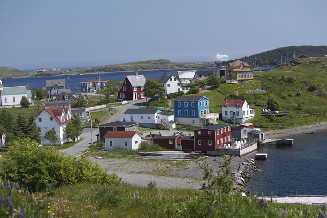
Our first view of Trinity. Can you see the iceberg?
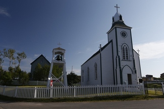
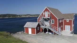
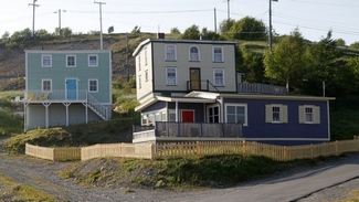
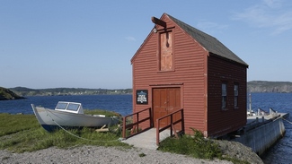
The Church of the Most Holy Trinity was built in 1833. In 1880 a bell tower was added. It now stands as the oldest wooden church in Newfoundland. The other three are just interesting looking buildings.
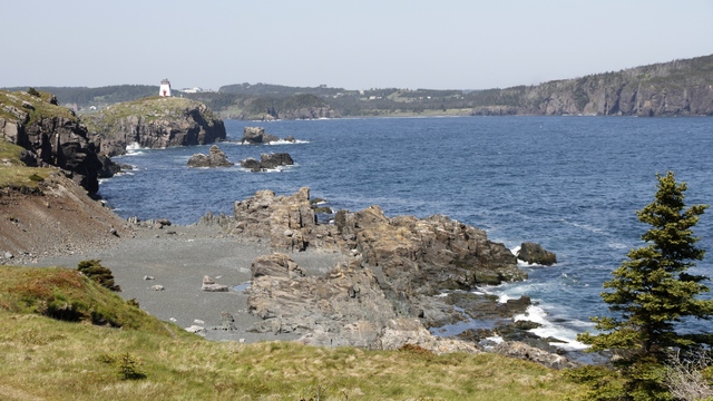
The fort and lighthouse are on a peninsula that protects the harbour.
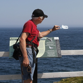
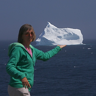
Fun with Icebergs. It's all a matter of perspective --- same iceberg, different location, different camera lenses, different photographer. Yes, it was 30C out but the wind off the water was really cold .... maybe something to do with the overgrown ice cube floating in it.
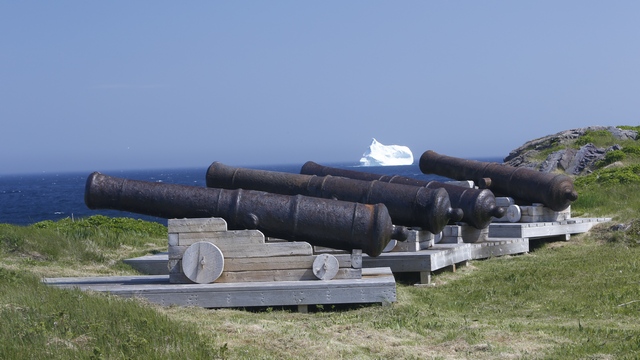
Fort Point was fortified in 1746. In 1762 the French invaded Trinity reducing the Fort Point to ruins.
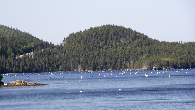
A commercial mussel farm has been set up in this cove. Usually the buoys are in straight lines but the wind moves them around.
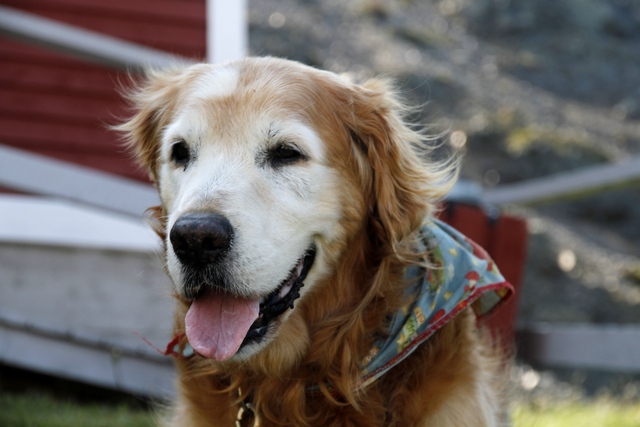
Today's destination is Trinity, on the Bonavista Peninsula. From the Town of Trinity website: "Trinity has been a viable North Atlantic community for hundreds of years. Its defensible harbour, with abundant room for the ships of the day and shores well suited for outbuildings, wharves and fish-flakes, made it ideal for the early migratory fishery. Later, merchants from Poole, England, made Trinity the base for a new-world fishery."
Our first view of Trinity. Can you see the iceberg?
The Church of the Most Holy Trinity was built in 1833. In 1880 a bell tower was added. It now stands as the oldest wooden church in Newfoundland. The other three are just interesting looking buildings.
The fort and lighthouse are on a peninsula that protects the harbour.
Fun with Icebergs. It's all a matter of perspective --- same iceberg, different location, different camera lenses, different photographer. Yes, it was 30C out but the wind off the water was really cold .... maybe something to do with the overgrown ice cube floating in it.
Fort Point was fortified in 1746. In 1762 the French invaded Trinity reducing the Fort Point to ruins.
A commercial mussel farm has been set up in this cove. Usually the buoys are in straight lines but the wind moves them around.
2014/07/02: Lazy Day
Category: General
Posted by: The Agnew Family
We woke up to a lot of wind and fog this morning. We had planned on
taking the ferry to Bell Island but decided it might not be the best
thing to do. Instead, we spent some time planning our drive home and
doing a few errands. I can't figure out which button I'm suppose to push
so the refrigerator will restock itself.
As the weatherman predicted the sun did come out and though the wind still blew it was warm. Turned into a beautiful afternoon, so we decided to take a drive up the coast from Holyrood to Portugal Cove (where you catch the ferry to Bell Island). This was one area we hadn't explored yet. I was surprised to see how far metropolitan St. John's has expanded. There were lots of new sub-divisions and new roads.
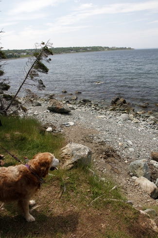
We stopped at Topsail Beach and went for a walk. Guess what we found??? yup a couple of geocaches.
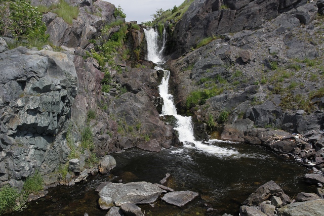
Portugal Cove turned out to be the prettiest spot on the drive. There was a small waterfall the said of the road.
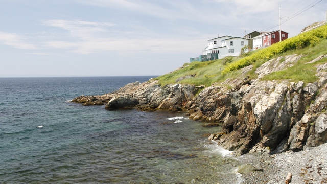
Some interesting houses on a cliff.
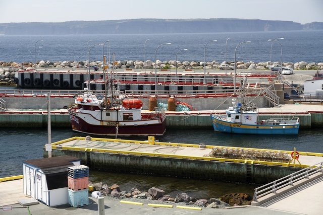
and of course boats and the ferry dock.
We also found a little restaurant that had really good fish and chips.
As the weatherman predicted the sun did come out and though the wind still blew it was warm. Turned into a beautiful afternoon, so we decided to take a drive up the coast from Holyrood to Portugal Cove (where you catch the ferry to Bell Island). This was one area we hadn't explored yet. I was surprised to see how far metropolitan St. John's has expanded. There were lots of new sub-divisions and new roads.
We stopped at Topsail Beach and went for a walk. Guess what we found??? yup a couple of geocaches.
Portugal Cove turned out to be the prettiest spot on the drive. There was a small waterfall the said of the road.
Some interesting houses on a cliff.
and of course boats and the ferry dock.
We also found a little restaurant that had really good fish and chips.
2014/07/01: Here a Bird, There a Bird, Everywhere a Bird
Category: General
Posted by: The Agnew Family
Today we celebrate Canada Day. We learned that today is also Memorial
Day for Newfoundland. On July 1, 1916 the Dominion of Newfoundland
troops suffered huge losses at The Battle of Somme during the First
World War. While Ed and I were at Cape Mary's Ecological Reserve we saw
part of a Memorial Day service.
I learned a second thing today --- how to embed a google map into my blog. Using your mouse you can move the map around and zoom in and out. If you click on the map, google maps will load in a new window.
We traveled clockwise around the route. The first stretch south was highway 90. The Newfoundland "paper" map, shows one town and that is where highway 90 intersections highway 91 so we were surprised to see a lot of homes in the first part of our drive. All the homes were on or near ponds so we're wondering if this is "cottage country". Continuing south on highway 92 we just see trees, lots of trees, some rocks and water and just the odd house here and there. The first town is Branch where highway 92 and highway 100 intersect. There are a number of homes here and a small harbour. The landscape changes as we travel west, we see fewer trees and more bogs, included a Cranberry bog (there was a sign) and a few fields. At least what looked like fields with fenced loading areas for livestock. Turning south towards the reserve, we see more fields and livestock loading areas. When we reached the reserve we saw sheep grazing.
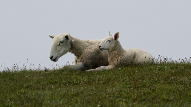
When we walked toward the birding area we had to watch where we stepped as the sheep had free rein.
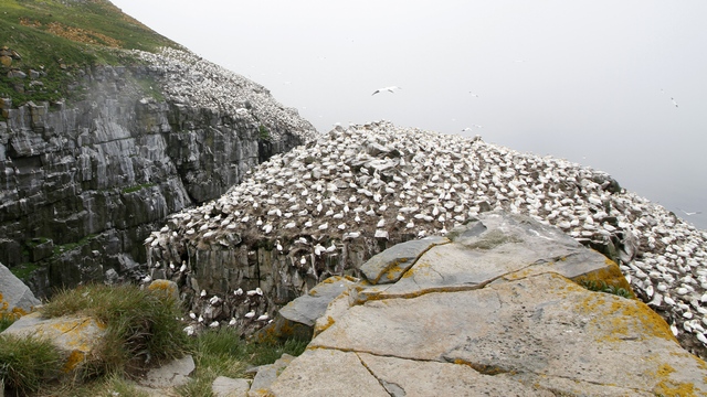
Over 32,000 nesting pairs can be found in this area. 11,000+ Northern Gannets, 10,000+ Common Mures, 10,000+ Black-Legged Kittiwakes, 150+ Razorbills, 60+ Black Guillemot, 1,000+ Thick-billed Mure. The birds nest in layers --- the Northern Gannet are found on top of the rocks, the Kittiwakes and ledges below the Gannets, the Razorbills below the Kittiwakes and the Murres below the Razorbills. The photo shows only a small portion of the nesting area.
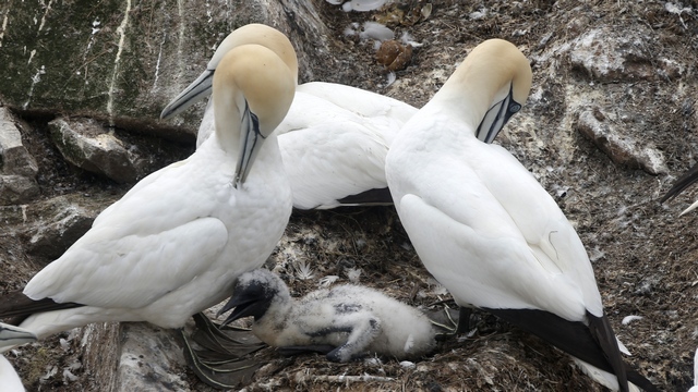
The Northern Gannet chicks have hatched. Most of the chicks are being sat on but this one seemed to be getting some air.
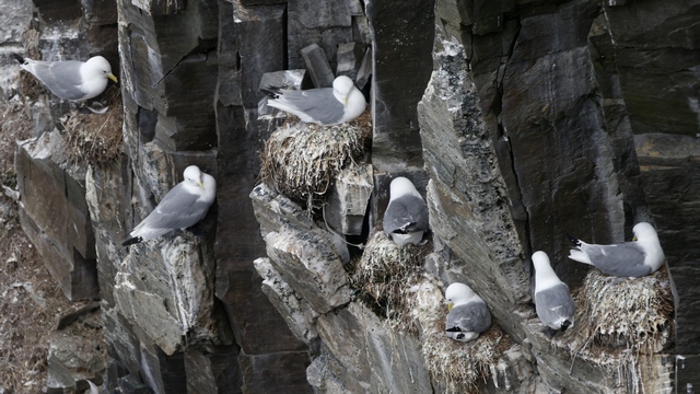
Black-legged Kittiwakes build their nests on small ledges to try and prevent the bigger birds (predators) from landing.
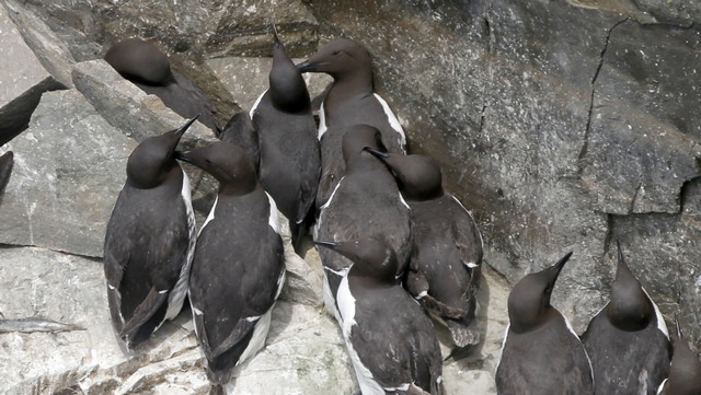
Common Mures.
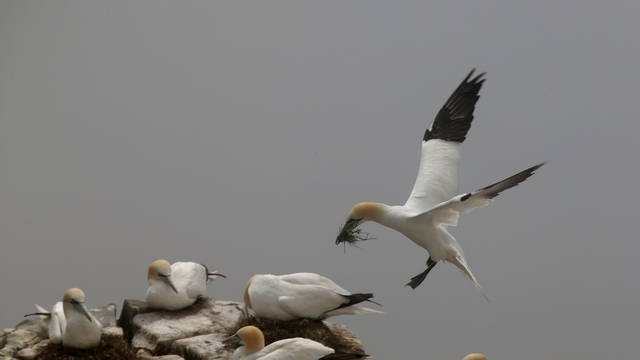
Ed took a lot of amazing shots. It was hard choosing the shots to show.
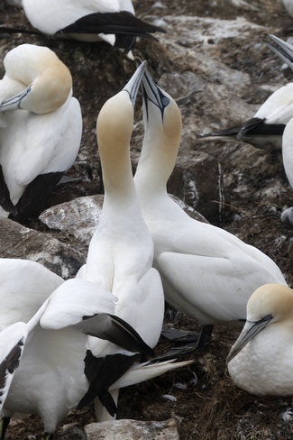
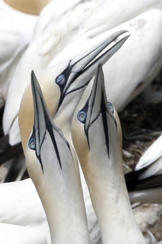
Gannet pairs are monogamous and may remain together over several seasons, if not for all their lives. The pairs separate when their chicks leave the nest but they pair up again the following year. The knocking of beaks is part of the pairs ritual behaviour.
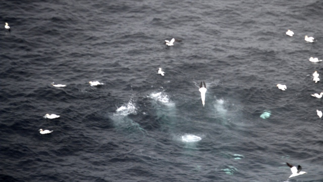
This isn't a very good photo but it's the best I have (for some reason Ed didn't take photos of the birds diving). The splashes are where Gannets dove into the water. The birds would be flying normally then suddenly aim straight down and dive into the water. A minute or so later the bird would surface. The "blobs" under the water are the birds swimming.
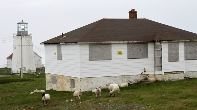
Cape St. Mary lighthouse and more sheep.
Leaving the reserve, we drove north on highway 100. Each cove we passed was a village but no docks or boats, fishing or otherwise to be seen. We did see a field with 14 cows and few gardens. Placentia is a small city. Here there was a harbour and some industry.
Ed decided to do some geocaching. One of the geocaches was at Fort Royal National Historic Sites. Happy Canada Day --- there was no charge today.
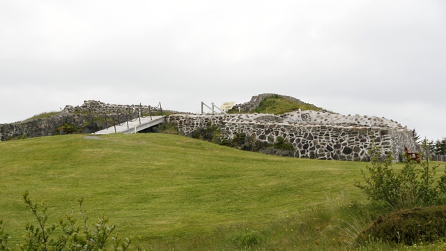
Fort Royal is a French fort built in 1687 on top of a hill to protect the harbour.
Another geocache took us to a blocked off driveway at the edge of a field. This is what we found:
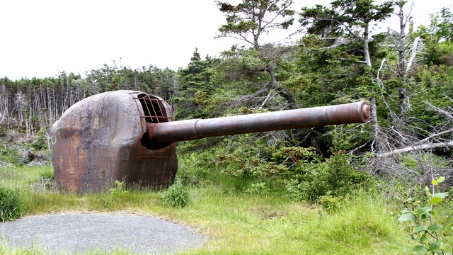
From the cache information and other websites, Ed was able to learn it is very rare, only a half dozen exit, it fired a 105 lb. 6" armour piercing shell at least 25KM (15 miles) at 5 per minute and electrically operated. Installed by the US Navy to protect US/Canadian/British ships operating in the nearby harbour." Another web site states: "Argentia 282 Coastal Defense Battery has aesthetic value as its design and construction technique are rare in the province. Known as the “200 Series” bunker, this underground fortification is likely the only one of its kind remaining with its original artillery guns in place. Built of concrete, the bunker is covered with soil and vegetation, blending into the landscape as its original design intended. The rare 6-inch Seacoast Guns M1903A2 remain in situ, complete with shields." We're surprised that it's laying basically abandoned in a field.
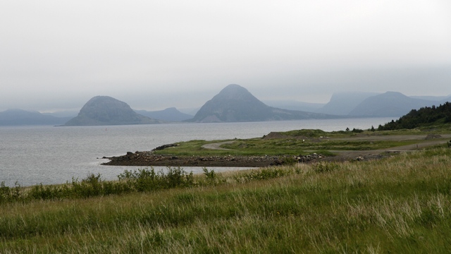
A third geocache took us near the Argentia ferry dock. Just loved the hills in the background.
The final leg of the drive was similar to what we have seen elsewhere in the Avalon Peninsula --- trees, rocks and water.
I learned a second thing today --- how to embed a google map into my blog. Using your mouse you can move the map around and zoom in and out. If you click on the map, google maps will load in a new window.
We traveled clockwise around the route. The first stretch south was highway 90. The Newfoundland "paper" map, shows one town and that is where highway 90 intersections highway 91 so we were surprised to see a lot of homes in the first part of our drive. All the homes were on or near ponds so we're wondering if this is "cottage country". Continuing south on highway 92 we just see trees, lots of trees, some rocks and water and just the odd house here and there. The first town is Branch where highway 92 and highway 100 intersect. There are a number of homes here and a small harbour. The landscape changes as we travel west, we see fewer trees and more bogs, included a Cranberry bog (there was a sign) and a few fields. At least what looked like fields with fenced loading areas for livestock. Turning south towards the reserve, we see more fields and livestock loading areas. When we reached the reserve we saw sheep grazing.
When we walked toward the birding area we had to watch where we stepped as the sheep had free rein.
Over 32,000 nesting pairs can be found in this area. 11,000+ Northern Gannets, 10,000+ Common Mures, 10,000+ Black-Legged Kittiwakes, 150+ Razorbills, 60+ Black Guillemot, 1,000+ Thick-billed Mure. The birds nest in layers --- the Northern Gannet are found on top of the rocks, the Kittiwakes and ledges below the Gannets, the Razorbills below the Kittiwakes and the Murres below the Razorbills. The photo shows only a small portion of the nesting area.
The Northern Gannet chicks have hatched. Most of the chicks are being sat on but this one seemed to be getting some air.
Black-legged Kittiwakes build their nests on small ledges to try and prevent the bigger birds (predators) from landing.
Common Mures.
Ed took a lot of amazing shots. It was hard choosing the shots to show.
Gannet pairs are monogamous and may remain together over several seasons, if not for all their lives. The pairs separate when their chicks leave the nest but they pair up again the following year. The knocking of beaks is part of the pairs ritual behaviour.
This isn't a very good photo but it's the best I have (for some reason Ed didn't take photos of the birds diving). The splashes are where Gannets dove into the water. The birds would be flying normally then suddenly aim straight down and dive into the water. A minute or so later the bird would surface. The "blobs" under the water are the birds swimming.
Cape St. Mary lighthouse and more sheep.
Leaving the reserve, we drove north on highway 100. Each cove we passed was a village but no docks or boats, fishing or otherwise to be seen. We did see a field with 14 cows and few gardens. Placentia is a small city. Here there was a harbour and some industry.
Ed decided to do some geocaching. One of the geocaches was at Fort Royal National Historic Sites. Happy Canada Day --- there was no charge today.
Fort Royal is a French fort built in 1687 on top of a hill to protect the harbour.
Another geocache took us to a blocked off driveway at the edge of a field. This is what we found:
From the cache information and other websites, Ed was able to learn it is very rare, only a half dozen exit, it fired a 105 lb. 6" armour piercing shell at least 25KM (15 miles) at 5 per minute and electrically operated. Installed by the US Navy to protect US/Canadian/British ships operating in the nearby harbour." Another web site states: "Argentia 282 Coastal Defense Battery has aesthetic value as its design and construction technique are rare in the province. Known as the “200 Series” bunker, this underground fortification is likely the only one of its kind remaining with its original artillery guns in place. Built of concrete, the bunker is covered with soil and vegetation, blending into the landscape as its original design intended. The rare 6-inch Seacoast Guns M1903A2 remain in situ, complete with shields." We're surprised that it's laying basically abandoned in a field.
A third geocache took us near the Argentia ferry dock. Just loved the hills in the background.
The final leg of the drive was similar to what we have seen elsewhere in the Avalon Peninsula --- trees, rocks and water.