2014/06/30: A Picture Perfect Day
Category: General
Posted by: The Agnew Family
Couldn't have asked for a better day today. Lots of sun, some warmth and
a bit of fog thrown in to give the water based photos some extra
character.
We decided that it was to visit the two best known tourist attractions in St. John's --- Cape Spear and Signal Hill.
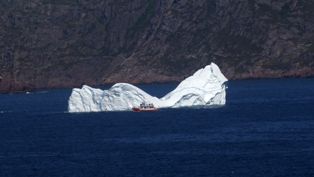
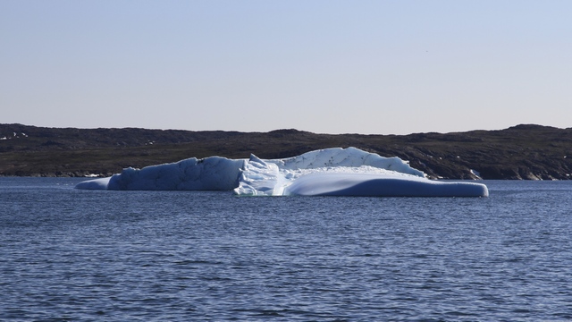
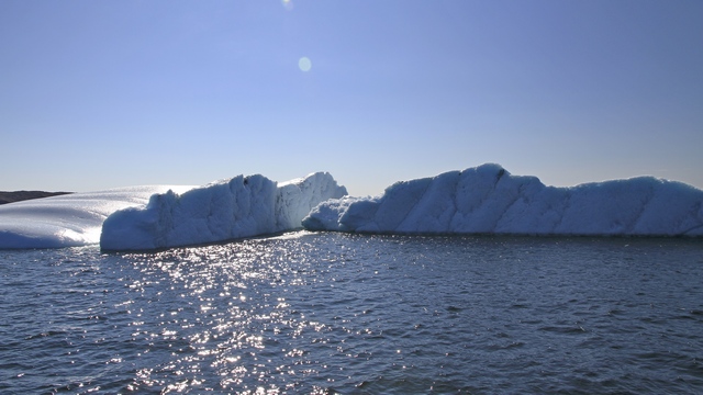
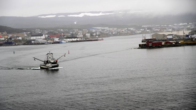
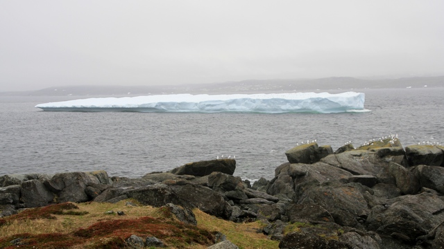
Yes, more icebergs. We saw several bergs as we neared Cape Spear. That's a tour boat driving past the iceberg in St. John's Bay.
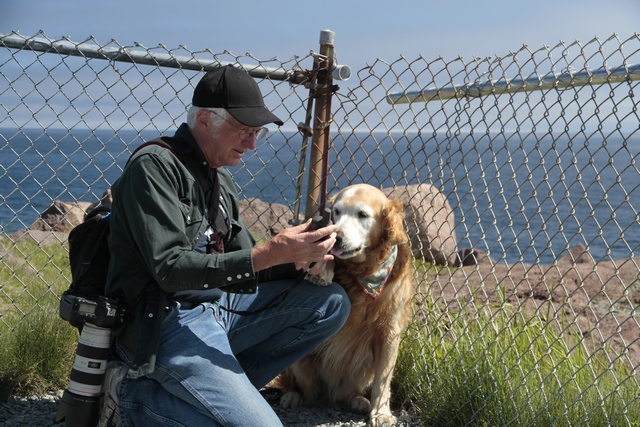
Cape Spear is the eastern most point in Canada and the eastern most point in continental North America. My boy's at the most eastern point .... well at least as far as they were allowed to go.
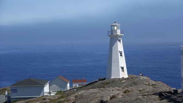
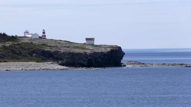
A lighthouse has operated at Cape Spear since September 1836. This is the current lighthouse.
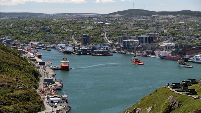
Signal Hill is a hill which overlooks the city of St. John's. Due to its strategic placement overlooking the harbour, fortifications have been placed on the hill since the mid 17th century. Signal Hill is also famous as the place where Guglielmo Marconi received the first transatlantic wireless transmission on December 12, 1901.
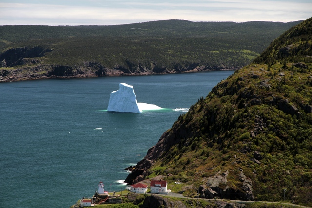
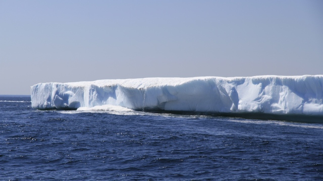
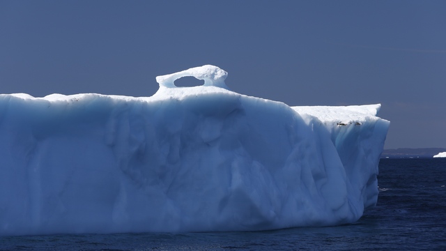
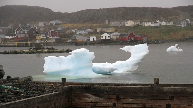
Another berg in St. John's Bay. I think this is the tallest one we've seen. Fort Amherst is at the bottom of the photo. The first lighthouse was built in 1810, the current lighthouse was built in 1951.
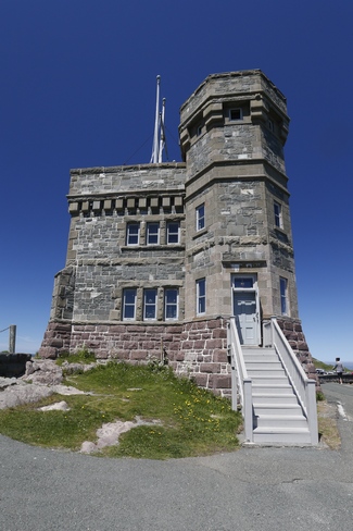
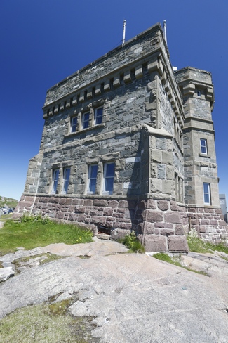
Construction on Cabot Tower began in 1897 to commemorate Queen Victoria's Diamond Jubilee in 1897 and the 400th anniversary of John Cabot's landfall in 1497. The building was declared officially open in 1900. The practical uses of the building were flag mast signalling, and a Marconi wireless station which has since been moved to St. John's International Airport.
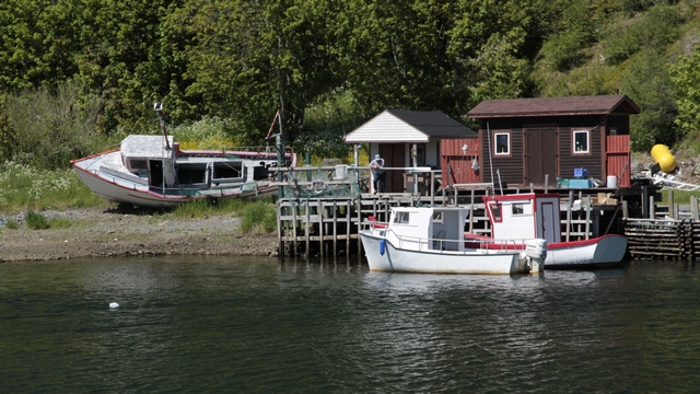
Quidi Vidi Village was once a fishing village, now it is home to the Quidi Vidi Plantation and Quidi Vidi Brewery.
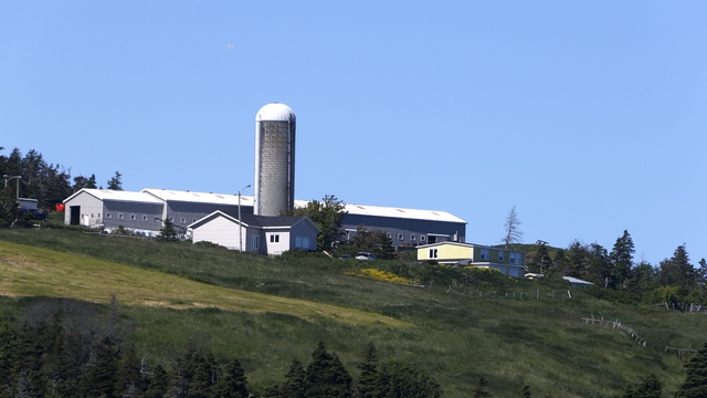
This is the first barn and silo we have seen in Newfoundland. Most of the landscape is trees, water, rocks and bogs, so seeing fields was unusual.
The Trans Canada Highway either starts or ends in St. John's depending which direction you are traveling. We drove to the start of the Trans Canada Highway and were a little disappointed --- the highway just started, no sign, no fan fare just a road. We pulled off at the first exit to figure out where we were going next and thought we had teleported to one of the larger cities in Ontario. There was plaza after plaza filled with box stores, all the big brand name stores, restaurants from most of the big chains and a huge Princess Auto. After Ed made a quick visit to Princess Auto (for any Americans reading this, Princess Auto is like Harbor Freight only bigger) we sped out of the area look for picturesque harbours and fishing villages.
We decided that it was to visit the two best known tourist attractions in St. John's --- Cape Spear and Signal Hill.
Yes, more icebergs. We saw several bergs as we neared Cape Spear. That's a tour boat driving past the iceberg in St. John's Bay.
Cape Spear is the eastern most point in Canada and the eastern most point in continental North America. My boy's at the most eastern point .... well at least as far as they were allowed to go.
A lighthouse has operated at Cape Spear since September 1836. This is the current lighthouse.
Signal Hill is a hill which overlooks the city of St. John's. Due to its strategic placement overlooking the harbour, fortifications have been placed on the hill since the mid 17th century. Signal Hill is also famous as the place where Guglielmo Marconi received the first transatlantic wireless transmission on December 12, 1901.
Another berg in St. John's Bay. I think this is the tallest one we've seen. Fort Amherst is at the bottom of the photo. The first lighthouse was built in 1810, the current lighthouse was built in 1951.
Construction on Cabot Tower began in 1897 to commemorate Queen Victoria's Diamond Jubilee in 1897 and the 400th anniversary of John Cabot's landfall in 1497. The building was declared officially open in 1900. The practical uses of the building were flag mast signalling, and a Marconi wireless station which has since been moved to St. John's International Airport.
Quidi Vidi Village was once a fishing village, now it is home to the Quidi Vidi Plantation and Quidi Vidi Brewery.
This is the first barn and silo we have seen in Newfoundland. Most of the landscape is trees, water, rocks and bogs, so seeing fields was unusual.
The Trans Canada Highway either starts or ends in St. John's depending which direction you are traveling. We drove to the start of the Trans Canada Highway and were a little disappointed --- the highway just started, no sign, no fan fare just a road. We pulled off at the first exit to figure out where we were going next and thought we had teleported to one of the larger cities in Ontario. There was plaza after plaza filled with box stores, all the big brand name stores, restaurants from most of the big chains and a huge Princess Auto. After Ed made a quick visit to Princess Auto (for any Americans reading this, Princess Auto is like Harbor Freight only bigger) we sped out of the area look for picturesque harbours and fishing villages.
2014/06/29: Puffins!!!!
Category: General
Posted by: The Agnew Family
Todays outing took us to the coast and slightly south. Our final
destination is a tour of the Witless Bay Estuary out of Mobile which is
about 40 kilometers south of St. John's. One of the "must do" items on
my list for Newfoundland was to see Puffins.
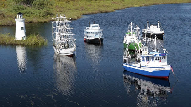
SHIPS AHOY!!!! As we were driving down highway 10, we spotted boats in a pond. Turns out the fellow across the road builds and sells model boats. He even has small boats with docks and people.
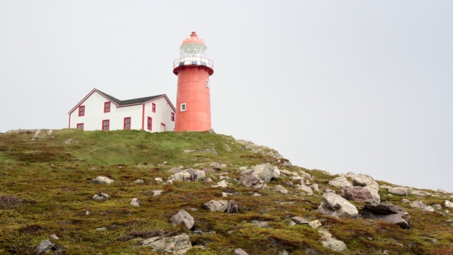
Ferryland was founded in 1621 by Lord Baltimore. This is the Ferryland lighthouse. Some enterprising people office picnics at the lighthouse. You pre-order your picnic and pick it up at the light keepers house.
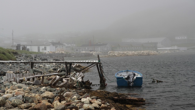
Interesting weather today. One minute you were in the sun, next minute you were in fog. Makes for some great photographs.
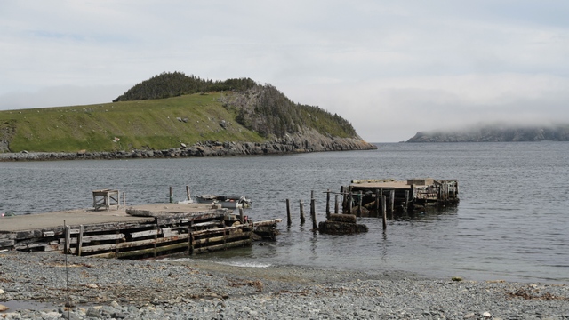
The island on the left of photo has sheep grazing on it. The sheep are taken out to the island in the summer.
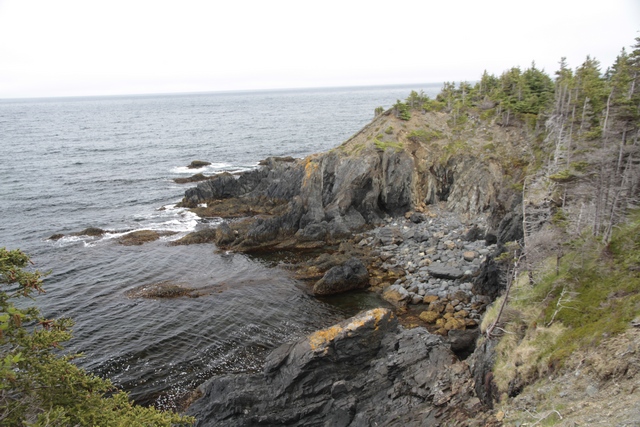
The East Coast Trail is 540 kilometers long (265 kilometers of it have maps and signage). The trail follows the east coast of the Avalon Peninsula. We walked a couple of kilometers of it.
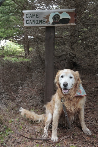
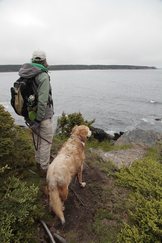
Zaph's favourite cove.
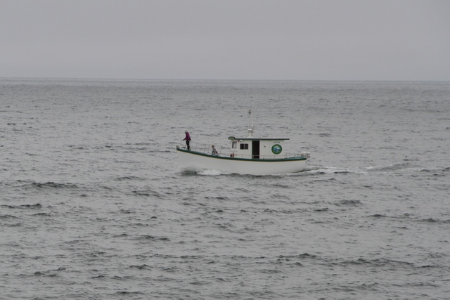
After researching all the Puffin and Whale Watching Tours, we chose Molly Bawn Whale and Puffin Tours. It is a smaller boat that holds 12 people but it's still big enough to keep the cameras dry. Ed and I were lucky and were the only people on the 5:30 tour today. The ladies asked what we were most interested in and we answered Puffins, so they choose a route that would give us good views of puffins. Not only did we see puffins but we saw Kittiwakes, Razorbills, Black Guillemots, Murres and Humpback Whales.
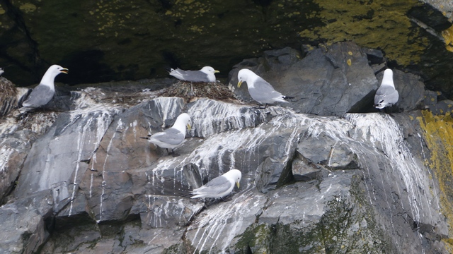
Black-legged Kittiwake like to nest on small rock ledges.
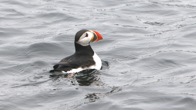
The Atlantic Puffin is the smallest of the three Puffins, with a length of 12.5 inches, wing span of 21 inches and a weight of 13 ounces. The other two puffins being the tufted and horned that are found along the west coast.
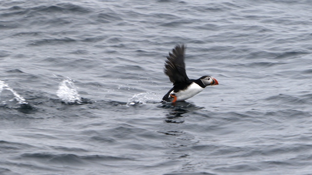
Sometimes you just have to run on the water before you can take off.
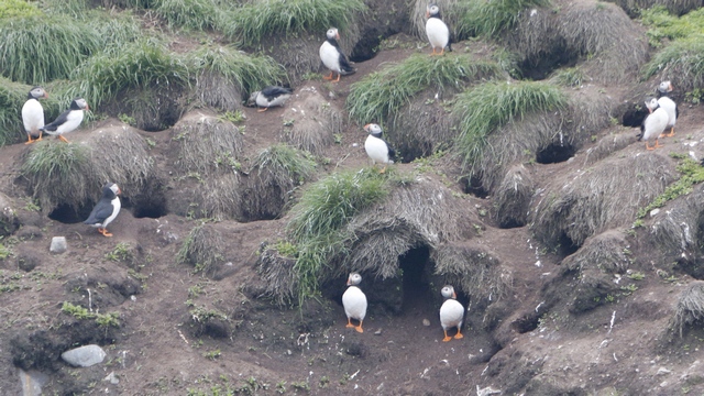
The puffins winter in the Atlantic Ocean and spend the summers nesting on small islands along the coast. Puffins dig burrows and lay one egg in the burrow. The chick remains in the burrow until it is nearly fully fledged.
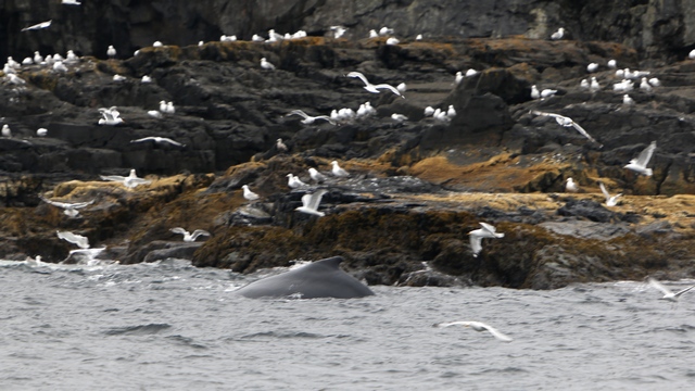
We saw a couple of whales while we were out. People living along the coast will text the boat if they see a whale, which was the case today. Capelin (a small fish) have come into the bay and whales follow them in. This whale was pushing the capelin up to the rocks making it easier to feed. The Gulls were taking advantage of the situation.
SHIPS AHOY!!!! As we were driving down highway 10, we spotted boats in a pond. Turns out the fellow across the road builds and sells model boats. He even has small boats with docks and people.
Ferryland was founded in 1621 by Lord Baltimore. This is the Ferryland lighthouse. Some enterprising people office picnics at the lighthouse. You pre-order your picnic and pick it up at the light keepers house.
Interesting weather today. One minute you were in the sun, next minute you were in fog. Makes for some great photographs.
The island on the left of photo has sheep grazing on it. The sheep are taken out to the island in the summer.
The East Coast Trail is 540 kilometers long (265 kilometers of it have maps and signage). The trail follows the east coast of the Avalon Peninsula. We walked a couple of kilometers of it.
Zaph's favourite cove.
After researching all the Puffin and Whale Watching Tours, we chose Molly Bawn Whale and Puffin Tours. It is a smaller boat that holds 12 people but it's still big enough to keep the cameras dry. Ed and I were lucky and were the only people on the 5:30 tour today. The ladies asked what we were most interested in and we answered Puffins, so they choose a route that would give us good views of puffins. Not only did we see puffins but we saw Kittiwakes, Razorbills, Black Guillemots, Murres and Humpback Whales.
Black-legged Kittiwake like to nest on small rock ledges.
The Atlantic Puffin is the smallest of the three Puffins, with a length of 12.5 inches, wing span of 21 inches and a weight of 13 ounces. The other two puffins being the tufted and horned that are found along the west coast.
Sometimes you just have to run on the water before you can take off.
The puffins winter in the Atlantic Ocean and spend the summers nesting on small islands along the coast. Puffins dig burrows and lay one egg in the burrow. The chick remains in the burrow until it is nearly fully fledged.
We saw a couple of whales while we were out. People living along the coast will text the boat if they see a whale, which was the case today. Capelin (a small fish) have come into the bay and whales follow them in. This whale was pushing the capelin up to the rocks making it easier to feed. The Gulls were taking advantage of the situation.
2014/06/28: The Sun is Back!!!
Category: General
Posted by: The Agnew Family
The rain stopped but the fog rolled. Couldn't see very far this morning
so we opted for a lazy morning. The weatherman was correct and it
started to clear by noon.
Today's adventure would take us to the small town of Holyrood, then northwest along the coast through Brigus, Cupids and to Bay Roberts.

Wild Lupins are growing everywhere. Purple is dominate but sprinkled in the mix are pinks and a few white.
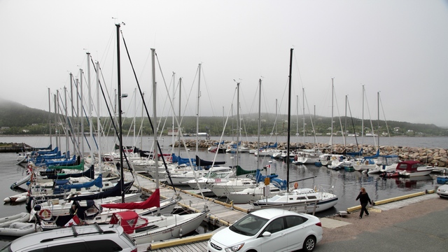
The Holyrood yacht club ... a little different from the fishing boats we've been seeing.
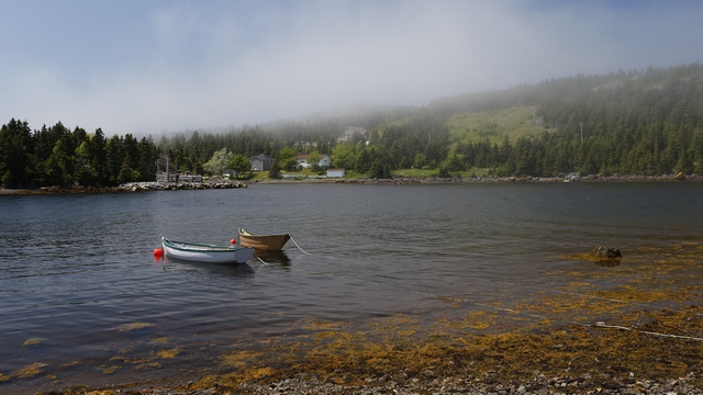
Along the road, this little harbour caught our attention.
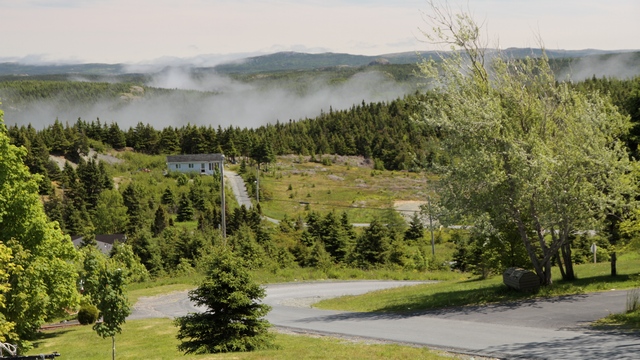
I think the fog coming up from the valleys gives the area a fairytale feeling.
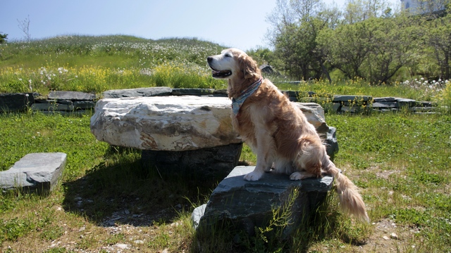
The town of Brigus dates back to around 1612. It is famous for its sea Captains, especially Captain Bob Barlett. Table and chairs of rocks were built in this small park looking out into Conception Bay.
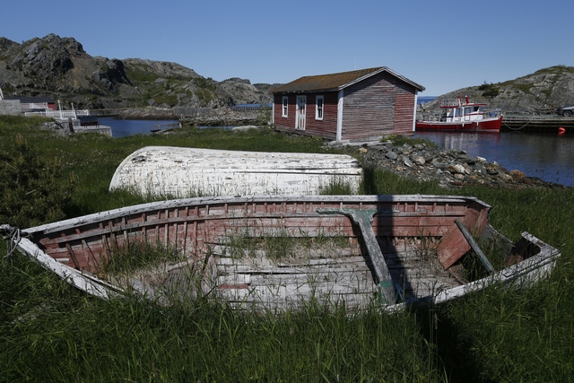
The streets are narrow, many of the houses are old and views are beautiful.
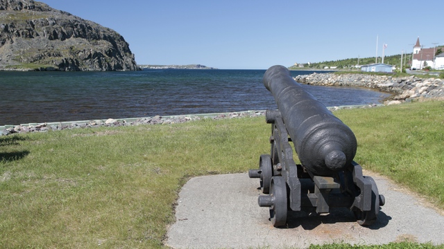
The town of Cupids is steeped in history. Cupids was founded in 1610 and is considered the birth place of English Canada. John Guy and 39 colonists of the London and Bristol Company of Merchant Venturers were the first settlers. The town has been continuously occupied since then.
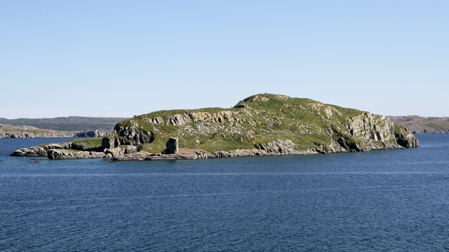
The town of Bay Roberts has a shoreline trail that we decided to walk. Looking at Fergus Island from this point you can see that it is shaped like a large Newfoundland dog at rest. The dog's head is forward and its two paws are stretched in front of its face.
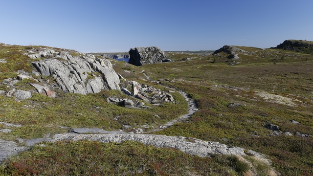
The trail lead us along the rocky coastline and over a pass.
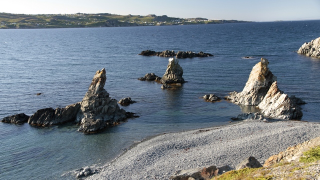
At the end of the trail we found the "Mad Rocks", these ones are referred to as the three sisters .... and a parking lot. The guide book didn't mention that you could drive to the end of the point to see the view and the rocks. Oh, well we did enjoy the 6km hike.
Today's adventure would take us to the small town of Holyrood, then northwest along the coast through Brigus, Cupids and to Bay Roberts.
Wild Lupins are growing everywhere. Purple is dominate but sprinkled in the mix are pinks and a few white.
The Holyrood yacht club ... a little different from the fishing boats we've been seeing.
Along the road, this little harbour caught our attention.
I think the fog coming up from the valleys gives the area a fairytale feeling.
The town of Brigus dates back to around 1612. It is famous for its sea Captains, especially Captain Bob Barlett. Table and chairs of rocks were built in this small park looking out into Conception Bay.
The streets are narrow, many of the houses are old and views are beautiful.
The town of Cupids is steeped in history. Cupids was founded in 1610 and is considered the birth place of English Canada. John Guy and 39 colonists of the London and Bristol Company of Merchant Venturers were the first settlers. The town has been continuously occupied since then.
The town of Bay Roberts has a shoreline trail that we decided to walk. Looking at Fergus Island from this point you can see that it is shaped like a large Newfoundland dog at rest. The dog's head is forward and its two paws are stretched in front of its face.
The trail lead us along the rocky coastline and over a pass.
At the end of the trail we found the "Mad Rocks", these ones are referred to as the three sisters .... and a parking lot. The guide book didn't mention that you could drive to the end of the point to see the view and the rocks. Oh, well we did enjoy the 6km hike.
2014/06/27: Splish, Splash, I was...
Category: General
Posted by: The Agnew Family
walking through St. John's. As predicted it was raining today, so it
became "visit downtown day". Figured when we got too wet we could go
into a store, restaurant, etc. and dry off.
St. John's is a pretty city, even in the rain. The focal point is the habour.
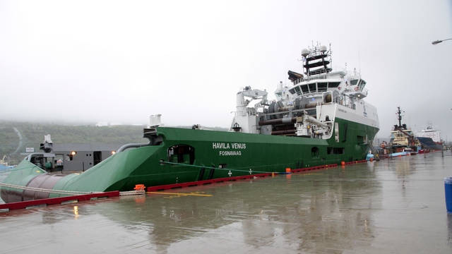
Ed and I have never seen a ship with a stern like this one so we looked it up on the Internet. It is an "anchor handling tug supply vessel". The ship handles anchors for oil rigs, tows oil rigs to location, anchor the rigs up and in few cases serve as emergency rescue and recovery vessels. This particular ship was built in 2009.
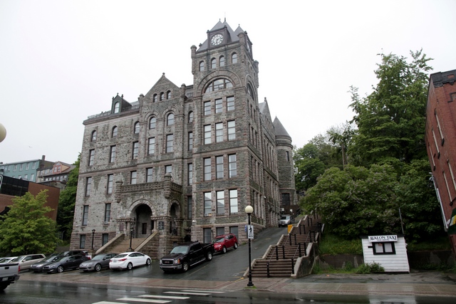
Best as I can tell Water Street is the main street in the downtown area --- all the Canadian banks have large buildings on it, the courthouse is on it as well as a lots of stores and restaurants. The photo is of the court house on Water Street.
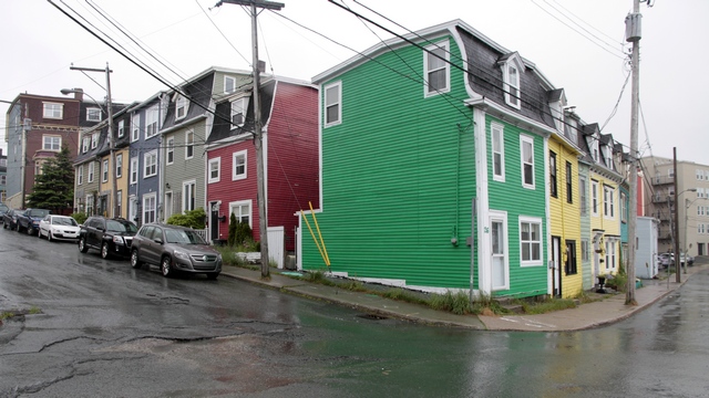
St. John's is well known for it's brightly coloured houses. Everywhere you look in the old area of town are the mult-coloured houses. Certainly helped brightened up a cold rainy day.
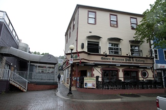
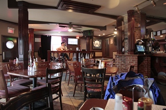
George Street is only 2 blocks long, but it's a fun street. Every building on the street is a bar or pub. They say the street becomes one big party in the late evenings. We stopped at Green Sleeve Pub and Eatery for lunch. I was surprised to see entertainment.
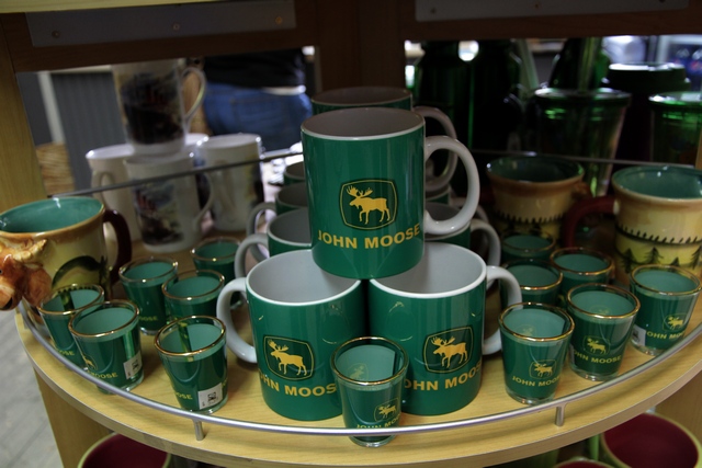
We don't usually take photos in stores but did this one for our "farmer" friends.
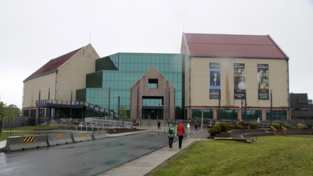
The Rooms houses the Art Gallery of Newfoundland and Labrador, the Provincial Archives of Newfoundland and Labrador and the Provincial Museum of Newfoundland and Labrador. The building was constructed in 2005 on a hill overlooking the city.
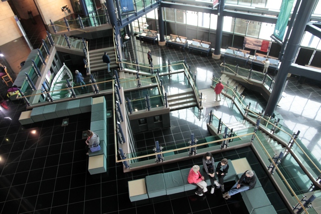
The interior of the building. We learned a lot about Newfoundland and particularly St. John's history. The views from the building are probably amazing on a clear day as they weren't bad today.
I added a photo of a moose detector to yesterday's blog.
St. John's is a pretty city, even in the rain. The focal point is the habour.
Ed and I have never seen a ship with a stern like this one so we looked it up on the Internet. It is an "anchor handling tug supply vessel". The ship handles anchors for oil rigs, tows oil rigs to location, anchor the rigs up and in few cases serve as emergency rescue and recovery vessels. This particular ship was built in 2009.
Best as I can tell Water Street is the main street in the downtown area --- all the Canadian banks have large buildings on it, the courthouse is on it as well as a lots of stores and restaurants. The photo is of the court house on Water Street.
St. John's is well known for it's brightly coloured houses. Everywhere you look in the old area of town are the mult-coloured houses. Certainly helped brightened up a cold rainy day.
George Street is only 2 blocks long, but it's a fun street. Every building on the street is a bar or pub. They say the street becomes one big party in the late evenings. We stopped at Green Sleeve Pub and Eatery for lunch. I was surprised to see entertainment.
We don't usually take photos in stores but did this one for our "farmer" friends.
The Rooms houses the Art Gallery of Newfoundland and Labrador, the Provincial Archives of Newfoundland and Labrador and the Provincial Museum of Newfoundland and Labrador. The building was constructed in 2005 on a hill overlooking the city.
The interior of the building. We learned a lot about Newfoundland and particularly St. John's history. The views from the building are probably amazing on a clear day as they weren't bad today.
I added a photo of a moose detector to yesterday's blog.
2014/06/26: Holyrood
Category: General
Posted by: The Agnew Family
Ed was feeling geocached deprived, so he took an hour this morning and
found a few geocaches around Gander. Then we drove to the most easterly
campground on our trip. We're about 45 kilometers from St. John's, the
capital of Newfoundland. The campground we're at is just off the Trans
Canada highway and has absolutely nothing around it. We chose this
location as it puts us within day trip range to a lot of things we want
to see in the Avalon Peninsula. Once we settled in, Ed ran a couple of
errands (and found a couple of geocaches) in the town of Holyrood, about
6 kilometers away. Lucky me, I did laundry.
On our drive today we saw moose detectors on the side of the highway (this is the second time we've seen them). When a moose is detected, signs flash lights to warm of a moose on the highway. We've also seen a couple of signs indicating the number of car/moose accidents so far this year. Moose on the highways appears to be a major problem in Newfoundland.
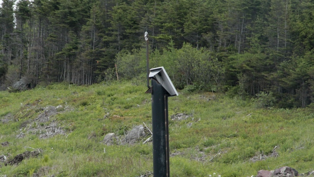
On our drive today we saw moose detectors on the side of the highway (this is the second time we've seen them). When a moose is detected, signs flash lights to warm of a moose on the highway. We've also seen a couple of signs indicating the number of car/moose accidents so far this year. Moose on the highways appears to be a major problem in Newfoundland.
2014/06/25: Rain, Rain Go Away ....
Category: General
Posted by: The Agnew Family
I'll start with the token Zaphod picture today.
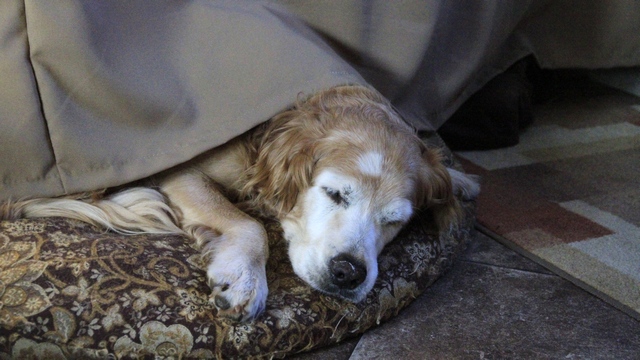
It was actually sunny when I got up this morning so I closed the curtain around the bed to darken the sleeping area. Zaph didn't seem to mind.
The two big iceberg areas in Newfoundland are St. Anthony and Twillingate. This year icebergs are plentiful and are being seen all the way down the coast to St. John's. We opted to do the iceberg boat tour in St. Anthony but I managed to fit a day trip to Twillingate into our itinerary. Happily, there were lots of icebergs and closer to shore than in St. Anthony; sadly it was raining so the iceberg photos aren't as good as they could be.
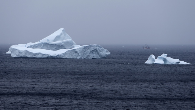
If you look closely you can see a fishing boat just over the smaller iceberg. There are some pretty big bergs in the Twillingate area.
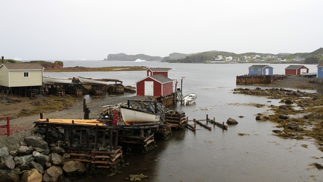
As we drove around the Twillingate area we saw one picturesque spot after another. The brightly coloured buildings help to add some light to a dull day.
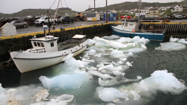
There's still a lot of pack ice around the harbour. Some boats aren't able to get out yet.
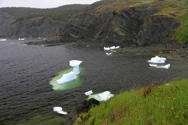
The light green area around the bigger iceberg in this photo is under water.
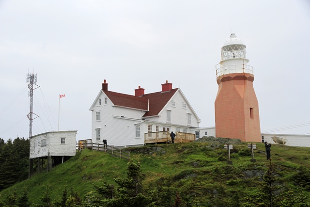
Long Point Lighthouse in Crow Head, Twillingate. The lighthouse is still operational and is operated by one lighthouse keeper year-round.
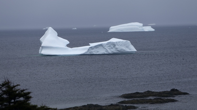
One more iceberg photo.
It was actually sunny when I got up this morning so I closed the curtain around the bed to darken the sleeping area. Zaph didn't seem to mind.
The two big iceberg areas in Newfoundland are St. Anthony and Twillingate. This year icebergs are plentiful and are being seen all the way down the coast to St. John's. We opted to do the iceberg boat tour in St. Anthony but I managed to fit a day trip to Twillingate into our itinerary. Happily, there were lots of icebergs and closer to shore than in St. Anthony; sadly it was raining so the iceberg photos aren't as good as they could be.
If you look closely you can see a fishing boat just over the smaller iceberg. There are some pretty big bergs in the Twillingate area.
As we drove around the Twillingate area we saw one picturesque spot after another. The brightly coloured buildings help to add some light to a dull day.
There's still a lot of pack ice around the harbour. Some boats aren't able to get out yet.
The light green area around the bigger iceberg in this photo is under water.
Long Point Lighthouse in Crow Head, Twillingate. The lighthouse is still operational and is operated by one lighthouse keeper year-round.
One more iceberg photo.
2014/06/24: Gander
Category: General
Posted by: The Agnew Family
Time to leave beautiful Gros Morne National Park and start heading east.
Today we are driving as far as Gander, about 375 kilometers. After
settling in we drive over to the North Atlantic Aviation Museum. The
front of the building looks like this
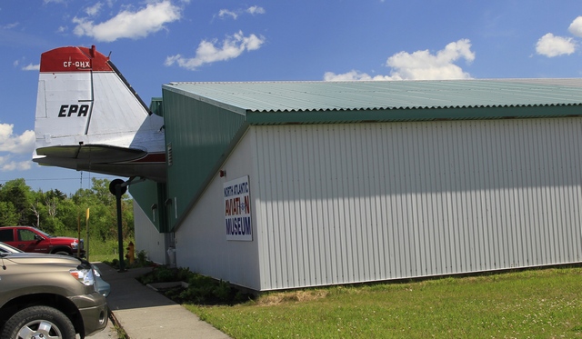
the tail of a DC 3
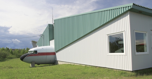
The back of the building is the nose of the DC-3
How Gander came to be is an interesting story. In 1935, The British Overseas Airways Corporation came to Newfoundland to find a suitable place for an airport. Their motivation was profit and pit stops, airplanes need to refuel before they flew across the Atlantic. They found Hattie`s Camp -- an abandoned sawmill at Mile 213 of the Newfoundland Railway. The land was flat, accessible by rail and close to a lake suitable for landing sea planes. Within three short years, Hattie`s Camp became not just an airport but the largest airport in the world. Somewhere along the way, Hattie's Camp became known as Gander. Gander was a hub of activity during WWII as it was used as the departure point for planes being sent to England. After WWII, Gander became a hub of international travel. Just about every plane heading to or from Europe stopped to refuel. The invention of the jet engine changed things for Gander as planes no longer need to stop to refuel. On September 11, 2001 Gander was temporarily a busy airport. With the closing of air space in both Canada and US, 40 planes landed at the Gander Airport. The town of 10,000 rallied finding food and accommodation for 6,600 passengers.
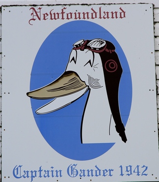
This sign is on a building out at the old seaport.
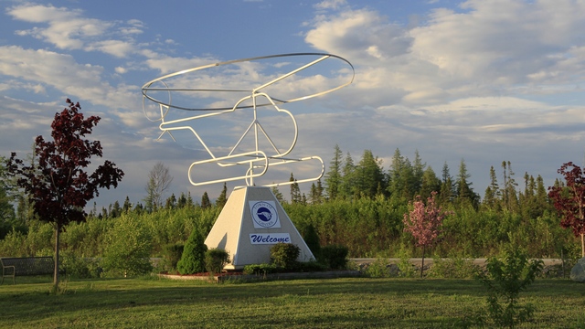
When we drove around town we noticed several pipe airplanes. This helicopter is just outside of the RV.
the tail of a DC 3
The back of the building is the nose of the DC-3
How Gander came to be is an interesting story. In 1935, The British Overseas Airways Corporation came to Newfoundland to find a suitable place for an airport. Their motivation was profit and pit stops, airplanes need to refuel before they flew across the Atlantic. They found Hattie`s Camp -- an abandoned sawmill at Mile 213 of the Newfoundland Railway. The land was flat, accessible by rail and close to a lake suitable for landing sea planes. Within three short years, Hattie`s Camp became not just an airport but the largest airport in the world. Somewhere along the way, Hattie's Camp became known as Gander. Gander was a hub of activity during WWII as it was used as the departure point for planes being sent to England. After WWII, Gander became a hub of international travel. Just about every plane heading to or from Europe stopped to refuel. The invention of the jet engine changed things for Gander as planes no longer need to stop to refuel. On September 11, 2001 Gander was temporarily a busy airport. With the closing of air space in both Canada and US, 40 planes landed at the Gander Airport. The town of 10,000 rallied finding food and accommodation for 6,600 passengers.
This sign is on a building out at the old seaport.
When we drove around town we noticed several pipe airplanes. This helicopter is just outside of the RV.
2014/06/23: A Beautiful Day in Paradise
Category: General
Posted by: The Agnew Family
The sun is shining and the temperatures are rising. It's going to be a
beautiful day. Everybody who has been to Gros Morne National Park tells
you to be sure to take the boat tour on Western Brook Pond and now I
will be one of those people. Western Brook Pond is a land locked fjord.
Before you can take the boat ride you have to walk in 3 kilometers that
includes some forest and three bogs, it's actually a nice walk. The
fjord is 10 miles (16km) in length with a maximum depth of 541 feet
(165m). It is surrounded by steep rock walls 2,000 feet (600m) high. On
the boat tour I met two people who love to go to work every day ... the
captain of the boat and the tour guide. The captain says his first
memories are of the pond as he spent summers there as a kid.
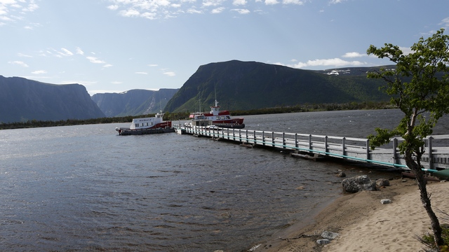
First view into Western Brook Pond.
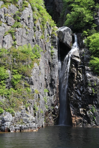
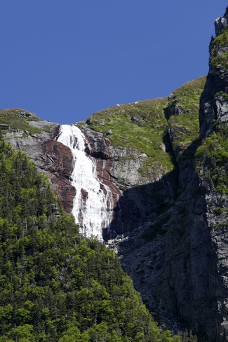
There are a number of waterfalls created by run off from the rain.
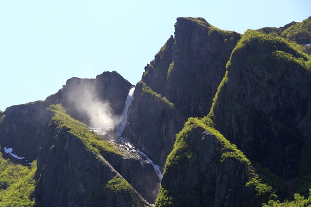
"Pissing Mare Falls", not sure how that name was derived. This falls is created by a brook.
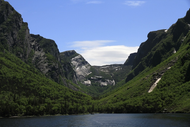
The valley at the end of Western Brook Pond.
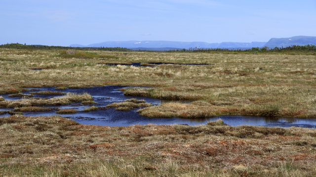
One of the three bogs we passed through on the hike to and from the pond.
 >
>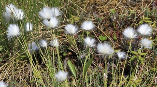
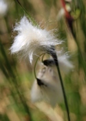
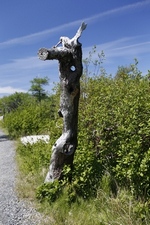
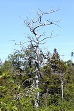
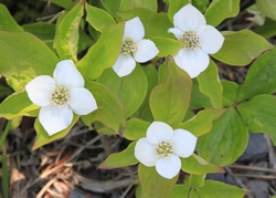
Sites on the bog.
After the boat tour Ed and I went back to the trailer to get Zaph so we could hike the trail to Bakers Brook Falls. The hike is advertised as 9.2 kilometers return. As "the park" is in the process of updating the trail, signage was missing and we ending up walking two side loops that made the hike 11.2km, a little longer than we planned on.
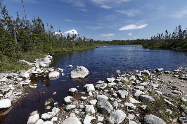
Little Pond, the goal of one of the side trips. The other side trip took us to a "anti-moose" enclosure. Moose have made a negative impact on the vegetation in this area of the park. In an effort to help regeneration of the natural vegetation fenced areas have been created.
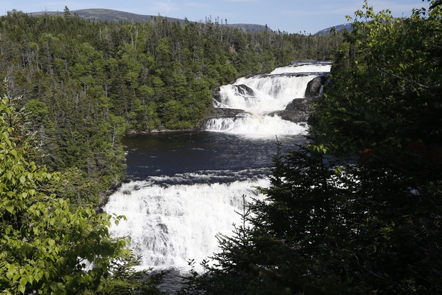
Bakers Brook Falls. The rain of the past few days made this falls spectacular.
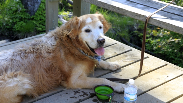
Zaph having a well deserved rest by the falls.
First evening in Gros Morne with a clear sky so we headed to the harbour to see the sunset. We had heard that there are great sunsets in Rocky Harbour and it didn't disappoint.
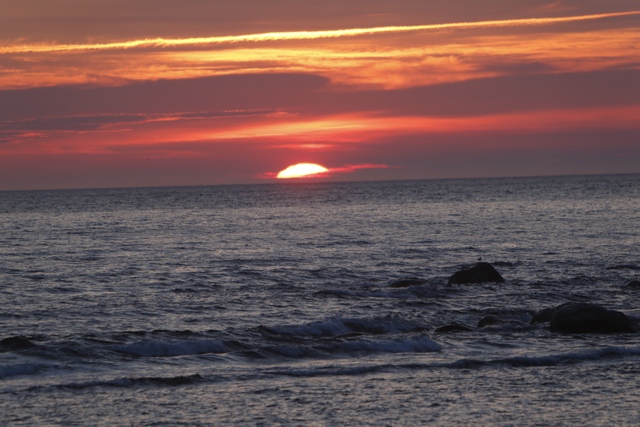
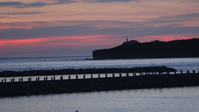
Lobster Cove Lighthouse
First view into Western Brook Pond.
There are a number of waterfalls created by run off from the rain.
"Pissing Mare Falls", not sure how that name was derived. This falls is created by a brook.
The valley at the end of Western Brook Pond.
One of the three bogs we passed through on the hike to and from the pond.
Sites on the bog.
After the boat tour Ed and I went back to the trailer to get Zaph so we could hike the trail to Bakers Brook Falls. The hike is advertised as 9.2 kilometers return. As "the park" is in the process of updating the trail, signage was missing and we ending up walking two side loops that made the hike 11.2km, a little longer than we planned on.
Little Pond, the goal of one of the side trips. The other side trip took us to a "anti-moose" enclosure. Moose have made a negative impact on the vegetation in this area of the park. In an effort to help regeneration of the natural vegetation fenced areas have been created.
Bakers Brook Falls. The rain of the past few days made this falls spectacular.
Zaph having a well deserved rest by the falls.
First evening in Gros Morne with a clear sky so we headed to the harbour to see the sunset. We had heard that there are great sunsets in Rocky Harbour and it didn't disappoint.
Lobster Cove Lighthouse
2014/06/22: The Other Side
Category: General
Posted by: The Agnew Family
of the park, that is. Bonne Bay sort of splits Gros Morne into two
sections --- the south-west and north-east. Until today we had spent all
of our time in the north-east section. Today we drove the 80 kilometers
to get to Woody Point (it's about 8 to go from Norris Point to Woody
Point by boat).
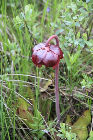
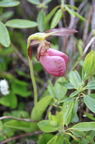
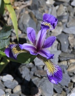
The Pitcher Plant (on the left) is the provincial flower of Newfoundland and Labrador. The Laddies Slipper is on the right. I'm really enjoying seeing all the different wildflowers in Newfoundland.
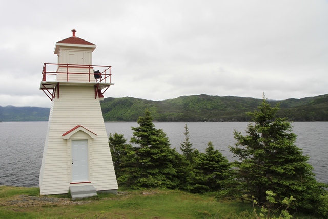
The lighthouse in Woody Point.
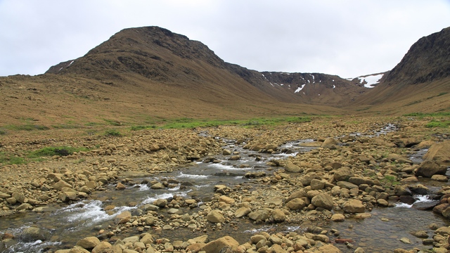
Just outside of Woody Point is Tablelands. Tablelands is made of ultramafic rock - peridotite. It is thought to originate in the earth's mantle and was forced up from the depths during a plate collision several hundred million years ago.
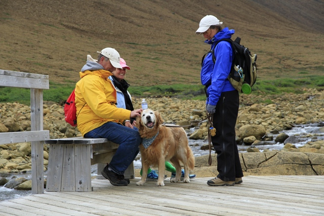
Zaph hard at work getting pets ... the token Zaphod photo.
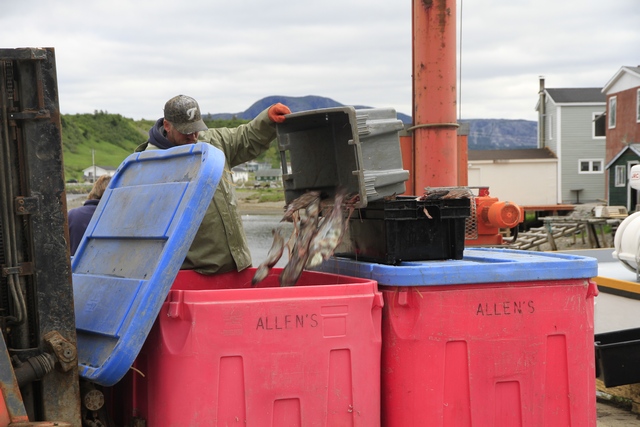
Continuing down the road we get to Trout River, an active fishing community. A boat had returned from fishing and was unloading when we arrived in town.
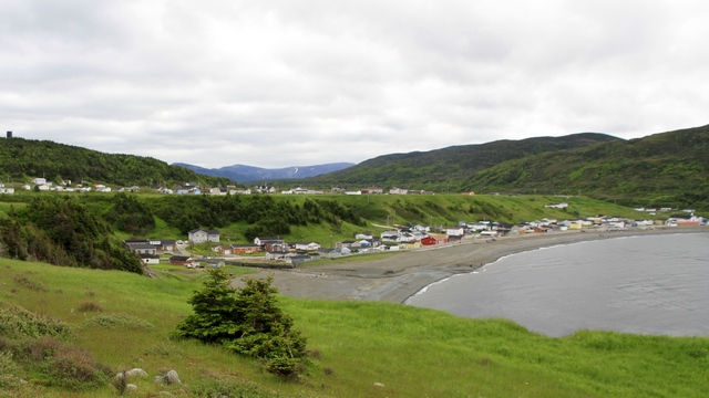
While we were in Trout River we took a walk along the cliff edge. Looking back you can see town ... upper and lower.
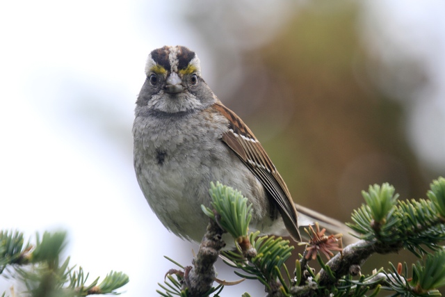
Ed used a telephoto lens to capture this photo but I have not enlarged it. The White Throated Sparrow was less than 5 feet from us.
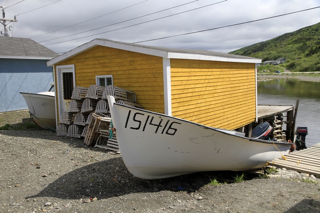
One of many fishing shacks in Trout River.
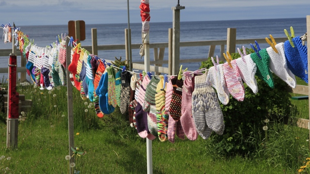
A lot of women in Newfoundland sell items they have knit. First time we seen them displayed on a clothes line beside their home.
The Pitcher Plant (on the left) is the provincial flower of Newfoundland and Labrador. The Laddies Slipper is on the right. I'm really enjoying seeing all the different wildflowers in Newfoundland.
The lighthouse in Woody Point.
Just outside of Woody Point is Tablelands. Tablelands is made of ultramafic rock - peridotite. It is thought to originate in the earth's mantle and was forced up from the depths during a plate collision several hundred million years ago.
Zaph hard at work getting pets ... the token Zaphod photo.
Continuing down the road we get to Trout River, an active fishing community. A boat had returned from fishing and was unloading when we arrived in town.
While we were in Trout River we took a walk along the cliff edge. Looking back you can see town ... upper and lower.
Ed used a telephoto lens to capture this photo but I have not enlarged it. The White Throated Sparrow was less than 5 feet from us.
One of many fishing shacks in Trout River.
A lot of women in Newfoundland sell items they have knit. First time we seen them displayed on a clothes line beside their home.
2014/06/21: Cow Head and More
Category: General
Posted by: The Agnew Family
Overnight the rain had stopped but started again shortly after I got up
this morning. On went the rain gear and off we went to Cow Head, a
village about 50 kilometers north of Rocky Harbour. The town is split
into two parts --- Winterside on the mainland and Summerside on an
island knows as "the Head". Back before the automobile, the town people
would move to the island for the summer to fish and back to the mainland
for the winter.
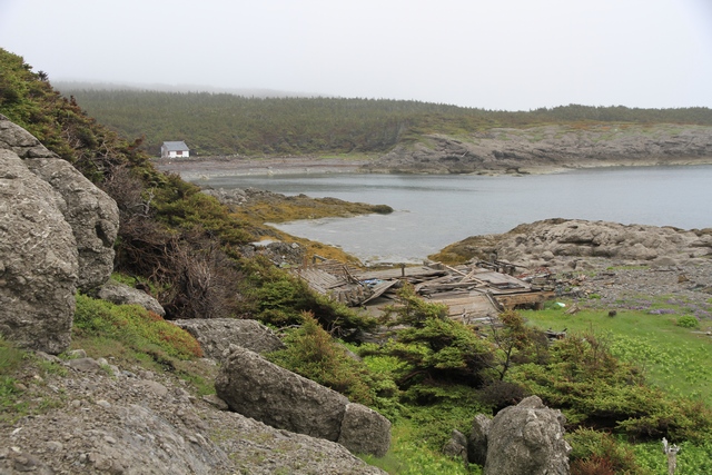
There is a trail on the island that takes you to an old lighthouse and to several places by the shore. At the end of the trail we found the remains of a house.
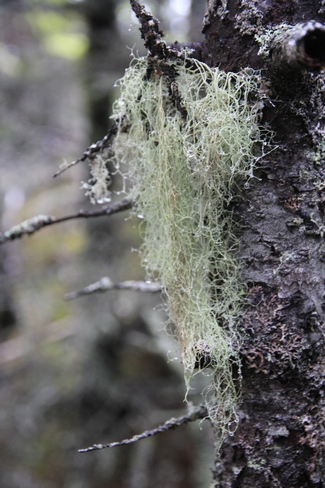
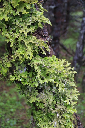
The woods on the island is full of different kinds of moss and lichen. Not quite sure what class the one on the right falls into.
When we drove into Cow Head we saw a restaurant advertising Moose Burgers. Cold and wet after our hike we decided that a cold sandwich would not be enough for lunch, so we gave the restaurant a try. Ed ordered the Moose Burger and I ordered Moose Stew. Well, the burger was good but the stew was amazing. After lunch the weather improved, the sun came out and it was a beautiful afternoon.
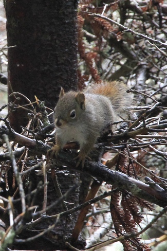
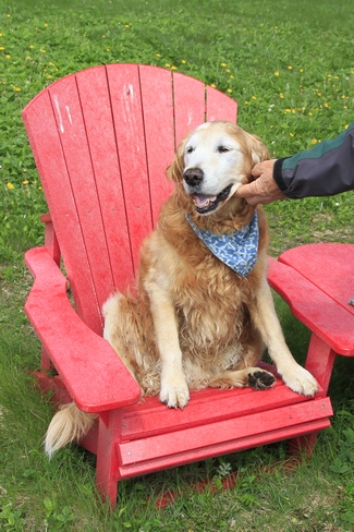
The guy on the right was scolding us as we started walking down the trail to Western Brook. The Canadian National Parks must have gotten a great deal on two red chairs joined by a table. We have seen them on almost every trail in the two national parks we have visited so far.
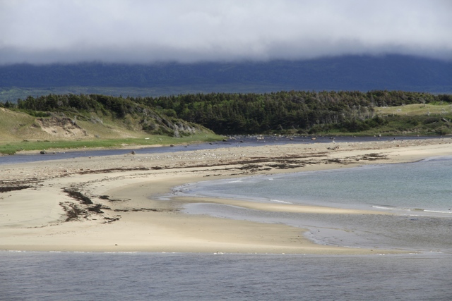
The beach where Western Brook meets the Gulf of St. Lawrence. After seeing so many rocky beaches it was nice to see a sandy one.
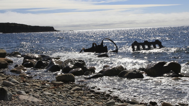
The remains of the S.S. Ethie. She sank on December 13, 1919. All of the passengers and crew were rescued.
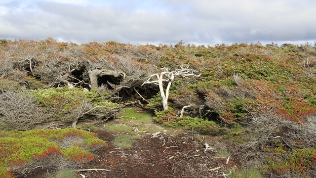
To a Newfoundlander these trees are knows as Tuckamores. They are Spruce trees that are dwarfed and beaten down by the sea winds. The foliage is thick creating cave like areas.
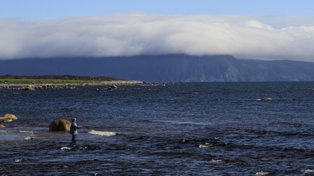
A typical way to spend a beautiful afternoon in Newfoundland.
There is a trail on the island that takes you to an old lighthouse and to several places by the shore. At the end of the trail we found the remains of a house.
The woods on the island is full of different kinds of moss and lichen. Not quite sure what class the one on the right falls into.
When we drove into Cow Head we saw a restaurant advertising Moose Burgers. Cold and wet after our hike we decided that a cold sandwich would not be enough for lunch, so we gave the restaurant a try. Ed ordered the Moose Burger and I ordered Moose Stew. Well, the burger was good but the stew was amazing. After lunch the weather improved, the sun came out and it was a beautiful afternoon.
The guy on the right was scolding us as we started walking down the trail to Western Brook. The Canadian National Parks must have gotten a great deal on two red chairs joined by a table. We have seen them on almost every trail in the two national parks we have visited so far.
The beach where Western Brook meets the Gulf of St. Lawrence. After seeing so many rocky beaches it was nice to see a sandy one.
The remains of the S.S. Ethie. She sank on December 13, 1919. All of the passengers and crew were rescued.
To a Newfoundlander these trees are knows as Tuckamores. They are Spruce trees that are dwarfed and beaten down by the sea winds. The foliage is thick creating cave like areas.
A typical way to spend a beautiful afternoon in Newfoundland.
2014/06/20: Another Rainy Day
Category: General
Posted by: The Agnew Family
It rained most of last night, most of today and is suppose to rain some
more tonight and tomorrow. I'm starting to get really tired of it.
Hoping for a couple of good days while we're in Gros Morne National
Park.
Today we toured around Rocky Harbour and Norris Point walking a few of the trails. A few times we were lucky and the weather cleared a little so we could see the view.
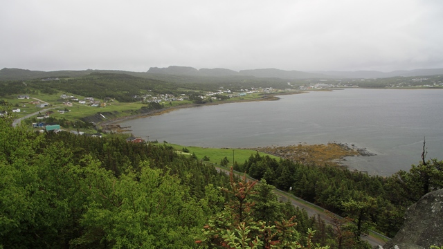
Looking down on Rocky Harbour
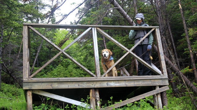
The token Zaph photo.
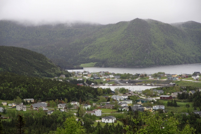
Looking down on Norris Point.
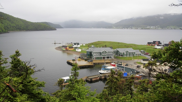
Looking down at the taxi dock in Norris Point.
Today we toured around Rocky Harbour and Norris Point walking a few of the trails. A few times we were lucky and the weather cleared a little so we could see the view.
Looking down on Rocky Harbour
The token Zaph photo.
Looking down on Norris Point.
Looking down at the taxi dock in Norris Point.
2014/06/19: Gros Morne National Park
Category: General
Posted by: The Agnew Family
There was rain in today's forecast so we got on the road early in hopes
to avoid some of it (we did). Within the first ten minutes of the drive
we saw four moose by the side of the road.
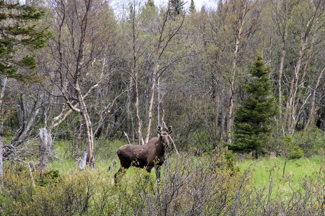
This was one of them.
We arrived at Rocky Harbour just outside of Gros Morne in the early afternoon and decided to drive around. We found a fish market that had fresh cooked lobster .... yum (it made a good dinner) and we found a lighthouse.
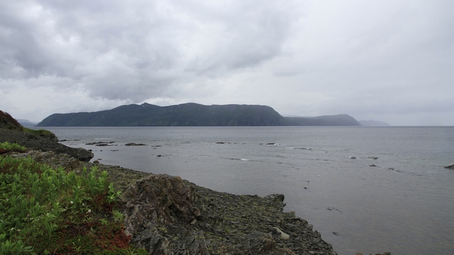
This picture is for Jack. It's the closest I could get to fog.
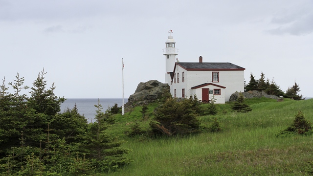
The lighthouse at Lobster Cove.
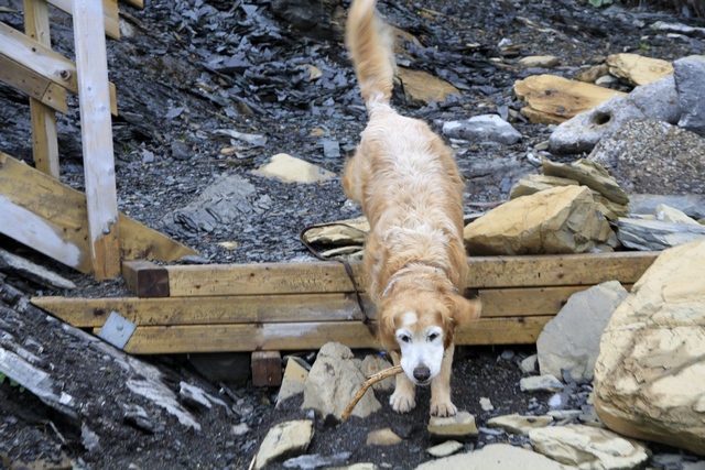
Guess who found a stick.
This was one of them.
We arrived at Rocky Harbour just outside of Gros Morne in the early afternoon and decided to drive around. We found a fish market that had fresh cooked lobster .... yum (it made a good dinner) and we found a lighthouse.
This picture is for Jack. It's the closest I could get to fog.
The lighthouse at Lobster Cove.
Guess who found a stick.
2014/06/18: Iceberg and Whale Boat Tour with photos
Category: General
Posted by: The Agnew Family
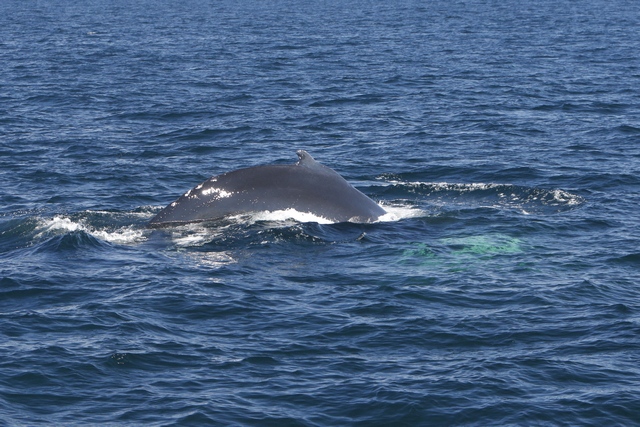
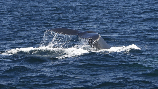
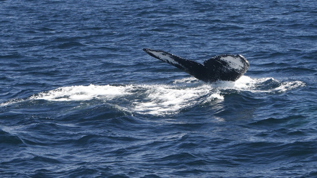
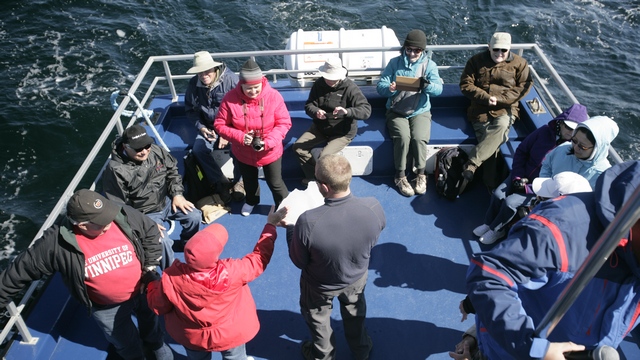
Today was a big photo day. Not only did we get to see icebergs up close, but we also were within 50 feet of a humpback whale.
The humpback whale.
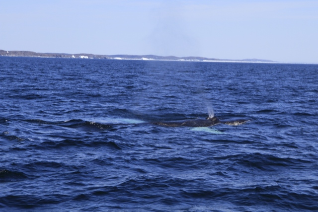
If you look closely, you can see icebergs in the background.
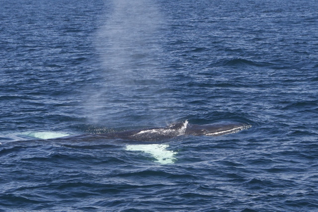
There she blows!!! You can see you fins under the water.
On the 16th, there is a photo of an iceberg that floated into the harbour and grounded. Last night one of the crew went down to the harbour to take a photo of the iceberg and heard a loud rumble --- the iceberg split into two pieces and rolled. The next two photos shows what it looks like now. The shiny smooth surface use to be under water.
This iceberg wasn't as tall as some but it was definitely interesting.
It had several waterfalls and it had a dip in, like a small bay.
It even came with it's own handle.
This iceberg is at least 75 feet tall.
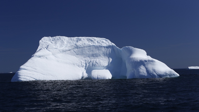
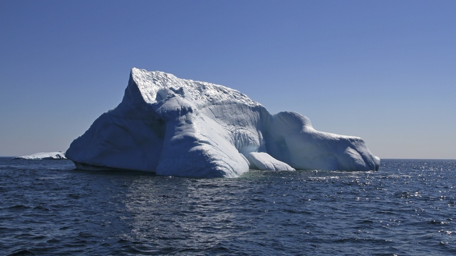
The tall iceberg from a slightly different angle.
There were a lot of berger bits floating around the flat iceberg --- these are large chunks of ice that have fallen off the iceberg. One brewing company collects the berger bits and brews Iceberg beer. One of the crew used a net and brought up a piece for us to see
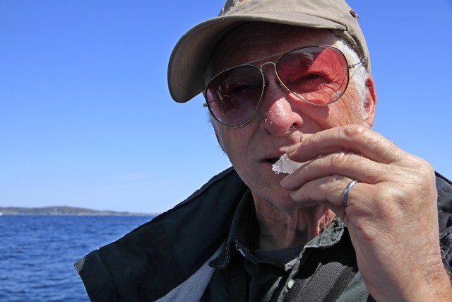
and taste.
After the boat tour we drove to a couple of nearby towns in search of geocaches.
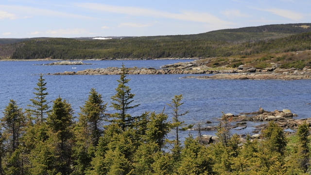
A view near St. Anthony Bight. Did you know that a "Bight" is bigger than a "Cove" and smaller than a "Bay"?
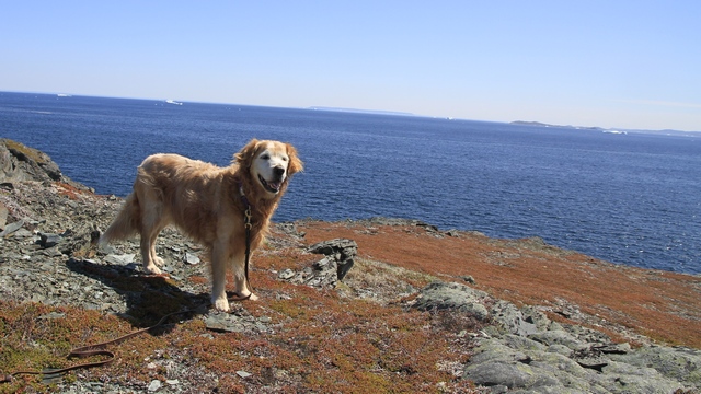
Another place we went was Goose Cove. We found the geocaches and walked the trail. From the cliffs we could see lots of icebergs --- I stopped counting at 30. Most of them were a fair distance away but with binoculars I could make out some interesting shapes. Here are a couple that were withing photographing range.
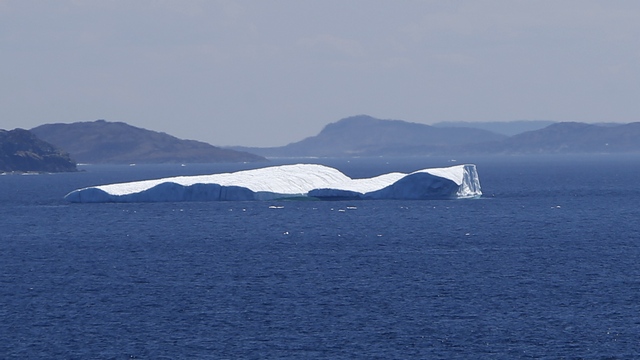
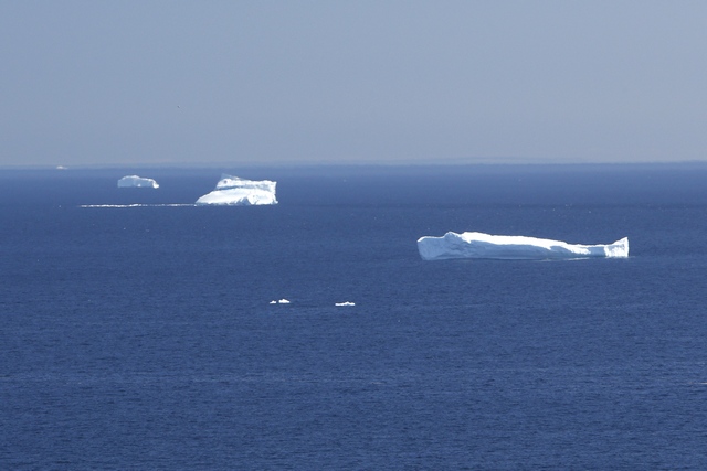
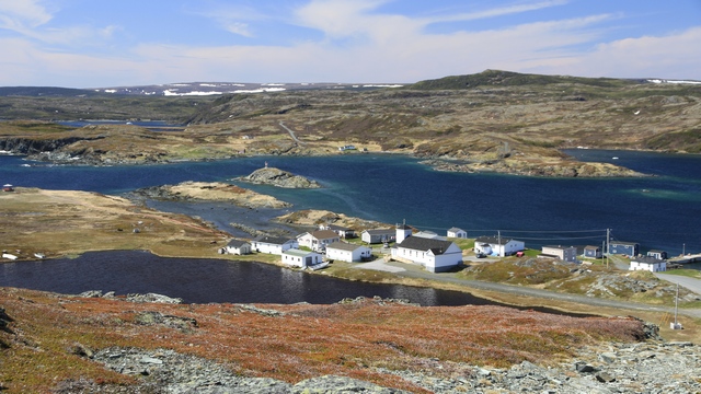
Looking down on Goose Cove.
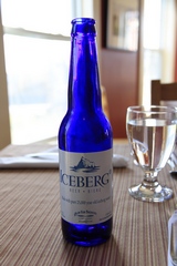
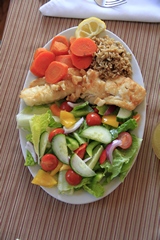
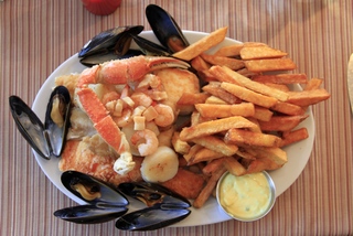
To end a great day we decided to go out for dinner. Soon as Ed saw Iceberg Beer on the menu he had to try it. I had pan fried cod and Ed had the Fisherman's platter. Everything was very good, especially the scallops.
The humpback whale.
If you look closely, you can see icebergs in the background.
There she blows!!! You can see you fins under the water.
On the 16th, there is a photo of an iceberg that floated into the harbour and grounded. Last night one of the crew went down to the harbour to take a photo of the iceberg and heard a loud rumble --- the iceberg split into two pieces and rolled. The next two photos shows what it looks like now. The shiny smooth surface use to be under water.
This iceberg wasn't as tall as some but it was definitely interesting.
It had several waterfalls and it had a dip in, like a small bay.
It even came with it's own handle.
This iceberg is at least 75 feet tall.
The tall iceberg from a slightly different angle.
There were a lot of berger bits floating around the flat iceberg --- these are large chunks of ice that have fallen off the iceberg. One brewing company collects the berger bits and brews Iceberg beer. One of the crew used a net and brought up a piece for us to see
and taste.
After the boat tour we drove to a couple of nearby towns in search of geocaches.
A view near St. Anthony Bight. Did you know that a "Bight" is bigger than a "Cove" and smaller than a "Bay"?
Another place we went was Goose Cove. We found the geocaches and walked the trail. From the cliffs we could see lots of icebergs --- I stopped counting at 30. Most of them were a fair distance away but with binoculars I could make out some interesting shapes. Here are a couple that were withing photographing range.
Looking down on Goose Cove.
To end a great day we decided to go out for dinner. Soon as Ed saw Iceberg Beer on the menu he had to try it. I had pan fried cod and Ed had the Fisherman's platter. Everything was very good, especially the scallops.
2014/06/18: Iceberg and Whale Boat Tour
Category: General
Posted by: The Agnew Family
This morning we headed to the dock to catch the Northern Discovery boat
tour. The goal was to see icebergs and maybe whales. We're definitely at
the correct time of year to see icebergs but a little early for whales
this year. As it's been so cold, the fish are late in coming to
Newfoundland and the whales that follow the fish are late as well. As we
were driving towards an iceberg, the captain spotted a "blow" --- there
was a hump back whale. We followed the whale for a bit and eventually
it was within 50 feet of the boat. You can just imagine how many photos
Ed took. Then we drove close to a couple of big icebergs --- one was at
least 75 feet high. Yup, lots more photos. Ed took enough that it's
going to take him a bit of time to go through them so no photos tonight.
Ed says I'll have them tomorrow.
2014/06/17: L'Anse aux Meadows
Category: General
Posted by: The Agnew Family
In Norway, tales of voyages west of Greenland lived in oral tradition,
passing from generation to generation until the Vinland sagas were
written down in the late 1200s. The legend inspired a quest to discover
this Viking base in North America. In 1960, Norwegian explorer and
writer Helge Ingstad came upon the site at L’Anse aux Meadows. Local
fisherman George Decker led him to what local’s called the “old Indian
camp”. The overgrown ruins were 11th-century Norse buildings, which
combined with a few small items left behind by the Vikings, have proven
the historic nature of the only recognized authentic Viking site to date
in North America. It is now a Canadian National Historic Site.
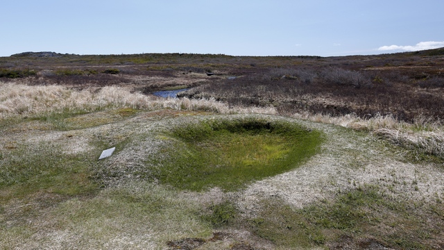
This is the location of one of the smaller buildings on the site. The locations of ten buildings have been determined, some are small huts and others are multi-roomed halls.
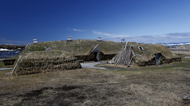
Several buildings have been reconstructed. There are two smaller huts in front of a larger multi-roomed hall. The buildings are deemed 90 % accurate.
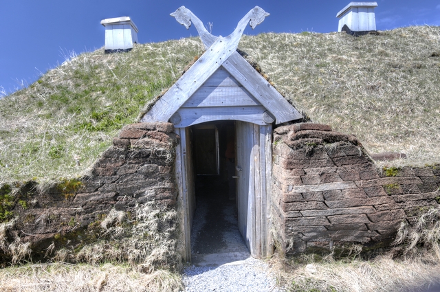
The front entrance to the hall.
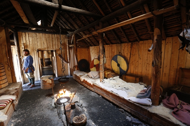
One of the rooms in the hall.
The Birchy Nuddick Trail took us along the shoreline and inland over bogs and barrens.
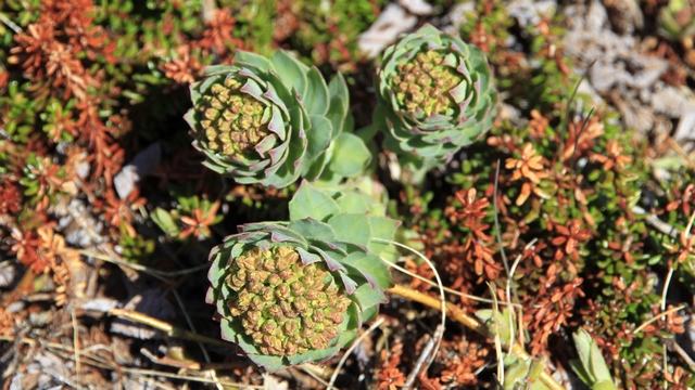
Not sure what this plant is but I thought is looked interesting.
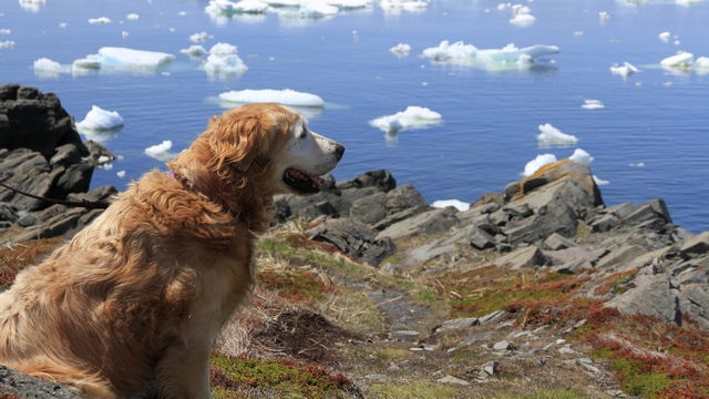
Zaph enjoying the view of the bay still filled with ice from the ice pack that floated in a couple of weeks ago. Even he wasn’t interested in going for a swim.
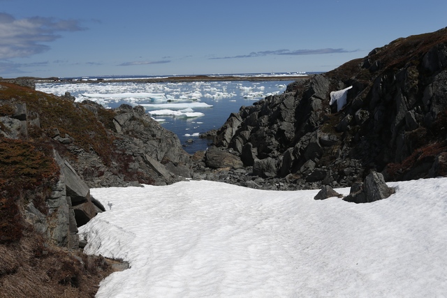
Even though sun was nice and warm today it couldn’t win over the cool air rising from snow still on the ground and the cool breeze coming from the ice filled bay.
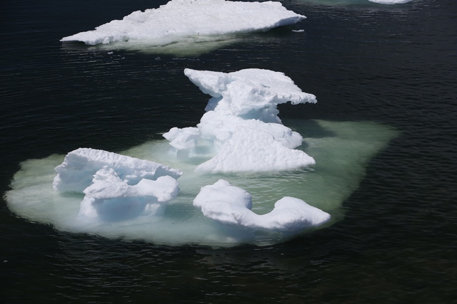
Ed thought this was an interesting looking piece of ice.
Not far from L’Anse aux Meadows we could see ice bergs beyond the ice pack.
Quirpon is advertised as Newfoundland’s Most North East Community with a population of 77 (Some days), at least that’s what their sign says. The ice pack has filled this harbour preventing boats from getting out.
One more boat, water and ice photo because I really like it.
By the way, I added a roadside garden photo and changed the wood pile photo in yesterdays blog.
This is the location of one of the smaller buildings on the site. The locations of ten buildings have been determined, some are small huts and others are multi-roomed halls.
Several buildings have been reconstructed. There are two smaller huts in front of a larger multi-roomed hall. The buildings are deemed 90 % accurate.

The front entrance to the hall.
One of the rooms in the hall.
The Birchy Nuddick Trail took us along the shoreline and inland over bogs and barrens.
Not sure what this plant is but I thought is looked interesting.
Zaph enjoying the view of the bay still filled with ice from the ice pack that floated in a couple of weeks ago. Even he wasn’t interested in going for a swim.
Even though sun was nice and warm today it couldn’t win over the cool air rising from snow still on the ground and the cool breeze coming from the ice filled bay.
Ed thought this was an interesting looking piece of ice.
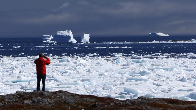
Not far from L’Anse aux Meadows we could see ice bergs beyond the ice pack.
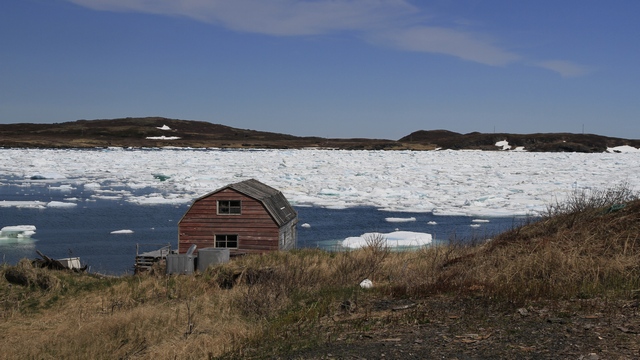
Quirpon is advertised as Newfoundland’s Most North East Community with a population of 77 (Some days), at least that’s what their sign says. The ice pack has filled this harbour preventing boats from getting out.
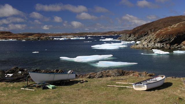
One more boat, water and ice photo because I really like it.
By the way, I added a roadside garden photo and changed the wood pile photo in yesterdays blog.
2014/06/16: Moose and Icebergs
Category: General
Posted by: The Agnew Family
The tire is fixed and we’re on the road in the rain. Shouldn’t complain,
as this is the first day since we left home (10 days) that it has
rained. I have my fingers crossed that the weatherman is correct and the
weather will improve tomorrow.
Today’s drive was relatively short, only 200 kilometers. We are now just outside of the town of St. Anthony, which is about 30 minutes from L’ance aux Meadows where the Vikings landed. The town of St. Anthony is larger than I expected.
Newfoundland is known as “the rock” because it is a huge rock. When the highway was put it a lot of ground was disturbed so the locals took advantage of the tilled soil and planted gardens. As we drove north we noticed a lot of garden plots, some with fences, some with scarecrows on the side of the road.
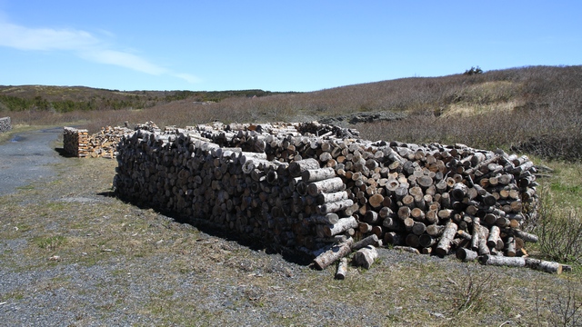
We also noticed a lot of wood piles. In the winter the locals go into wood lots with snowmobiles and sleds and bring out firewood stacking it by the side of the highway. In the fall, after the wood has dried they take it home.
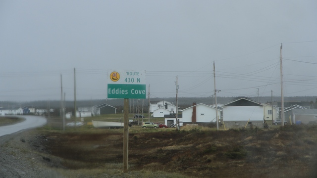
For some reason Ed likes the name of this town.
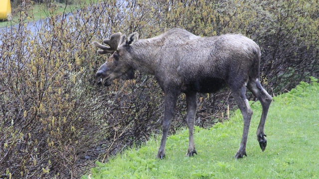
We were driving out of the RV park when we glanced to the side and noticed this fellow walking into the park. I think he stopped by for a snack.
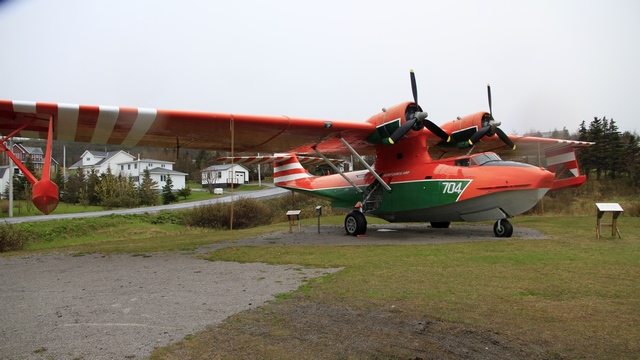
This PBY Canso Water Bomber commemorates two men one from St. Anthony who died while fighting forest fires in Newfoundland.
A fishing boat leave the St. Anthony harbour.
This iceberg (though not a big one) floated into the harbour a couple of days ago and grounded.
Some little icebergs in the harbour.
Today’s drive was relatively short, only 200 kilometers. We are now just outside of the town of St. Anthony, which is about 30 minutes from L’ance aux Meadows where the Vikings landed. The town of St. Anthony is larger than I expected.
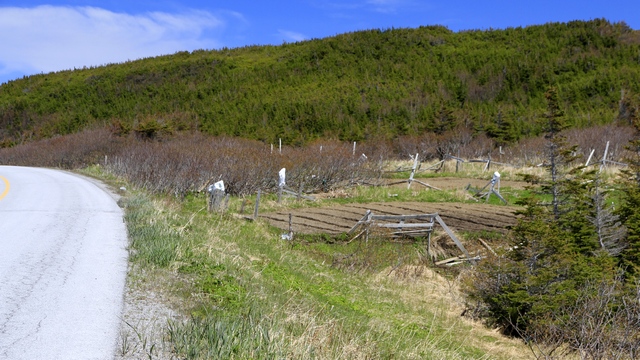
Newfoundland is known as “the rock” because it is a huge rock. When the highway was put it a lot of ground was disturbed so the locals took advantage of the tilled soil and planted gardens. As we drove north we noticed a lot of garden plots, some with fences, some with scarecrows on the side of the road.
We also noticed a lot of wood piles. In the winter the locals go into wood lots with snowmobiles and sleds and bring out firewood stacking it by the side of the highway. In the fall, after the wood has dried they take it home.
For some reason Ed likes the name of this town.
We were driving out of the RV park when we glanced to the side and noticed this fellow walking into the park. I think he stopped by for a snack.
This PBY Canso Water Bomber commemorates two men one from St. Anthony who died while fighting forest fires in Newfoundland.
A fishing boat leave the St. Anthony harbour.
This iceberg (though not a big one) floated into the harbour a couple of days ago and grounded.
Some little icebergs in the harbour.
2014/06/15: Port Saunders
Category: General
Posted by: The Agnew Family
As the flat tire necessitated our stay in Hawke's Bay an extra night we
checked the guide book to see if there was anything to see nearby and
there was. The guide book mentioned a hiking trail in Port Saunders
about 14 kilometers from Hawke's Bay. (Ed didn't mind driving a short
distance on the spare tire without a spare tire but didn't want to drive
200 km pulling a trailer.) What a picturesque (I think I'm going to
over use this word this trip) town.
At the end of the harbour is the Crow Head Walking Trail. The first view you see is the lighthouse across the water.
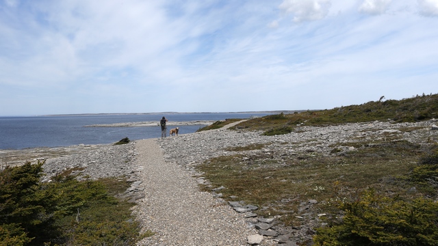
This area of Newfoundland really reminds me of the Northern Isles of Scotland. Big expanses with beautiful sea views.
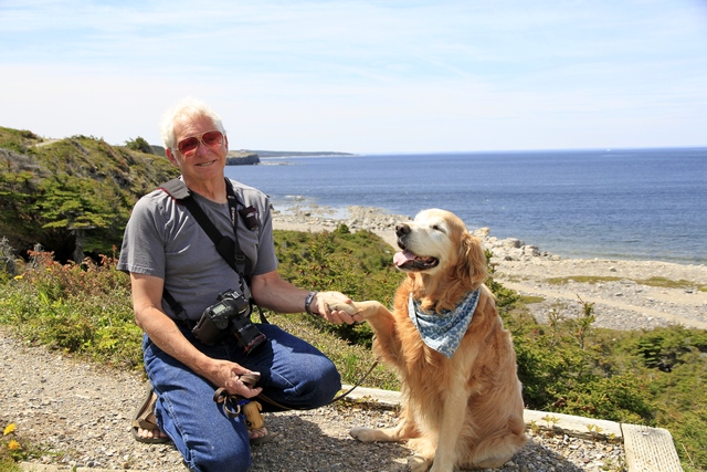
My favourite boys.
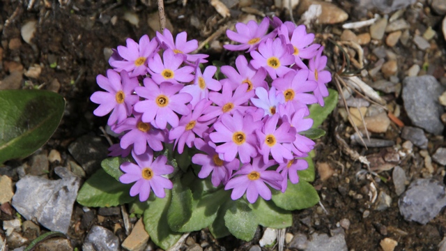
I think we're going to see lots of spring wildflowers. Too bad I left my book at home or I could try to identify them.
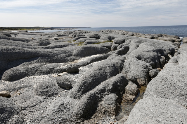
Interesting rock formations.
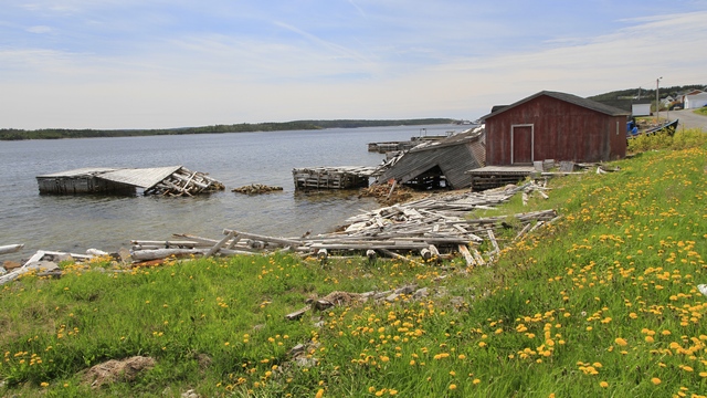
Ed really enjoyed walking around the harbour. There were lots of things to take photos of. These are just a few.
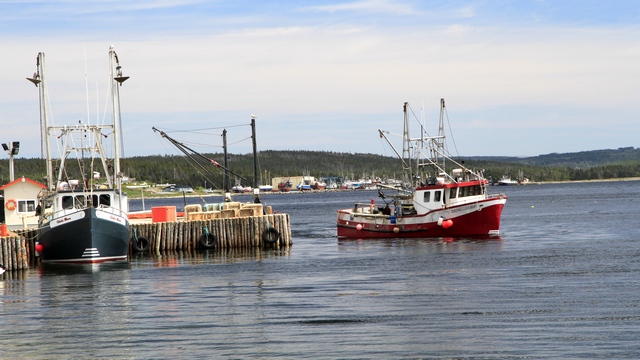
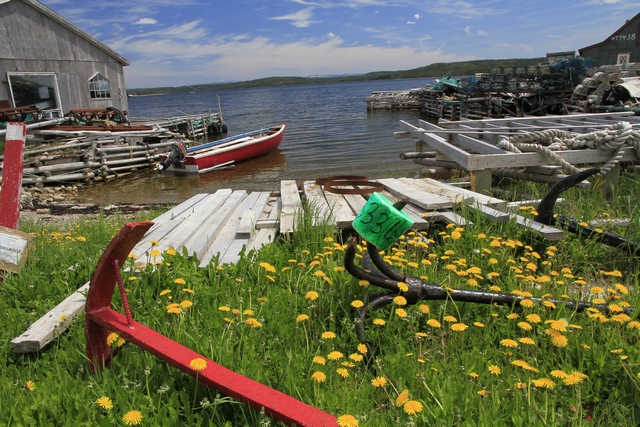
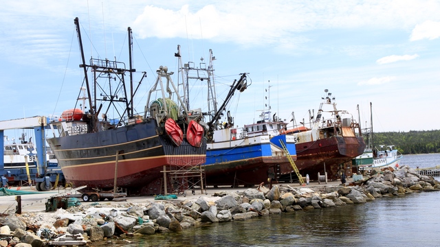
At the end of the harbour is the Crow Head Walking Trail. The first view you see is the lighthouse across the water.
This area of Newfoundland really reminds me of the Northern Isles of Scotland. Big expanses with beautiful sea views.
My favourite boys.
I think we're going to see lots of spring wildflowers. Too bad I left my book at home or I could try to identify them.
Interesting rock formations.
Ed really enjoyed walking around the harbour. There were lots of things to take photos of. These are just a few.
2014/06/14: Who Left The Nail in the Pull Off?
Category: General
Posted by: The Agnew Family
This morning we hitched up the trailer and started driving north. When I
was planning the trip, Ed said that once we were in Newfoundland he
didn't want to drive more than 400 kilometers in a day. With that in
mind I planned on the drive from Corner Brook to St. Anthony to take two
days with a stop in Hawke's Bay. The drive through the mountains to
Gros Morne National Park was interesting (relatively high pass) with
some beautiful scenery. Once we hit the coast the roads were flatter and
the scenery just as beautiful, the towns small ard far apart. We
stopped at a pull off to take some photos of a particularly pretty town
and must have picked up a nail. About 20 kilometers down the road the
low pressure tire light came on. Ed pulled over and checked all of the
truck's tire pressure's --- the drivers side front tire was low and on
careful examination Ed found the nail. Luckily, we have a small air
compressor that travels in the truck so he filled up the tire. We
stopped at the next town and asked where we could get our tire fixed.
The answer was Hawke's Bay. After stopping to fill the tire two more
times we arrived in Hawke's Bay only to find out that the garages were
closed on Saturday's and Sunday's. Luckily it's a pretty town as we'll
be spending two nights here.
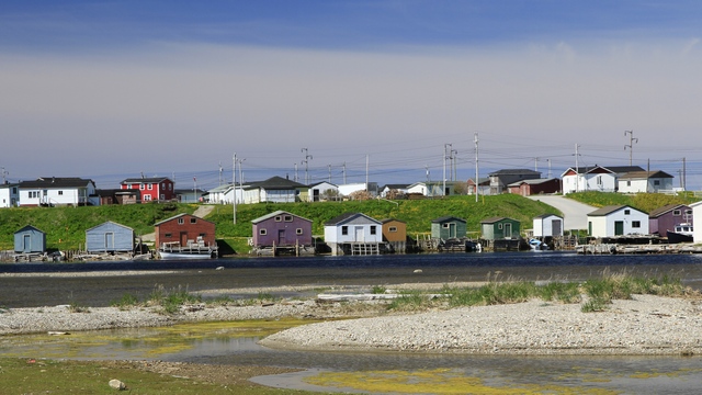
Parons's Pond a fishing community that's main stay these days is snow crab.
We are staying at the Torrent River Nature Park in Hawke's Bay.
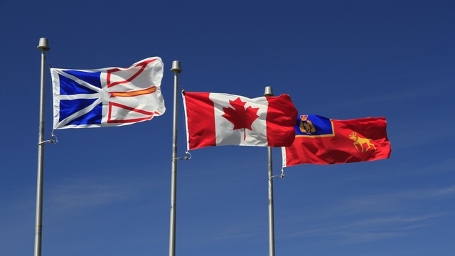
The Newfoundland, Canadian, and RCMP Newfoundland and Labrador Division flags fly proudly.
The park has a three kilometer (one way) boardwalk trail to the Salmon Interpretation Center that was built in honour of an RCMP officer.
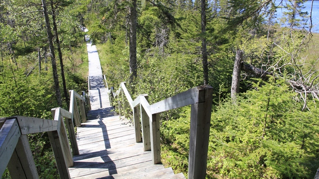
Part of the boardwalk --- a lot of work went into building this.
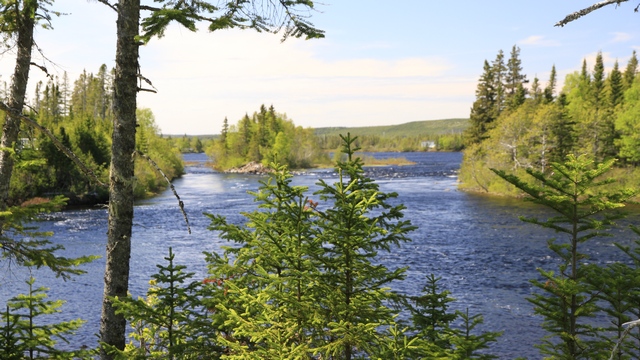
One of the views of the river.
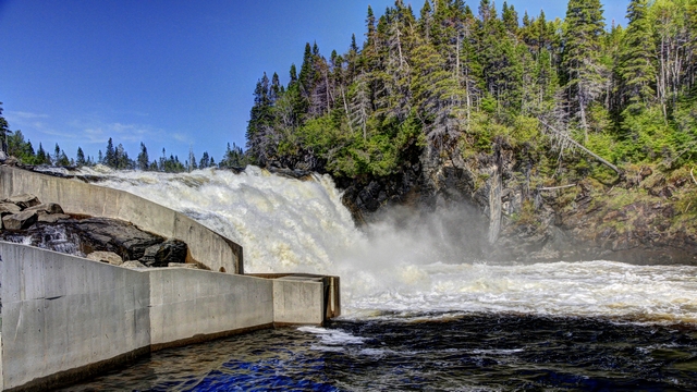
The waterfalls at the Salmon Interpretation Centre. The concrete structure on the left is the salmon ladder. We talked to a couple of fishermen and they said because the river is high the salmon aren't running yet but should be in a week.
Parons's Pond a fishing community that's main stay these days is snow crab.
We are staying at the Torrent River Nature Park in Hawke's Bay.
The Newfoundland, Canadian, and RCMP Newfoundland and Labrador Division flags fly proudly.
The park has a three kilometer (one way) boardwalk trail to the Salmon Interpretation Center that was built in honour of an RCMP officer.
Part of the boardwalk --- a lot of work went into building this.
One of the views of the river.

The waterfalls at the Salmon Interpretation Centre. The concrete structure on the left is the salmon ladder. We talked to a couple of fishermen and they said because the river is high the salmon aren't running yet but should be in a week.
2014/06/13: Our First Whale Siting
Category: General
Posted by: The Agnew Family
Today we drove Captain Cooks Trail --- how could you not after the guide
book said "the scenic drive along the south shore of the Bay of Islands
to Lark Harbour is a treat for the eyes". And I have to admit the book
was right.
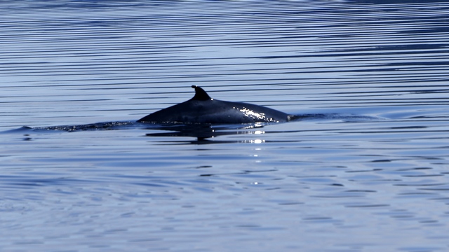
We stopped at an look out to take a few photos of the Bay of Islands and were told that there was a whale in the bay. Ed got a few photos and then we drove down to the water's edge and were able to get a few more photos. At one point the whale was less than a 100 feet from shore.
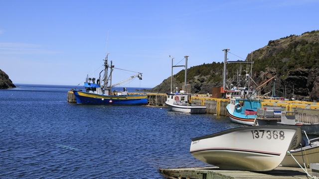
We passed through several fishing villages on the way to Lark Harbour.
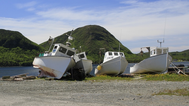
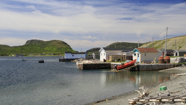
At Lark Harbour there were signs that led us to a couple of hiking trails.
The trail at the end of Little Port Road overlooked this harbour.
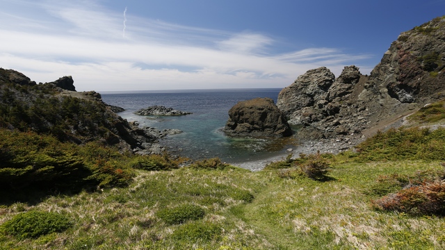
Another trail took us to Island Cove.
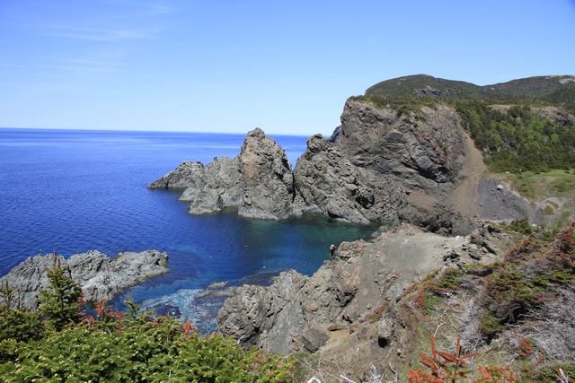
Island Cove from another angle.
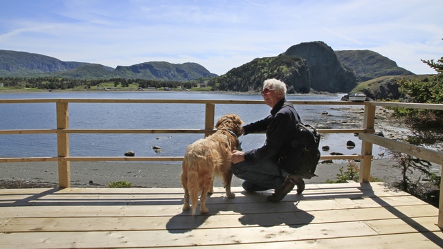
Zaph and Ed enjoying the view of Bottle Cove.
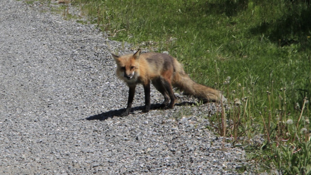
This little fellow was on the road when we turned into the road for Blow Me Down Provincial Park.
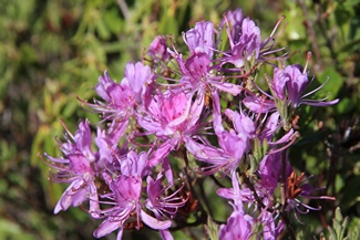
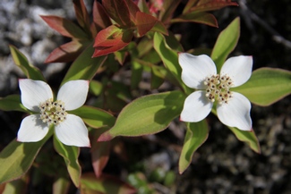
We were happy to see wildflowers that were not dandelions.
When I think of Captain Cook, I think of his travels in the Pacific Ocean. I actually didn't remember that he had spent several years in Newfoundland mapping out the coastline and the waters around the island. The Captain James Cook Historic Site is in Corner Brook. The GPS led us up some steep roads to get to the site.
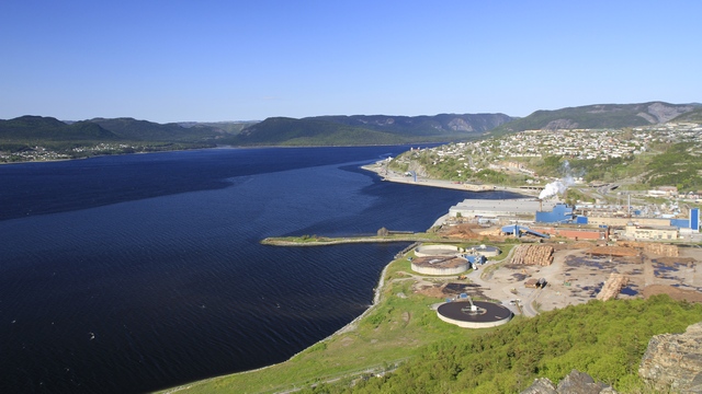
Looking down on Corner Brook from Captain James Cook Historical Site. The Corner Brook Pulp and Paper Mill is at the bottom right of the photo.
While Ed and I were driving up and down the steep roads of Corner Brook, I mentioned that I wondered how much snow Corner Brook received in the winter as I wouldn't enjoy driving the roads in slippery conditions. The Corner Brook web sites has this information "Winter begins in late December and lasts until early April. While the winter is longer than other parts of Canada, it can be warmer due to the ocean being close by. Winter temperatures average a comfortable -50 Celsius. These temperatures are optimal for snowfall. Corner Brook receives an average snowfall equivalent to 16 feet (4.87 metres) each winter. Snow usually falls daily instead of large snow storms." Corner Brook is a beautiful city full of friendly people but I don't think I could handle the winter.
We stopped at an look out to take a few photos of the Bay of Islands and were told that there was a whale in the bay. Ed got a few photos and then we drove down to the water's edge and were able to get a few more photos. At one point the whale was less than a 100 feet from shore.
We passed through several fishing villages on the way to Lark Harbour.
At Lark Harbour there were signs that led us to a couple of hiking trails.
The trail at the end of Little Port Road overlooked this harbour.
Another trail took us to Island Cove.
Island Cove from another angle.
Zaph and Ed enjoying the view of Bottle Cove.
This little fellow was on the road when we turned into the road for Blow Me Down Provincial Park.
We were happy to see wildflowers that were not dandelions.
When I think of Captain Cook, I think of his travels in the Pacific Ocean. I actually didn't remember that he had spent several years in Newfoundland mapping out the coastline and the waters around the island. The Captain James Cook Historic Site is in Corner Brook. The GPS led us up some steep roads to get to the site.
Looking down on Corner Brook from Captain James Cook Historical Site. The Corner Brook Pulp and Paper Mill is at the bottom right of the photo.
While Ed and I were driving up and down the steep roads of Corner Brook, I mentioned that I wondered how much snow Corner Brook received in the winter as I wouldn't enjoy driving the roads in slippery conditions. The Corner Brook web sites has this information "Winter begins in late December and lasts until early April. While the winter is longer than other parts of Canada, it can be warmer due to the ocean being close by. Winter temperatures average a comfortable -50 Celsius. These temperatures are optimal for snowfall. Corner Brook receives an average snowfall equivalent to 16 feet (4.87 metres) each winter. Snow usually falls daily instead of large snow storms." Corner Brook is a beautiful city full of friendly people but I don't think I could handle the winter.
2014/06/12: Newfoundland --- We're Here!!!
Category: General
Posted by: The Agnew Family
Wasn't sure what to call todays entry as there were several other
choices such as "Ed's First Newfoundland Geocache", "This RV Park's Got
it All", "Visiting a Vet in Newfoundland" and "First Lobster Dinner" but
decided that arriving in Newfoundland was the most significant part of
the day.
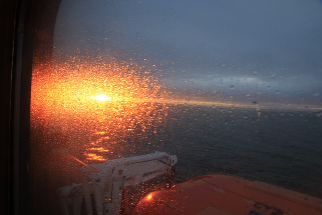
Around 6am the PA system beeped to wake people up and announce that we would be arriving in Newfoundland in one hour. The announcement woke Ed in time for him to see the sun rise through the dew covered windows.
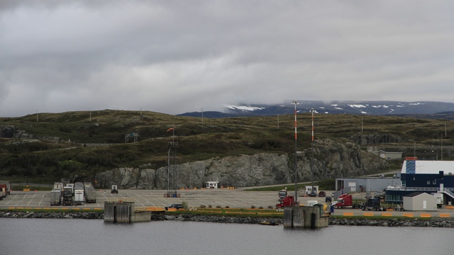
It was around 7C (mid 40s F) and cloudy when we docked. You can see the staging area for the ferry and snow on the hills in the background.
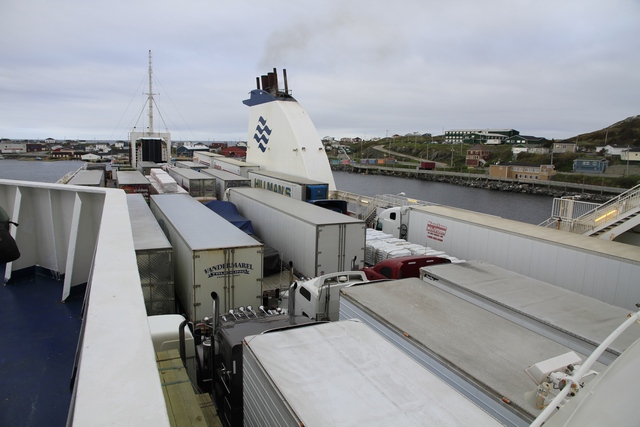
This is deck 5, the third parking level, full of trucks. There were also a lot of trucks our deck 3 where we were parked.
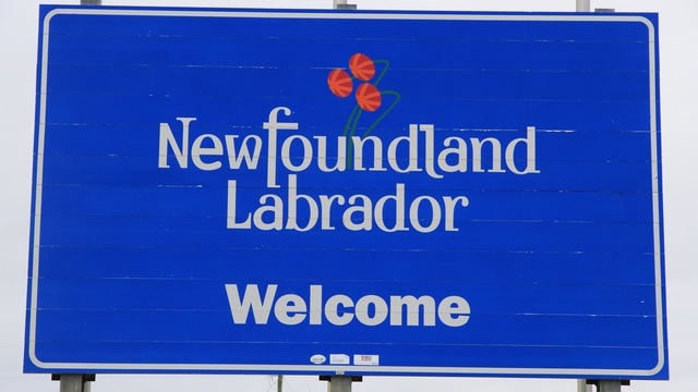
Made it! A sign just before the Welcome Center. Zaph was really happy to stop here --- he got to walk around and have breakfast.
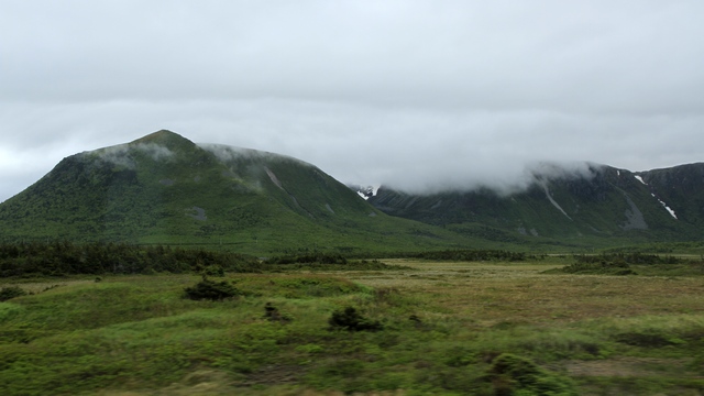
Driving toward Corner Brook I shot some photos out of the window of truck. Green hills, low cloud cover and snow. Hopefully we won't see too much of the low cloud cover and snow during our trip.
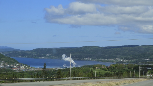
Approaching Corner Brook, again through the truck window. The temperature had risen and the sun was out.
Just past Corner Brook is the small town of Steady Brook where we found George's Mountain Village RV Park. This campground really has it all.
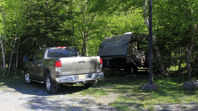
Eight nice RV sites, a dozen cabins, a Tim Horton's (for my American friends Tim Horton's is Canada's most popular coffee shop), a gas station, a liquor store that not only sells beer, wine and liquor but also ice cream cones and gifts and an outfitters store. It also has direct access to the highway. On top of all of that, it is at the base of Marble Mountain, which is a ski resort and has zip lines.
For the past week Zaph has been having some digestive problems. We thought we had corrected them but yesterday there was prove that we had not. It was time to see a veterinarian and get some antibiotics in hope they will fix the problem. The young man who checked us in at the RV park recommended the vet his mother uses. The vet and all of her staff were very helpful. Sometimes I think Zaph just likes to try out veterinarians in different parts of North America.
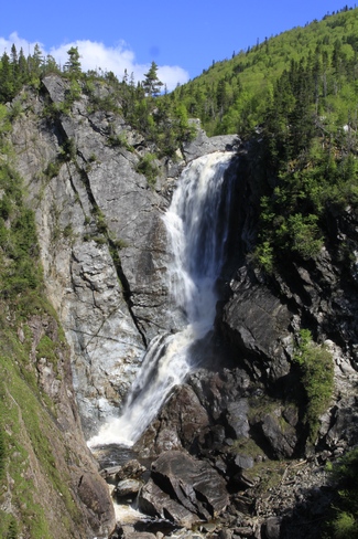
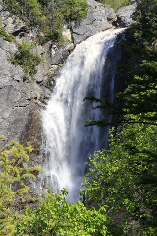
About a five minute walk from the campground is Steady Brook Falls. After viewing the falls we walked a bit further so Ed could find his first geocache in Newfoundland --- it was very exciting (for him).
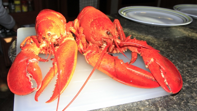
While we were in Corner Brook we stopped and picked up some groceries at a Dominion (now owned by Loblaws). Amazing store with more selection then I get at home. These guys jumped into my cart and said "have us for dinner".
Around 6am the PA system beeped to wake people up and announce that we would be arriving in Newfoundland in one hour. The announcement woke Ed in time for him to see the sun rise through the dew covered windows.
It was around 7C (mid 40s F) and cloudy when we docked. You can see the staging area for the ferry and snow on the hills in the background.
This is deck 5, the third parking level, full of trucks. There were also a lot of trucks our deck 3 where we were parked.
Made it! A sign just before the Welcome Center. Zaph was really happy to stop here --- he got to walk around and have breakfast.
Driving toward Corner Brook I shot some photos out of the window of truck. Green hills, low cloud cover and snow. Hopefully we won't see too much of the low cloud cover and snow during our trip.
Approaching Corner Brook, again through the truck window. The temperature had risen and the sun was out.
Just past Corner Brook is the small town of Steady Brook where we found George's Mountain Village RV Park. This campground really has it all.
Eight nice RV sites, a dozen cabins, a Tim Horton's (for my American friends Tim Horton's is Canada's most popular coffee shop), a gas station, a liquor store that not only sells beer, wine and liquor but also ice cream cones and gifts and an outfitters store. It also has direct access to the highway. On top of all of that, it is at the base of Marble Mountain, which is a ski resort and has zip lines.
For the past week Zaph has been having some digestive problems. We thought we had corrected them but yesterday there was prove that we had not. It was time to see a veterinarian and get some antibiotics in hope they will fix the problem. The young man who checked us in at the RV park recommended the vet his mother uses. The vet and all of her staff were very helpful. Sometimes I think Zaph just likes to try out veterinarians in different parts of North America.
About a five minute walk from the campground is Steady Brook Falls. After viewing the falls we walked a bit further so Ed could find his first geocache in Newfoundland --- it was very exciting (for him).
While we were in Corner Brook we stopped and picked up some groceries at a Dominion (now owned by Loblaws). Amazing store with more selection then I get at home. These guys jumped into my cart and said "have us for dinner".
2014/06/11: Louisbourg Scenic Drive
Category: General
Posted by: The Agnew Family
When we visited Nova Scotia about 30 years ago we toured the Fortress of
Louisbourg but nothing else in that area. So this time we skipped the
fort and toured the area. Here we found the picturesque Nova Scotia we
remembered.

On the edge of town is the harbour.
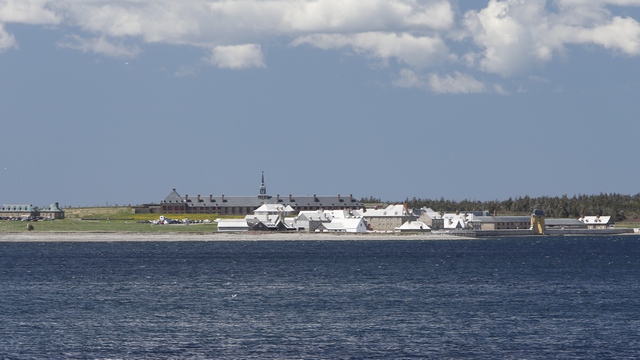
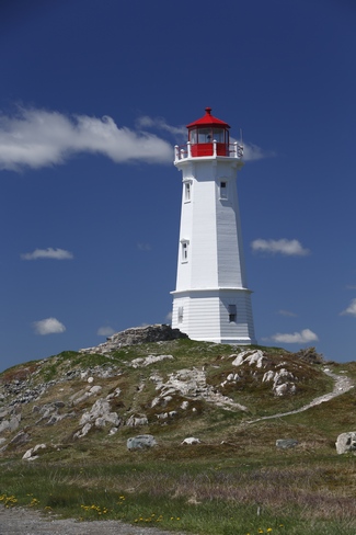
Not far from town is scenic lookout. From here you could see the fort, the lighthouse and the rocky shoreline.
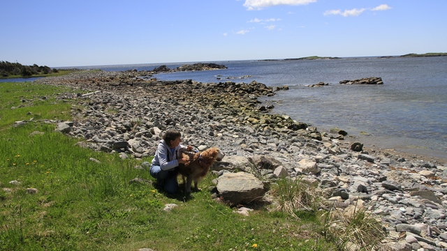
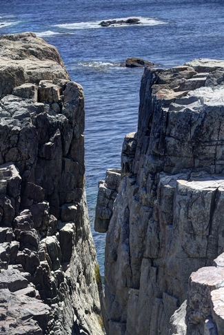
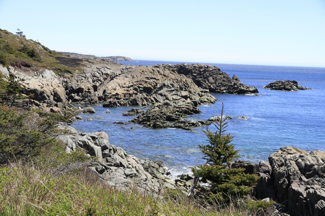
At the lighthouse is a trail that follows the coast for several kilometres. We were advised by a young woman walking a chocolate lab to turn around at the loop at 1.5 kilometres as the black flies were bad beyond that. Sounded like good advise to us. Lots of great views of the rocky coastline on the hike.
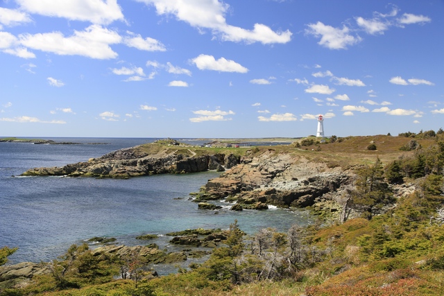
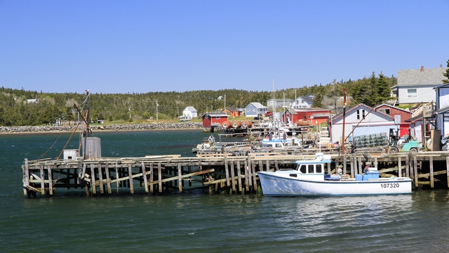
Leaving Louisbourg we headed north along the coast to Glace Bay. Along the way we found several picturesque towns.
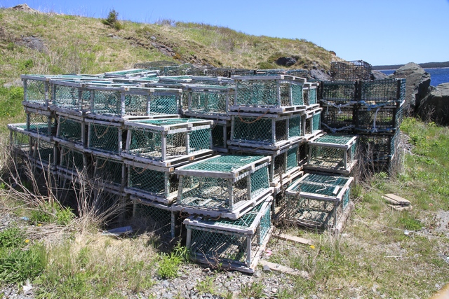
and lots of lobster traps both in and out of the water. It is lobster season after all.
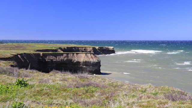
In Glace Bay we stop at the Marconi National Historic Site, unfortunately the museum was closed (it's only open in July and August). In 1902, the first official wireless message was sent from this site across the Atlantic Ocean to England.
Returning to the trailer we started packing up. Tonight we were leaving on the 11:45 ferry to Newfoundland and needed to be at the ferry docks by 9:00pm. We were told that it takes two hours to load the ferry --- I think there were somewhere between 50 and 100 tractor trailers to be loaded plus all the cars and recreational vehicles.
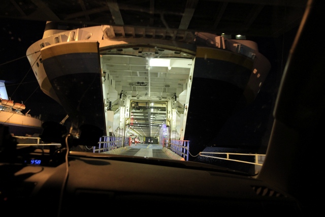
Boarding the ferry. The ferry's are the size of large cruise ships with three levels for vehicles and three levels for passengers. One level has private cabins, another level has reserved seating reclining chairs and the last level has a restaurant, bar, and open seating with reclining chairs but not as nice as the reserved seating. Dogs can either be put in crate in the kennel room or left in your vehicle --- Zaph opted to stay in the trailer as it is much nicer than a crate. We had opted for open seating but wandered into reserved seating as it wasn't busy. Turned out it was quieter and dimmer and we were able to get several hours of sleep.
On the edge of town is the harbour.
Not far from town is scenic lookout. From here you could see the fort, the lighthouse and the rocky shoreline.

At the lighthouse is a trail that follows the coast for several kilometres. We were advised by a young woman walking a chocolate lab to turn around at the loop at 1.5 kilometres as the black flies were bad beyond that. Sounded like good advise to us. Lots of great views of the rocky coastline on the hike.
Leaving Louisbourg we headed north along the coast to Glace Bay. Along the way we found several picturesque towns.
and lots of lobster traps both in and out of the water. It is lobster season after all.
In Glace Bay we stop at the Marconi National Historic Site, unfortunately the museum was closed (it's only open in July and August). In 1902, the first official wireless message was sent from this site across the Atlantic Ocean to England.
Returning to the trailer we started packing up. Tonight we were leaving on the 11:45 ferry to Newfoundland and needed to be at the ferry docks by 9:00pm. We were told that it takes two hours to load the ferry --- I think there were somewhere between 50 and 100 tractor trailers to be loaded plus all the cars and recreational vehicles.
Boarding the ferry. The ferry's are the size of large cruise ships with three levels for vehicles and three levels for passengers. One level has private cabins, another level has reserved seating reclining chairs and the last level has a restaurant, bar, and open seating with reclining chairs but not as nice as the reserved seating. Dogs can either be put in crate in the kennel room or left in your vehicle --- Zaph opted to stay in the trailer as it is much nicer than a crate. We had opted for open seating but wandered into reserved seating as it wasn't busy. Turned out it was quieter and dimmer and we were able to get several hours of sleep.
2014/06/10: Touring Around North Sydney
Category: General
Posted by: The Agnew Family
Neither Ed nor I felt like driving very far today, so we stayed in the North Sydney area.
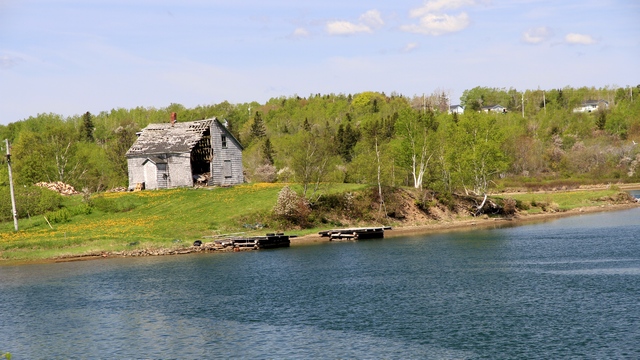
There were lots of interesting buildings to take pictures of.
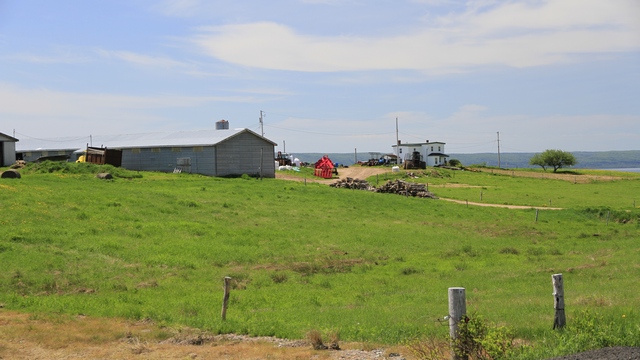
as well as some beautiful scenes.
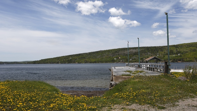
One of the places we ended up was Ross Ferry. In the late 1800's Angus Ross and Phillip Fraser were among first the men to ferry people and horses across the channel. In 1917 the first car crossed the channel prompting the construction of a car ferry. The last ferry to service this area was in 1961 when the Seal Island Bridge opened.
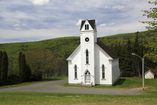
We drove around an island that was approximately 20 kilometers long and scarcely populated. This is one of the three churches we saw on the island.
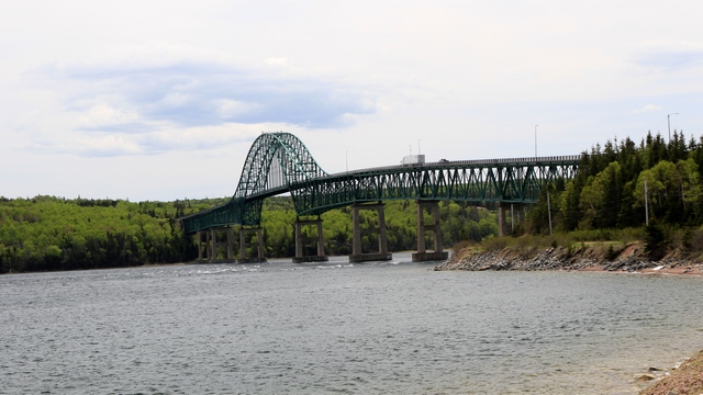
Seal Island Bridge.
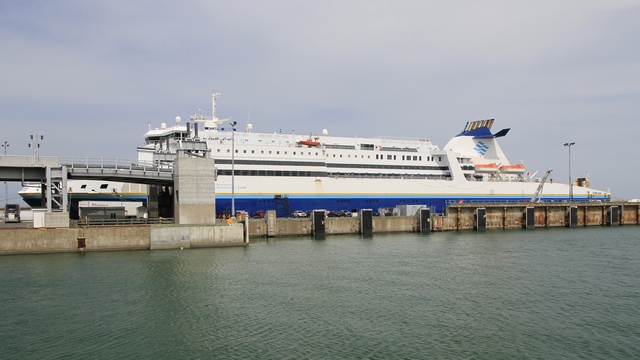
One of Marine Atlantic Ferries that run to Newfoundland.
There were lots of interesting buildings to take pictures of.
as well as some beautiful scenes.
One of the places we ended up was Ross Ferry. In the late 1800's Angus Ross and Phillip Fraser were among first the men to ferry people and horses across the channel. In 1917 the first car crossed the channel prompting the construction of a car ferry. The last ferry to service this area was in 1961 when the Seal Island Bridge opened.
We drove around an island that was approximately 20 kilometers long and scarcely populated. This is one of the three churches we saw on the island.
Seal Island Bridge.
One of Marine Atlantic Ferries that run to Newfoundland.
2014/06/09: Arrived in Nova Scotia
Category: General
Posted by: The Agnew Family
Just before noon we pulled into the Nova Scotia Welcome Centre. It's a perfect spot for taking a break from driving --- it's on top of a hill overlooking the water. There was even a piper playing a few tunes on his bag pipes.
I was surprised that things did not look familiar during our drive today. Then Ed determined that it was 1984 when we had previously visited the east coast. There's probably been some changes since then and it has been a while but it was another perfect day for driving and enjoying the view.
Part of today's drive took us along the shores of Bras d'Or Lake and this is one of the views we saw. A gentleman we met at tonight's RV park told us about the lake. Bras d'Or means Arm of Gold --- the name of the RV park where we are staying (yes, the parks on the lake). The lake is an inland sea of partially fresh / salt water and is approximately 1000 feet deep.
One thing I miss from our 5th wheel trailer is the large back window. It was great when your were parked where there was a view. The bathroom is at the back of the travel trailer and it does have a window in it. If I keep the bathroom door open I can see the view --- but it's just not the same. A couple of views from the RV park.
Zaph and I trying out one of the chairs in the park.
When I was researching Newfoundland I also did a little research on Labrador. In 2010 the road to Labrador was completed. You drive north from Quebec City entering Labrador at Labrador City, follow the road east to the Atlantic Ocean, work your way south back to the Quebec border where you can catch a ferry to Newfoundland. It's almost 2000 kilometers and large sections of it are gravel. At the RV park today we talked to a couple who are going to Newfoundland and then driving through Labrador. Then we talked to two couples who came via Labrador and Newfoundland. I asked them if it was worth the drive and they said they had an interesting tour of a Hydro-electric dam and they can put the Labrador sticker on the map on their Road-treks. Think I'm glad we're not trying to do Labrador.
2014/06/08: Long Drive
Category: General
Posted by: The Agnew Family
Compared to trips we've done in the past these are not long drives. Over
time Ed has found that he enjoys shorter drives with time to relax in
the evening especially when pulling a trailer. Also, we're retired so
it's not like we're in a hurry. Anyway today's drive was a little over
800 kilometers, the longest planned drive on the trip (well except for
maybe on the way home as we haven't planned that yet).
Friends told us about a bypass around Montreal that opened just over a year ago and we drove it today. It was wonderful (being early on a Sunday morning might have helped as well). It was a lot less stressful than trips we've done through Montreal in the past. The remainder of the day we drove through rural Quebec and New Brunswick. A nice drive on a beautiful day. We stopped at Yogi Bear's Jellystone Park in Woodstock New Brunswick for the night. This is a very kid oriented park, but they offer a traveler's discounted rate and it is located right by the highway where we wanted to stop. Being a Sunday night in June the park is just about deserted.
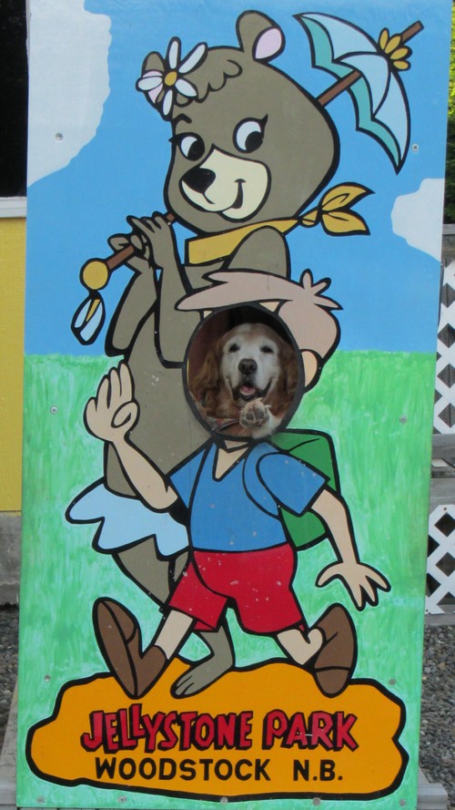
Someone has to have their picture taken in a cutout.
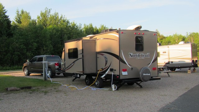
There's trailers in the section where we are parked but no one is in them. Kinda nice.
Friends told us about a bypass around Montreal that opened just over a year ago and we drove it today. It was wonderful (being early on a Sunday morning might have helped as well). It was a lot less stressful than trips we've done through Montreal in the past. The remainder of the day we drove through rural Quebec and New Brunswick. A nice drive on a beautiful day. We stopped at Yogi Bear's Jellystone Park in Woodstock New Brunswick for the night. This is a very kid oriented park, but they offer a traveler's discounted rate and it is located right by the highway where we wanted to stop. Being a Sunday night in June the park is just about deserted.
Someone has to have their picture taken in a cutout.
There's trailers in the section where we are parked but no one is in them. Kinda nice.
2014/06/07: And We’re Off
Category: General
Posted by: The Agnew Family
to Newfoundland that is. Yesterday we finished packing the trailer,
weeded the gardens, cleaned the house, turned off the gas to the
appliances, etc. As we wanted to get an early start this morning, we
slept in the trailer last night while it was parked in the driveway.
This definitely worked to my advantage as the sun beaming in the door at
6:30 am woke Ed up. He added a couple of more items to the list of
things that needed to be done before we left and we pulled out of the
driveway at 7:45 am --- good for us.
We had chosen Saturday as the day to leave because we thought it would be easier to get through Toronto and it was. There was a bit of a slow down by the airport where lanes merged that continued to where the collectors start but other than that we sailed on through. We arrived at Mapplewood Acres (they claim they are the closest RV park to the Quebec border) around 3:30pm. Ed does not have found memories of a trip we took to Quebec over 25 years ago. As it’s a beautiful day it’s nice to get a chance to sit outside and relax.
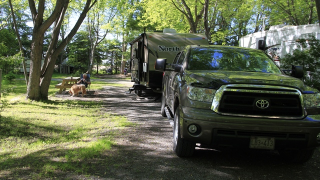
Our site.
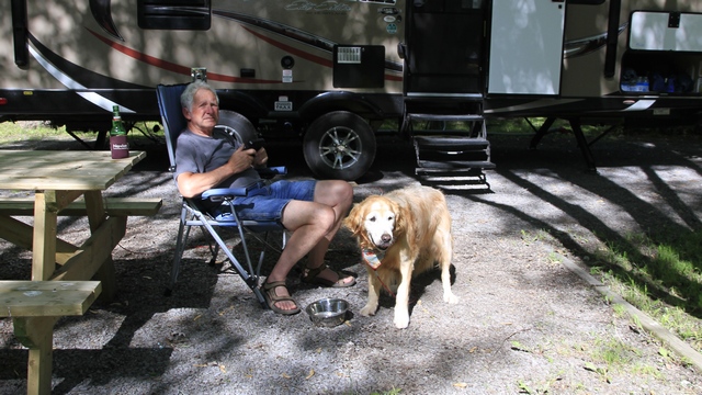
The boys relaxing.
We had chosen Saturday as the day to leave because we thought it would be easier to get through Toronto and it was. There was a bit of a slow down by the airport where lanes merged that continued to where the collectors start but other than that we sailed on through. We arrived at Mapplewood Acres (they claim they are the closest RV park to the Quebec border) around 3:30pm. Ed does not have found memories of a trip we took to Quebec over 25 years ago. As it’s a beautiful day it’s nice to get a chance to sit outside and relax.
Our site.
The boys relaxing.