2013/02/28: Hiking
Category: General
Posted by: The Agnew Family
Another cool and sunny morning. Today was laundry day and let me tell
you this was 100 per cent opposite to the laundry day in Quartzsite. The
building was heated (nice as it was only 40F when I went to do
laundry), eight new looking washers, 12 new looking dryers, 2 big clean
folding tables and not another person in site. The only draw back was
the money card. You had to buy a card for $2, then put money on it in
increments of $5. The washer was a $1.25 a load and the dryer was $1.00
for 40 minutes and 25 cents for each additional 15 minutes. When you're
only in the RV park for a week it's a little tricky figuring out how
much money to put on the card. Lucky for me, Carol and Esther are also
in the park. When I was done with the card I passed it on to Carol who
will pass it on to Esther who is staying here for a couple more weeks.
Hopefully, we'll get the residual money on the card down to a minimal
amount.
After an early lunch, Ed, Zaph and I headed out for a hike. When we stopped in Sedona in 2010 we did a number of hikes and decided to try a hike in a new area. First trail head didn't work for us as the trail wasn't marked and there we're paths leading every which way. Second trail head was much better. Baskets filled with stones marked the way. The hike took us through a forest, across a dry creek bed, slowly climbing up to a ridge, along the ridge above Oak Creek and finally down the road to the truck.
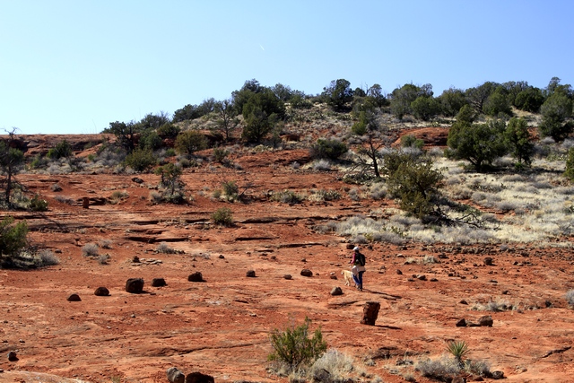
On the trail.
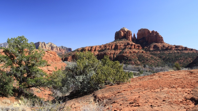
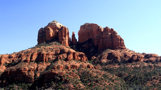
We could see this peak across Oak Creek.
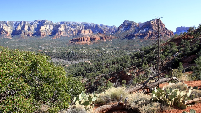
After the hike we drove over to the airport. It was a spot we remembered fondly from our trip in 2010.
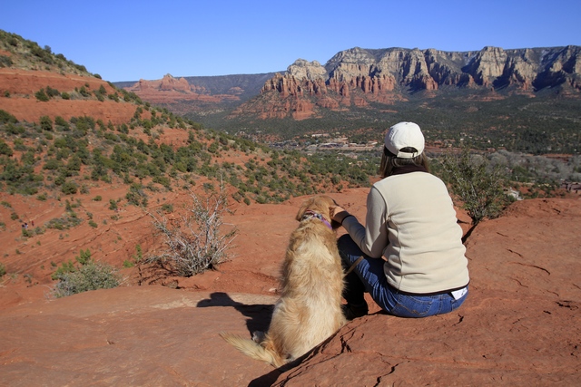
We climbed to the top of a hill and enjoyed the view.
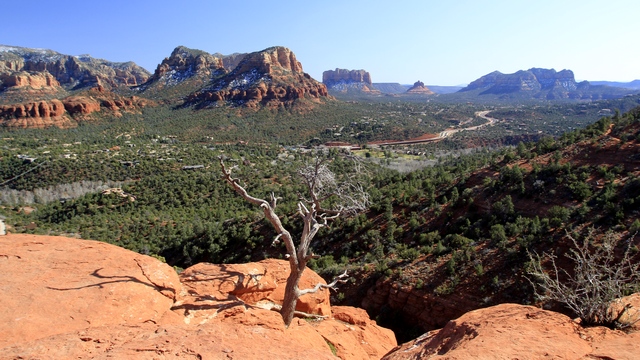
A view of the highway we had driven on yesterday.
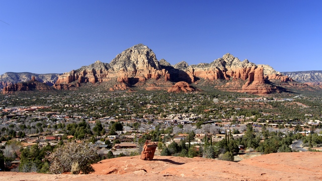
Another wonderful view from the hill top.
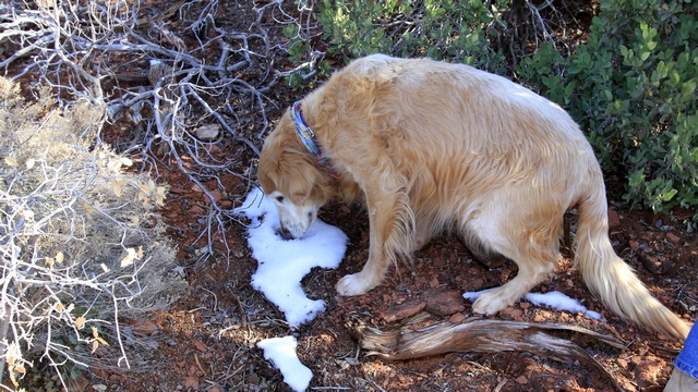
You probably didn't believe me when I said it was cold. Zaph found some snow that he quickly ate. I'm surprised that he new what to do with it.
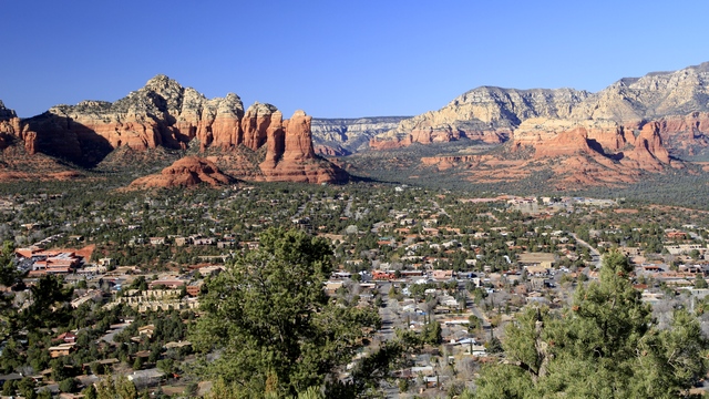
A view of Sedona.
After an early lunch, Ed, Zaph and I headed out for a hike. When we stopped in Sedona in 2010 we did a number of hikes and decided to try a hike in a new area. First trail head didn't work for us as the trail wasn't marked and there we're paths leading every which way. Second trail head was much better. Baskets filled with stones marked the way. The hike took us through a forest, across a dry creek bed, slowly climbing up to a ridge, along the ridge above Oak Creek and finally down the road to the truck.
On the trail.
We could see this peak across Oak Creek.
After the hike we drove over to the airport. It was a spot we remembered fondly from our trip in 2010.
We climbed to the top of a hill and enjoyed the view.
A view of the highway we had driven on yesterday.
Another wonderful view from the hill top.
You probably didn't believe me when I said it was cold. Zaph found some snow that he quickly ate. I'm surprised that he new what to do with it.
A view of Sedona.
2013/02/27: Sedona
Category: General
Posted by: The Agnew Family
It's still a little cool .... high in the mid 50s so we thought we leave
the major out door activities to another day and go shopping in Sedona
today.
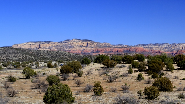
A scenic view point on the drive into Sedona.
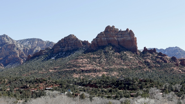
The old part of Sedona has some beautiful shops, expensive restaurants and beautiful views. As we had been out for dinner last night to celebrate Jim and Esther's 57th anniversary we opted for lunch at Burger King. I had a pretty good fish sandwich.
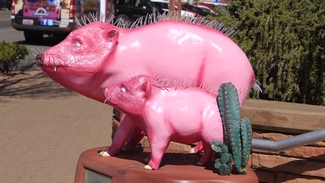
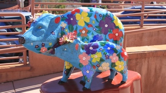
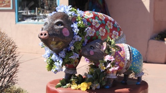
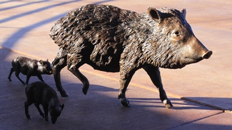
Javelinas around town.
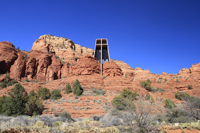
The Chapel of the Holy Cross is a beautiful piece of architecture. The church was inspired and commissioned by sculptor Marguerite Brunswig Stuade. The construction was completed in 1956.
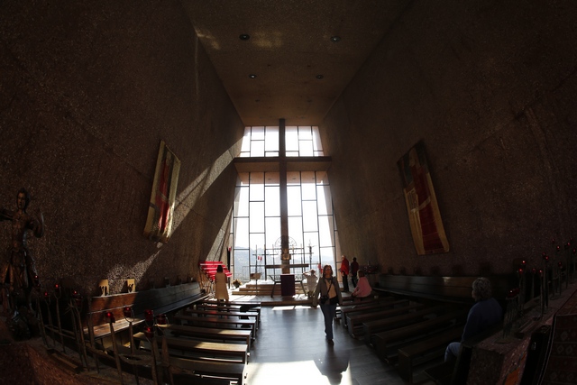
Ed had fun shooting photos of the church. This one was taken with a fish eye lens.
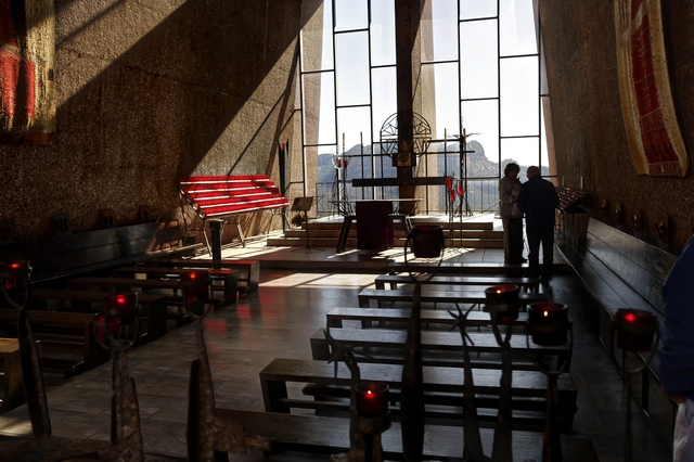
This one was taken with a normal lens.
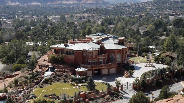
This mansion can be seen from the chapel. When we were here in 2010 there was an observatory dome on the roof ... not there now. Ed said he saw the dome on the ground. I guess they moved the observatory out of the house.
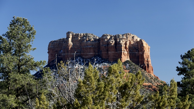
I think this is courthouse rock.
A scenic view point on the drive into Sedona.
The old part of Sedona has some beautiful shops, expensive restaurants and beautiful views. As we had been out for dinner last night to celebrate Jim and Esther's 57th anniversary we opted for lunch at Burger King. I had a pretty good fish sandwich.
Javelinas around town.
The Chapel of the Holy Cross is a beautiful piece of architecture. The church was inspired and commissioned by sculptor Marguerite Brunswig Stuade. The construction was completed in 1956.
Ed had fun shooting photos of the church. This one was taken with a fish eye lens.

This one was taken with a normal lens.
This mansion can be seen from the chapel. When we were here in 2010 there was an observatory dome on the roof ... not there now. Ed said he saw the dome on the ground. I guess they moved the observatory out of the house.
I think this is courthouse rock.
2013/02/26: On the Move
Category: General
Posted by: The Agnew Family
It was sad to leave Parker as the temperatures were warming up and we
knew we are heading to cooler temperatures in the Sedona area.
Happily once again the drive was uneventful. The last 30 miles were were very pretty as we drove through a mountain pass. We were wondering what the white stuff on the ground is ... I tried to convince Ed that it was white stones but he wouldn't believe me.
Our friends, Jim and Esther, belong to a camping club and are staying at member park in Cottonwood (not too far from Sedona) that allows non-members so we are joining them there.
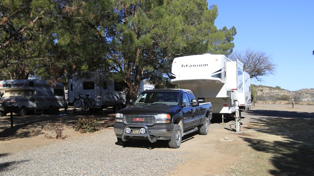
The park is situated on a large piece of property and the campground is split into several sections. The section we are in affords us a beautiful view of the hills in the distance. .... and there are trees here, real trees.
Happily once again the drive was uneventful. The last 30 miles were were very pretty as we drove through a mountain pass. We were wondering what the white stuff on the ground is ... I tried to convince Ed that it was white stones but he wouldn't believe me.
Our friends, Jim and Esther, belong to a camping club and are staying at member park in Cottonwood (not too far from Sedona) that allows non-members so we are joining them there.
The park is situated on a large piece of property and the campground is split into several sections. The section we are in affords us a beautiful view of the hills in the distance. .... and there are trees here, real trees.
2013/02/25: One last ATV ride
Category: General
Posted by: The Agnew Family
A few days ago Lorna called and asked if we were interested in another
ride .... yes, of course we were. We met the group just south of Parker
and drove about 15 miles in from the main road. We parked when the road
changed from pavement to gravel. Todays route took us up on top of
ridges giving us some wonderful views. Everyone was happy that
yesterday's wind was gone and the air was still ... it would have been
mighty cold on the ridges if the cold wind was a blowing. The fellow Ed
had ridden with the first time out was away and allowed us to use his
razor. Ed was a happy camper that he got to drive.
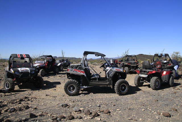
The ATV's all lined up at one of our stops.
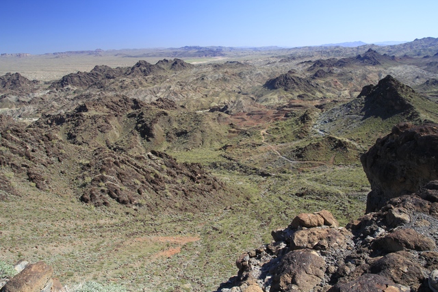
I know it's very different from the Grand Canyon but the view did remind me of the Canyon.
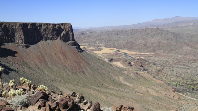
The river in the middle of the photo is the Bill Williams River. It joins into the Colorado River just north of Parker Dam.
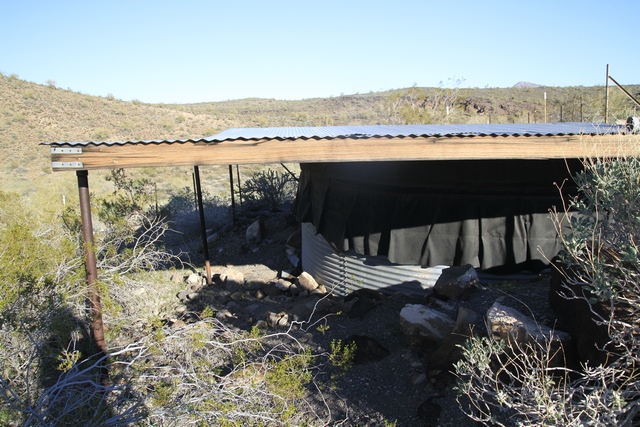
We saw several of these "drinks" or "tanks". During a rain storm, the flat surface will gather water draining into a large tank. The water is then slowly drained out creating a water spot for the sheep and other animals.
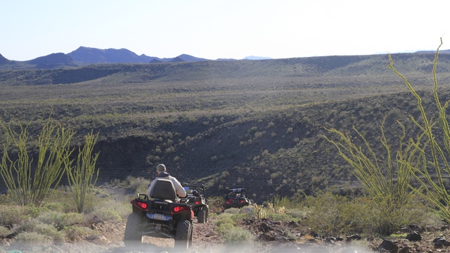
Interesting terrain today. Some nice flat easy sections and a few step loose rock hills. I was glad Ed was driving and not me.
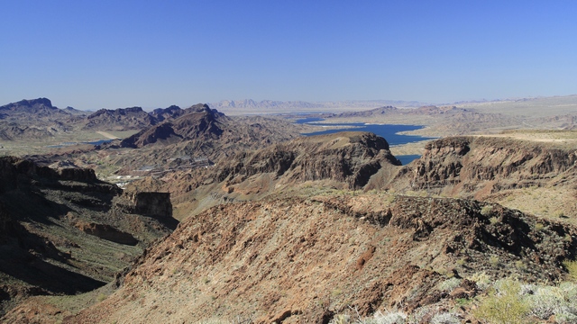
The water on the right side of the photo is Lake Havasu. To the right of it on the horizon you can just see some white splotches --- that's Lake Havasu City. The white building in the middle left are by the Parker Dam. The water above those buildings is a reservoir used in pumping the water from the Colorado River to California.
Tomorrow we are leaving Parker and driving to Cottonwood (just outside of Sedona) where we plan to stay for a week. Cottonwood is at a higher elevation so we will get to enjoy some cooler weather. Luckily, a patch of warm weather is coming so hopefully it won't be too cool. Unknown Internet access ahead but I'll try to update the blog.
The ATV's all lined up at one of our stops.
I know it's very different from the Grand Canyon but the view did remind me of the Canyon.
The river in the middle of the photo is the Bill Williams River. It joins into the Colorado River just north of Parker Dam.
We saw several of these "drinks" or "tanks". During a rain storm, the flat surface will gather water draining into a large tank. The water is then slowly drained out creating a water spot for the sheep and other animals.
Interesting terrain today. Some nice flat easy sections and a few step loose rock hills. I was glad Ed was driving and not me.
The water on the right side of the photo is Lake Havasu. To the right of it on the horizon you can just see some white splotches --- that's Lake Havasu City. The white building in the middle left are by the Parker Dam. The water above those buildings is a reservoir used in pumping the water from the Colorado River to California.
Tomorrow we are leaving Parker and driving to Cottonwood (just outside of Sedona) where we plan to stay for a week. Cottonwood is at a higher elevation so we will get to enjoy some cooler weather. Luckily, a patch of warm weather is coming so hopefully it won't be too cool. Unknown Internet access ahead but I'll try to update the blog.
2013/02/24: Parker Geocaching
Category: General
Posted by: The Agnew Family
Quiet day today. Ed, Zaph and I went out for a few hours and did some
geocaching. We found eleven caches and had a nutty cone as our reward as
there isn't a dairy queen around here. Temperature wasn't bad today but
there was a very cool east wind.
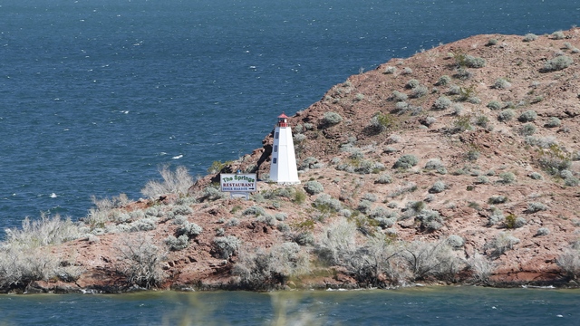
There were three geocaches near the Parker dam as well as a trail. We followed a trail and saw one of the lighthouses on Lake Havasu.
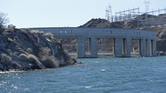
A view of the Parker dam from Lake Havasu.
There were three geocaches near the Parker dam as well as a trail. We followed a trail and saw one of the lighthouses on Lake Havasu.
A view of the Parker dam from Lake Havasu.
2013/02/23: Nellie E Saloon
Category: General
Posted by: The Agnew Family
Out in the desert about five miles off the main road you can find the
Desert Bar Nellie E Saloon. This land was once an old mining camp.
Nothing remained of the camp when Ken purchased it in 1975. In 1983, Ken
opened the business in a temporary three sided building and operated
out of there for five years till the current bar was constructed. The
bar is only open Saturdays and Sundays and a few holidays from October
to April from high noon till 6pm. There is live entertainment and todays
is Bob Gulley and I thought Bob and his band were pretty good.
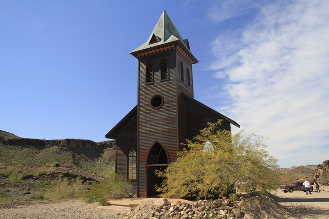
One of the first things you notice when you drive into the bar parking lot is the church spire. The church appears to be mostly metal construction. The web site says that there are no regular services in the church but it can be used for special occasions like weddings.
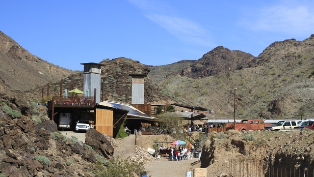
The Nellie E Saloon. It is mostly an open air bar with at least four levels. If you want a drink you line up at the bar, if you want food you can get it either on the lower level or the mid level. The band was set up on the mid level. The Philly cheese steak sandwiches were pretty good though it took Carol and I about 20 minutes of line standing to get them.
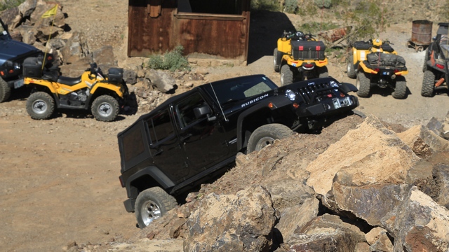
Couldn't resist taking a photo of this parking job. Wasn't there a jeep commercial like this.
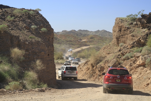
This bar is amazingly popular given it is a five mile drive on a dirt road. This narrow section is just before the parking lot.
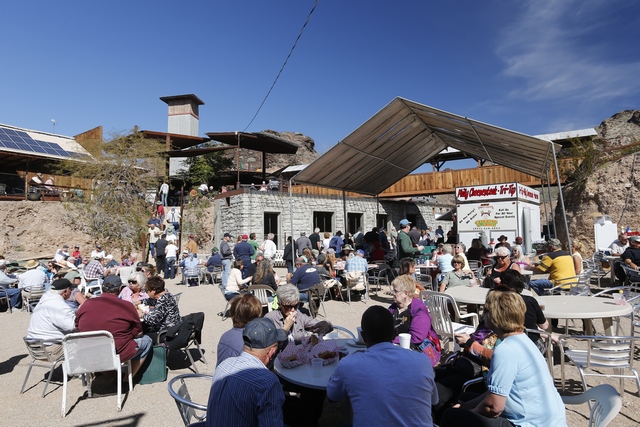
The lower level of the bar. The owner keeps expanding and adding things. The stone building in the back is a work in progress. The bar is solar powered --- there are solar panels on most roof surfaces also lots of batteries and inverters.
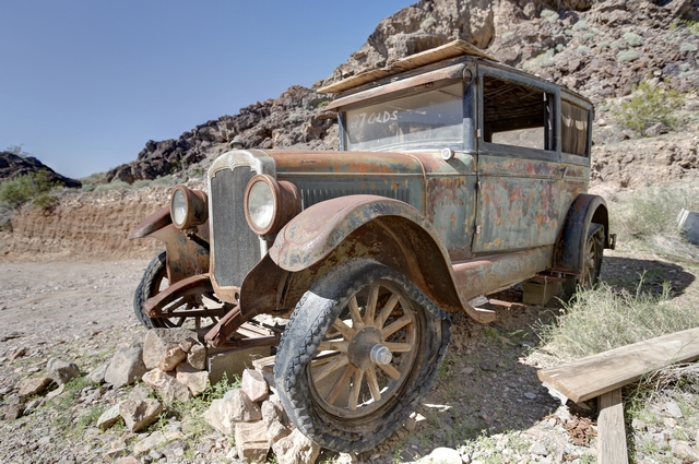
Years ago an old firetruck was used to bring water into the bar before a well was dug. Now the truck is on display with a number of other old trucks, cars and tractors. Old firehose is nailed into the ground marking the parking spots.
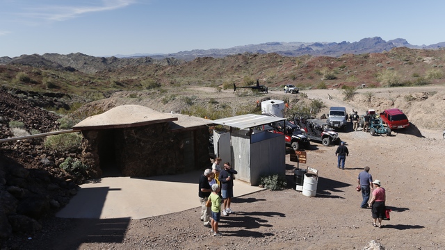
The mens ...
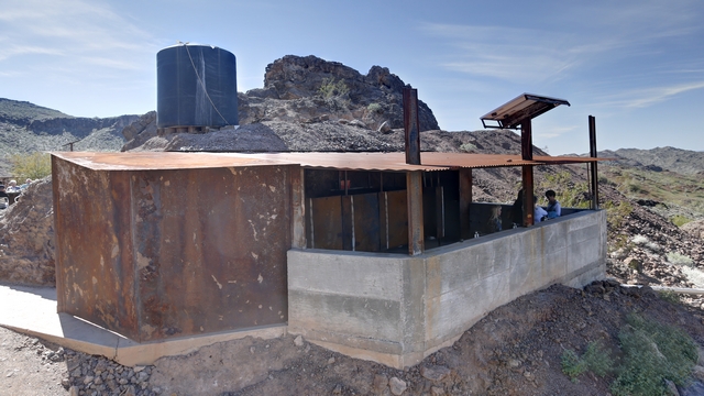
and the ladies. Even here the owner of the bar loves steel. The stall doors are massive pieces of steel. The sinks have taps that look like old fashioned pumps and the view is pretty good.
One of the first things you notice when you drive into the bar parking lot is the church spire. The church appears to be mostly metal construction. The web site says that there are no regular services in the church but it can be used for special occasions like weddings.
The Nellie E Saloon. It is mostly an open air bar with at least four levels. If you want a drink you line up at the bar, if you want food you can get it either on the lower level or the mid level. The band was set up on the mid level. The Philly cheese steak sandwiches were pretty good though it took Carol and I about 20 minutes of line standing to get them.
Couldn't resist taking a photo of this parking job. Wasn't there a jeep commercial like this.
This bar is amazingly popular given it is a five mile drive on a dirt road. This narrow section is just before the parking lot.
The lower level of the bar. The owner keeps expanding and adding things. The stone building in the back is a work in progress. The bar is solar powered --- there are solar panels on most roof surfaces also lots of batteries and inverters.

Years ago an old firetruck was used to bring water into the bar before a well was dug. Now the truck is on display with a number of other old trucks, cars and tractors. Old firehose is nailed into the ground marking the parking spots.
The mens ...

and the ladies. Even here the owner of the bar loves steel. The stall doors are massive pieces of steel. The sinks have taps that look like old fashioned pumps and the view is pretty good.
2013/02/22: River Drive
Category: General
Posted by: The Agnew Family
One of the ideas in the visitor's guide is a scenic drive from Parker to
Parker Dam along the Colorado River. They were correct, it was a very
picturesque drive.
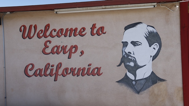
The drive started in Earp, California across the river from Parker. Wyatt Earp spent a number of winters in Earp after he retired to Los Angeles. Shortly after his death in 1929 a post office was established and the town given the name Earp.
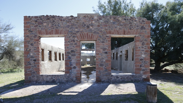
About five miles up the road from Earp is Crossroads, once a thriving tent city of 3,000 people. It was the home of miners and laborers who hope to make their stake copper mining. Parker Dam construction workers moved in during the 1930s, and Crossroads could boast five grocery stores, three restaurants, a pool hall, barber shop, mortuary, bowling alley, three service stations, several automobile garages, two used car lots, a church, power plant, saloons and tourist cabins. Today, there's only the shell of the Crossroads Mercantile Company.
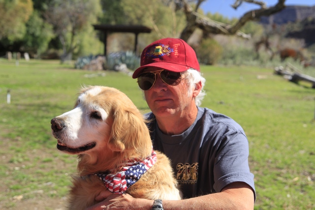
There was a lot of evidence that burros had been in the park where we stopped to eat lunch, so we invited Zaph to sit on the bench of the picnic table with us. He decided that daddy's lap was more comfortable.
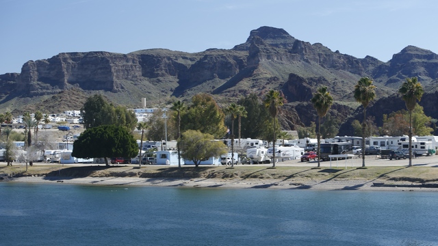
A view across the water to Castle Rock RV park where we are staying.
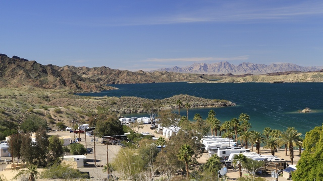
One of the wonderful river views.
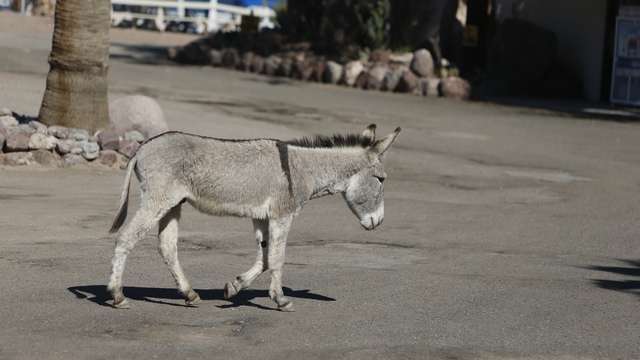
One of the many burros we saw on our drive. At one of the stops while we were looking at the river we heard the braying of a burro .... when they bray they want everyone to hear them.
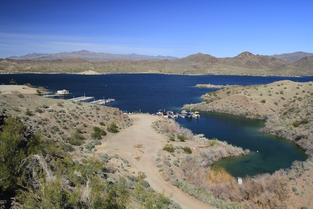
Just before the Parker Dam was a road that had a sign pointing to Black Meadow Landing. Not sure what Black Meadow Landing was but the road looked interesting so we drove it. Turned out after driving ten miles on a beautiful hilly road we ended up at an RV park on Lake Havasu. This photo was taken from the mesa in the park looking down at the lake.
The drive started in Earp, California across the river from Parker. Wyatt Earp spent a number of winters in Earp after he retired to Los Angeles. Shortly after his death in 1929 a post office was established and the town given the name Earp.
About five miles up the road from Earp is Crossroads, once a thriving tent city of 3,000 people. It was the home of miners and laborers who hope to make their stake copper mining. Parker Dam construction workers moved in during the 1930s, and Crossroads could boast five grocery stores, three restaurants, a pool hall, barber shop, mortuary, bowling alley, three service stations, several automobile garages, two used car lots, a church, power plant, saloons and tourist cabins. Today, there's only the shell of the Crossroads Mercantile Company.
There was a lot of evidence that burros had been in the park where we stopped to eat lunch, so we invited Zaph to sit on the bench of the picnic table with us. He decided that daddy's lap was more comfortable.
A view across the water to Castle Rock RV park where we are staying.
One of the wonderful river views.
One of the many burros we saw on our drive. At one of the stops while we were looking at the river we heard the braying of a burro .... when they bray they want everyone to hear them.
Just before the Parker Dam was a road that had a sign pointing to Black Meadow Landing. Not sure what Black Meadow Landing was but the road looked interesting so we drove it. Turned out after driving ten miles on a beautiful hilly road we ended up at an RV park on Lake Havasu. This photo was taken from the mesa in the park looking down at the lake.
2013/02/21: Golf, museum, oil change
Category: General
Posted by: The Agnew Family
Castle Rock RV has a lot of activities going on. One of them is Goofy Golf.
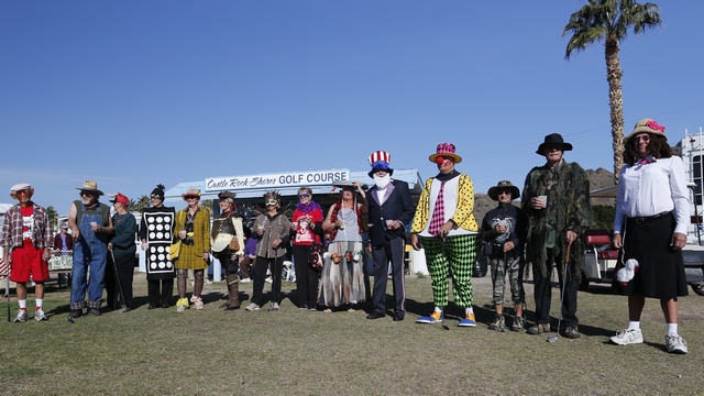
The participants.
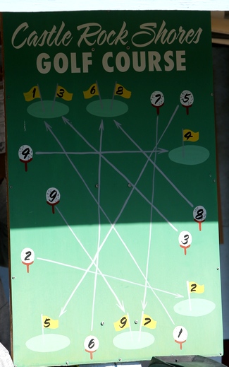
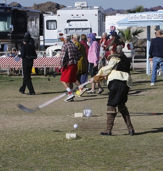
The golf course is interesting ... there are nine holes in a small area. Guess it's a good place to practice. There are more challenging courses in the area. One course we drive by is built in the rocks making narrow fairways. Back to Goofy Golf, you tee off using a floor hockey ball and a hockey stick, or a t-ball bat and ball. Once the best ball is determined you go back to golf balls and two golf clubs.
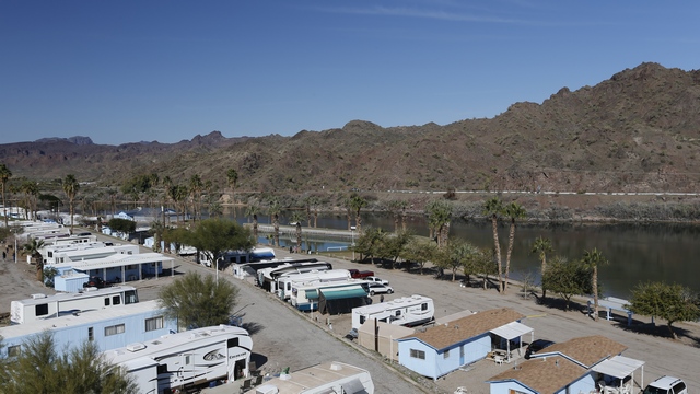
Ed walked to one of the highest points in the park and took some photos of the river.
The morning was beautiful ... reasonably warm and sunny but by mid afternoon it was cool and cloudy. Of course, the clouds started to go away just before sunset. Todays destination was Parker as the truck had an appointment for an oil change late afternoon. We met John, Carol, Esther and Jim at the Indian Museum. The area around Parker is the Colorado River Indian Reservation. The museum was small but interesting. No photos as photography was not allowed in the museum. After a nice lunch, Ed and I took the truck for its oil change. Esther and Jim went to the casino to try their luck and John and Carol toured the area.
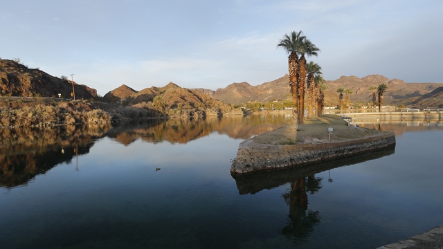
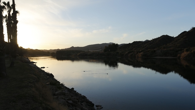
Back at the RV park, Ed couldn't resist some photos of the river as the sun was starting to set.
The participants.
The golf course is interesting ... there are nine holes in a small area. Guess it's a good place to practice. There are more challenging courses in the area. One course we drive by is built in the rocks making narrow fairways. Back to Goofy Golf, you tee off using a floor hockey ball and a hockey stick, or a t-ball bat and ball. Once the best ball is determined you go back to golf balls and two golf clubs.
Ed walked to one of the highest points in the park and took some photos of the river.
The morning was beautiful ... reasonably warm and sunny but by mid afternoon it was cool and cloudy. Of course, the clouds started to go away just before sunset. Todays destination was Parker as the truck had an appointment for an oil change late afternoon. We met John, Carol, Esther and Jim at the Indian Museum. The area around Parker is the Colorado River Indian Reservation. The museum was small but interesting. No photos as photography was not allowed in the museum. After a nice lunch, Ed and I took the truck for its oil change. Esther and Jim went to the casino to try their luck and John and Carol toured the area.
Back at the RV park, Ed couldn't resist some photos of the river as the sun was starting to set.
2013/02/20: Rain is better than snow
Category: General
Posted by: The Agnew Family
Sometimes I wonder if we really are in the desert and this one of one
those times. It started raining around 5:30am and didnít stop to around
9:30am. The sun came out for a little while then the clouds came back.
Decided to take a drive into Lake Havasu today as the weather didnít
seem like it was going to co-operate to allow any real exploring of the
area.
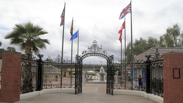
The entrance to London Bridge.
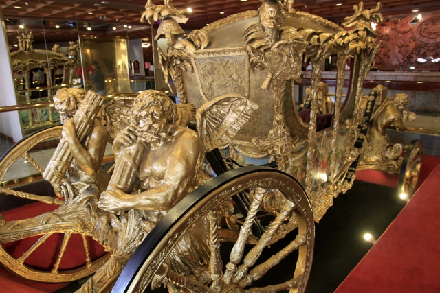
On the previous trip into Lake Havasu we missed the lobby of the London Bridge Resort where the only replica of Englandís Legendary Gold Stage Coach can be found. The original was built in 1762 to replace Queen Anneís coach and was pulled by a team of eight matched horses. It has reportedly carried every British Monarch since King George III to the coronation at Westminster Abbey.
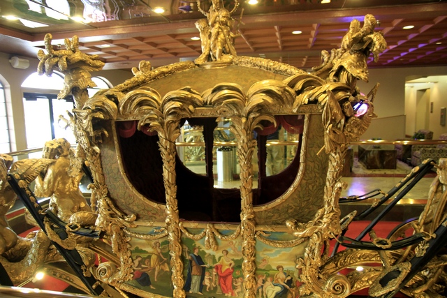
Another shot of the coach
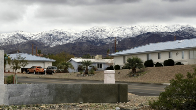
I canít complain about the rain and cool weather as snow fell at higher altitudes. Areas around Phoenix and Tuscon also received snow. Hope mother nature gets winter out of its system before we move to the Phoenix area.
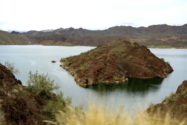
An island in Lake Havasu
The entrance to London Bridge.
On the previous trip into Lake Havasu we missed the lobby of the London Bridge Resort where the only replica of Englandís Legendary Gold Stage Coach can be found. The original was built in 1762 to replace Queen Anneís coach and was pulled by a team of eight matched horses. It has reportedly carried every British Monarch since King George III to the coronation at Westminster Abbey.
Another shot of the coach
I canít complain about the rain and cool weather as snow fell at higher altitudes. Areas around Phoenix and Tuscon also received snow. Hope mother nature gets winter out of its system before we move to the Phoenix area.
An island in Lake Havasu
2013/02/19: Moving Day
Category: General
Posted by: The Agnew Family
Moving day was uneventful, which is a good thing. As we only had 55
miles to drive we took our time packing and saying good-bye to Jim and
Esther. There is a chance weíll see them again, but we donít know for
sure. As the Parker Wal-mart came before the RV park we decided to stop
and pick up a few groceries. We expected RVs in the parking lot but not
as many as we found. We managed to find parking spots for both rigs but
it wasnít easy. A few more rigs snuck in while we were in the store
making the exit a little trickier.
Castle Rock RV park is between the highway and the Colorado River with mountains all around it making it a very pretty spot. It is also quite a change from La Paz Valley RV park outside of Quartzsite which was out in the desert away from major roads. Another big change is the water. La Paz Valley was on well water that was nice to drink. Castle Rockís water is not nice at all --- salty and yellowish in colour, so we are buying salt-free drinking water from a machine by the office.
Castle Rock RV park is between the highway and the Colorado River with mountains all around it making it a very pretty spot. It is also quite a change from La Paz Valley RV park outside of Quartzsite which was out in the desert away from major roads. Another big change is the water. La Paz Valley was on well water that was nice to drink. Castle Rockís water is not nice at all --- salty and yellowish in colour, so we are buying salt-free drinking water from a machine by the office.
2013/02/18: Packing
Category: General
Posted by: The Agnew Family
Ed's GPS indicated that he had found 392 geocaches and he decided that
he needed to reach 400 before we left Quartzsite. With that in mind, we
headed out Sunday morning to find eight geocaches. Even though Ed has
done a fair bit of geocaching around Quartzsite there are still a lot of
caches to find, so we didn't have a problem finding eight. We
celebrated with ice cream then went back to the RV park to help with the
final Quartzsite smoking ... this time it was chicken breasts and
turkey legs. Yum.
Tomorrow we are moving north but only 88km (55 miles). The area near the Parker Dam is very pretty so decided that we would like to spend a week there. We've been told that Internet and cell phone service is iffy up there so the blog may be updated sporadically .... not much different than lately but now I'll have a good reason.
Tomorrow we are moving north but only 88km (55 miles). The area near the Parker Dam is very pretty so decided that we would like to spend a week there. We've been told that Internet and cell phone service is iffy up there so the blog may be updated sporadically .... not much different than lately but now I'll have a good reason.
2013/02/16: Driving Back to Quartzsite
Category: General
Posted by: The Agnew Family
We followed the highway west then south to the Palm Springs area.
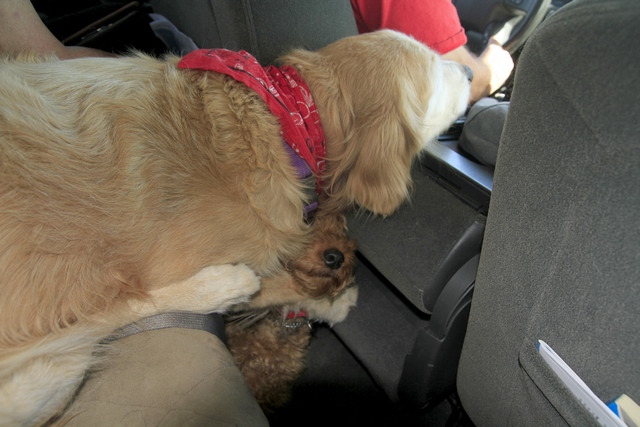
While we were driving I noticed how the kids were sleeping. Zaph was resting his head on the front armrest and Cait was resting her head on Zaph's leg. Didn't look comfortable to me but they stayed like for awhile.
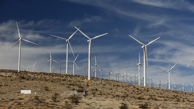
Just before we reached highway 10 was this huge wind farm, the San Gorgonio Pass Wind Farm. This wind farm was developed in the 1980s and is in one of the windiest places in Southern California.
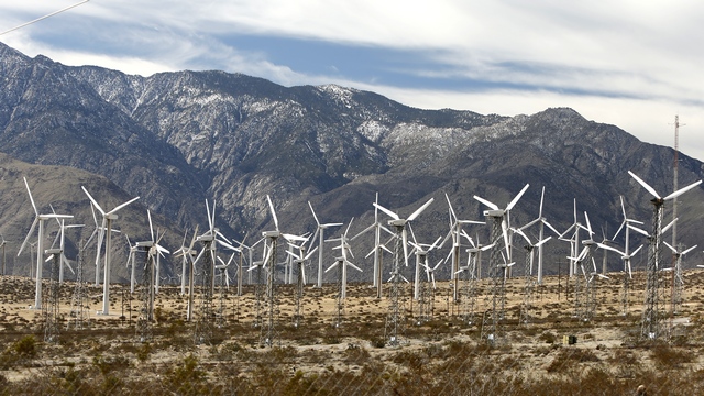
The wind turbines range from 80 to 160 feet in height. Always find it strange to see snow capped mountains in Southern California.
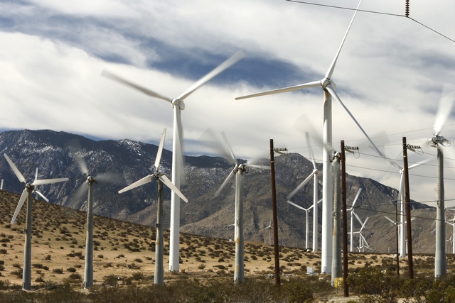
Some of the wind vanes were turning quickly while others were barely moving and others were not moving at all.
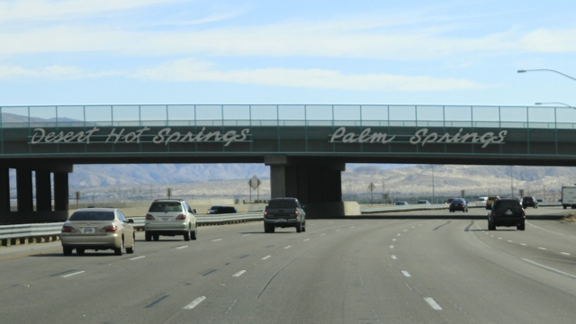
We have arrived in the Palm Springs area.
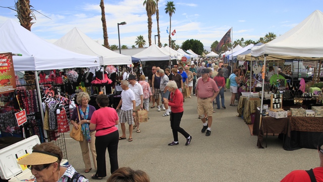
We stopped at a street fair.
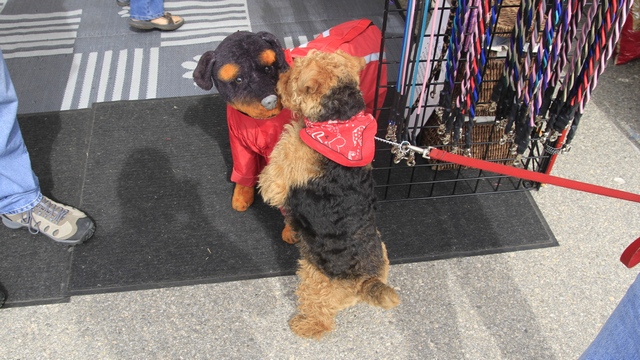
Zaph and Cait checked this guy out ... took them a moment to realize he was stuffed.
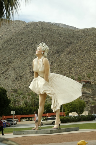
The 26 foot tall "Forever Marilyn" statue is currently in Palm Springs. This statue was originally on display in Chicago and was moved to Palm Springs in May 2012.
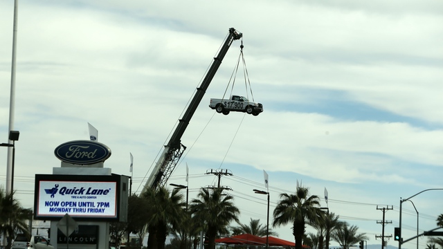
Thought this was an interesting way to display a truck.
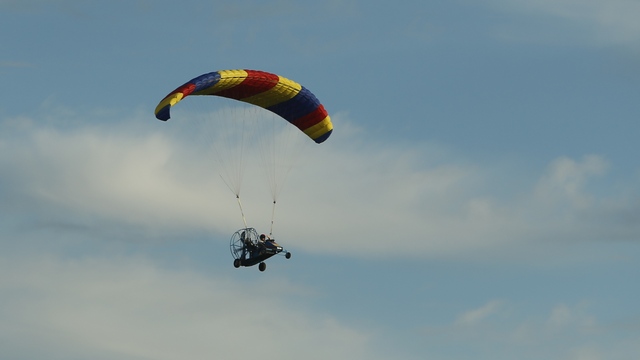
In the middle of the desert we saw this ultralight flying.
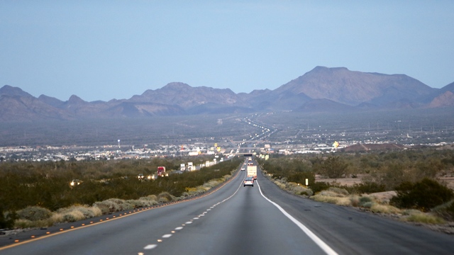
We arrived back in Quartzsite as the sun was setting and were surprised to see the line of traffic driving west. When you remember that highway 10 passes through Phoenix and goes to Los Angles the amount of traffic made sense.
While we were driving I noticed how the kids were sleeping. Zaph was resting his head on the front armrest and Cait was resting her head on Zaph's leg. Didn't look comfortable to me but they stayed like for awhile.
Just before we reached highway 10 was this huge wind farm, the San Gorgonio Pass Wind Farm. This wind farm was developed in the 1980s and is in one of the windiest places in Southern California.
The wind turbines range from 80 to 160 feet in height. Always find it strange to see snow capped mountains in Southern California.
Some of the wind vanes were turning quickly while others were barely moving and others were not moving at all.
We have arrived in the Palm Springs area.
We stopped at a street fair.
Zaph and Cait checked this guy out ... took them a moment to realize he was stuffed.
The 26 foot tall "Forever Marilyn" statue is currently in Palm Springs. This statue was originally on display in Chicago and was moved to Palm Springs in May 2012.
Thought this was an interesting way to display a truck.
In the middle of the desert we saw this ultralight flying.
We arrived back in Quartzsite as the sun was setting and were surprised to see the line of traffic driving west. When you remember that highway 10 passes through Phoenix and goes to Los Angles the amount of traffic made sense.
2013/02/15: Off to California
Category: General
Posted by: The Agnew Family
Joshua Tree National Park is about a two hour drive west of Quartzsite.
Instead of moving the trailers or trying to make a day trip out of the
visit we decided to make it a two day trip. Day one was driving to the
park and visiting in the park staying overnight in Twenty-nine Palms at
the north end of the park. The motel 6 was OK but the Mexican restaurant
where we ate dinner was wonderful. Day two was driving back to
Quartzsite via Palm Springs.
Joshua Tree National Park is a large and diverse park ... over 880,000 acres consisting of three ecosystems: the Colorado Desert (a western extension of the vast Sonoran Desert), the southern boundary of the Mojave Desert and the Little San Bernardino Mountains. Diversity of plants and animals comes with the ecosystems.
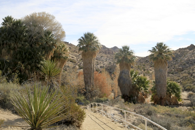
Driving in from the south brings you to Cottonwood Spring Oasis. Cottonwood trees and Fan Palm trees abound. The spring was the result of earthquake activity.
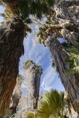
The palm trees reminded us of "Yeti" monsters on cartoons.
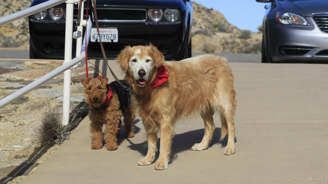
Cait and Zaph came along for the ride. Unfortunately, dogs are not allowed on any of the trails in the park. No, we didn't leave them tied to the fence while we went for a hike, they were tied up so Carol and I could take a few photos.
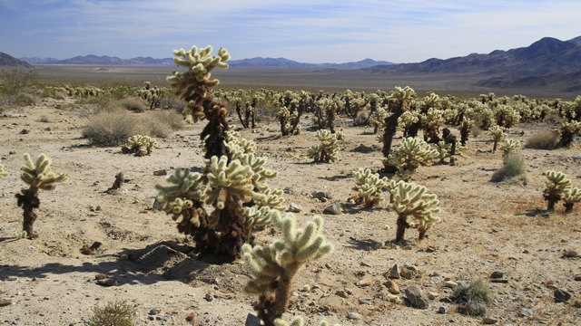
The Colorado Desert area of the park is full of mesquite, creosote bushes, ocotillo, cholla plus a number of other desert plants. This area is referred to as the Cholla Cactus Garden.
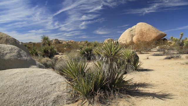
This area is the beginning the transition to the Mojave Desert. We are at a higher altitude, many of cacti have been replaced by Yucca plants and boulders replace rocky hills.
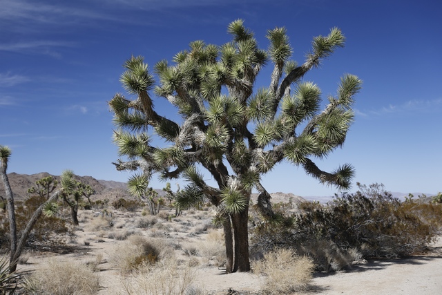
A Joshua Tree.
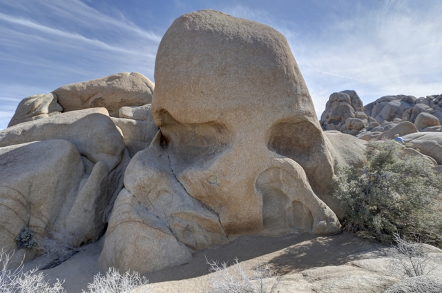
Erosion made the rocks into interesting shapes. This one is called Skull Rock.
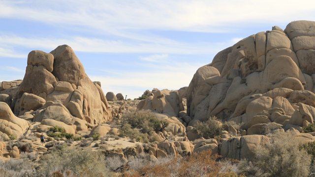
Small piles of boulders are replaced with large hills of boulders.
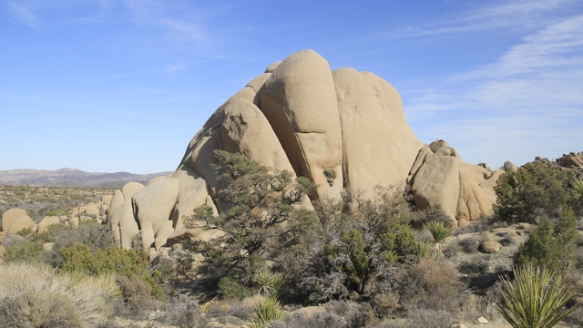
I liked this fan formation.
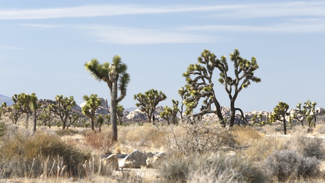
As we continue to drive west and north through the park we see "forests" of Joshua Trees.
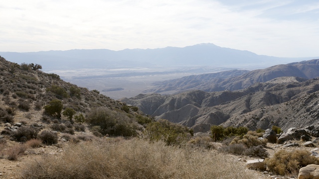
At the south western end of the park is Keys View in the Little San Bernardino Mountains. Junipers are the main plant life here. The cities of Palm Springs, Indio, etc can be seen from the view point along with the Salton Sea. We joked that this could be the new Pacific Coast line as we could see the ridge that marks the San Andres Fault.
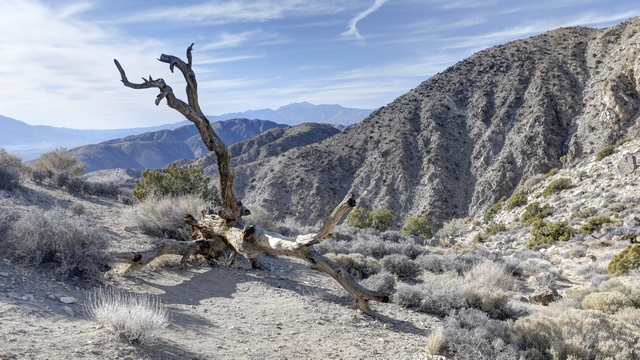
Looking across the mountains.
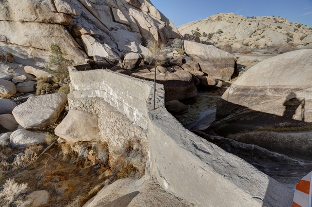
Driving towards the north west exit of the park we stopped to hike the trail to the Barker Dam. Ranchers built this dam to create a water source for their cattle. Today there wasn't a drop of water to be seen.
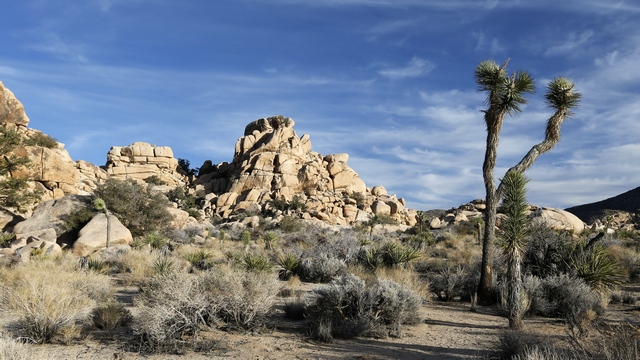
Some great views along the trail.
Joshua Tree National Park is a large and diverse park ... over 880,000 acres consisting of three ecosystems: the Colorado Desert (a western extension of the vast Sonoran Desert), the southern boundary of the Mojave Desert and the Little San Bernardino Mountains. Diversity of plants and animals comes with the ecosystems.
Driving in from the south brings you to Cottonwood Spring Oasis. Cottonwood trees and Fan Palm trees abound. The spring was the result of earthquake activity.

The palm trees reminded us of "Yeti" monsters on cartoons.
Cait and Zaph came along for the ride. Unfortunately, dogs are not allowed on any of the trails in the park. No, we didn't leave them tied to the fence while we went for a hike, they were tied up so Carol and I could take a few photos.
The Colorado Desert area of the park is full of mesquite, creosote bushes, ocotillo, cholla plus a number of other desert plants. This area is referred to as the Cholla Cactus Garden.
This area is the beginning the transition to the Mojave Desert. We are at a higher altitude, many of cacti have been replaced by Yucca plants and boulders replace rocky hills.
A Joshua Tree.

Erosion made the rocks into interesting shapes. This one is called Skull Rock.
Small piles of boulders are replaced with large hills of boulders.
I liked this fan formation.
As we continue to drive west and north through the park we see "forests" of Joshua Trees.
At the south western end of the park is Keys View in the Little San Bernardino Mountains. Junipers are the main plant life here. The cities of Palm Springs, Indio, etc can be seen from the view point along with the Salton Sea. We joked that this could be the new Pacific Coast line as we could see the ridge that marks the San Andres Fault.

Looking across the mountains.

Driving towards the north west exit of the park we stopped to hike the trail to the Barker Dam. Ranchers built this dam to create a water source for their cattle. Today there wasn't a drop of water to be seen.
Some great views along the trail.
2013/02/14: Happy Valentines Day!
Category: General
Posted by: The Agnew Family
Ed had been talking to some people in the park about razors and this morning one of the ladies offered to let me take her razor out for a spin. We didn't go far but I did drive it up a small but moderately steepish hill and back down again and drove through both loose sand and loose gravel. Razors really are a lot of fun to drive.
Decided to stay fairly close to home today. Drove out into the desert to visit another stone cabin and a couple of mines. Also drove through another section of the BLM camping area. This area allowed tent camping and had port-a-potties.
Just liked the tree.
Another old stone cabin.
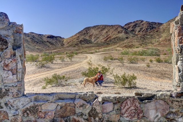
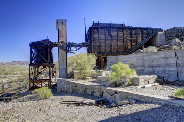
Not far from the cabin are two old mines. It looks fairly flat but we hiked up a hill to get to it.
This is called Q mountain as it has a large Q painted on the side of it near the top. It's only a couple of hundred feet about the desert floor, but it's fairly steep and feels much higher. Great view from the top.
The hill / mountain we climbed. If you look real close and use a bit of imagination you can see the flag on top.
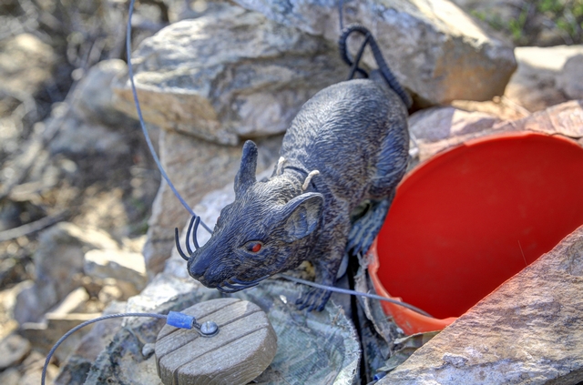
Ten geocaches today and this was the most interesting one --- it was called Willard. The hardest to get to cache was the one at the top of the hill by the flag.
2013/02/13: Laundry Day again
Category: General
Posted by: The Agnew Family
Ed used Google Earth to find the Blythe Intaglios and downloaded some photos. Here's what one looks like from above.
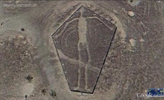
It is a much better view, isn't it. This is the Google earth version of the first photo in yesterday's blog.
Carol and I decided that unfortunately it was time to do laundry. Esther decided to sign up to do laundry in the park so she missed the great adventure. Actually it wasn't too bad. Easy to find a space to park the truck. The top load washers were almost all being used when we walked into the laundry mat but within five minutes or so enough machines freed up for us. Now the dryers ..... couldn't believe it, we managed to get seven dryers all together when our washers finished. Nice to finish the laundry not feeling like you've been in a war.
Being laundry day it was also smoking day --- pork tenderloin. Yum!!!!
2013/02/12: The Blythe Intanglios
Category: General
Posted by: The Agnew Family
About 15 miles north of Blythe, California are three Intaglios or
Geoglyphs. Geoglyphs are difficult to date, so archaeologists have no
way of knowing their age. According to Mohave and Quechan tribes of the
lower Colorado River area, the human figures represent Mastamho, the
Creator of Earth and all life. The animal figure represent Hatakulya,
one of two mountain lions/persons who helped in the Creation.
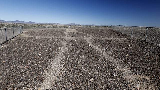
The human figure.
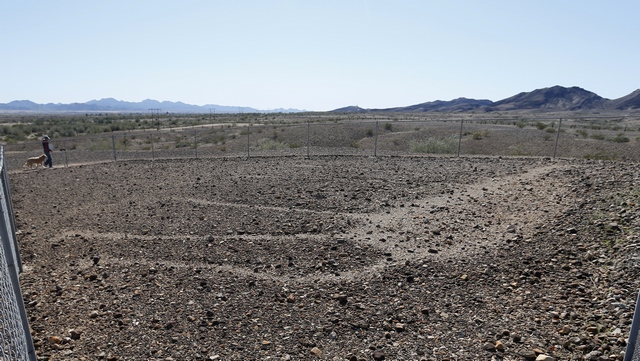
The animal figure. The figures are best viewed from the air, but that wasn't an option, so we viewed them from the ground.
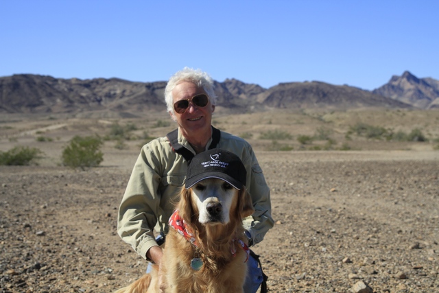
My boys.
From the Intanglios we could see a lake in the distance and decided to try and find it.
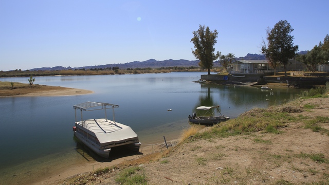
We found a small community of park models built by the lake, along with a boat launch and restaurant.
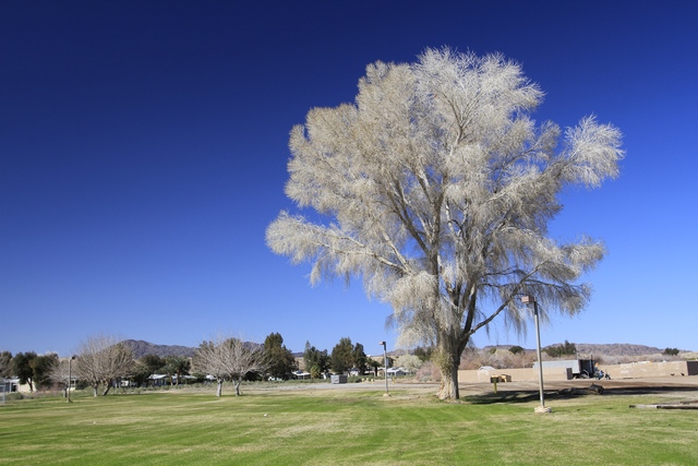
Near the boat ramp we saw this tree .... don't know what it is but we liked it.
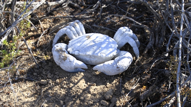
One of the 21 geocaches Ed found today. We really liked these ones as they were easy finds. One of my favorites was in a tube attached to a sign post. Ed stared at it for a while wondering how to get the cache out of the tube when he spotted a jar filled with water. We put our fingers over the holes in the tube and poured in the water, the cache floated to the top, Ed grabbed it then put the jar under the main hole and removed our fingers to fill the jar up again.
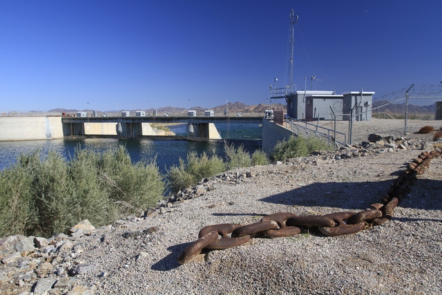
The Palo Verde Diversion Dam is earthen and rock fill, built solely to divert water into irrigation canals serving the Palo Verde Irrigation District. Construction of the dam, which began in 1956 and ended in 1958, was authorized by the U.S. Bureau of Reclamation. The dam was constructed to raise the water level of the river because the upstream Hoover and Davis Dams blocked sediment, causing significant degradation of the riverbed that hampered water diversion.
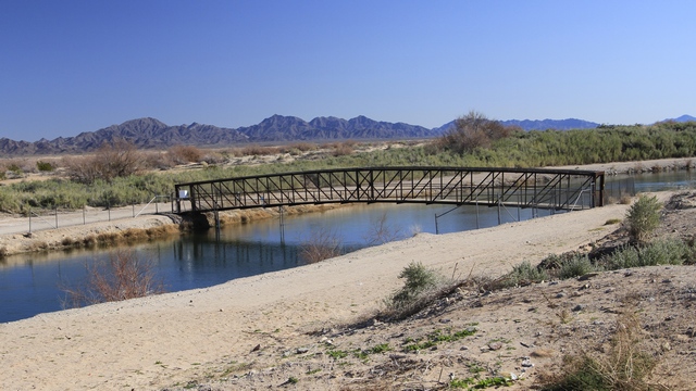
Just down from the dam was this pedestrian bridge.
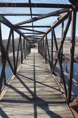
Not sure why it is covered in fencing material but it makes and interesting photo.
The human figure.
The animal figure. The figures are best viewed from the air, but that wasn't an option, so we viewed them from the ground.
My boys.
From the Intanglios we could see a lake in the distance and decided to try and find it.
We found a small community of park models built by the lake, along with a boat launch and restaurant.
Near the boat ramp we saw this tree .... don't know what it is but we liked it.
One of the 21 geocaches Ed found today. We really liked these ones as they were easy finds. One of my favorites was in a tube attached to a sign post. Ed stared at it for a while wondering how to get the cache out of the tube when he spotted a jar filled with water. We put our fingers over the holes in the tube and poured in the water, the cache floated to the top, Ed grabbed it then put the jar under the main hole and removed our fingers to fill the jar up again.
The Palo Verde Diversion Dam is earthen and rock fill, built solely to divert water into irrigation canals serving the Palo Verde Irrigation District. Construction of the dam, which began in 1956 and ended in 1958, was authorized by the U.S. Bureau of Reclamation. The dam was constructed to raise the water level of the river because the upstream Hoover and Davis Dams blocked sediment, causing significant degradation of the riverbed that hampered water diversion.
Just down from the dam was this pedestrian bridge.
Not sure why it is covered in fencing material but it makes and interesting photo.
2013/02/11: Cuteness is .....
Category: General
Posted by: The Agnew Family
When I got up this morning I saw this bit of cuteness and couldn't resist taking a photo. Happily he slept through the camera flash.
The day started out cool and rainy ---- there was frost on the truck and periods of rain though not enough to measure. By the afternoon the sky had cleared and the temperatures hit the high fifties. We had planned on driving into California today but decided to put it off due to the weather. So, instead we drove into Quartzsite to kick some tires. It's always fun to look at trailers especially the ones you know you'll never buy. There was one that was absolutely beautiful .... leather chairs and couch in the living room along with a fairly big flat screen TV that has hung over the gas fire place. There were more cupboards and counter space than my kitchen at home and curved iron railings leading to the bedroom. It would also be a nightmare to pull and park at over 40 feet in length and with four slides I don't want to think about the weight.
Just after sunset.
2013/02/10: Checking out Quartzsite
Category: General
Posted by: The Agnew Family
As the markets in Quartzsite are rapidly closing down, we did one last
trip on Saturday looking for rocks. I still have trouble with the
concept of buying rocks but we did ... ok they were fossils and Ed says
that makes them special so it's OK to buy them for display. Of course,
if they are finished stones to be worn as pendants thats OK too! Yes, I
bought a couple more and have lost count of how many I now own.
Sunday was a hang around the trailer blogging and figuring out the trip home. Hard to believe but it's almost time to start heading slowly east again.
Today, we went into into Quartzsite to look at a few of the "attractions" in town and do a little geocaching.
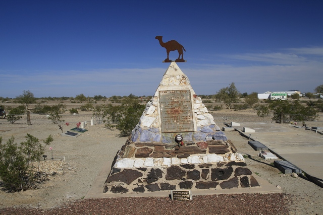
This pyramid of native stone marks the resting place of Hi Jolly, a Greek born in Syria, also known as Hadji Ali. Hi Jolly was hired in 1857 as a camel herder in the U.S. Army's short-lived historic Camel Corps. In 1861 the Civil War commenced, ending the day of the Camel Corps. Hi Jolly returned to Quartzsite, trying his had at mining, packing, scouting, delivering the "Jackass Mail", and selling water to travelers.
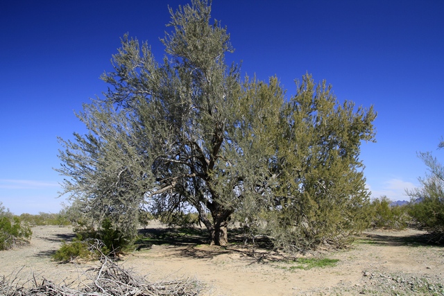
This native Ironwood tree is 1050 years old. The Ironwood tree is only found in the Sonoran desert. It can grow to 45 feet tall (short by Ontario standards). The shaded sanctuary and richer soils created by ironwoods increase plant diversity and provide benefits to wildlife. Another noteworthy item about the Ironwood is the weight of the wood --- it is an extremely dense and heavy wood.
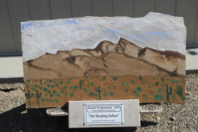
While looking for a geocache we met some people from Alberta. They were in the same vicinity but instead of looking for geocaches they were looking for painted rocks. As Quartzsite has lots of rocks they decided to do painted rocks instead of moose or horses as other city have done.
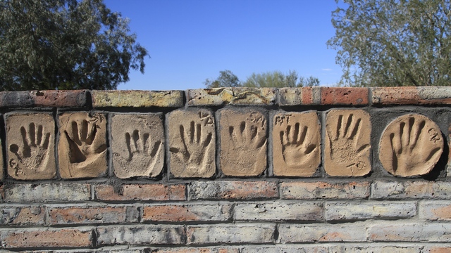
Celia's Rainbow garden can be found in the Quartzsite town park. Unfortunately, Celia, an eight year old, died in 1994. The garden was created in her memory. Since then it has become a memorial garden for many people. We loved this wall with children's hand prints.
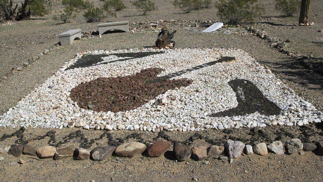
This picture was done using different color rocks.
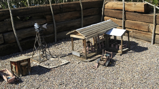
This miniature western town was donated to the park. Reminded us of the Dome ghost town only smaller.
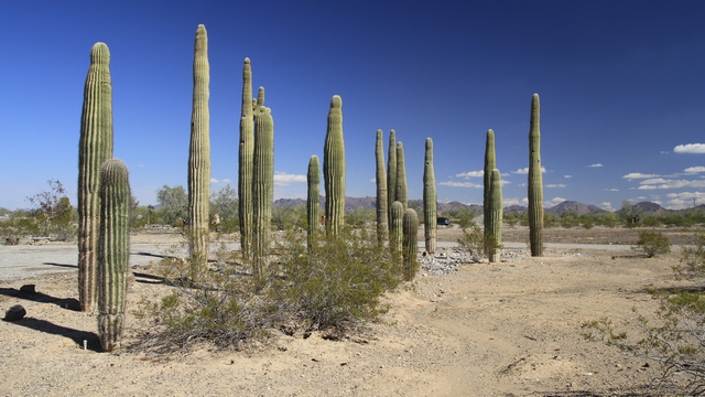
Ed found a geocache called Saguaro-henge here. Don't know if that's the name for this section of the garden but I thought it fit.
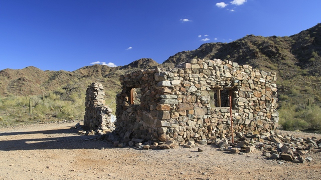
A book we have about Quartzsite told us about the Spanish wall and stone cabin south east of Quartzsite. Sounded fairly easy to get to and the roads sounded not too bad so we decided to look for it. The road was OK but the directions weren't the best. After parking the truck and walking Zaph and I found the cabin. It was interesting and afforded some good views of Quartzsite and the mountains.
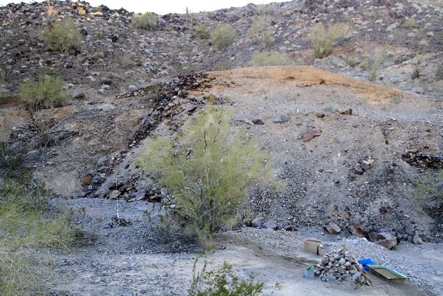
The Spanish wall was missed on the trek to the cabin but found on the way out. It no longer looks like the picture in the book.
Sunday was a hang around the trailer blogging and figuring out the trip home. Hard to believe but it's almost time to start heading slowly east again.
Today, we went into into Quartzsite to look at a few of the "attractions" in town and do a little geocaching.
This pyramid of native stone marks the resting place of Hi Jolly, a Greek born in Syria, also known as Hadji Ali. Hi Jolly was hired in 1857 as a camel herder in the U.S. Army's short-lived historic Camel Corps. In 1861 the Civil War commenced, ending the day of the Camel Corps. Hi Jolly returned to Quartzsite, trying his had at mining, packing, scouting, delivering the "Jackass Mail", and selling water to travelers.
This native Ironwood tree is 1050 years old. The Ironwood tree is only found in the Sonoran desert. It can grow to 45 feet tall (short by Ontario standards). The shaded sanctuary and richer soils created by ironwoods increase plant diversity and provide benefits to wildlife. Another noteworthy item about the Ironwood is the weight of the wood --- it is an extremely dense and heavy wood.
While looking for a geocache we met some people from Alberta. They were in the same vicinity but instead of looking for geocaches they were looking for painted rocks. As Quartzsite has lots of rocks they decided to do painted rocks instead of moose or horses as other city have done.
Celia's Rainbow garden can be found in the Quartzsite town park. Unfortunately, Celia, an eight year old, died in 1994. The garden was created in her memory. Since then it has become a memorial garden for many people. We loved this wall with children's hand prints.
This picture was done using different color rocks.
This miniature western town was donated to the park. Reminded us of the Dome ghost town only smaller.
Ed found a geocache called Saguaro-henge here. Don't know if that's the name for this section of the garden but I thought it fit.
A book we have about Quartzsite told us about the Spanish wall and stone cabin south east of Quartzsite. Sounded fairly easy to get to and the roads sounded not too bad so we decided to look for it. The road was OK but the directions weren't the best. After parking the truck and walking Zaph and I found the cabin. It was interesting and afforded some good views of Quartzsite and the mountains.
The Spanish wall was missed on the trek to the cabin but found on the way out. It no longer looks like the picture in the book.
2013/02/07: London Bridge
Category: General
Posted by: The Agnew Family
Lake Havasu City is about 80 north of the RV park. The community first
started as a Army Air Corp rest camp. The city was established in 1963
by Robert P. McCulloch (of McCulloch chainsaws) as a planned community.
In 1962, it was discovered that the London Bridge (London England) was
falling down, sinking into the Thames. When McCulloch learned the
British Government was putting the bridge up for sale, he submitted the
winning bid of $2,460,000. Another $7,500,000 was spent on shipping and
rebuilding the bridge. The bridge now stands in Lake Havasu and is the
main tourist attraction.
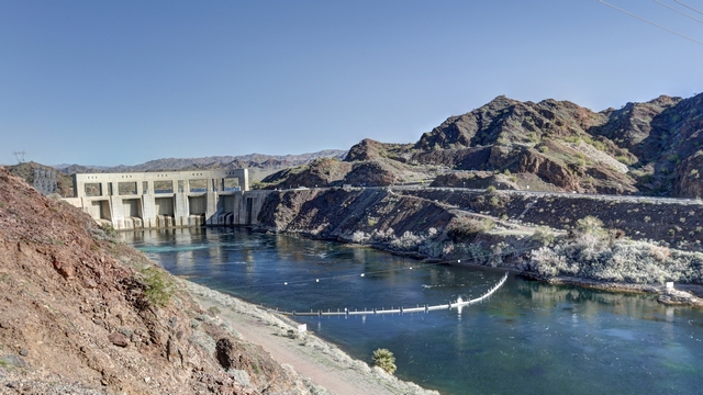
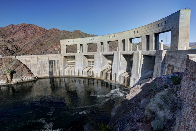
On the way to Lake Havasu we stopped to see the Parker Dam. From the government web site "Parker Dam is a concrete arch structure commonly called the 'deepest dam in the world.' Seventy-three percent of the dam's structural height of 320 feet is below the original river bed; only about 85 feet of the dam's structural height is visible (its superstructure rises another 62 feet above the roadway across the top of the dam). Parker Dam has a volume of 380,000 cubic yards of concrete. At its crest, the dam is 856 feet long. Water control is provided by five 50-ft-square gates."
A power plant is on the California side of the river.
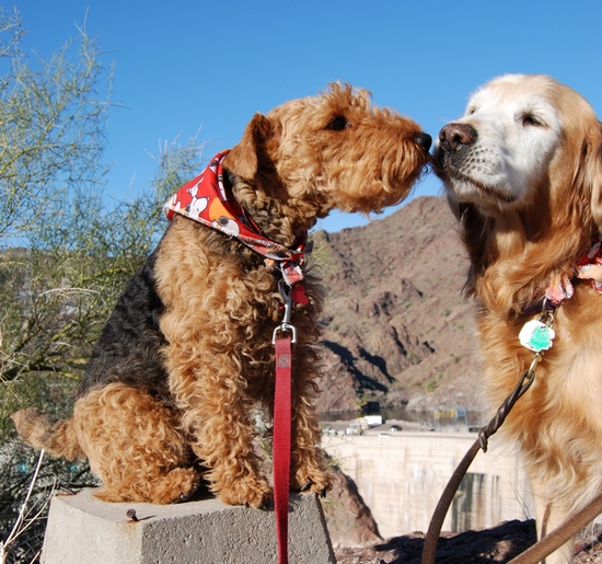
Cait was put on a survey pier for a photo and Zaph marched in to get a kiss. Thanks for the photo, Carol.
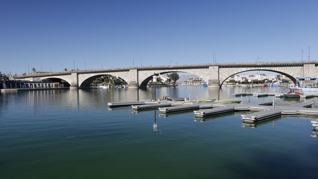
The rebuilding of London Bridge was completed and dedicated on October 10, 1971. The channel was dredged after the bridge was completed turning the peninsula into an island.
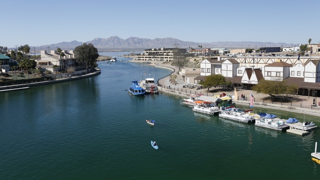
A view looking toward Lake Havasu from the bridge.
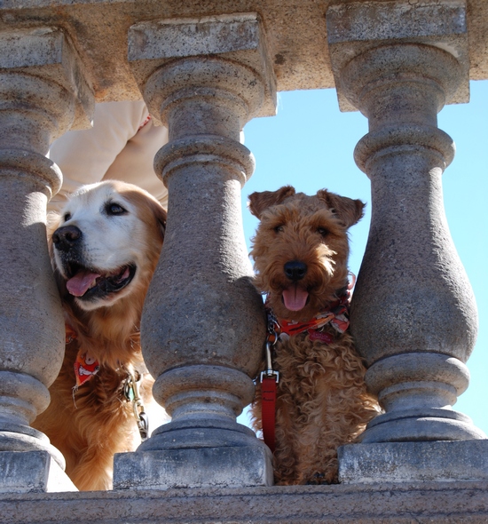
Another great photo by Carol.
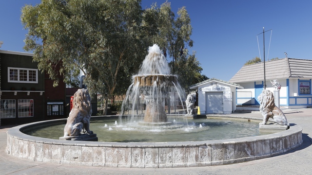
A fountain near the bridge.
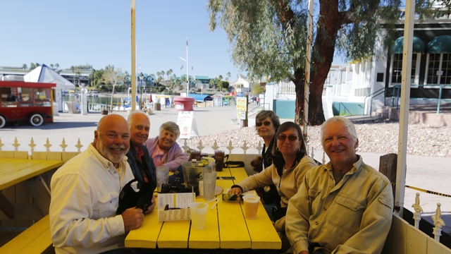
We found a great restaurant with outdoor seating that was dog friendly. A bowl of water came out with the menus.
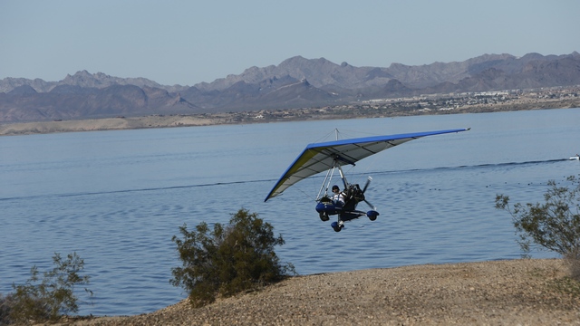
After driving across the bridge we drove the road around the island. This ultra-light was following the coastline.
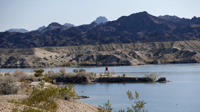
The lighthouse club of Lake Havasu have built 21 replicas of lighthouses around the Great Lakes. The replicas are one third to one half the size of the original lighthouse and have working lights in them to help with navigation around Lake Havasu.
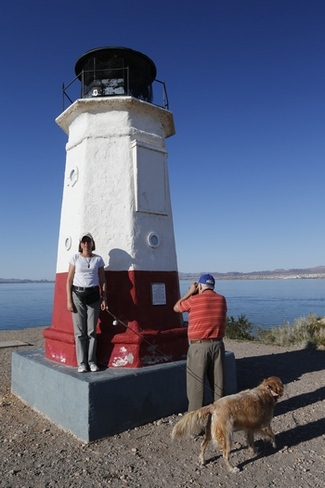
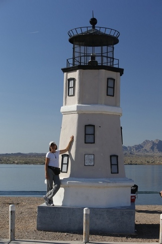
Vermillion Lighthouse replica and Split Rock Lighthouse replica. I'm in the photos for sizing.

On the way to Lake Havasu we stopped to see the Parker Dam. From the government web site "Parker Dam is a concrete arch structure commonly called the 'deepest dam in the world.' Seventy-three percent of the dam's structural height of 320 feet is below the original river bed; only about 85 feet of the dam's structural height is visible (its superstructure rises another 62 feet above the roadway across the top of the dam). Parker Dam has a volume of 380,000 cubic yards of concrete. At its crest, the dam is 856 feet long. Water control is provided by five 50-ft-square gates."

A power plant is on the California side of the river.
Cait was put on a survey pier for a photo and Zaph marched in to get a kiss. Thanks for the photo, Carol.
The rebuilding of London Bridge was completed and dedicated on October 10, 1971. The channel was dredged after the bridge was completed turning the peninsula into an island.
A view looking toward Lake Havasu from the bridge.
Another great photo by Carol.
A fountain near the bridge.
We found a great restaurant with outdoor seating that was dog friendly. A bowl of water came out with the menus.
After driving across the bridge we drove the road around the island. This ultra-light was following the coastline.
The lighthouse club of Lake Havasu have built 21 replicas of lighthouses around the Great Lakes. The replicas are one third to one half the size of the original lighthouse and have working lights in them to help with navigation around Lake Havasu.
Vermillion Lighthouse replica and Split Rock Lighthouse replica. I'm in the photos for sizing.
2013/02/06: Exploring
Category: General
Posted by: The Agnew Family
Today was a geocaching / exploring day. We drove north east to the town
of Bouse. Bouse is home to about 1000 people and was founded as a mining
camp. In WWII, Camp Bouse (about 20 miles to the east) was an Army tank
training camp. Leaving Bouse we drove south and were surprised to pass a
canal then a large feed lot beside a number of hay (I think) fields. We
stopped at a spot looking for a water tank and possibly bighorn sheep.
The hike was nice but we didn't find the tank or see any sheep. Driving
east we headed back to Quartzsite and home. Ed was happy as we did find a
number of geocaches.
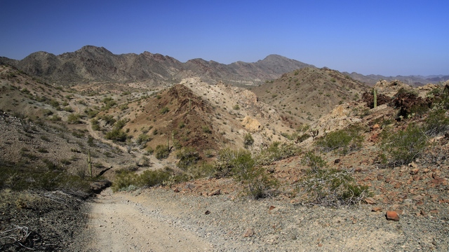
One of the beautiful views we saw.
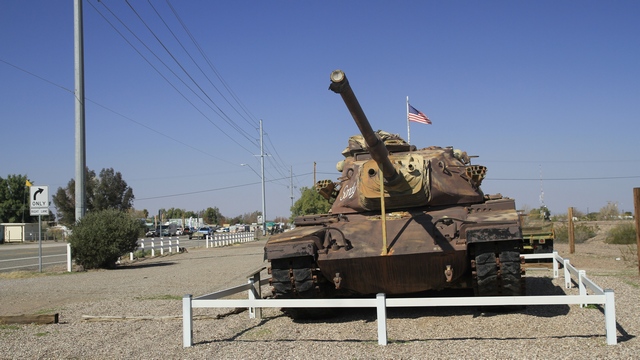
A couple of tanks are on display at the memorial park in Bouse.
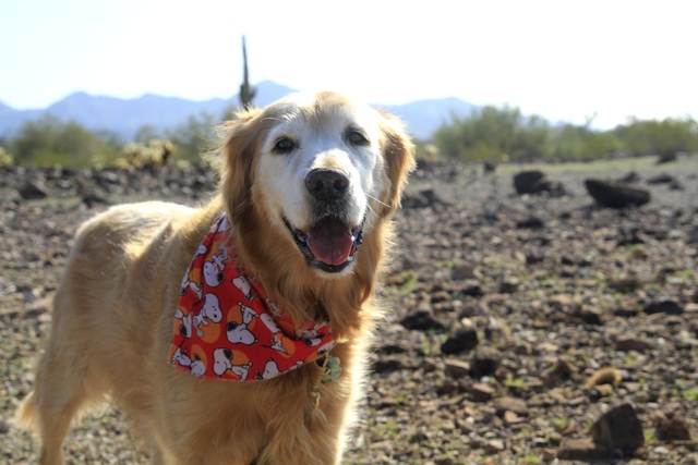
Some one was having a good time.
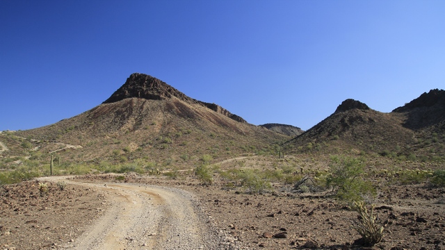
A view from the area where we hiked.
One of the beautiful views we saw.
A couple of tanks are on display at the memorial park in Bouse.
Some one was having a good time.
A view from the area where we hiked.
2013/02/05: Four Wheeling Again
Category: General
Posted by: The Agnew Family
Last night we received an invitation to go riding in the morning. There
was no hesitation in our answer just a "sure we'd love to go". As the
planned ride was south of us, we waited for them by the highway. Wasn't
hard to spot the group as they drove past .... first truck was pulling a
flat bed with five off road vehicles and it was followed by at least
six vehicles pulling trailers. Today, I road with Shelly from Iowa. It's
the first time her and her husband are in this part of Arizona. They
met the group about ten days ago and have been riding with them pretty
much every day. Ed was suppose to ride with Jerome again but
unfortunately he was sick, so Ed road with Tom in Jerome's razor. Tom,
being a really nice guy let Ed drive the second half of the ride. Guess
who wants a razor now.
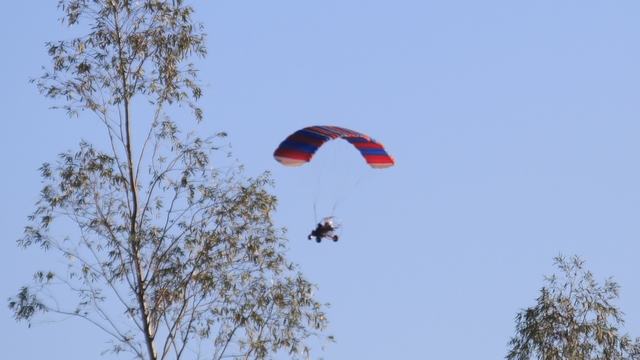
Before we left the RV park this morning we saw this ultra light flying by.
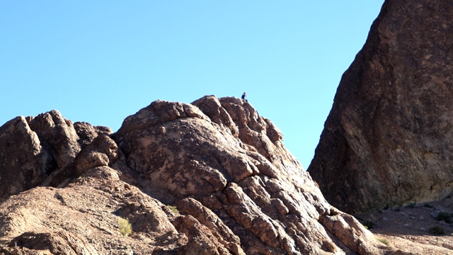
At the first stop, Shelly's husband Harlan decided to walk up the hill. If you look close you can see him in the middle of the photo.
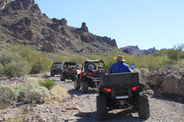
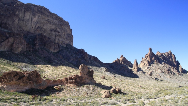
This was an easy ride with amazing scenery.
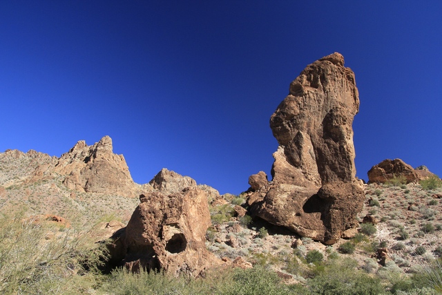
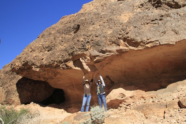
Shelly and I took our turn holding the rock up.
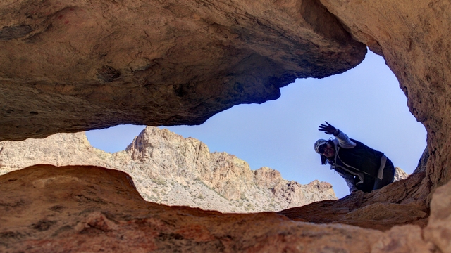
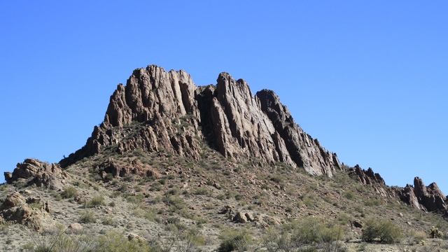
Interesting hole in the rock formation.
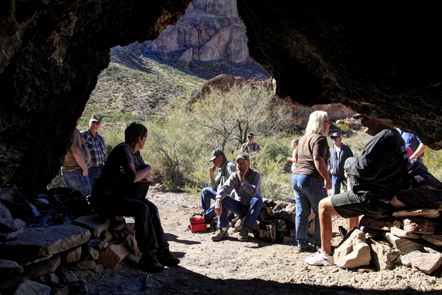
Just off the trail was a cave ... perfect spot to stop and enjoy lunch.
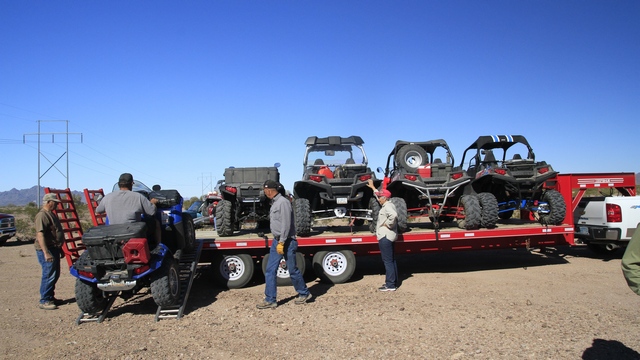
Loading the flat bed trailer.
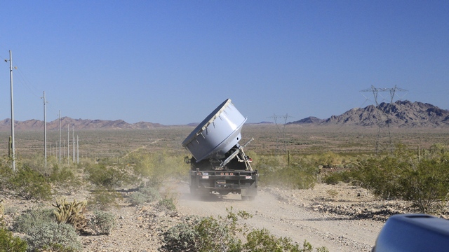
On the way back to the trailer we detoured to do a little geocaching. Not sure what was being carried but it sure looked interesting.
Before we left the RV park this morning we saw this ultra light flying by.
At the first stop, Shelly's husband Harlan decided to walk up the hill. If you look close you can see him in the middle of the photo.
This was an easy ride with amazing scenery.
Shelly and I took our turn holding the rock up.

Interesting hole in the rock formation.

Just off the trail was a cave ... perfect spot to stop and enjoy lunch.
Loading the flat bed trailer.
On the way back to the trailer we detoured to do a little geocaching. Not sure what was being carried but it sure looked interesting.
2013/02/04: Combat Laundry
Category: General
Posted by: The Agnew Family
Carol, Esther and myself loaded Carol's truck full of dirty laundry and
drove into town anticipating a better laundry experience than our last
one. A lot of people have left town and the laundry parking lot seemed
emptier when we drove past it the last couple of days.
Yes! the laundry parking lot wasn't crowded and we found a good parking spot. No! almost all of the washing machines were in use. We eventually found enough, with Carol and myself using some front loader double washers. Two of Carol's machines finished in the expected time while the other two seemed to just keep spinning forever. Her first loads were almost dried before the second two finished washing.
Of course, there was a line-up for the driers but it didn't take too long to get all of our clothes in the driers. One man was a little impatient as he grabbed the drier door out of my hand as I was unloading. Guess I wasn't deciding quick enough if I was putting more money into the drier or moving the remaining damp items to another drier.
We were all very happy when the laundry was done and we were back at the RV park where the guys were smoking salmon.
2013/02/03: Car Show and Shopping
Category: General
Posted by: The Agnew Family
The men decided to go to the car show so the ladies decided to go
shopping. Personally, I think the ladies had more fun but then I may be
slightly biased. We found a few interesting items that we just needed to
have and we found Esther her turquoise pendant, all in all a good day.
The guys said they had fun as well and they have photos to prove it.
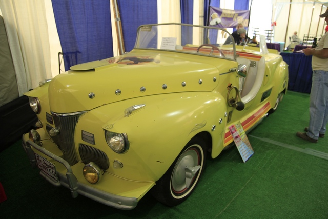
This highly modified Ford super deluxe was built in the early 1960s possibly to be used as a clown car in parades.
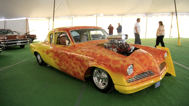
What a paint job
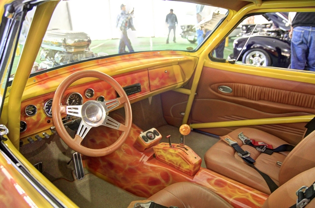
and the interior is painted to match.
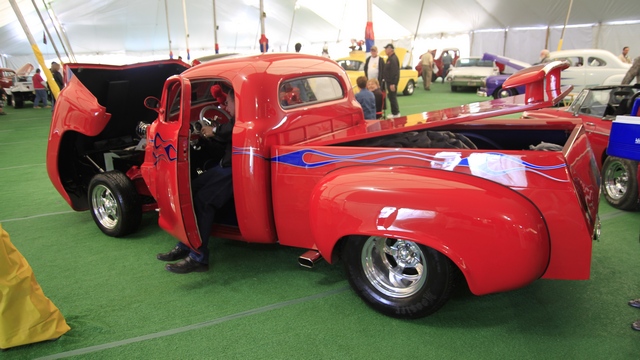
Pretty truck.
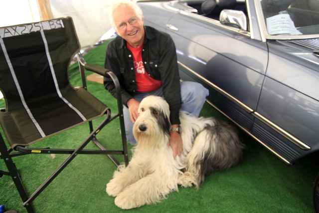
Ed found a new buddy.
The guys said they had fun as well and they have photos to prove it.
This highly modified Ford super deluxe was built in the early 1960s possibly to be used as a clown car in parades.
What a paint job

and the interior is painted to match.
Pretty truck.
Ed found a new buddy.
2013/02/02: Chore Day
Category: General
Posted by: The Agnew Family
Last evening was a little warmer than normal and extremely clear so Ed took his camera took a walk.
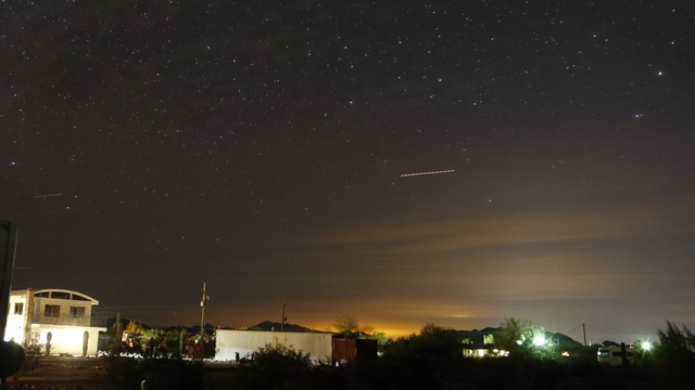
The streak is an airplane.
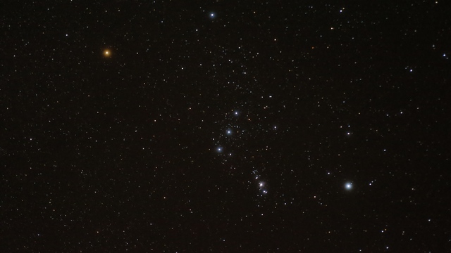
I'm amazed at the number of stars we can see out here .... but that probably has more to do with the lack of stars we can see at home.
Today was a day you can only avoid for so long ... cleaning day. The trailer was cleaned and Zaph was bathed. While I was cleaning the trailer Ed and Zaph went geocaching. As they found 10 geocaches, I'm owed a trip to dairy queen .... yah!!!!
The streak is an airplane.
I'm amazed at the number of stars we can see out here .... but that probably has more to do with the lack of stars we can see at home.
Today was a day you can only avoid for so long ... cleaning day. The trailer was cleaned and Zaph was bathed. While I was cleaning the trailer Ed and Zaph went geocaching. As they found 10 geocaches, I'm owed a trip to dairy queen .... yah!!!!
2013/02/01: Hobby and Craft Show
Category: General
Posted by: The Agnew Family
Drove into Quartzsite to see the Hobby and Craft show ... lunch bag let
down. Only a few vendors and most of them did not fit into our
definition of hobby or craft. Ended going to Tyson Wells market and
looking at rocks.
A woman I talked to at the vet office told me the pizza restaurant in town was great, so the six of us decided to try it out. The boys order a "meat lovers" and girls ordered a Canadian bacon, mushroom and spinach pizza. Pizza's were OK, though the "girls" pizza could have been warmer and the mushrooms would have been better if they had been cooked. Ed said the "boys" pizza was good.
A woman I talked to at the vet office told me the pizza restaurant in town was great, so the six of us decided to try it out. The boys order a "meat lovers" and girls ordered a Canadian bacon, mushroom and spinach pizza. Pizza's were OK, though the "girls" pizza could have been warmer and the mushrooms would have been better if they had been cooked. Ed said the "boys" pizza was good.